Bayport is a city in Washington County, Minnesota, United States. The population was 4,024 at the 2020 census.
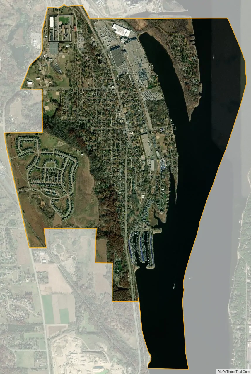
Bayport is located along the St. Croix River, one mile south of Stillwater.
| Name: | Bayport city |
|---|---|
| LSAD Code: | 25 |
| LSAD Description: | city (suffix) |
| State: | Minnesota |
| County: | Washington County |
| Elevation: | 699 ft (213 m) |
| Total Area: | 2.64 sq mi (6.84 km²) |
| Land Area: | 1.73 sq mi (4.49 km²) |
| Water Area: | 0.91 sq mi (2.35 km²) |
| Total Population: | 4,024 |
| Population Density: | 2,321.98/sq mi (896.48/km²) |
| ZIP code: | 55003 |
| Area code: | 651 |
| FIPS code: | 2704114 |
| GNISfeature ID: | 2394090 |
| Website: | ci.bayport.mn.us |
Online Interactive Map
Click on ![]() to view map in "full screen" mode.
to view map in "full screen" mode.
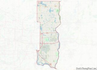
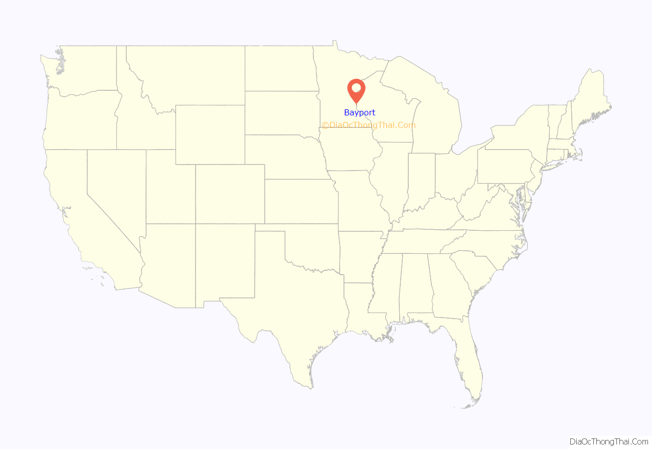
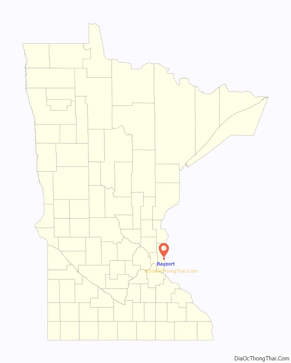
Bayport location map. Where is Bayport city?
History
The City of Bayport began as three small settlements along the St. Croix River. In 1873, the St. Croix Railway Improvement Company combined the three settlements into South Stillwater, which was incorporated as a village in 1881. Because many people confused South Stillwater with the city of Stillwater, the city changed its name to Bayport in 1922.
Like its northern neighbor Stillwater, the early economy of Bayport centered around the lumber industry. From 1852 to 1916, several sawmills operated within the City. The Andersen Corporation is the successor to Bayport’s early lumbering firms. The Andersen Corporation (then the Andersen Lumber Company) moved to Bayport in 1913, among other reasons, to take advantage of the city’s rail lines first built in 1872. The Andersen Corporation prospered in Bayport, becoming the largest window and patio door manufacturer in the world.
In 1914, the Minnesota Correctional Facility – Stillwater moved from Stillwater to Bayport. Experts at the time considered the prison to be one of the most modern penal institutions in the world. As of 2010, the prison housed about 1600 inmates, who are counted as Bayport residents for census purposes. The maximum security Minnesota Correctional Facility – Oak Park Heights opened just beyond Bayport’s western boundary in 1982.
Due to its location on the St. Croix River, Bayport has long been associated with boating. The Bayport Boat Yard, located just south of the Andersen Corporation, built several well-known steamboats. Barge construction and repairs continued at the boatyard through World War Two. Today, the city is home to the Bayport Marina, and many boaters gain access to the St. Croix River at one of Bayport’s public boat launches.
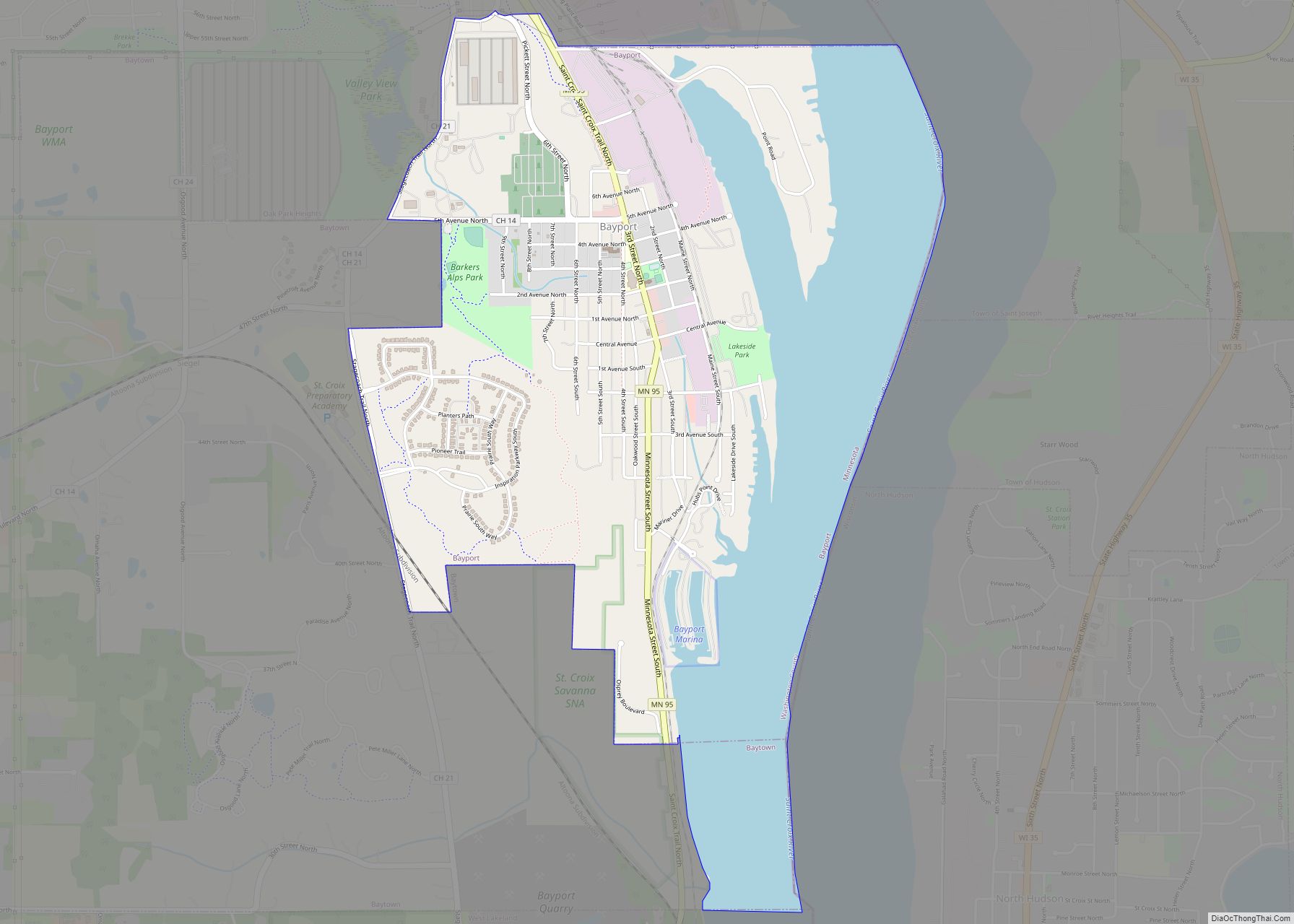
Bayport Road Map
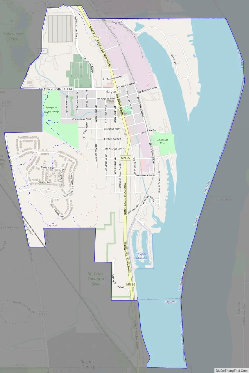
Bayport city Satellite Map
Geography
According to the United States Census Bureau, the city has a total area of 1.75 square miles (4.53 km), all land.
Minnesota State Highway 95 serves as a main route in the community.
See also
Map of Minnesota State and its subdivision:- Aitkin
- Anoka
- Becker
- Beltrami
- Benton
- Big Stone
- Blue Earth
- Brown
- Carlton
- Carver
- Cass
- Chippewa
- Chisago
- Clay
- Clearwater
- Cook
- Cottonwood
- Crow Wing
- Dakota
- Dodge
- Douglas
- Faribault
- Fillmore
- Freeborn
- Goodhue
- Grant
- Hennepin
- Houston
- Hubbard
- Isanti
- Itasca
- Jackson
- Kanabec
- Kandiyohi
- Kittson
- Koochiching
- Lac qui Parle
- Lake
- Lake of the Woods
- Lake Superior
- Le Sueur
- Lincoln
- Lyon
- Mahnomen
- Marshall
- Martin
- McLeod
- Meeker
- Mille Lacs
- Morrison
- Mower
- Murray
- Nicollet
- Nobles
- Norman
- Olmsted
- Otter Tail
- Pennington
- Pine
- Pipestone
- Polk
- Pope
- Ramsey
- Red Lake
- Redwood
- Renville
- Rice
- Rock
- Roseau
- Saint Louis
- Scott
- Sherburne
- Sibley
- Stearns
- Steele
- Stevens
- Swift
- Todd
- Traverse
- Wabasha
- Wadena
- Waseca
- Washington
- Watonwan
- Wilkin
- Winona
- Wright
- Yellow Medicine
- Alabama
- Alaska
- Arizona
- Arkansas
- California
- Colorado
- Connecticut
- Delaware
- District of Columbia
- Florida
- Georgia
- Hawaii
- Idaho
- Illinois
- Indiana
- Iowa
- Kansas
- Kentucky
- Louisiana
- Maine
- Maryland
- Massachusetts
- Michigan
- Minnesota
- Mississippi
- Missouri
- Montana
- Nebraska
- Nevada
- New Hampshire
- New Jersey
- New Mexico
- New York
- North Carolina
- North Dakota
- Ohio
- Oklahoma
- Oregon
- Pennsylvania
- Rhode Island
- South Carolina
- South Dakota
- Tennessee
- Texas
- Utah
- Vermont
- Virginia
- Washington
- West Virginia
- Wisconsin
- Wyoming