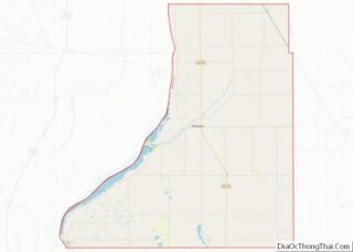
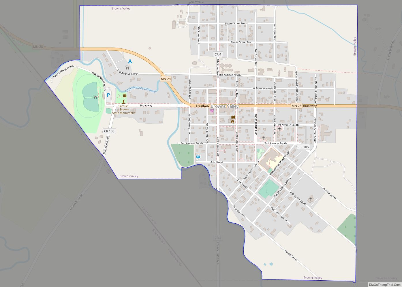
Browns Valley is a city in Traverse County, Minnesota, United States, adjacent to the South Dakota border. The population was 558 at the 2020 census.
Browns Valley lies along the Little Minnesota River between the northern end of Big Stone Lake and the southern end of Lake Traverse, which is separated from the Little Minnesota River by a low and narrow continental divide that skirts the northern edge of town. The city, both lakes, and the river lie in the Traverse Gap, the bed of ancient, south-flowing Glacial River Warren, the outlet to Glacial Lake Agassiz which, when drained, became the valley of the north-flowing Red River of the North.
| Name: | Browns Valley city |
|---|---|
| LSAD Code: | 25 |
| LSAD Description: | city (suffix) |
| State: | Minnesota |
| County: | Traverse County |
| Elevation: | 988 ft (301 m) |
| Total Area: | 0.78 sq mi (2.02 km²) |
| Land Area: | 0.78 sq mi (2.02 km²) |
| Water Area: | 0.00 sq mi (0.00 km²) |
| Total Population: | 558 |
| Population Density: | 714.47/sq mi (275.87/km²) |
| ZIP code: | 56219 |
| Area code: | 320 |
| FIPS code: | 2708200 |
| GNISfeature ID: | 0659752 |
| Website: | brownsvalleymn.com |
Online Interactive Map
Click on ![]() to view map in "full screen" mode.
to view map in "full screen" mode.
Browns Valley location map. Where is Browns Valley city?


History
Browns Valley was first settled in 1867 by Joseph R. Brown, and named for him. The settlement was platted in 1878. A post office was established in the community in 1867 under the name Lake Traverse. The post office was renamed Browns Valley in 1872. Two properties in the city are listed on the National Register of Historic Places: the 1864 Fort Wadsworth Agency and Scout Headquarters Building within Sam Brown Memorial State Wayside and the 1916 Browns Valley Carnegie Library.
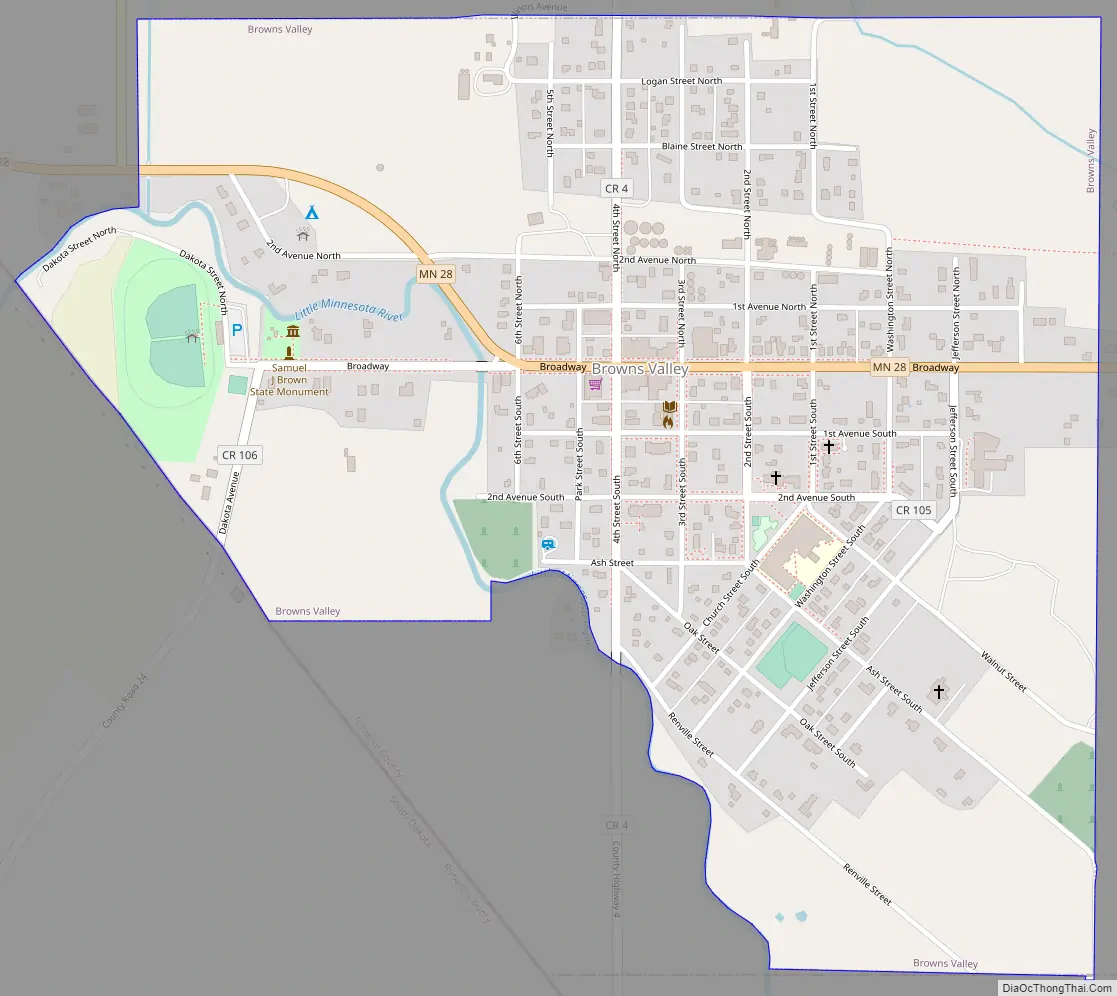
Browns Valley Road Map
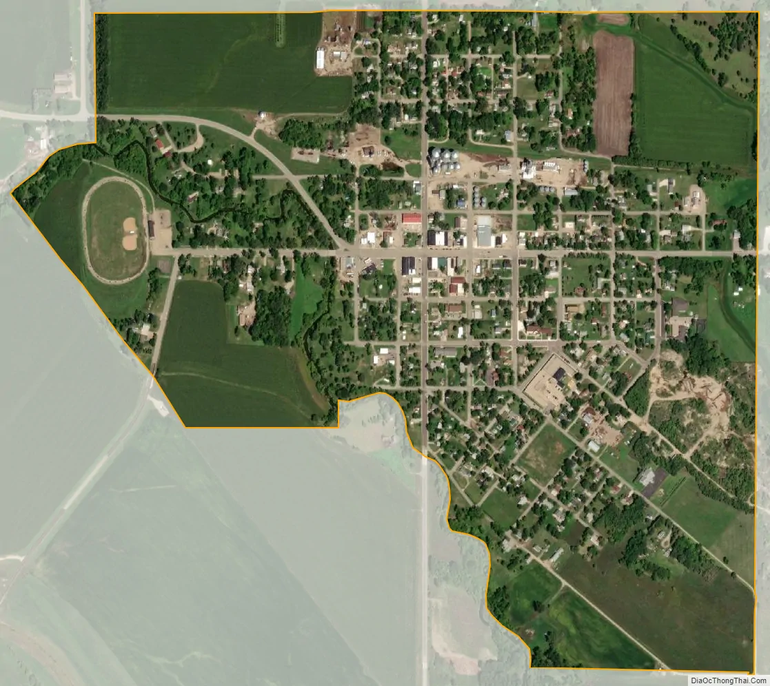
Browns Valley city Satellite Map
Geography
According to the United States Census Bureau, the city has a total area of 0.79 square miles (2.05 km), all land. Browns Valley is rested in an old glacier path.
Browns Valley Lies in the center of Traverse Gap, a valley and ancient riverbed. This valley is also home to a continental divide. The divide is the southernmost point of the Northern Divide between the watersheds of the Arctic and Atlantic oceans. The area is also home to Browns Valley Man, the oldest human remains found in Minnesota. The remains were found in Traverse Gap and carbon dated to about 9,000 years ago.
Minnesota Highways 27 and 28 are two of the main routes in the community.
Climate
The Browns Valley weather station records some of Minnesota’s highest summer temperatures; on July 31, 2007, a high of 107 °F (42 °C) was registered.
See also
Map of Minnesota State and its subdivision:- Aitkin
- Anoka
- Becker
- Beltrami
- Benton
- Big Stone
- Blue Earth
- Brown
- Carlton
- Carver
- Cass
- Chippewa
- Chisago
- Clay
- Clearwater
- Cook
- Cottonwood
- Crow Wing
- Dakota
- Dodge
- Douglas
- Faribault
- Fillmore
- Freeborn
- Goodhue
- Grant
- Hennepin
- Houston
- Hubbard
- Isanti
- Itasca
- Jackson
- Kanabec
- Kandiyohi
- Kittson
- Koochiching
- Lac qui Parle
- Lake
- Lake of the Woods
- Lake Superior
- Le Sueur
- Lincoln
- Lyon
- Mahnomen
- Marshall
- Martin
- McLeod
- Meeker
- Mille Lacs
- Morrison
- Mower
- Murray
- Nicollet
- Nobles
- Norman
- Olmsted
- Otter Tail
- Pennington
- Pine
- Pipestone
- Polk
- Pope
- Ramsey
- Red Lake
- Redwood
- Renville
- Rice
- Rock
- Roseau
- Saint Louis
- Scott
- Sherburne
- Sibley
- Stearns
- Steele
- Stevens
- Swift
- Todd
- Traverse
- Wabasha
- Wadena
- Waseca
- Washington
- Watonwan
- Wilkin
- Winona
- Wright
- Yellow Medicine
- Alabama
- Alaska
- Arizona
- Arkansas
- California
- Colorado
- Connecticut
- Delaware
- District of Columbia
- Florida
- Georgia
- Hawaii
- Idaho
- Illinois
- Indiana
- Iowa
- Kansas
- Kentucky
- Louisiana
- Maine
- Maryland
- Massachusetts
- Michigan
- Minnesota
- Mississippi
- Missouri
- Montana
- Nebraska
- Nevada
- New Hampshire
- New Jersey
- New Mexico
- New York
- North Carolina
- North Dakota
- Ohio
- Oklahoma
- Oregon
- Pennsylvania
- Rhode Island
- South Carolina
- South Dakota
- Tennessee
- Texas
- Utah
- Vermont
- Virginia
- Washington
- West Virginia
- Wisconsin
- Wyoming