Crosslake is a city in Crow Wing County, Minnesota, United States. The population was 2,141 at the 2010 census. It is part of the Brainerd Micropolitan Statistical Area.
| Name: | Crosslake city |
|---|---|
| LSAD Code: | 25 |
| LSAD Description: | city (suffix) |
| State: | Minnesota |
| County: | Crow Wing County |
| Elevation: | 1,240 ft (380 m) |
| Total Area: | 36.90 sq mi (95.58 km²) |
| Land Area: | 25.76 sq mi (66.72 km²) |
| Water Area: | 11.14 sq mi (28.86 km²) |
| Total Population: | 2,394 |
| Population Density: | 92.93/sq mi (35.88/km²) |
| ZIP code: | 56442 |
| Area code: | 218 |
| FIPS code: | 2713978 |
| GNISfeature ID: | 0642486 |
| Website: | www.cityofcrosslake.org |
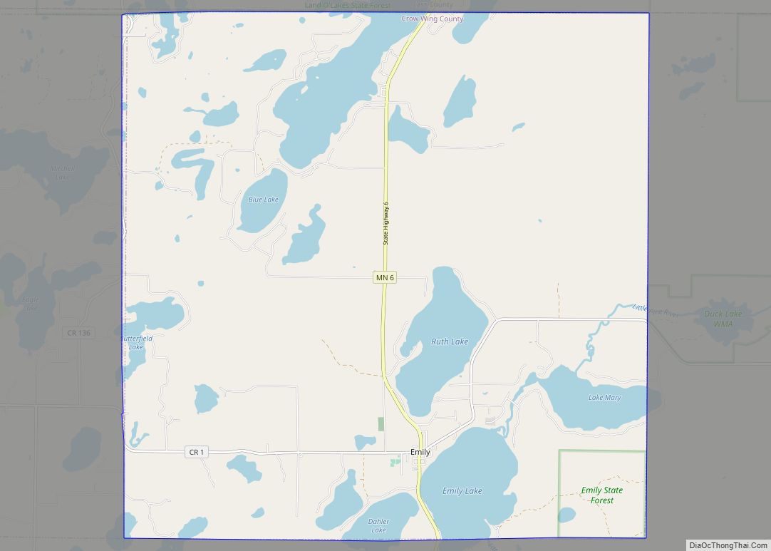
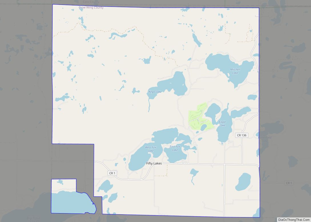
Online Interactive Map
Click on ![]() to view map in "full screen" mode.
to view map in "full screen" mode.
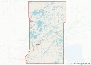
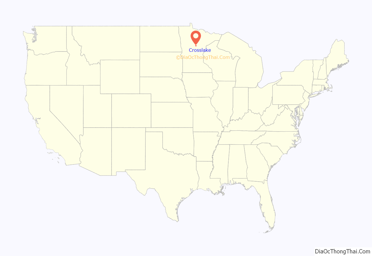
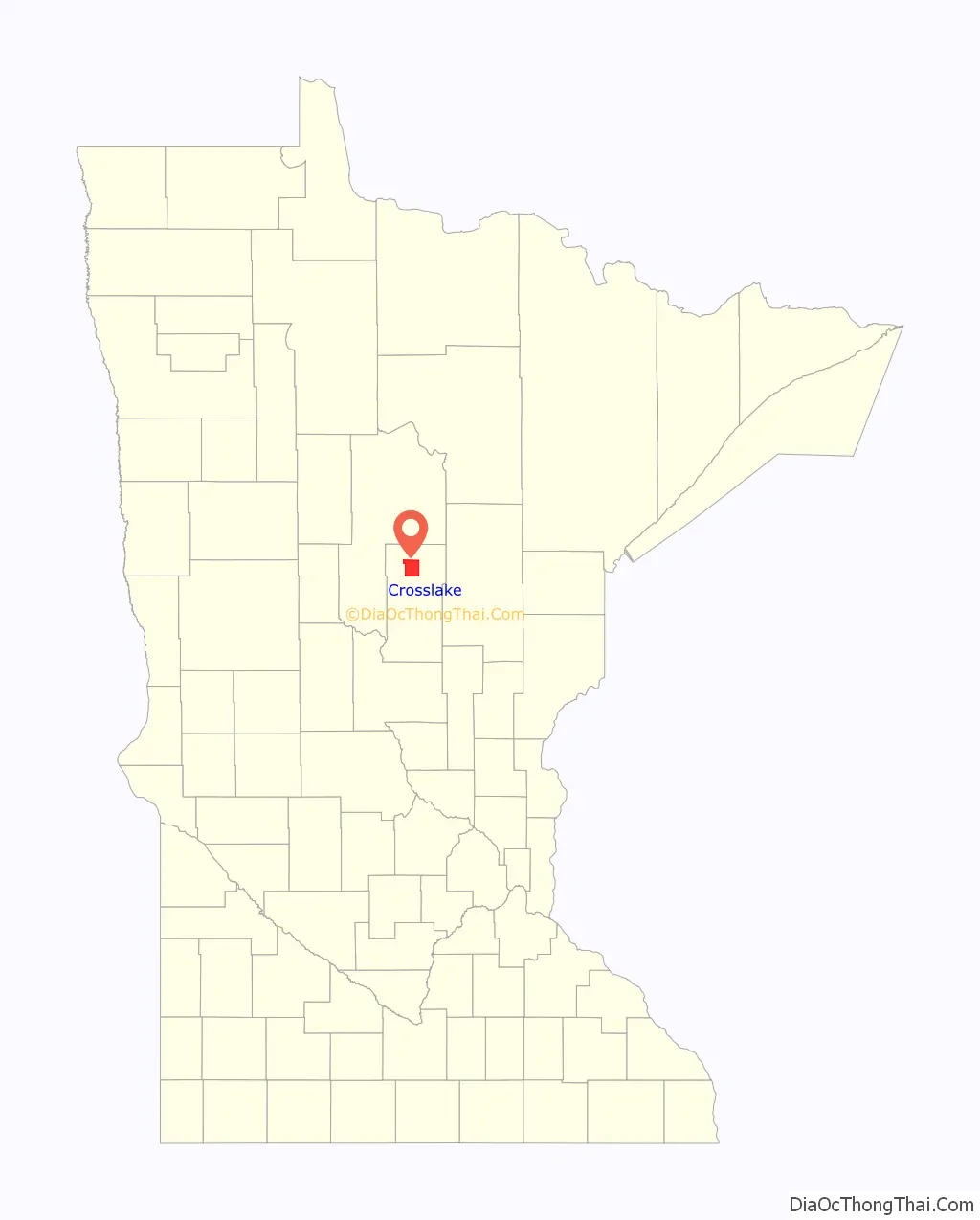
Crosslake location map. Where is Crosslake city?
History
The area of what is now Crosslake, Minnesota gained traction near the late 1800s, after the construction of the Pine River Dam in 1885. The Logging Industry in upper Minnesota at the time was flourishing, attracting many of the first early residents of Crosslake.
Originally, the area was part of Watertown Township of Cass County. This township was annexed to Crow Wing County in 1887. It was finally accepted as by the Crow Wing County board in 1903. In 1951, the south half of this township became Crosslake Village with the remainder becoming North Crosslake Village in 1964. They became Crosslake Village in 1972 and the City of Crosslake in 1974.
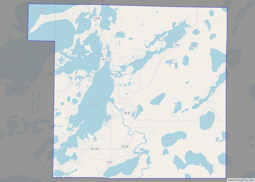
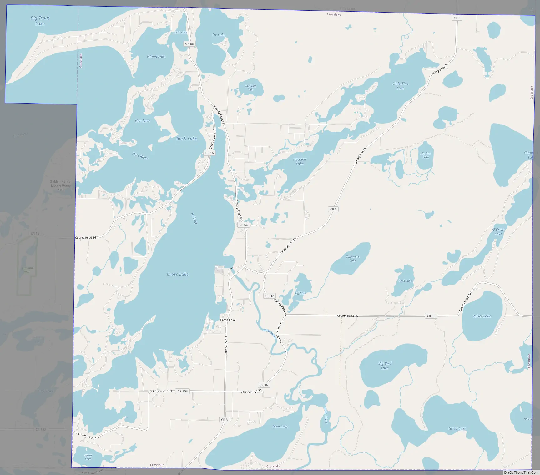
Crosslake Road Map
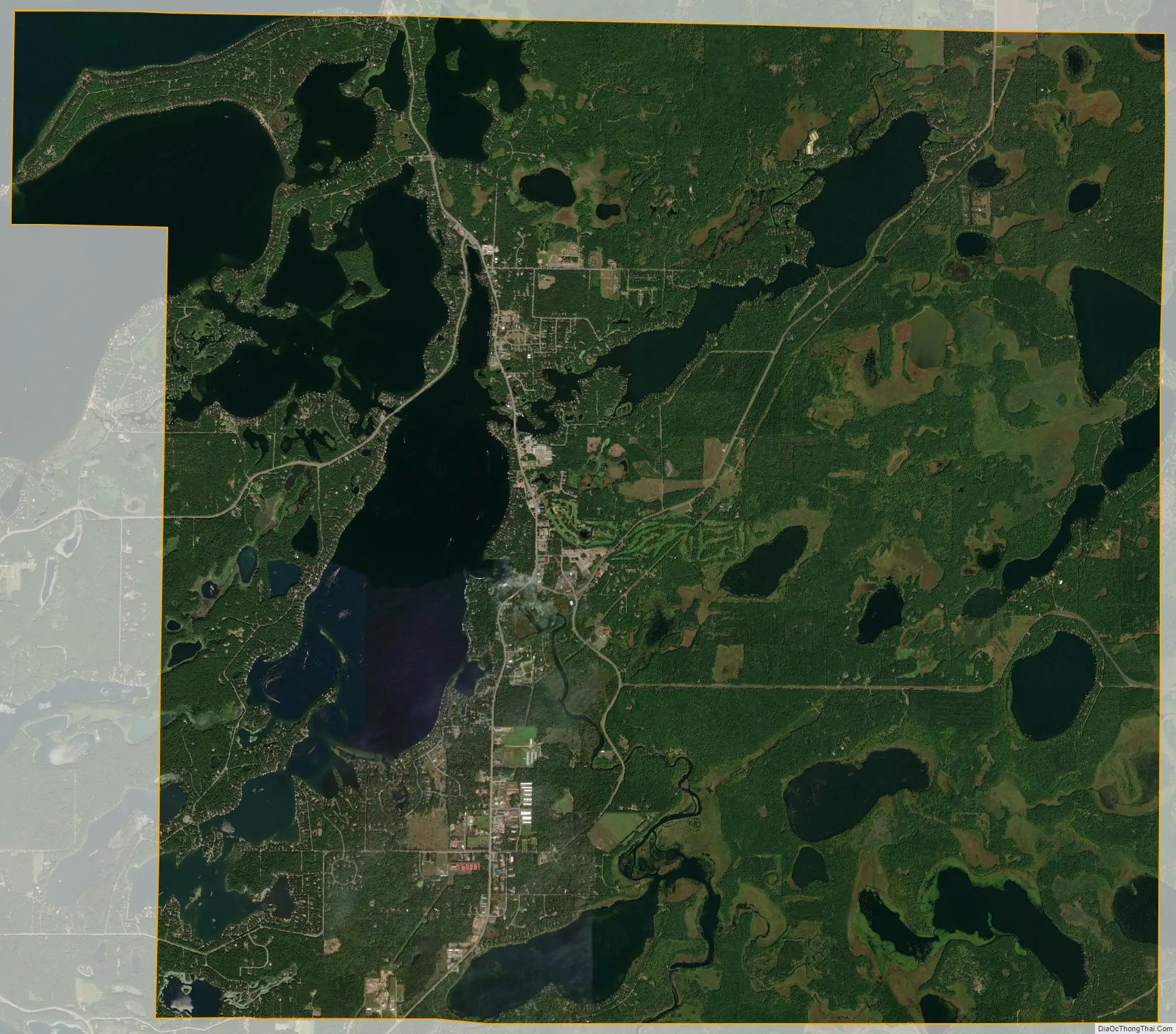
Crosslake city Satellite Map
Geography
According to the United States Census Bureau, the city has a total area of 36.89 square miles (95.54 km), of which 25.74 square miles (66.67 km) is land and 11.15 square miles (28.88 km) is water. Main routes include County Roads 3, 16, 36, 66, and 103.
Crosslake is part of the Brainerd Lakes Area, consisting of nearly 460 lakes within a 25-mile radius of Brainerd.
Climate
See also
Map of Minnesota State and its subdivision:- Aitkin
- Anoka
- Becker
- Beltrami
- Benton
- Big Stone
- Blue Earth
- Brown
- Carlton
- Carver
- Cass
- Chippewa
- Chisago
- Clay
- Clearwater
- Cook
- Cottonwood
- Crow Wing
- Dakota
- Dodge
- Douglas
- Faribault
- Fillmore
- Freeborn
- Goodhue
- Grant
- Hennepin
- Houston
- Hubbard
- Isanti
- Itasca
- Jackson
- Kanabec
- Kandiyohi
- Kittson
- Koochiching
- Lac qui Parle
- Lake
- Lake of the Woods
- Lake Superior
- Le Sueur
- Lincoln
- Lyon
- Mahnomen
- Marshall
- Martin
- McLeod
- Meeker
- Mille Lacs
- Morrison
- Mower
- Murray
- Nicollet
- Nobles
- Norman
- Olmsted
- Otter Tail
- Pennington
- Pine
- Pipestone
- Polk
- Pope
- Ramsey
- Red Lake
- Redwood
- Renville
- Rice
- Rock
- Roseau
- Saint Louis
- Scott
- Sherburne
- Sibley
- Stearns
- Steele
- Stevens
- Swift
- Todd
- Traverse
- Wabasha
- Wadena
- Waseca
- Washington
- Watonwan
- Wilkin
- Winona
- Wright
- Yellow Medicine
- Alabama
- Alaska
- Arizona
- Arkansas
- California
- Colorado
- Connecticut
- Delaware
- District of Columbia
- Florida
- Georgia
- Hawaii
- Idaho
- Illinois
- Indiana
- Iowa
- Kansas
- Kentucky
- Louisiana
- Maine
- Maryland
- Massachusetts
- Michigan
- Minnesota
- Mississippi
- Missouri
- Montana
- Nebraska
- Nevada
- New Hampshire
- New Jersey
- New Mexico
- New York
- North Carolina
- North Dakota
- Ohio
- Oklahoma
- Oregon
- Pennsylvania
- Rhode Island
- South Carolina
- South Dakota
- Tennessee
- Texas
- Utah
- Vermont
- Virginia
- Washington
- West Virginia
- Wisconsin
- Wyoming