Cuyuna (/kaɪˈjuːnə/ kye-YOO-nə) is a city in Crow Wing County, Minnesota, United States. The population was 332 at the 2010 census. It is part of the Brainerd Micropolitan Statistical Area.
The city lies within its namesake, the Cuyuna Range, a line of iron-bearing hills in central Minnesota. Cuyuna was one of the mining towns along the range, part of a list including Crosby, Ironton, Trommald, and Manganese. The Cuyuna iron range saw its heyday in the first half of the 20th century, and mining on the range ceased in 1984. The local economy is now dependent upon tourism from mountain bikers. Cuyuna has been declared to have the best trail systems in Minnesota as of 2014. The Cuyuna Country State Recreation Area now encompasses some of the range.
Cuyuna is located within ZIP code 56444 based in Deerwood.
| Name: | Cuyuna city |
|---|---|
| LSAD Code: | 25 |
| LSAD Description: | city (suffix) |
| State: | Minnesota |
| County: | Crow Wing County |
| Elevation: | 1,253 ft (382 m) |
| Total Area: | 3.38 sq mi (8.75 km²) |
| Land Area: | 3.23 sq mi (8.38 km²) |
| Water Area: | 0.14 sq mi (0.37 km²) |
| Total Population: | 296 |
| Population Density: | 91.53/sq mi (35.33/km²) |
| ZIP code: | 56444 |
| Area code: | 218 |
| FIPS code: | 2714428 |
| GNISfeature ID: | 0642570 |
| Website: | www.ci.cuyuna.mn.us |
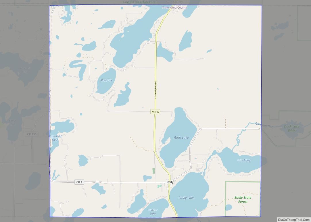
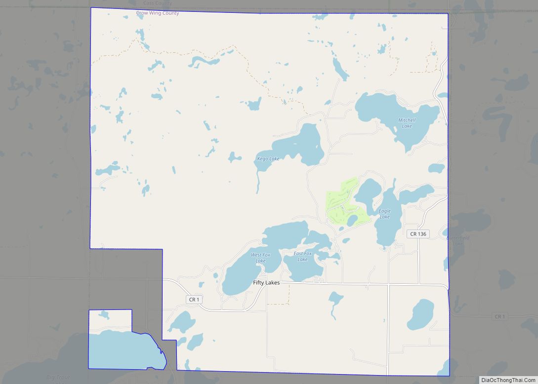
Online Interactive Map
Click on ![]() to view map in "full screen" mode.
to view map in "full screen" mode.
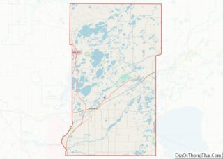
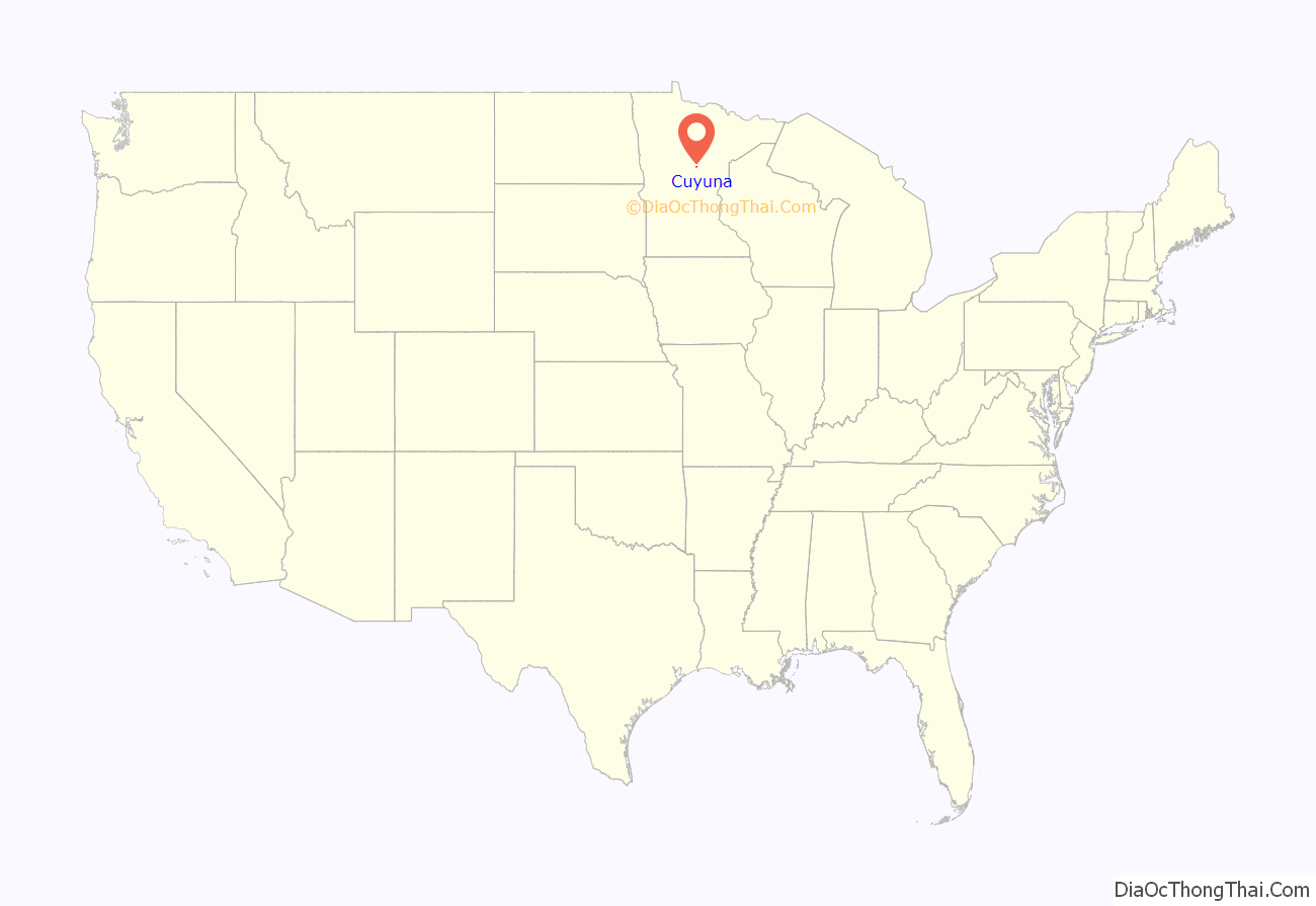
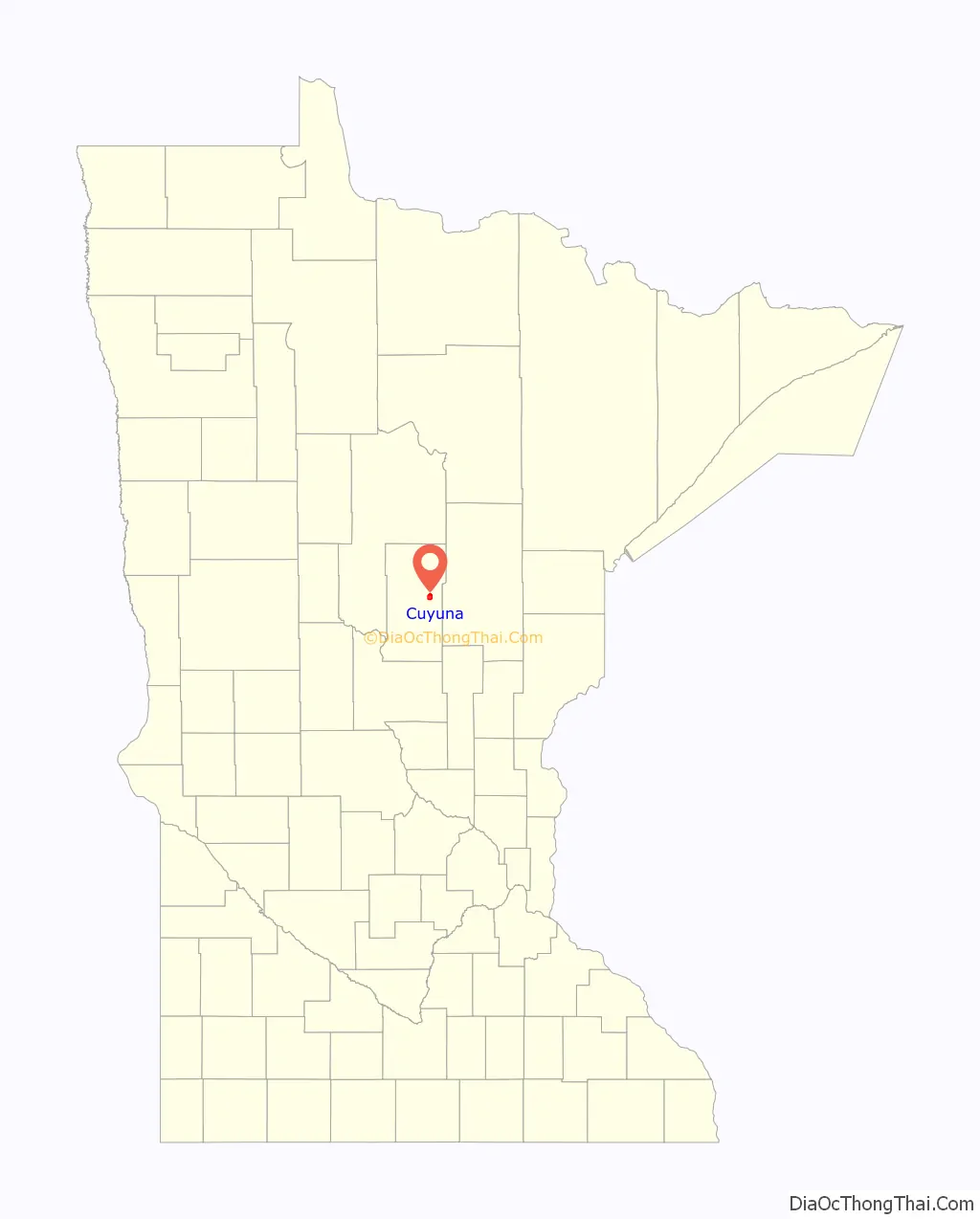
Cuyuna location map. Where is Cuyuna city?
History
Cuyuna was incorporated in 1910. Cuyuna, and the iron ore range on which it is situated, were named by and for Cuyler Adams, and for his dog, Una, who accompanied him in many lone prospecting trips. Cuyler Adams was a prospector, discoverer, and then mine owner of the Cuyuna range. Cuyler Adams affirmed the discovery of workable ore deposits nearby, and credited jointly to himself and the valuable aid of Una.
The Rabbit Lake Band of Mississippi Chippewa historically lived in the Cuyuna area. Under the authority of the 1855 Treaty of Washington (10 Stat. 1165), the Rabbit Lake Indian Reservation was established, encompassing an area from where Riverton to Cuyuna are located. After the Dakota War of 1862, majority of the Rabbit Lake Band were removed to the area about Leech Lake and eventually to the White Earth Indian Reservation, and minority of the remaining Rabbit Lake Band members amalgamating with the Mille Lacs Band of Ojibwe to their south. After they were removed there was little settlement in the area until the beginning of a mining village named Cuyuna in 1906. Cuyuna was platted in November 1908.
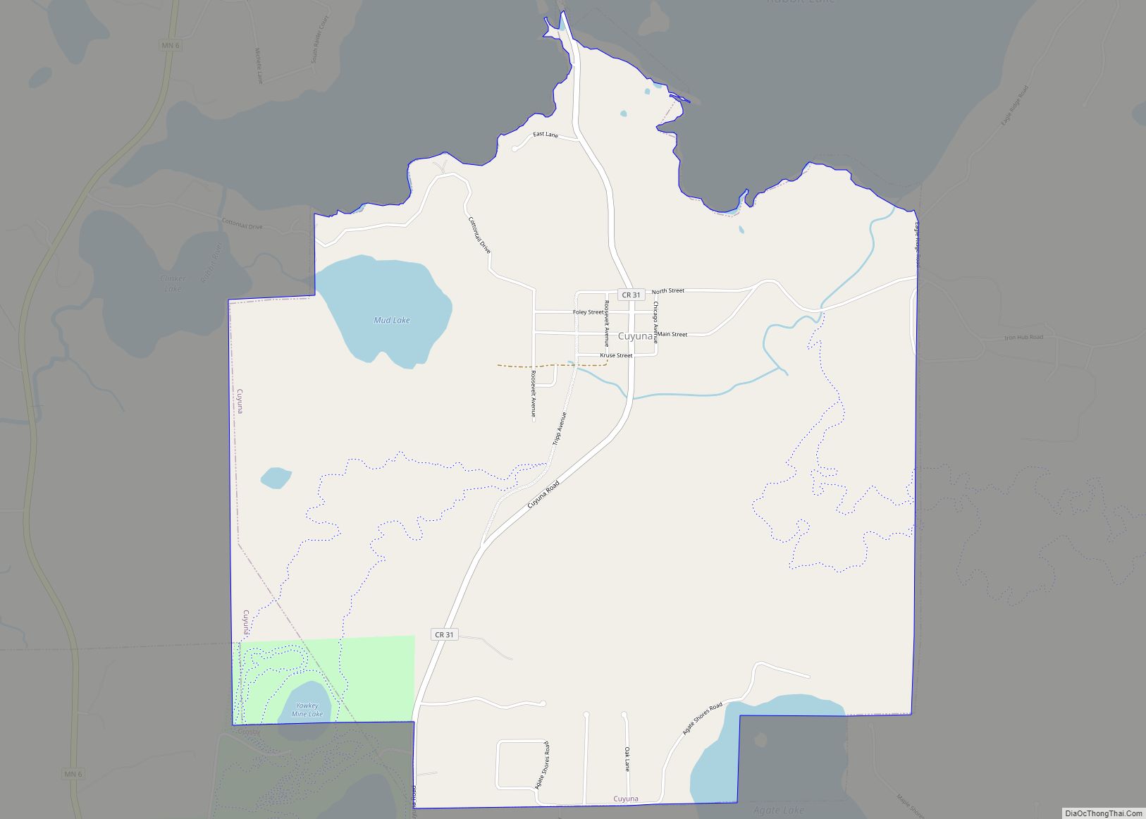
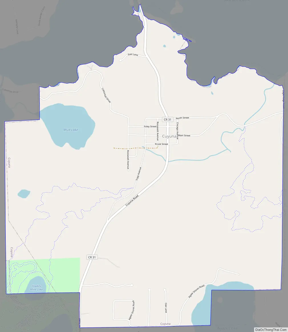
Cuyuna Road Map
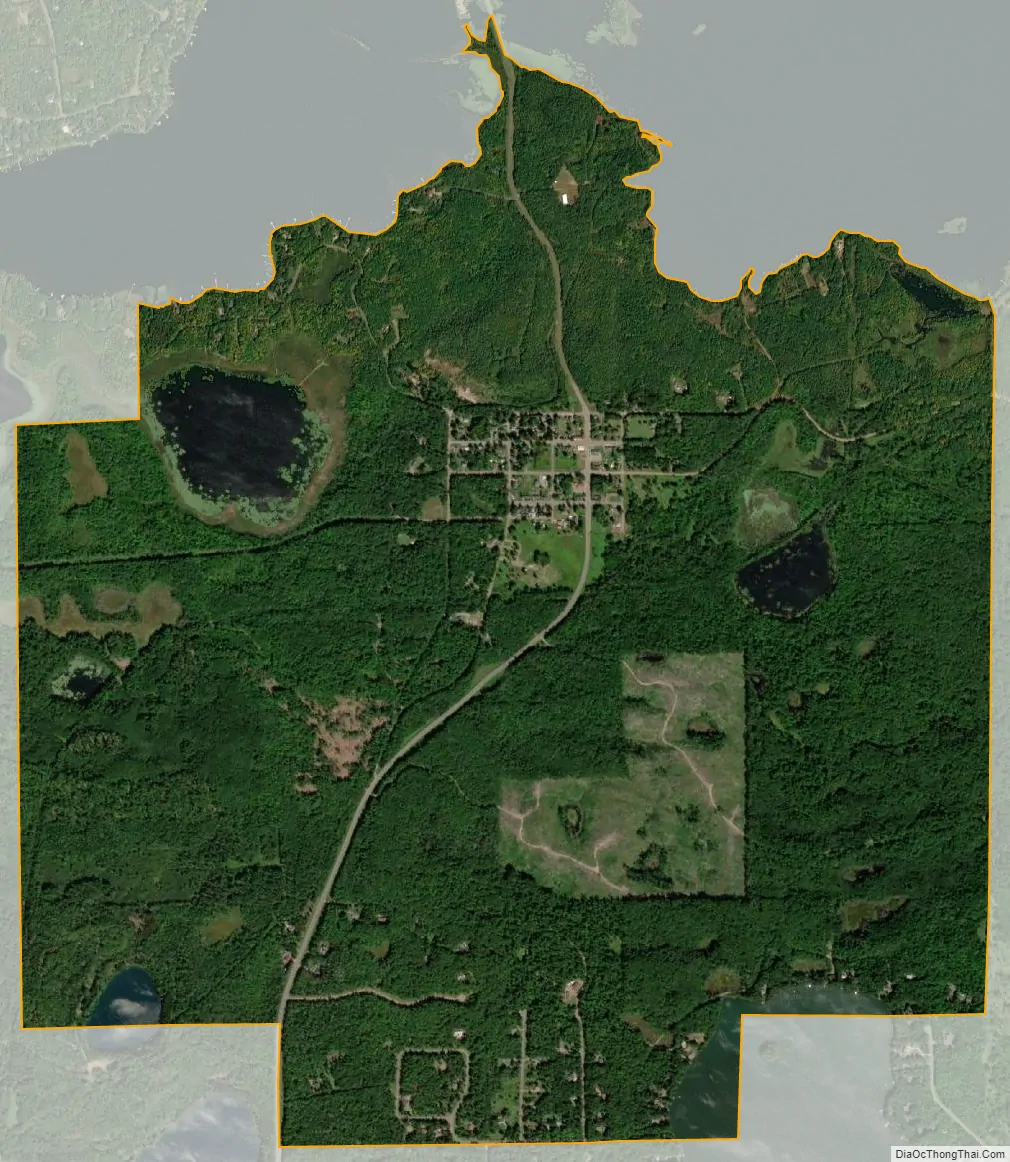
Cuyuna city Satellite Map
Geography
According to the United States Census Bureau, the city has a total area of 3.53 square miles (9.14 km), of which 3.28 square miles (8.50 km) is land and 0.25 square miles (0.65 km) is water.
Crow Wing County Road 31 serves as a main route in the community. Nearby routes include State Highways 6 (MN 6) and 210 (MN 210), and County Road 30.
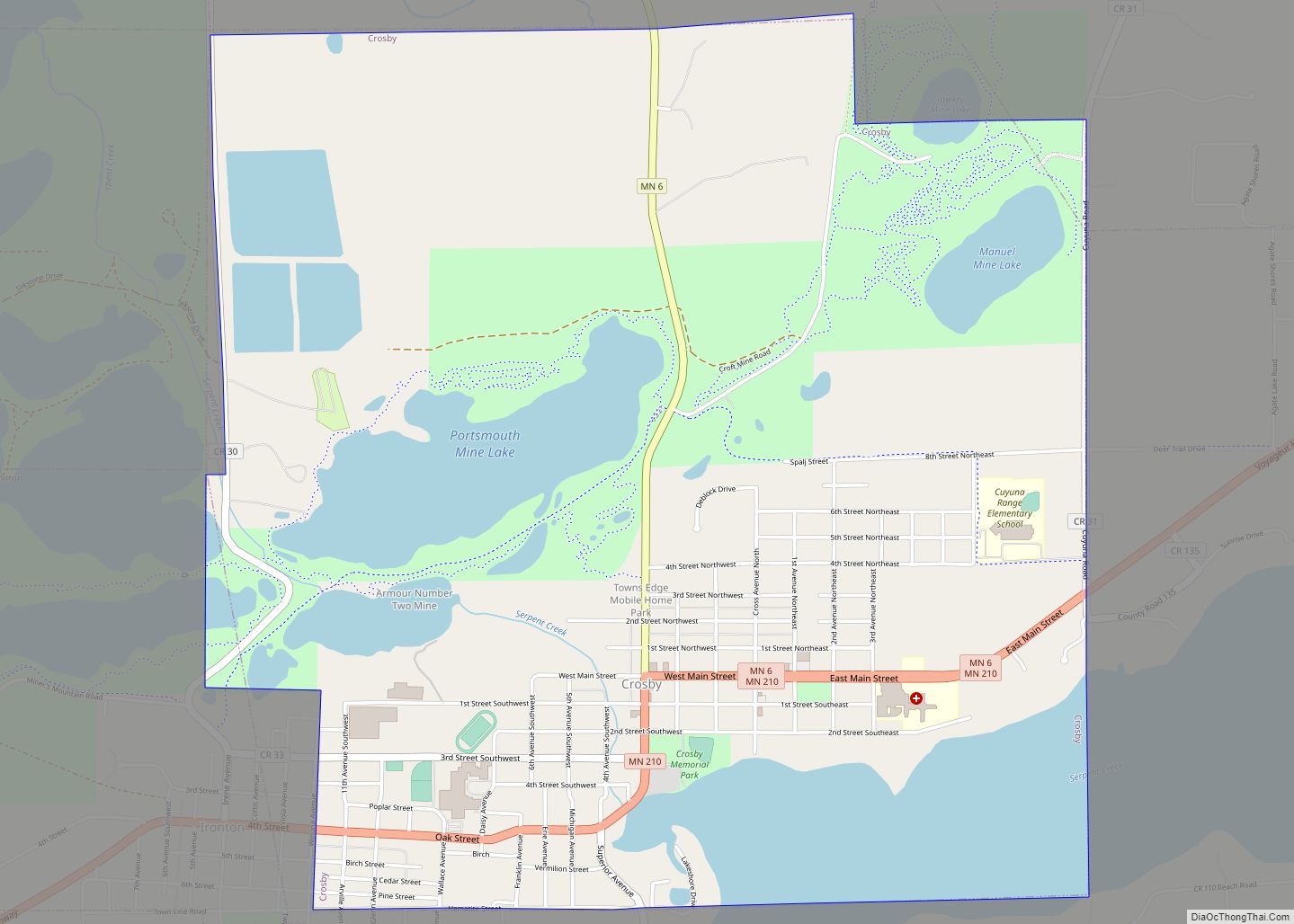
The community is located south of Rabbit Lake. The town of Crosby and the Cuyuna Country State Recreation Area are approximately three miles to the south-southwest.
See also
Map of Minnesota State and its subdivision:- Aitkin
- Anoka
- Becker
- Beltrami
- Benton
- Big Stone
- Blue Earth
- Brown
- Carlton
- Carver
- Cass
- Chippewa
- Chisago
- Clay
- Clearwater
- Cook
- Cottonwood
- Crow Wing
- Dakota
- Dodge
- Douglas
- Faribault
- Fillmore
- Freeborn
- Goodhue
- Grant
- Hennepin
- Houston
- Hubbard
- Isanti
- Itasca
- Jackson
- Kanabec
- Kandiyohi
- Kittson
- Koochiching
- Lac qui Parle
- Lake
- Lake of the Woods
- Lake Superior
- Le Sueur
- Lincoln
- Lyon
- Mahnomen
- Marshall
- Martin
- McLeod
- Meeker
- Mille Lacs
- Morrison
- Mower
- Murray
- Nicollet
- Nobles
- Norman
- Olmsted
- Otter Tail
- Pennington
- Pine
- Pipestone
- Polk
- Pope
- Ramsey
- Red Lake
- Redwood
- Renville
- Rice
- Rock
- Roseau
- Saint Louis
- Scott
- Sherburne
- Sibley
- Stearns
- Steele
- Stevens
- Swift
- Todd
- Traverse
- Wabasha
- Wadena
- Waseca
- Washington
- Watonwan
- Wilkin
- Winona
- Wright
- Yellow Medicine
- Alabama
- Alaska
- Arizona
- Arkansas
- California
- Colorado
- Connecticut
- Delaware
- District of Columbia
- Florida
- Georgia
- Hawaii
- Idaho
- Illinois
- Indiana
- Iowa
- Kansas
- Kentucky
- Louisiana
- Maine
- Maryland
- Massachusetts
- Michigan
- Minnesota
- Mississippi
- Missouri
- Montana
- Nebraska
- Nevada
- New Hampshire
- New Jersey
- New Mexico
- New York
- North Carolina
- North Dakota
- Ohio
- Oklahoma
- Oregon
- Pennsylvania
- Rhode Island
- South Carolina
- South Dakota
- Tennessee
- Texas
- Utah
- Vermont
- Virginia
- Washington
- West Virginia
- Wisconsin
- Wyoming