Dundas (/ˈdʌndəs/ DUN-dəss) is a city in Rice County, Minnesota, United States. The population was 1,367 at the 2010 census. Dundas is bordered by the city of Northfield. United States Army Major General Ulysses G. McAlexander was born in Dundas in 1864.
| Name: | Dundas city |
|---|---|
| LSAD Code: | 25 |
| LSAD Description: | city (suffix) |
| State: | Minnesota |
| County: | Rice County |
| Elevation: | 932 ft (284 m) |
| Total Area: | 1.85 sq mi (4.78 km²) |
| Land Area: | 1.85 sq mi (4.78 km²) |
| Water Area: | 0.00 sq mi (0.00 km²) |
| Total Population: | 1,712 |
| Population Density: | 926.91/sq mi (357.83/km²) |
| ZIP code: | 55019 |
| Area code: | 507 |
| FIPS code: | 2717126 |
| GNISfeature ID: | 0642978 |
| Website: | http://www.cityofdundas.org/ |
Online Interactive Map
Click on ![]() to view map in "full screen" mode.
to view map in "full screen" mode.
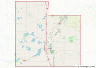
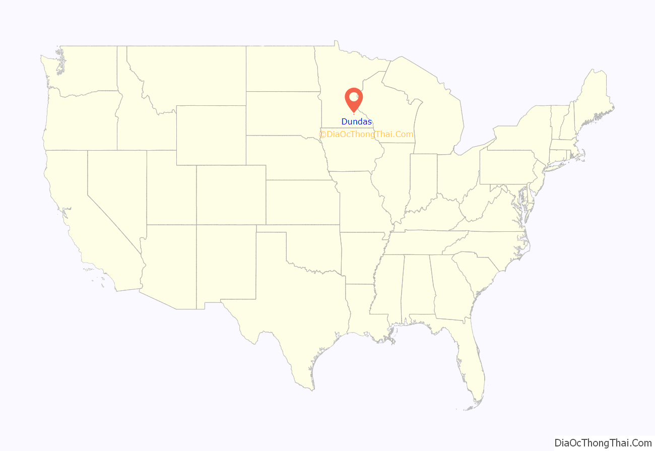
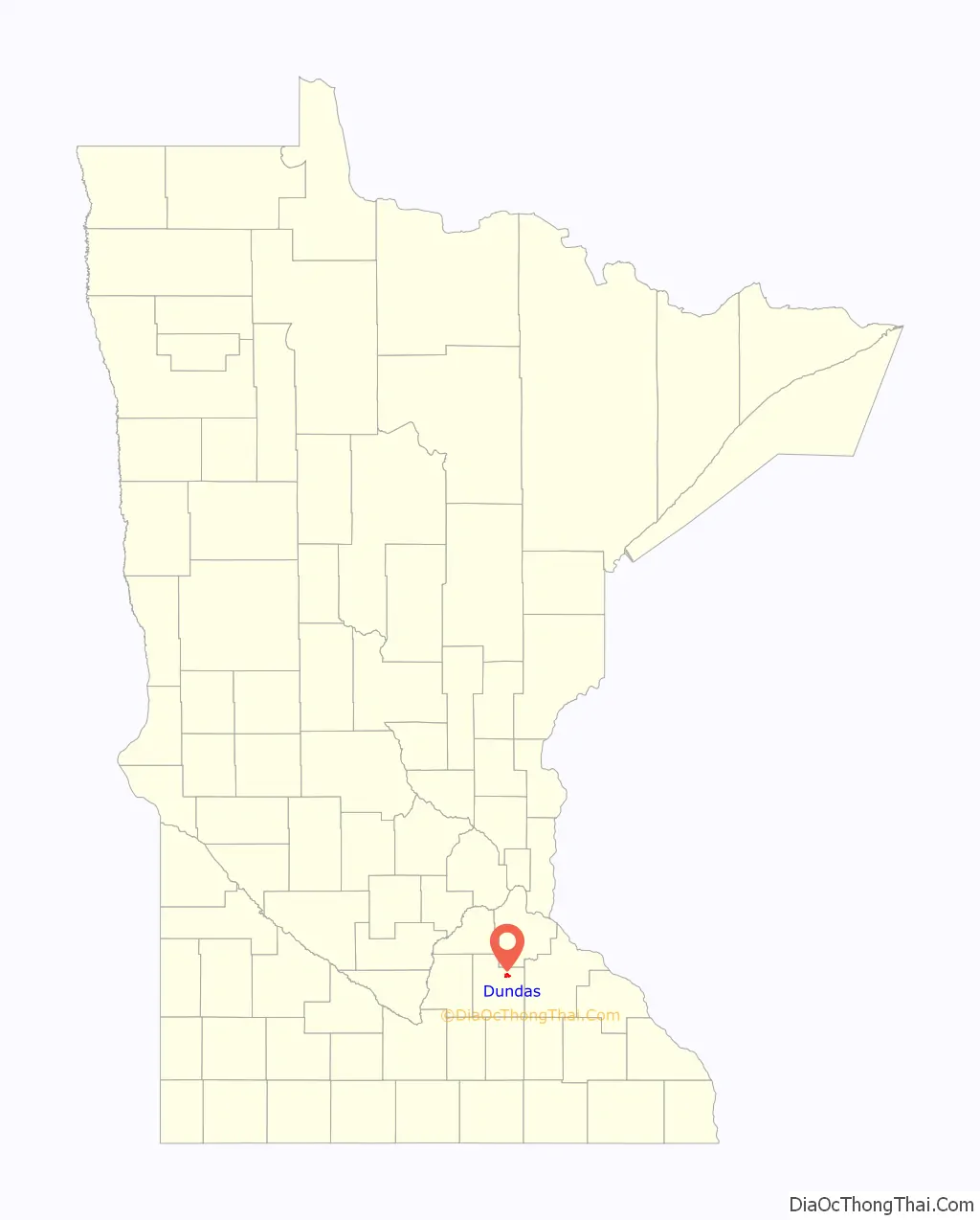
Dundas location map. Where is Dundas city?
History
Dundas was platted in 1857 by the Archibalds: brothers John Sidney and Edward T., along with their cousin George Archibald, who built mills on both sides of the Cannon River. The brothers named the city after their home Dundas County, Ontario, Canada.
The ruins of The Archibald Mill a flour mill can still be seen today on the west bank of the Cannon River. The milling industry contributed greatly to Dundas’ 19th-century success, and at one point the mills in Dundas were considered among the best in the world.
The city’s original central business district was located on Second Street, and by 1866 it included two general stores, a library, hotel, shoe store, restaurant, meeting hall and saloon. The neighborhood began to shift once the Minnesota Central Railway built its station on the west side of the river, resulting in the development of Railway Street and the platting of the Railway Addition in 1865. All that remains of the original commercial district is the Ault Store (built in 1866), which started as a general store and housed the town’s first library on the second floor; the same building also served as the home of the Dundas News for its operation from 1876-79 when it was bought and absorbed by the Northfield News.
The Archibald Mill, Adult Store and Edward T. Archibald House are among the five local structures listed on the National Register of Historic Places.
Today, the town is chiefly a bedroom community for nearby Northfield and the more distant Minneapolis-St. Paul metropolitan area. The juxtaposition of Dundas and Northfield and their disparate zoning policies and attitudes toward development have led to some unusual growth patterns. Dundas is home to a number of businesses, such as an off-sale liquor store and two bars that would be unable to get licenses to operate in Northfield. Contrary to popular opinion and local lore, Dundas Technical University (Dundas Tech) only exists on T-shirts and jokes from Northfield and Faribault natives.
Dundas has the only public feed mill within about 40 miles. It is operated by Interstate Mills on the site of the original grain elevator. In 1999, the threat of a Target store being sited in Dundas—rather than Northfield—was instrumental in forcing changes to Northfield’s zoning to allow such uses.
A Union Pacific freight railroad line passes through Dundas.
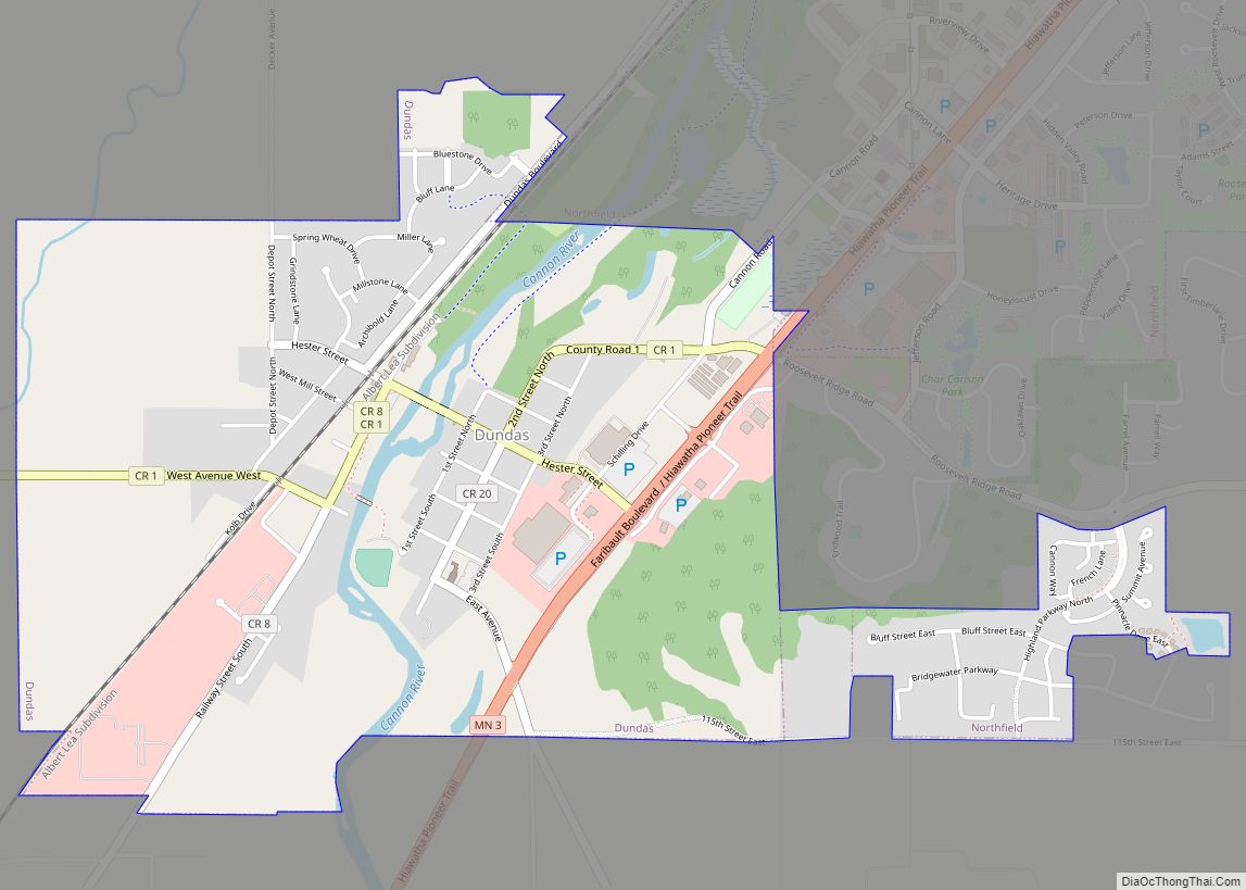
Dundas Road Map
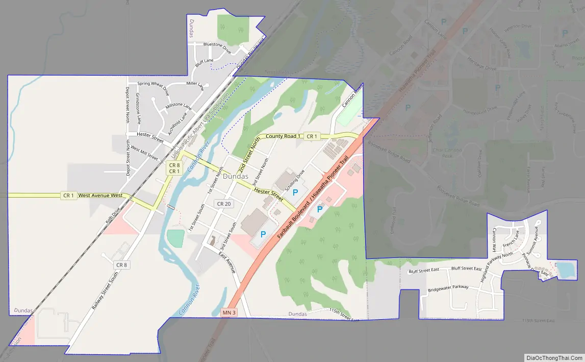
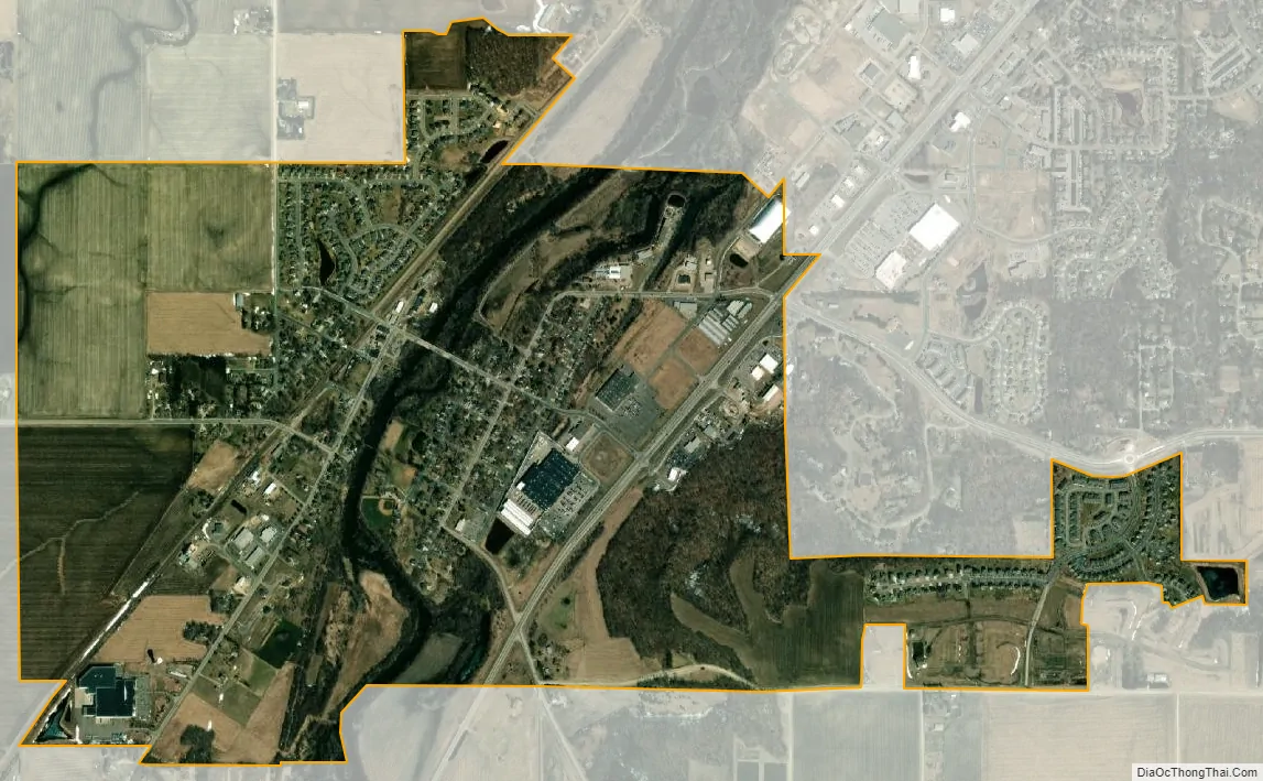
Dundas city Satellite Map
Geography
According to the United States Census Bureau, the city has a total area of 1.92 square miles (4.97 km), all land. The Cannon River passes through the center of town. The latitude of Dundas is 44.429N. The longitude is 93.204W. Dundas’ elevation is 932 feet above sea level.
Minnesota State Highway 3 and Rice County Road 1 are two of the main routes in the community. Interstate 35 is nearby.
See also
Map of Minnesota State and its subdivision:- Aitkin
- Anoka
- Becker
- Beltrami
- Benton
- Big Stone
- Blue Earth
- Brown
- Carlton
- Carver
- Cass
- Chippewa
- Chisago
- Clay
- Clearwater
- Cook
- Cottonwood
- Crow Wing
- Dakota
- Dodge
- Douglas
- Faribault
- Fillmore
- Freeborn
- Goodhue
- Grant
- Hennepin
- Houston
- Hubbard
- Isanti
- Itasca
- Jackson
- Kanabec
- Kandiyohi
- Kittson
- Koochiching
- Lac qui Parle
- Lake
- Lake of the Woods
- Lake Superior
- Le Sueur
- Lincoln
- Lyon
- Mahnomen
- Marshall
- Martin
- McLeod
- Meeker
- Mille Lacs
- Morrison
- Mower
- Murray
- Nicollet
- Nobles
- Norman
- Olmsted
- Otter Tail
- Pennington
- Pine
- Pipestone
- Polk
- Pope
- Ramsey
- Red Lake
- Redwood
- Renville
- Rice
- Rock
- Roseau
- Saint Louis
- Scott
- Sherburne
- Sibley
- Stearns
- Steele
- Stevens
- Swift
- Todd
- Traverse
- Wabasha
- Wadena
- Waseca
- Washington
- Watonwan
- Wilkin
- Winona
- Wright
- Yellow Medicine
- Alabama
- Alaska
- Arizona
- Arkansas
- California
- Colorado
- Connecticut
- Delaware
- District of Columbia
- Florida
- Georgia
- Hawaii
- Idaho
- Illinois
- Indiana
- Iowa
- Kansas
- Kentucky
- Louisiana
- Maine
- Maryland
- Massachusetts
- Michigan
- Minnesota
- Mississippi
- Missouri
- Montana
- Nebraska
- Nevada
- New Hampshire
- New Jersey
- New Mexico
- New York
- North Carolina
- North Dakota
- Ohio
- Oklahoma
- Oregon
- Pennsylvania
- Rhode Island
- South Carolina
- South Dakota
- Tennessee
- Texas
- Utah
- Vermont
- Virginia
- Washington
- West Virginia
- Wisconsin
- Wyoming