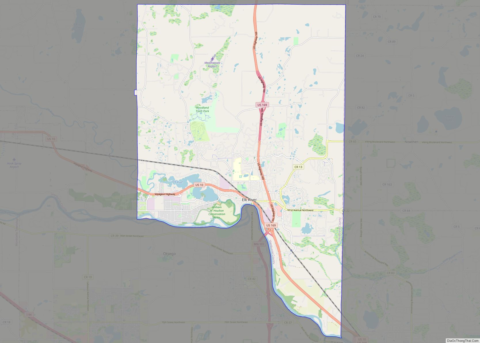
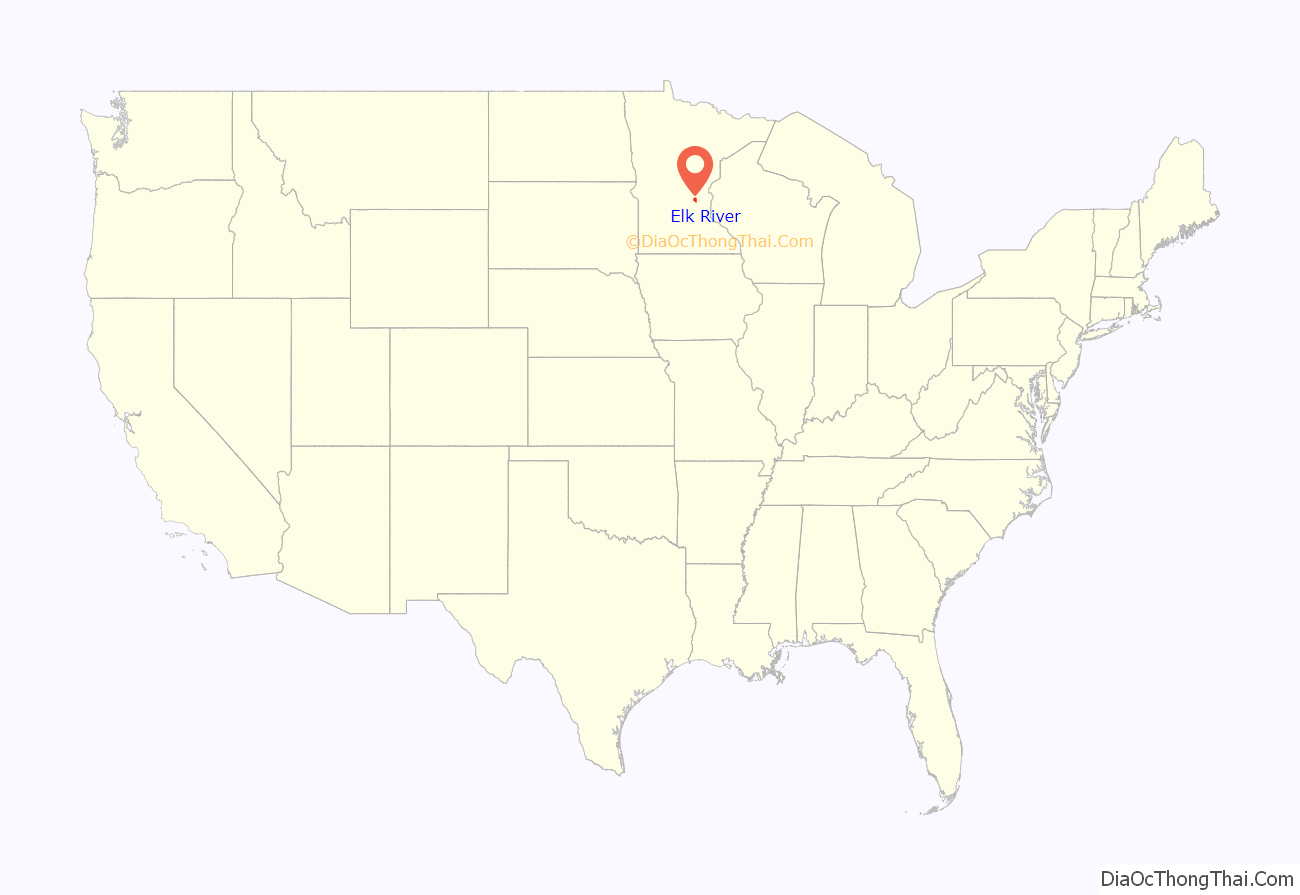
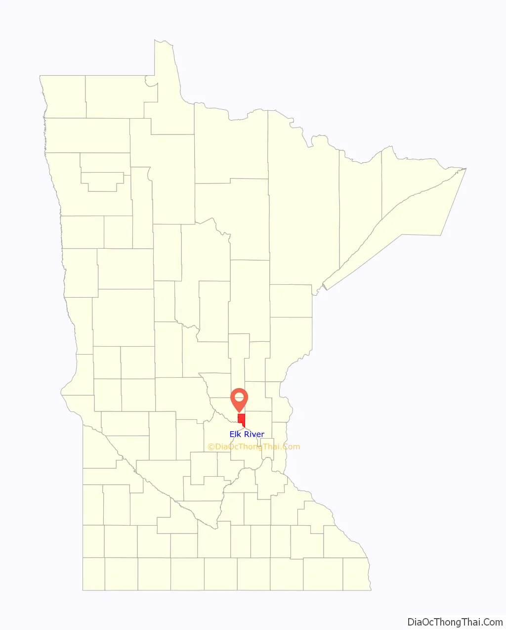
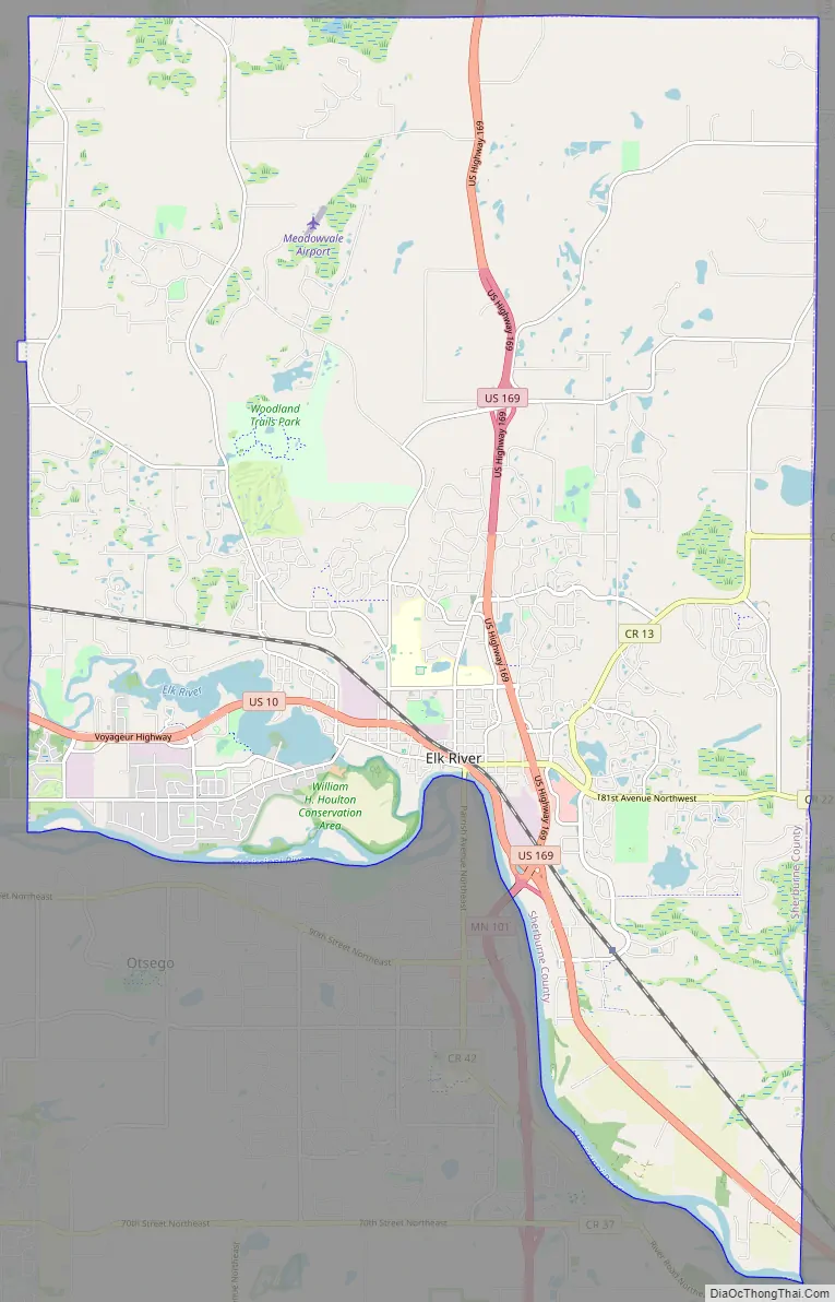
Elk River is a city in Sherburne County, Minnesota, United States, approximately 34 miles northwest of Minneapolis. It is situated at the confluence of the Mississippi and Elk Rivers. The population was 25,835 at the 2020 census, making Elk River the second largest city in the Central Minnesota region after St. Cloud. It is the county seat. U.S. Highways 10 and 169 and State Highway 101 are three of the main routes in Elk River, and a station on the Northstar Commuter Rail line to downtown Minneapolis is located in the city. Elk River is located 33.2 miles northwest of Minneapolis and 37.4 miles southeast of St. Cloud.
| Name: | Elk River city |
|---|---|
| LSAD Code: | 25 |
| LSAD Description: | city (suffix) |
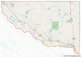
| State: | Minnesota |
| County: | Sherburne County |
| Elevation: | 896 ft (273 m) |
| Total Area: | 43.85 sq mi (113.56 km²) |
| Land Area: | 42.33 sq mi (109.63 km²) |
| Water Area: | 1.52 sq mi (3.93 km²) |
| Total Population: | 25,835 |
| Population Density: | 610.34/sq mi (235.66/km²) |
| ZIP code: | 55330 |
| Area code: | Area code 763 |
| FIPS code: | 2718674 |
| GNISfeature ID: | 0643266 |
| Website: | elkrivermn.gov |
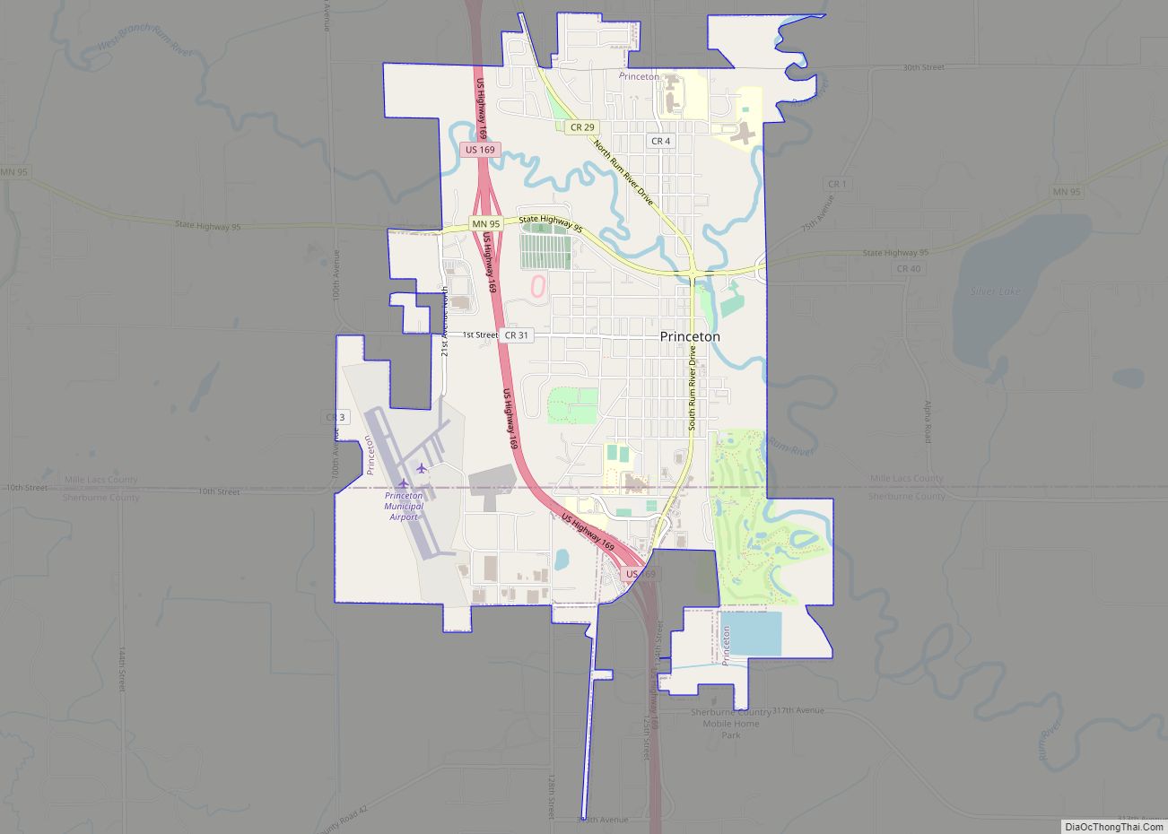
Online Interactive Map
Click on ![]() to view map in "full screen" mode.
to view map in "full screen" mode.
Elk River location map. Where is Elk River city?
History
The hardwood-forested hills in which Elk River is situated was pushed up by the last glacier that advanced across Minnesota. These hills are made up of coarse materials which is the reason gravel mining is so prevalent in Elk River, and also the reason much of the area is not considered good farmland for culture and agriculture use.
To the south of Elk River lies the prairie. This natural boundary between the prairie and woods was also a boundary between Indian nations. Two battles between the Dakota and Ojibwe took place where the Elk River meets the Mississippi in 1772 and 1773.
Rivers
Zebulon Pike passed through the area on his 1805 exploration of the Upper Mississippi River and named the Elk River after the herds of elk he saw in the area. David Frederic Faribault, son of French-Canadian fur trader Jean-Baptiste Faribault built a trading post near the conjunction of the Elk and Mississippi Rivers in 1846, which he later sold, in 1848, to H.M. Rice and S.P. Folsom. Folsom moved his family to the place and built a log cabin. French fur trader and guide Pierre Bottineau bought the post and cabin from Folsom. The trading post stood on a bluff just north of the present day bridge across the Elk River on main street. Bottineau also built a hotel in 1850 on the bank of the Mississippi about a half mile below the mouth of the Elk. The two rivers and the Red River Trail, which passed nearby, made this area a good location for commerce.
Silas Lane opened up a farm near the old trading post site, making his claim in section 33 in 1850. A large number of early settlers came from Maine and nearly all of them were experts in lumbering. In 1851, Ard Godfrey and John C. Jamieson, a native of Orono, Maine, saw the potential of the water power of the Elk River and purchased the claim from Lane. They built a dam and a sawmill. Their dam created the first lobe of Lake Orono (called the Mill Pond), which extended from the present day dam to Orono Cemetery Point. In 1855, the area by the dam was platted and the town of Orono (known as Upper Town) was created.
In the latter half of the 19th century, agriculture and dairy farming replaced lumber as the base of Elk River’s economy. Grist mills and a starch factory, which took advantage of the potato fields to the west, were built.
The Orono-Elk River area continued to grow until by 1860 it had reached a population of 723 people. These early settlers typically came from New England. Elk River’s population continued to grow following a slow period caused by the civil war. The majority of people moving to Elk River by that time were from Northern Europe.
The village of Elk River was platted in 1865, replatted in 1868, and when incorporated in the winter of 1880–1881, included both Orono and Elk River. By 1870, Elk River swelled to a population of 2,050 and became the county seat in 1872. Around this same time, the railroads replaced the rivers as the main focus of transportation and the Lower Town (the present day historic downtown area) replaced Upper Town as the focus of commerce.
The Orono Dam was destroyed by an ice storm in 1912, but hydropower gave a new incentive to dam the Elk River in 1915. This new dam created the four lobes of Lake Orono as we know it today. In 1916, the Village of Elk River received electricity for the first time. The entire township of Elk River would not get electricity until after World War II.
Road transportation
Charles Babcock, a native son of Elk River and the first Commissioner of Highways for the state, had a visionary plan to “get Minnesota out of the mud.” His plan to create a network of paved roads became a model for the rest of the nation and the Jefferson Highway (now Highway 10) became one of the first paved roads in the state. Highway 10 used to cross the Elk River over the dam bridge, but was rerouted to its present location shortly after World War II.
Jackson Avenue used to be Highway 169. For years, the intersection of this road and Highway 10 was the only one with a stoplight in Elk River and on major travel weekends, traffic would back up halfway to Anoka. Work on Highway 169 to bypass Elk River began in 1961. Work on a new route for Highway 101 between Rogers and Elk River began in 1968.
In 1974, the Village of Elk River changed to the City of Elk River. In 1978, the City of Elk River and the township of Elk River were consolidated to create one unit known as the City of Elk River as it exists today. The result was one of the largest land-based cities in the state of Minnesota, at 44 square miles.
Besides transportation, energy has always played a significant role in shaping Elk River. The first rural nuclear power plant in the United States went online in 1960 as Great River Energy’s (GRE) site in Elk River. It was meant only as a demonstration site and was dismantled after several successful years of operation.
Energy City
In the late 1980s, GRE’s power plant was converted to burn refuse-derived fuel. This innovative source of energy was one factor that helped Elk River receive the designation of “Energy City” by the Minnesota Environmental Initiative in October 1997. As Energy City, Minnesota’s energy industries demonstrate cutting edge renewable and energy efficient technologies in Elk River.
By the 1990s, Elk River and Sherburne County were in one of the fastest growing corridors in the state and in the country. This population growth and the area’s high commuter rate factored into the ultimate approval and implementation of the Northstar Commuter Rail service from Minneapolis to Big Lake, which began service on November 16, 2009.
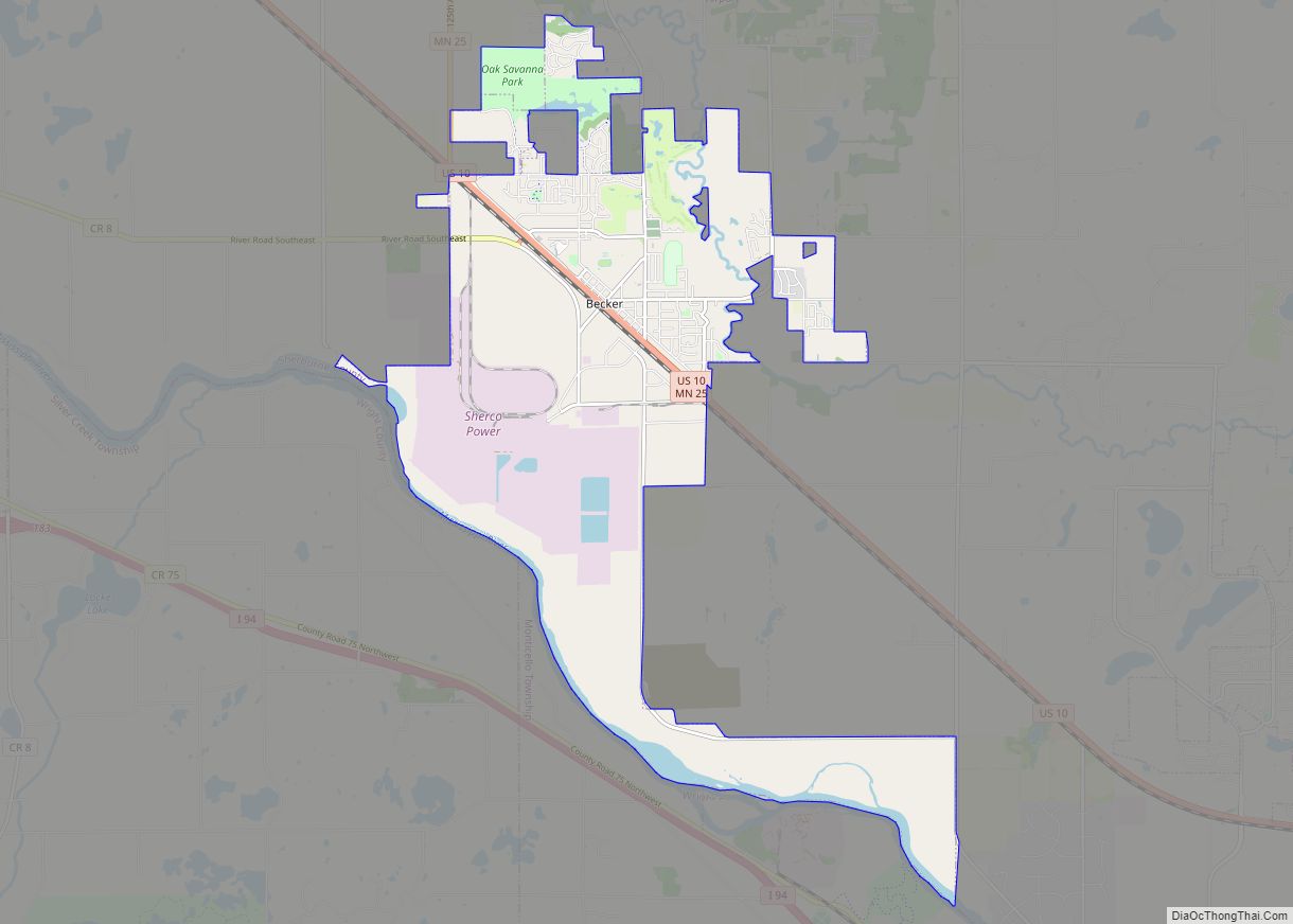
Elk River Road Map
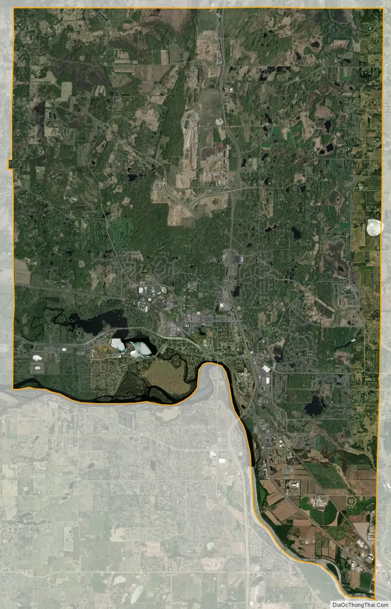
Elk River city Satellite Map
Geography
According to the United States Census Bureau, the city has a total area of 43.82 square miles (113.49 km); 42.29 square miles (109.53 km) is land and 1.53 square miles (3.96 km) is water. The city’s latitude and longitude are 45.313601° N and 93.5814° W.
Elk River is bordered to the south by the Mississippi River. The Elk River meanders through Sherburne County to its terminus at the Mississippi River through the western side of Elk River, pausing at Lake Orono, created by a dam not far from its conjunction with the Mississippi River.
Climate
Elk River has a hot summer humid continental climate (Köppen Dfa).
See also
Map of Minnesota State and its subdivision:- Aitkin
- Anoka
- Becker
- Beltrami
- Benton
- Big Stone
- Blue Earth
- Brown
- Carlton
- Carver
- Cass
- Chippewa
- Chisago
- Clay
- Clearwater
- Cook
- Cottonwood
- Crow Wing
- Dakota
- Dodge
- Douglas
- Faribault
- Fillmore
- Freeborn
- Goodhue
- Grant
- Hennepin
- Houston
- Hubbard
- Isanti
- Itasca
- Jackson
- Kanabec
- Kandiyohi
- Kittson
- Koochiching
- Lac qui Parle
- Lake
- Lake of the Woods
- Lake Superior
- Le Sueur
- Lincoln
- Lyon
- Mahnomen
- Marshall
- Martin
- McLeod
- Meeker
- Mille Lacs
- Morrison
- Mower
- Murray
- Nicollet
- Nobles
- Norman
- Olmsted
- Otter Tail
- Pennington
- Pine
- Pipestone
- Polk
- Pope
- Ramsey
- Red Lake
- Redwood
- Renville
- Rice
- Rock
- Roseau
- Saint Louis
- Scott
- Sherburne
- Sibley
- Stearns
- Steele
- Stevens
- Swift
- Todd
- Traverse
- Wabasha
- Wadena
- Waseca
- Washington
- Watonwan
- Wilkin
- Winona
- Wright
- Yellow Medicine
- Alabama
- Alaska
- Arizona
- Arkansas
- California
- Colorado
- Connecticut
- Delaware
- District of Columbia
- Florida
- Georgia
- Hawaii
- Idaho
- Illinois
- Indiana
- Iowa
- Kansas
- Kentucky
- Louisiana
- Maine
- Maryland
- Massachusetts
- Michigan
- Minnesota
- Mississippi
- Missouri
- Montana
- Nebraska
- Nevada
- New Hampshire
- New Jersey
- New Mexico
- New York
- North Carolina
- North Dakota
- Ohio
- Oklahoma
- Oregon
- Pennsylvania
- Rhode Island
- South Carolina
- South Dakota
- Tennessee
- Texas
- Utah
- Vermont
- Virginia
- Washington
- West Virginia
- Wisconsin
- Wyoming