New London is a city in Kandiyohi County, Minnesota, United States along the Middle Fork of the Crow River. The population was 1,251 at the 2010 census. Sibley State Park is nearby. It was named after New London, Wisconsin, by Louis Larson because of the similarity he saw with his previous home there. It was incorporated on April 8, 1889. The city was the temporary county seat of Kandiyohi County from 1867 to 1870.
| Name: | New London city |
|---|---|
| LSAD Code: | 25 |
| LSAD Description: | city (suffix) |
| State: | Minnesota |
| County: | Kandiyohi County |
| Elevation: | 1,201 ft (366 m) |
| Total Area: | 1.35 sq mi (3.51 km²) |
| Land Area: | 1.29 sq mi (3.35 km²) |
| Water Area: | 0.06 sq mi (0.16 km²) |
| Total Population: | 1,252 |
| Population Density: | 968.29/sq mi (373.84/km²) |
| ZIP code: | 56273 |
| Area code: | 320 |
| FIPS code: | 2745682 |
| GNISfeature ID: | 0648513 |
Online Interactive Map
Click on ![]() to view map in "full screen" mode.
to view map in "full screen" mode.
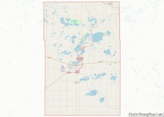
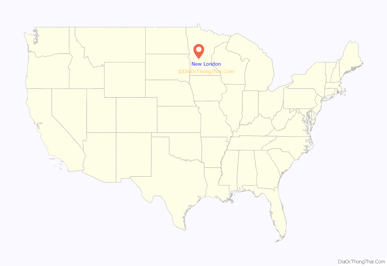
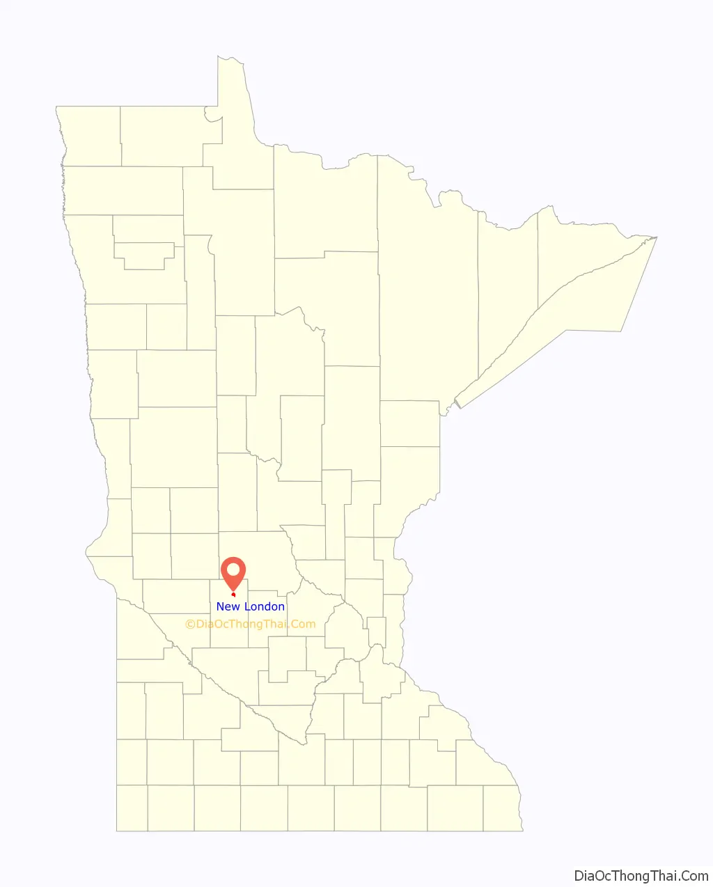
New London location map. Where is New London city?
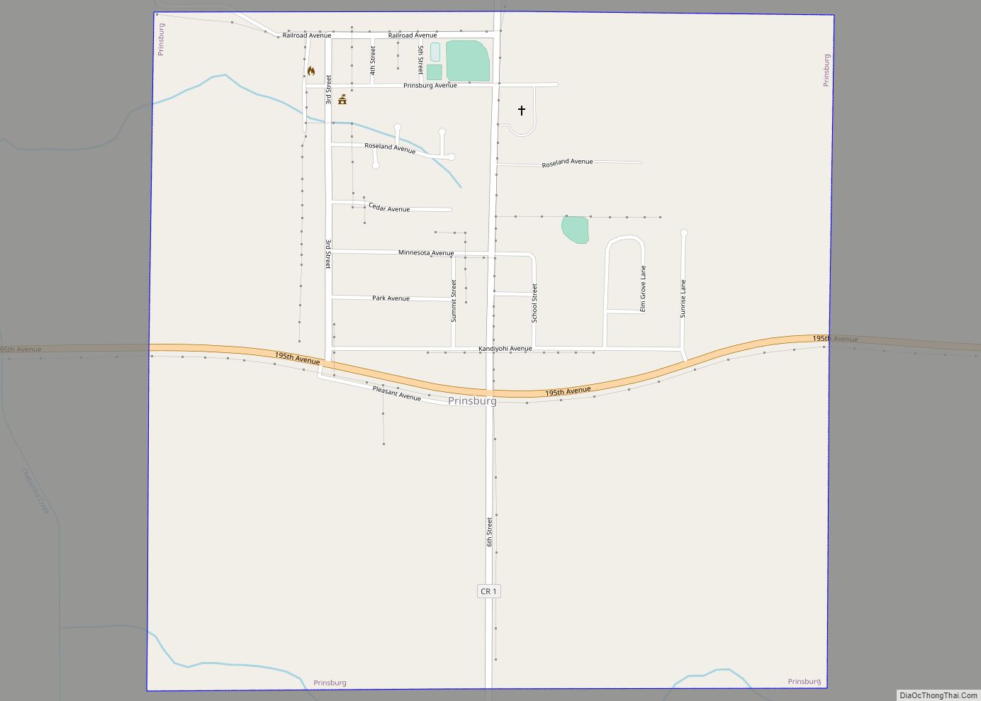
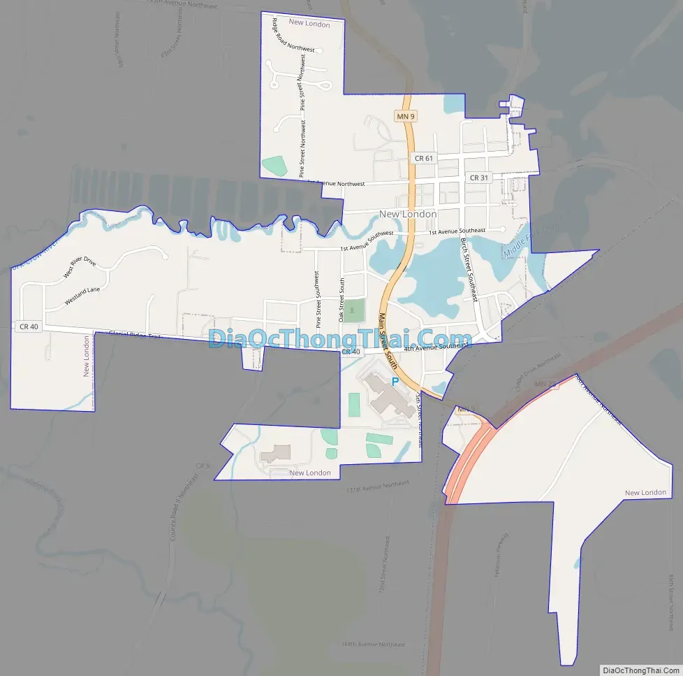
New London Road Map
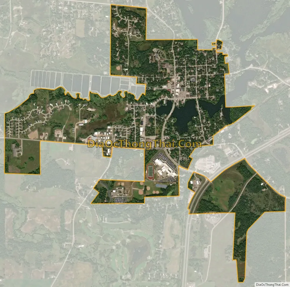
New London city Satellite Map
Geography
According to the United States Census Bureau, the city has an area of 1.24 square miles (3.21 km), of which 1.19 square miles (3.08 km) is land and 0.05 square miles (0.13 km) is water.
Minnesota State Highways 9 and 23 are two of the main routes in the city, and U.S. Route 71 is nearby.
Climate
See also
Map of Minnesota State and its subdivision:- Aitkin
- Anoka
- Becker
- Beltrami
- Benton
- Big Stone
- Blue Earth
- Brown
- Carlton
- Carver
- Cass
- Chippewa
- Chisago
- Clay
- Clearwater
- Cook
- Cottonwood
- Crow Wing
- Dakota
- Dodge
- Douglas
- Faribault
- Fillmore
- Freeborn
- Goodhue
- Grant
- Hennepin
- Houston
- Hubbard
- Isanti
- Itasca
- Jackson
- Kanabec
- Kandiyohi
- Kittson
- Koochiching
- Lac qui Parle
- Lake
- Lake of the Woods
- Lake Superior
- Le Sueur
- Lincoln
- Lyon
- Mahnomen
- Marshall
- Martin
- McLeod
- Meeker
- Mille Lacs
- Morrison
- Mower
- Murray
- Nicollet
- Nobles
- Norman
- Olmsted
- Otter Tail
- Pennington
- Pine
- Pipestone
- Polk
- Pope
- Ramsey
- Red Lake
- Redwood
- Renville
- Rice
- Rock
- Roseau
- Saint Louis
- Scott
- Sherburne
- Sibley
- Stearns
- Steele
- Stevens
- Swift
- Todd
- Traverse
- Wabasha
- Wadena
- Waseca
- Washington
- Watonwan
- Wilkin
- Winona
- Wright
- Yellow Medicine
- Alabama
- Alaska
- Arizona
- Arkansas
- California
- Colorado
- Connecticut
- Delaware
- District of Columbia
- Florida
- Georgia
- Hawaii
- Idaho
- Illinois
- Indiana
- Iowa
- Kansas
- Kentucky
- Louisiana
- Maine
- Maryland
- Massachusetts
- Michigan
- Minnesota
- Mississippi
- Missouri
- Montana
- Nebraska
- Nevada
- New Hampshire
- New Jersey
- New Mexico
- New York
- North Carolina
- North Dakota
- Ohio
- Oklahoma
- Oregon
- Pennsylvania
- Rhode Island
- South Carolina
- South Dakota
- Tennessee
- Texas
- Utah
- Vermont
- Virginia
- Washington
- West Virginia
- Wisconsin
- Wyoming