New Richland is a city in Waseca County, Minnesota, United States. The city was founded in 1877. The population was 1,203 at the 2010 census.
| Name: | New Richland city |
|---|---|
| LSAD Code: | 25 |
| LSAD Description: | city (suffix) |
| State: | Minnesota |
| County: | Waseca County |
| Elevation: | 1,181 ft (360 m) |
| Total Area: | 0.59 sq mi (1.53 km²) |
| Land Area: | 0.59 sq mi (1.53 km²) |
| Water Area: | 0.00 sq mi (0.00 km²) |
| Total Population: | 1,229 |
| Population Density: | 2,079.53/sq mi (802.92/km²) |
| ZIP code: | 56072 |
| Area code: | 507 |
| FIPS code: | 2745862 |
| GNISfeature ID: | 0648518 |
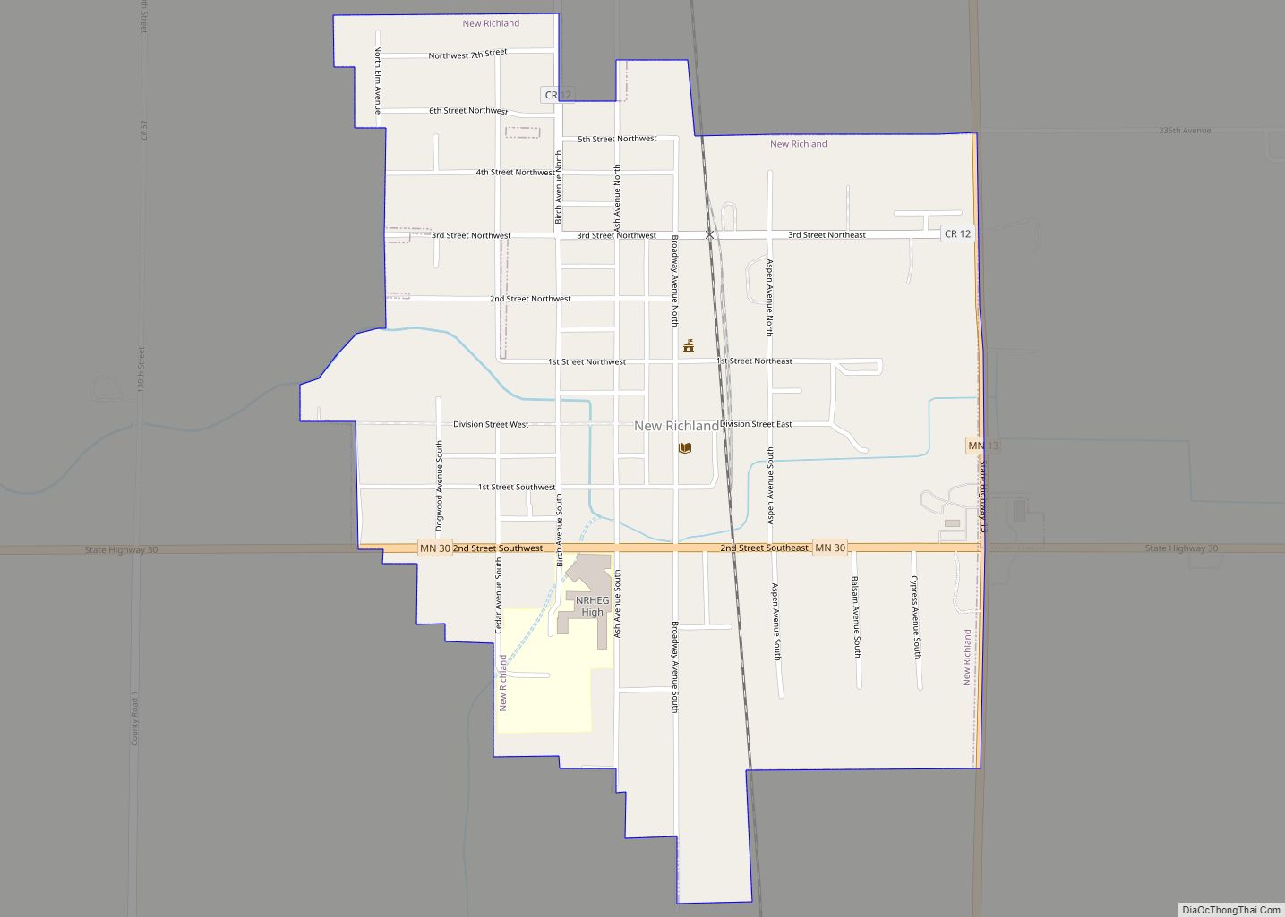
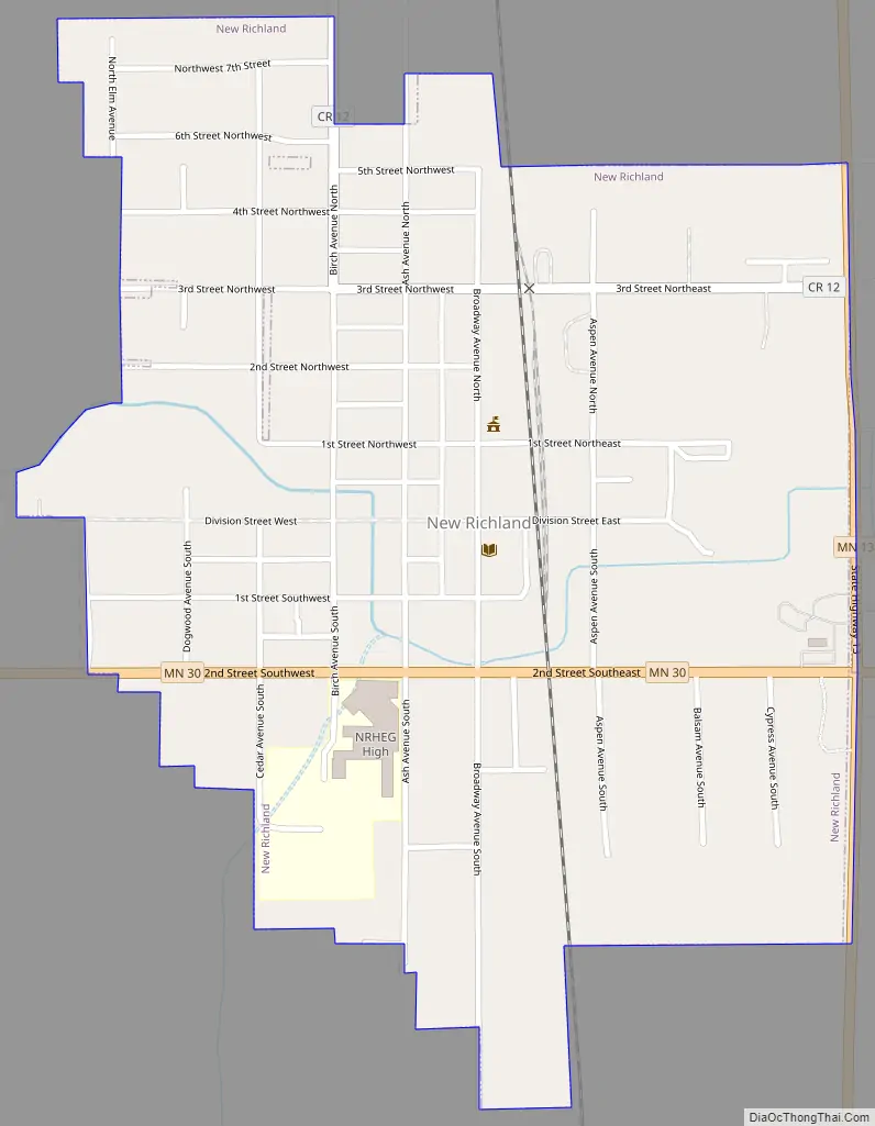
Online Interactive Map
Click on ![]() to view map in "full screen" mode.
to view map in "full screen" mode.
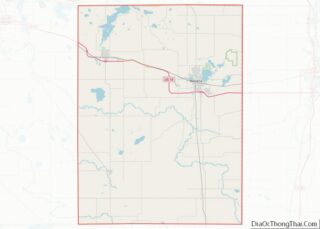
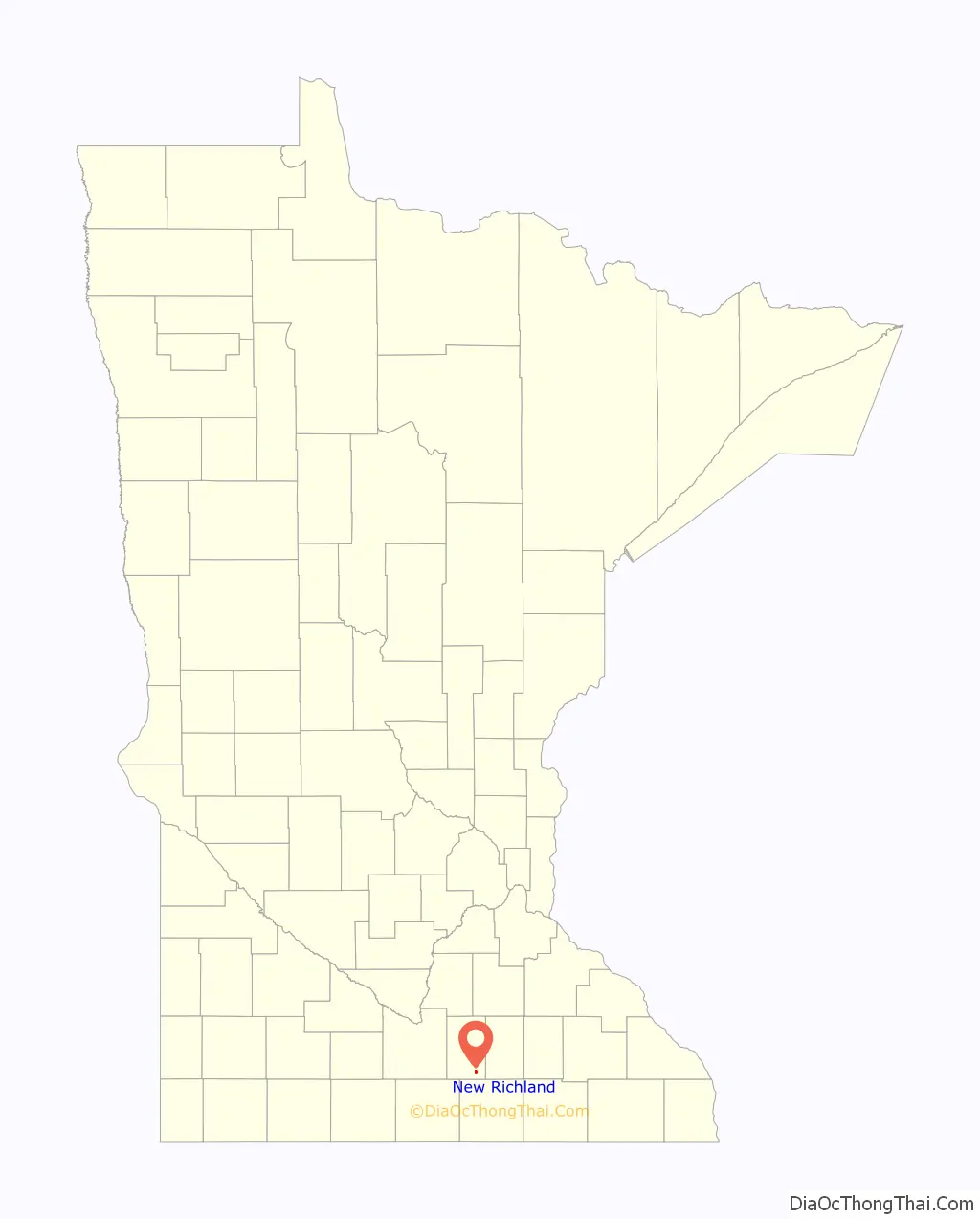
New Richland location map. Where is New Richland city?

History
New Richland was platted in 1877, taking its name from New Richland Township, which was named after Richland County, Wisconsin. The city contains one property listed on the National Register of Historic Places, the 1902 New Richland Odd Fellows Hall.
New Richland Road Map
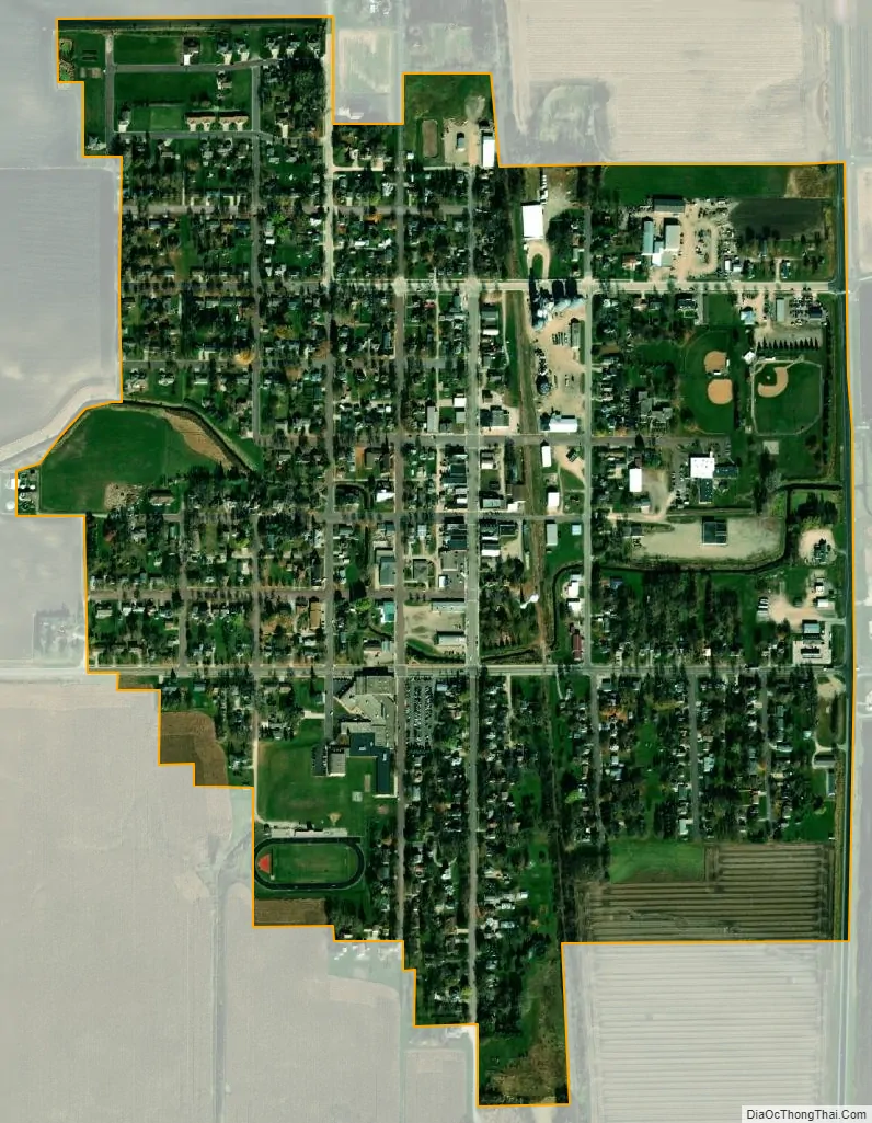
New Richland city Satellite Map
Geography
According to the United States Census Bureau, the city has an area of 0.61 square miles (1.58 km), all land. Minnesota Highways 13 and 30 are two of the main routes in the city.
See also
Map of Minnesota State and its subdivision:- Aitkin
- Anoka
- Becker
- Beltrami
- Benton
- Big Stone
- Blue Earth
- Brown
- Carlton
- Carver
- Cass
- Chippewa
- Chisago
- Clay
- Clearwater
- Cook
- Cottonwood
- Crow Wing
- Dakota
- Dodge
- Douglas
- Faribault
- Fillmore
- Freeborn
- Goodhue
- Grant
- Hennepin
- Houston
- Hubbard
- Isanti
- Itasca
- Jackson
- Kanabec
- Kandiyohi
- Kittson
- Koochiching
- Lac qui Parle
- Lake
- Lake of the Woods
- Lake Superior
- Le Sueur
- Lincoln
- Lyon
- Mahnomen
- Marshall
- Martin
- McLeod
- Meeker
- Mille Lacs
- Morrison
- Mower
- Murray
- Nicollet
- Nobles
- Norman
- Olmsted
- Otter Tail
- Pennington
- Pine
- Pipestone
- Polk
- Pope
- Ramsey
- Red Lake
- Redwood
- Renville
- Rice
- Rock
- Roseau
- Saint Louis
- Scott
- Sherburne
- Sibley
- Stearns
- Steele
- Stevens
- Swift
- Todd
- Traverse
- Wabasha
- Wadena
- Waseca
- Washington
- Watonwan
- Wilkin
- Winona
- Wright
- Yellow Medicine
- Alabama
- Alaska
- Arizona
- Arkansas
- California
- Colorado
- Connecticut
- Delaware
- District of Columbia
- Florida
- Georgia
- Hawaii
- Idaho
- Illinois
- Indiana
- Iowa
- Kansas
- Kentucky
- Louisiana
- Maine
- Maryland
- Massachusetts
- Michigan
- Minnesota
- Mississippi
- Missouri
- Montana
- Nebraska
- Nevada
- New Hampshire
- New Jersey
- New Mexico
- New York
- North Carolina
- North Dakota
- Ohio
- Oklahoma
- Oregon
- Pennsylvania
- Rhode Island
- South Carolina
- South Dakota
- Tennessee
- Texas
- Utah
- Vermont
- Virginia
- Washington
- West Virginia
- Wisconsin
- Wyoming