Pine City is a city in and the county seat of Pine County, in east central Minnesota, United States. The population was 3,130 at the 2020 census. Part of the city is on the Mille Lacs Indian Reservation. Founded as a railway town, it soon became a logging community and the surrounding lakes made it a resort town. Today, it is in part as a commuter town for people working in the Minneapolis–Saint Paul metropolitan area.
| Name: | Pine City city |
|---|---|
| LSAD Code: | 25 |
| LSAD Description: | city (suffix) |
| State: | Minnesota |
| County: | Pine County |
| Incorporated: | February 14, 1881 |
| Elevation: | 945 ft (288 m) |
| Total Area: | 4.24 sq mi (10.98 km²) |
| Land Area: | 3.84 sq mi (9.93 km²) |
| Water Area: | 0.40 sq mi (1.04 km²) |
| Total Population: | 3,130 |
| Population Density: | 815.95/sq mi (315.07/km²) |
| ZIP code: | 55063 |
| Area code: | 320 |
| FIPS code: | 2751064 |
| GNISfeature ID: | 665301 |
| Website: | pinecity.govoffice.com |
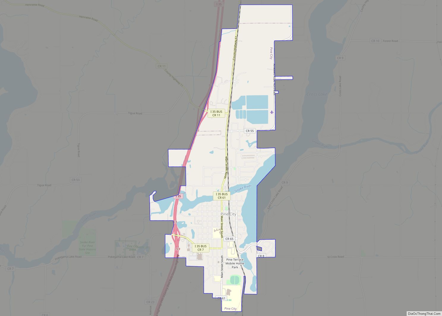
Online Interactive Map
Click on ![]() to view map in "full screen" mode.
to view map in "full screen" mode.
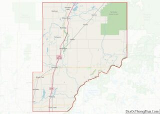
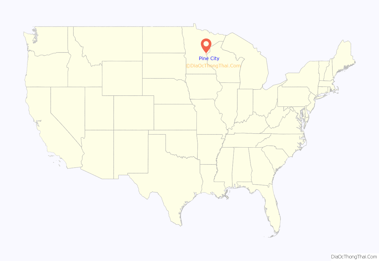
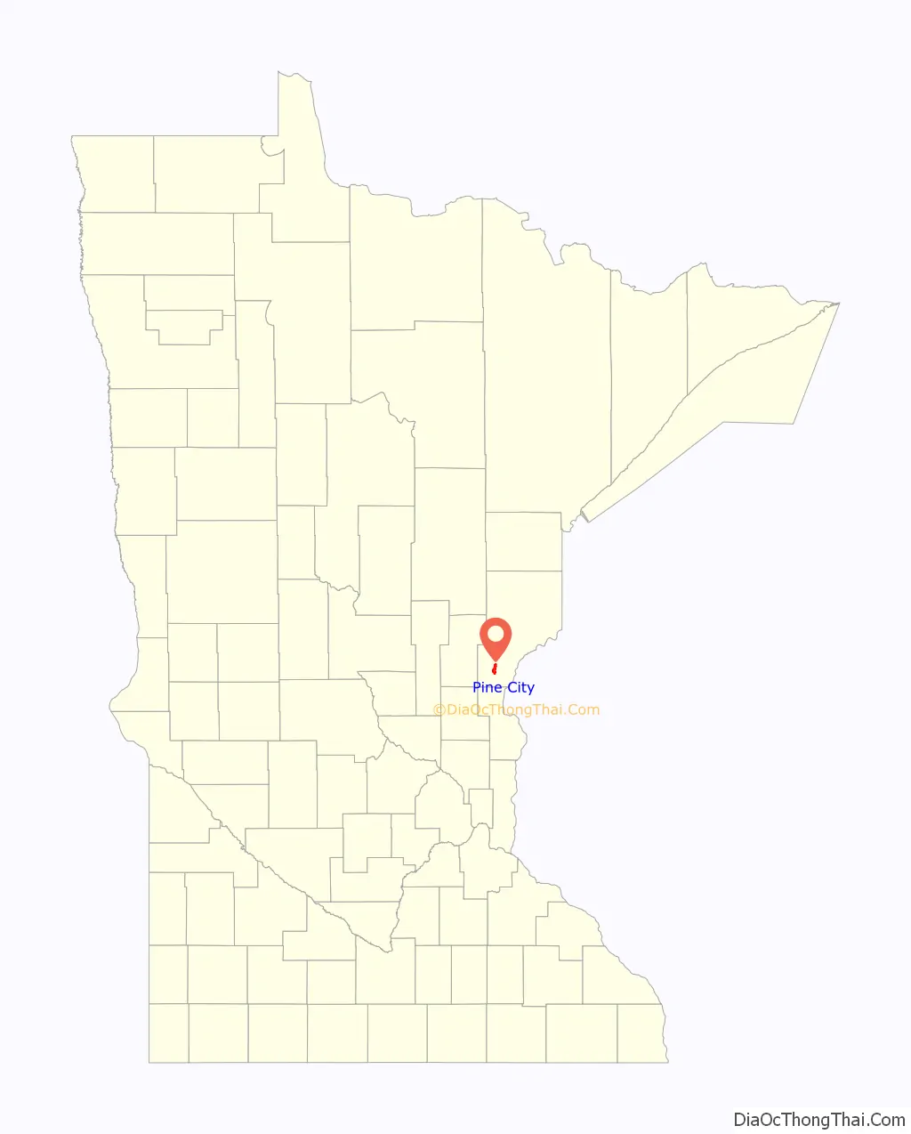
Pine City location map. Where is Pine City city?
History
The Dakota Indians were the first in the area. With the Ojibwe expansion, the area became a mixture of the two. By the early 19th century, the area became predominantly Ojibwe. They trapped and hunted on the land and traded furs at the nearby trading posts. With the 1837 Treaty of St. Peters, dubbed the “White Pine Treaty”, lumbering began in the area, but was limited by access to available waterways.
In the late 19th century, European settlers came to the Pine City area, which was still heavily forested with thick stands of white pine, some of the state’s largest. When the railroad arrived in Pine City, a logging expansion began. Pine City prospered and grew to have everything it needed to serve residents, farmers, and the expanding lumber industry. It was platted in 1869 and incorporated in 1881.
When Buchanan County merged with Pine County in 1861, the county seat was consolidated to Pine City because it was already well-established. Because of its location on the far southern edge of Pine County, there have been attempts over the years to move the county seat to more central Hinckley or Sandstone.
In 2005, Pine City became the first city in rural America with an annual gay pride event, East-Central Minnesota Pride. A book capturing Pine City’s history in vintage photos, part of the Images of America series, was published in 2010.
Timeline
- 1804 – European settlers arrived.
- 1837 – With the Treaty of St. Peters, dubbed “White Pine Treaty”, lumbering began in the area.
- 1848 – The Ojibwe community of Chengwatana forms as an official village.
- 1856 – Chengwatana became the county seat for Pine County.
- 1872 – Two years after a fire at the Chengwatana courthouse, by popular vote Pine City became the county seat and a new courthouse was built.
- 1881 – Pine City incorporated as a village west of Chengwatana due to the railroad’s location west of Cross Lake. Chengwatana declined into a ghost town.
- 1894 – Pine City’s Robinson Park became a staging area, a “ground zero”, for support and relief from the Great Hinckley Fire.
- 1903 – James Adam Bede speaks at Associated Press annual dinner in New York City.
- 1914 – A Minnesota Naval Militia Armory opened in Pine City and Minnesota Governor Eberhart gave a speech at the November dedication ceremony.
- 1939 – The Village of Pine City built a yellow brick, two-story city hall but gave the building to the county, nervous it might lose its county seat status because of the need for better office space. Even so, the words “Pine City Village Hall” were carved over the east entrance.
- 1952 – The towered, Romanesque Revival style courthouse building built in 1886 was struck by lightning, causing it to burn.
- 1954 – In a bond issue, Pine County raised the money needed for a new courthouse and added it onto the north end of the one-time city hall (which ironically is used in part by city hall today), using the same marble wainscoting and terrazzo floors. The words “Court House” were carved over the north entrance.
- 1967 – Interstate 35 was completed through Pine City.
- 1978 – First International Polkafest held here.
- 1980 – Pine City’s Jean Lindig Kessler was named Princess Kay of the Milky Way.
- 1992 – 30-foot tall voyageur statue erected on the north shore of the Snake River, near downtown.
- 2005 – People around the region hosted first annual East-Central Minnesota Pride in Pine City.
- 2007 – A few years after a failed attempt to split the county in two, a new courthouse was erected on the northern edge of Pine City near the freeway.
- 2009 – The Financial crisis of 2007–2008 led to the failure of Pine City’s Horizon Bank and its nearly 90 million in assets were acquired by Stearns Bank.
- 2010 – Lakeside Medical Center, Pine City’s hospital, closed in the midst of many rural hospital closures across America.
- 2012 – June 5, with H.R.3220 the Pine City post office was renamed the “Master Sergeant Daniel L. Fedder Post Office”.
- 2017 – The Pine City boys’ basketball team received national attention in The Wall Street Journal for their offensive philosophy to shoot primarily 3-pointers.
Pine City Road Map
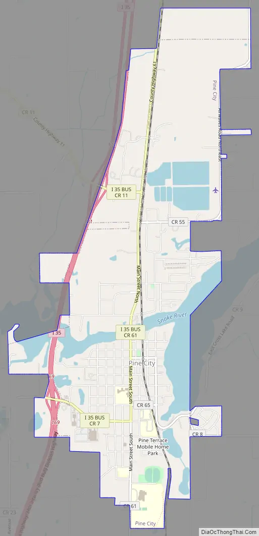
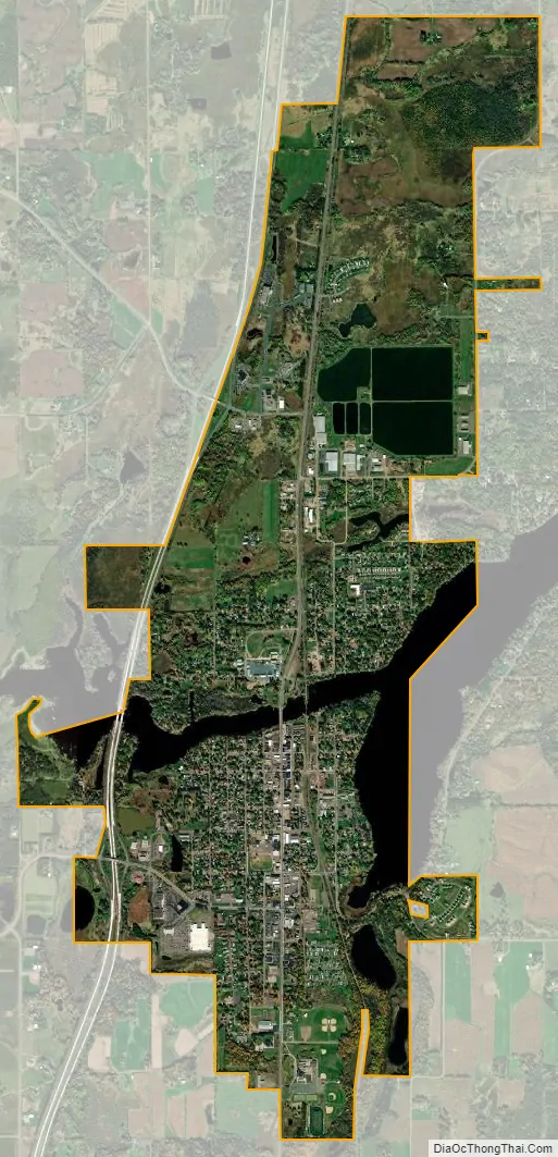
Pine City city Satellite Map
Geography
According to the United States Census Bureau, the city has an area of 3.91 square miles (10.13 km), of which 3.44 square miles (8.91 km) is land and 0.47 square miles (1.22 km) is water.
Climate
Below is a table of average high and low temperatures throughout the year in Pine City. Of note, Pine City’s early years included historic temperature extremes as it was the site of three record-setting cold temperatures:
- March 2, 1897 (-50 °F, March lowest temperature)
- November 30, 1896 (-45 °F, November lowest temperature)
- December 31, 1898 (-57 °F, December lowest temperature)
See also
Map of Minnesota State and its subdivision:- Aitkin
- Anoka
- Becker
- Beltrami
- Benton
- Big Stone
- Blue Earth
- Brown
- Carlton
- Carver
- Cass
- Chippewa
- Chisago
- Clay
- Clearwater
- Cook
- Cottonwood
- Crow Wing
- Dakota
- Dodge
- Douglas
- Faribault
- Fillmore
- Freeborn
- Goodhue
- Grant
- Hennepin
- Houston
- Hubbard
- Isanti
- Itasca
- Jackson
- Kanabec
- Kandiyohi
- Kittson
- Koochiching
- Lac qui Parle
- Lake
- Lake of the Woods
- Lake Superior
- Le Sueur
- Lincoln
- Lyon
- Mahnomen
- Marshall
- Martin
- McLeod
- Meeker
- Mille Lacs
- Morrison
- Mower
- Murray
- Nicollet
- Nobles
- Norman
- Olmsted
- Otter Tail
- Pennington
- Pine
- Pipestone
- Polk
- Pope
- Ramsey
- Red Lake
- Redwood
- Renville
- Rice
- Rock
- Roseau
- Saint Louis
- Scott
- Sherburne
- Sibley
- Stearns
- Steele
- Stevens
- Swift
- Todd
- Traverse
- Wabasha
- Wadena
- Waseca
- Washington
- Watonwan
- Wilkin
- Winona
- Wright
- Yellow Medicine
- Alabama
- Alaska
- Arizona
- Arkansas
- California
- Colorado
- Connecticut
- Delaware
- District of Columbia
- Florida
- Georgia
- Hawaii
- Idaho
- Illinois
- Indiana
- Iowa
- Kansas
- Kentucky
- Louisiana
- Maine
- Maryland
- Massachusetts
- Michigan
- Minnesota
- Mississippi
- Missouri
- Montana
- Nebraska
- Nevada
- New Hampshire
- New Jersey
- New Mexico
- New York
- North Carolina
- North Dakota
- Ohio
- Oklahoma
- Oregon
- Pennsylvania
- Rhode Island
- South Carolina
- South Dakota
- Tennessee
- Texas
- Utah
- Vermont
- Virginia
- Washington
- West Virginia
- Wisconsin
- Wyoming