Rushmore is a town in Nobles County, Minnesota, United States. The population was 342 at the 2010 census.
| Name: | Rushmore city |
|---|---|
| LSAD Code: | 25 |
| LSAD Description: | city (suffix) |
| State: | Minnesota |
| County: | Nobles County |
| Elevation: | 1,660 ft (506 m) |
| Total Area: | 0.25 sq mi (0.66 km²) |
| Land Area: | 0.25 sq mi (0.66 km²) |
| Water Area: | 0.00 sq mi (0.00 km²) |
| Total Population: | 365 |
| Population Density: | 1,437.01/sq mi (554.95/km²) |
| ZIP code: | 56168 |
| Area code: | 507 |
| FIPS code: | 2756338 |
| GNISfeature ID: | 0650420 |
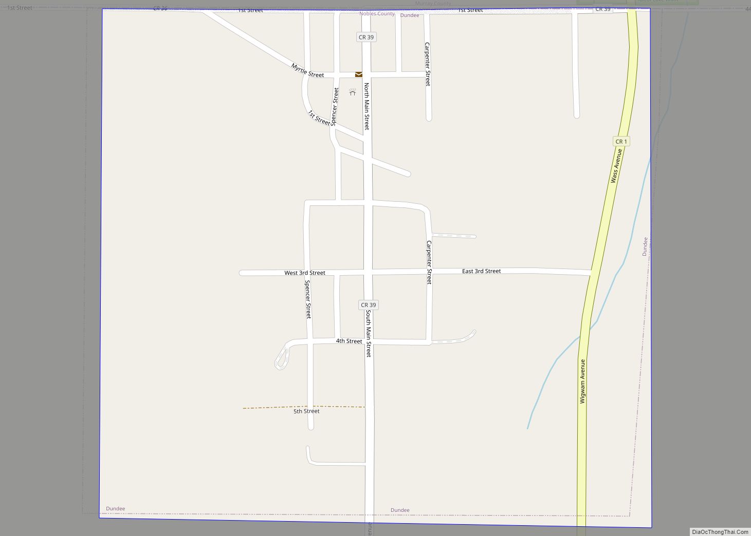
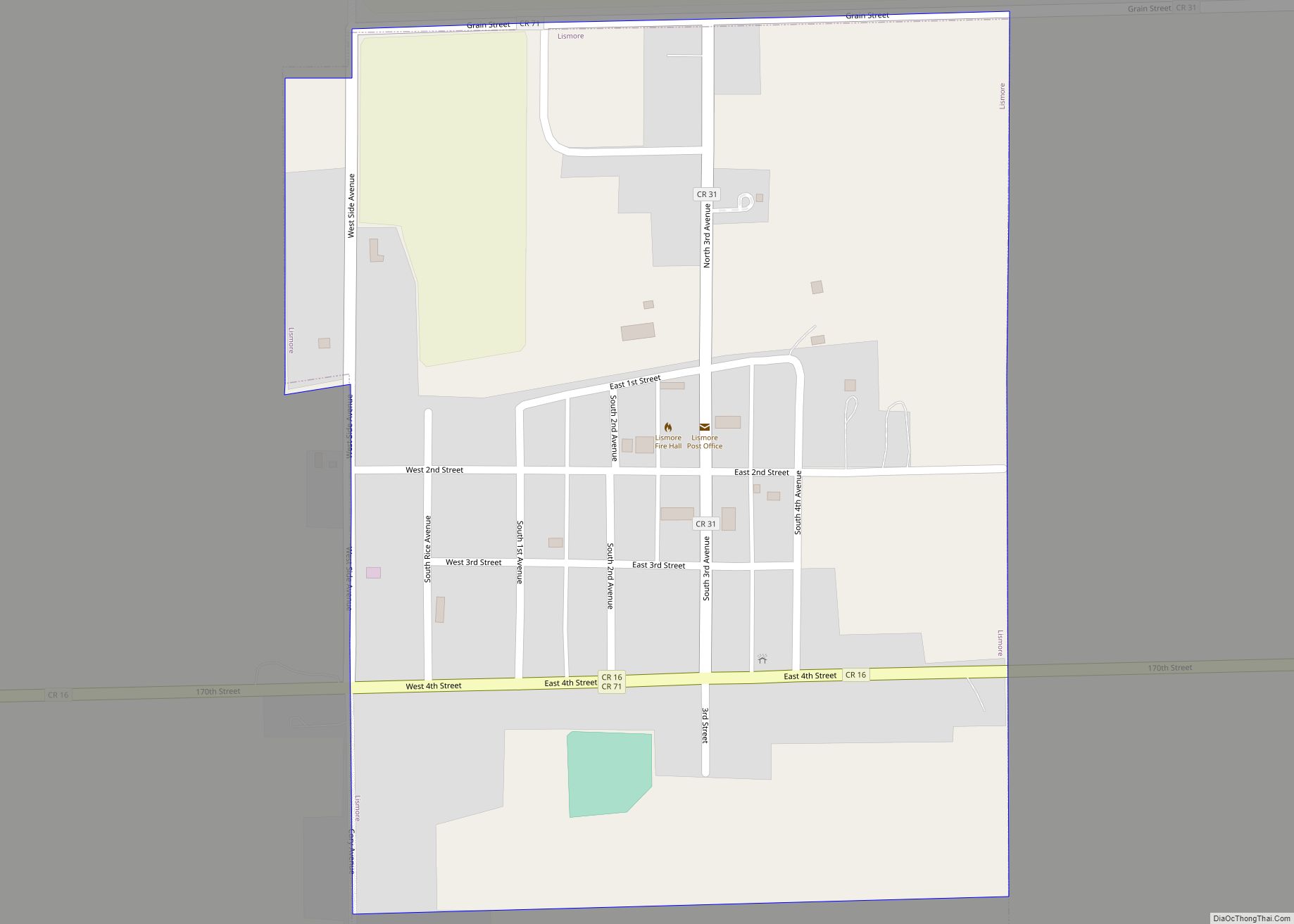
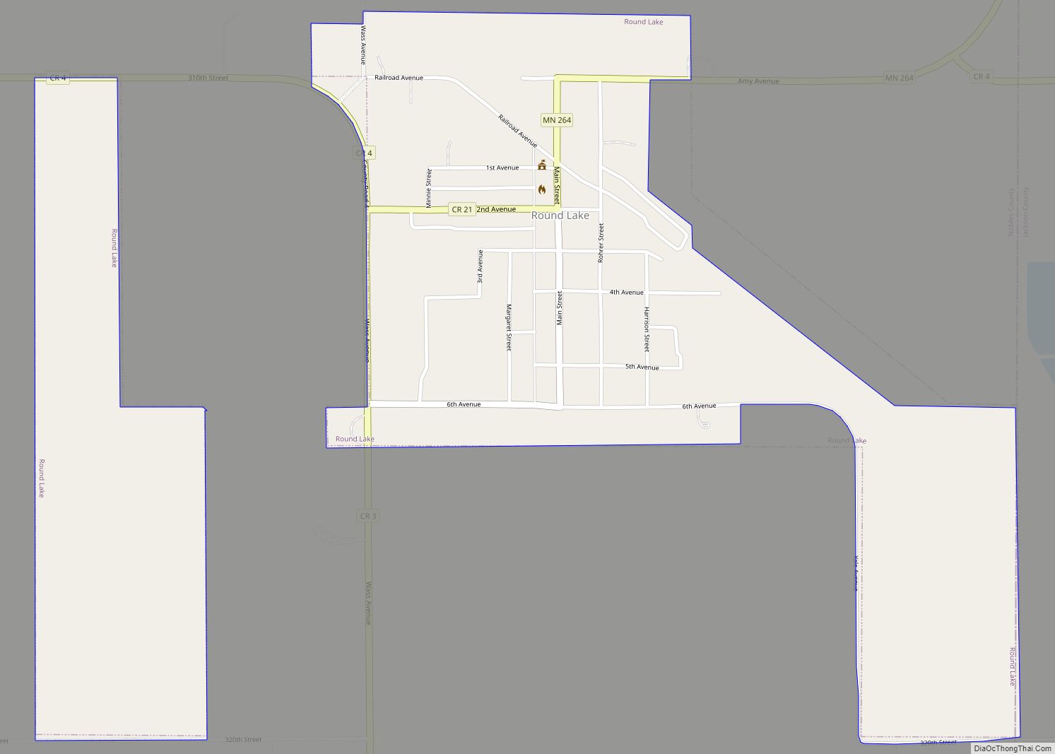
Online Interactive Map
Click on ![]() to view map in "full screen" mode.
to view map in "full screen" mode.
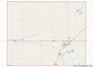
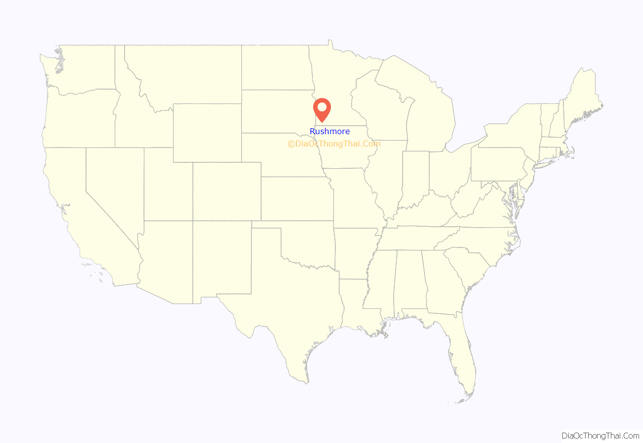
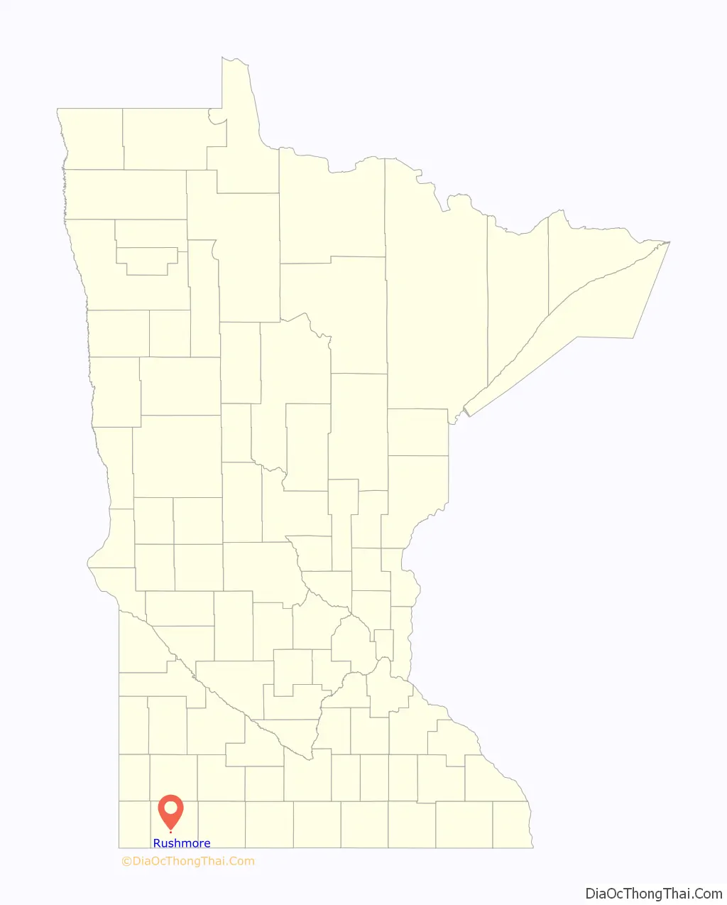
Rushmore location map. Where is Rushmore city?
History
The founding of Rushmore: The city was named for S.M. Rushmore, an early pioneer. The town owes its existence to the construction of the Worthington and Sioux Falls Railway, and the desire of a New York capitalist to establish a land colonization scheme in southwestern Minnesota. When the Worthington and Sioux Falls Railway was initially surveyed, it was decided to construct a station house in section 19 of Dewald Township. The station house was Named Miller Station, in honor of ex-governor Stephen Miller, and for two years it had no inhabitants. In 1878, George I. Seney, a New York capitalist, secured control of large plots of railroad land in Dewald and Olney Townships. He immediately began the process of colonizing the lands, bringing out settlers from New York City and other eastern points. On May 27, 1878, a Mr. S. M. Rushmore arrived in Worthington along with his family, and immediately took a train for Miller Station. There he established a store to serve Mr. Seney’s flood of colonists. A railroad depot was also constructed, and the town was surveyed and platted. In August 1878, the town was renamed Rushmore in honor of the pioneer shopkeeper, and the community grew rapidly. Indeed, a business directory from the fall of 1879 shows that Rushmore had a general store, a feed mill, an elevator, a hotel, a hardware store, a grocer, a lumber agent, a tinware dealer, a notion store, a jeweler, and two blacksmiths. The town also had a new church and a new school. On March 27, 1900, Rushmore, with a population of 204, was incorporated. Village government promptly began under President S. B. Bedford.
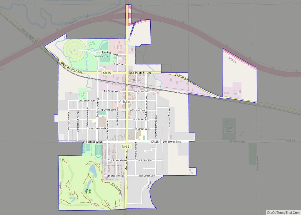
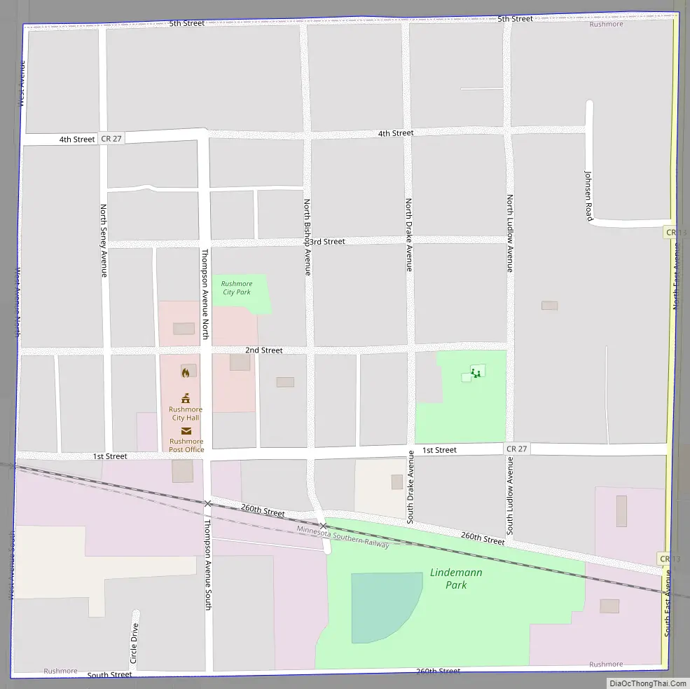
Rushmore Road Map
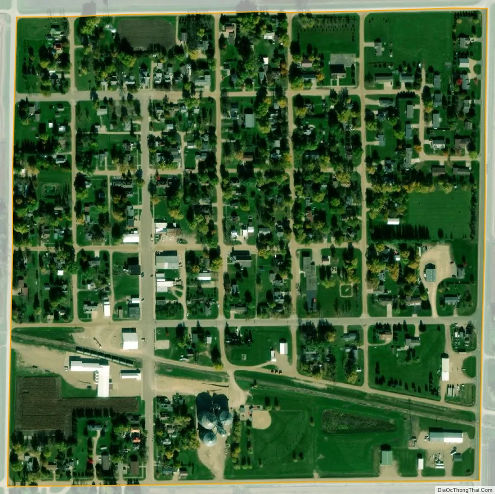
Rushmore city Satellite Map
Geography
According to the United States Census Bureau, the city has a total area of 0.25 square miles (0.65 km), all land. Rushmore is located in section 19 of Dewald Township. It is situated on the Buffalo Ridge, a drainage divide between the Mississippi and Missouri River systems.
Main highways include:
- Interstate 90
- Nobles County Road 35
- Nobles County Road 13
See also
Map of Minnesota State and its subdivision:- Aitkin
- Anoka
- Becker
- Beltrami
- Benton
- Big Stone
- Blue Earth
- Brown
- Carlton
- Carver
- Cass
- Chippewa
- Chisago
- Clay
- Clearwater
- Cook
- Cottonwood
- Crow Wing
- Dakota
- Dodge
- Douglas
- Faribault
- Fillmore
- Freeborn
- Goodhue
- Grant
- Hennepin
- Houston
- Hubbard
- Isanti
- Itasca
- Jackson
- Kanabec
- Kandiyohi
- Kittson
- Koochiching
- Lac qui Parle
- Lake
- Lake of the Woods
- Lake Superior
- Le Sueur
- Lincoln
- Lyon
- Mahnomen
- Marshall
- Martin
- McLeod
- Meeker
- Mille Lacs
- Morrison
- Mower
- Murray
- Nicollet
- Nobles
- Norman
- Olmsted
- Otter Tail
- Pennington
- Pine
- Pipestone
- Polk
- Pope
- Ramsey
- Red Lake
- Redwood
- Renville
- Rice
- Rock
- Roseau
- Saint Louis
- Scott
- Sherburne
- Sibley
- Stearns
- Steele
- Stevens
- Swift
- Todd
- Traverse
- Wabasha
- Wadena
- Waseca
- Washington
- Watonwan
- Wilkin
- Winona
- Wright
- Yellow Medicine
- Alabama
- Alaska
- Arizona
- Arkansas
- California
- Colorado
- Connecticut
- Delaware
- District of Columbia
- Florida
- Georgia
- Hawaii
- Idaho
- Illinois
- Indiana
- Iowa
- Kansas
- Kentucky
- Louisiana
- Maine
- Maryland
- Massachusetts
- Michigan
- Minnesota
- Mississippi
- Missouri
- Montana
- Nebraska
- Nevada
- New Hampshire
- New Jersey
- New Mexico
- New York
- North Carolina
- North Dakota
- Ohio
- Oklahoma
- Oregon
- Pennsylvania
- Rhode Island
- South Carolina
- South Dakota
- Tennessee
- Texas
- Utah
- Vermont
- Virginia
- Washington
- West Virginia
- Wisconsin
- Wyoming