Sebeka (/səˈbiːkə/ sə-BEE-kə) is a city in Wadena County, Minnesota, United States. Its population was 711 at the 2010 census. The name comes from an Ojibwe word meaning “town by the water”.
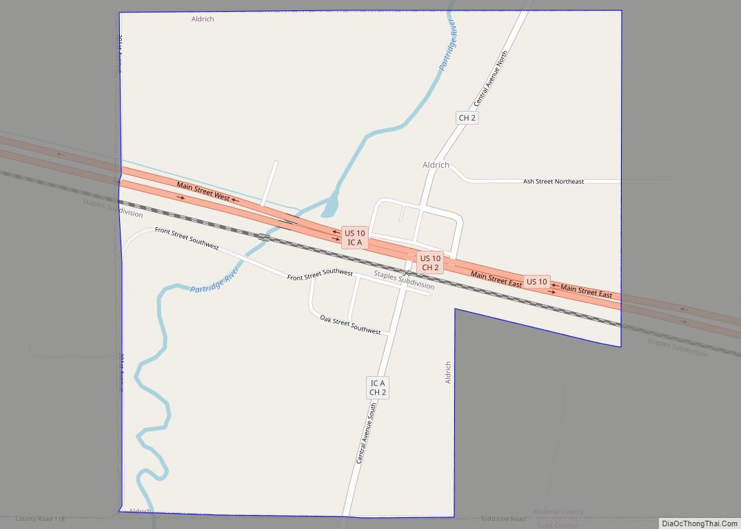
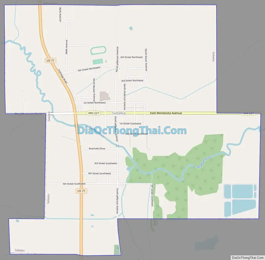
U.S. Highway 71, State Highway 227, and the historic Jefferson Highway (now Jefferson Avenue), are three of the main routes in the city.
| Name: | Sebeka city |
|---|---|
| LSAD Code: | 25 |
| LSAD Description: | city (suffix) |
| State: | Minnesota |
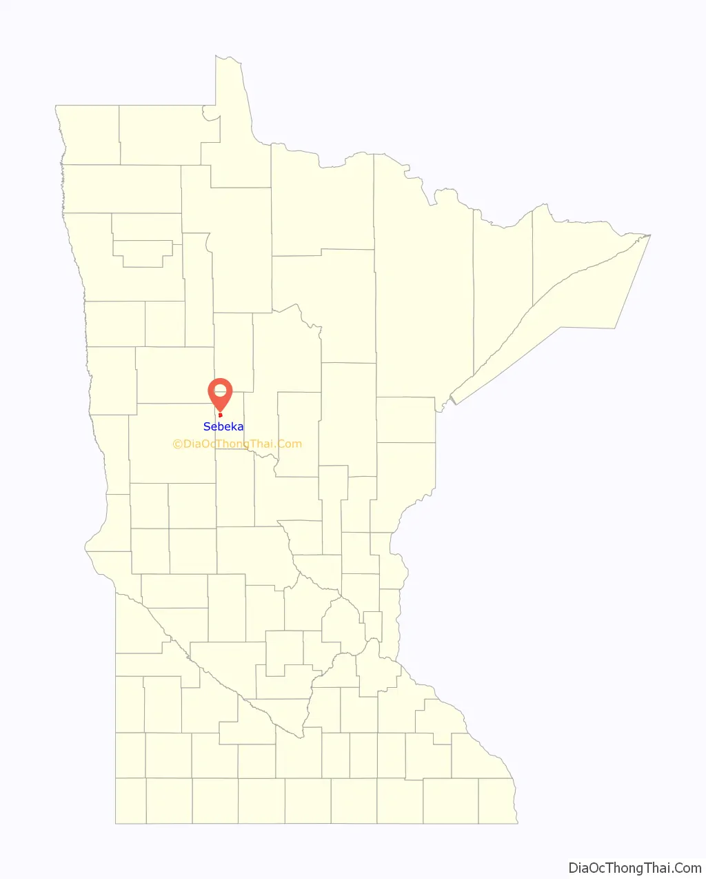
| County: | Wadena County |
| Incorporated: | March 19, 1898 |
| Elevation: | 1,385 ft (422 m) |
| Total Area: | 2.47 sq mi (6.40 km²) |
| Land Area: | 2.47 sq mi (6.40 km²) |
| Water Area: | 0.00 sq mi (0.00 km²) |
| Total Population: | 741 |
| Population Density: | 299.64/sq mi (115.69/km²) |
| ZIP code: | 56477 |
| Area code: | 218 |
| FIPS code: | 2759152 |
| GNISfeature ID: | 0651815 |
| Website: | http://www.cityofsebeka.org/ |
Online Interactive Map
Click on ![]() to view map in "full screen" mode.
to view map in "full screen" mode.
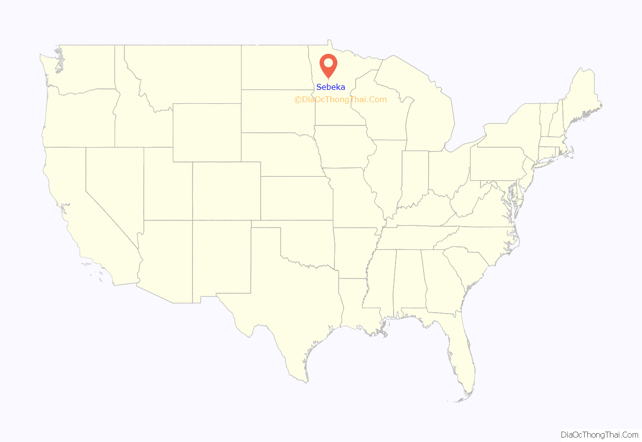
Sebeka location map. Where is Sebeka city?
History
Sebeka originally grew around the depot of the K-line branch of the Great Northern Railway, which first came through the area in 1892. The first major industry in the area was logging. The town’s first store was the Anderson Pioneer Store. The town was incorporated on March 19, 1898. Its population has gone from 233 in 1900 to a peak of 818 in 1960.
Point of interest
In the Sebeka High School building is a mural, painted in 1938, by artist Richard Haines that demonstrates the casein paint process as used in fresco-painting. Murals were produced from 1934 to 1943 in the United States through the Section of Painting and Sculpture, later called the Section of Fine Arts, of the Treasury Department.
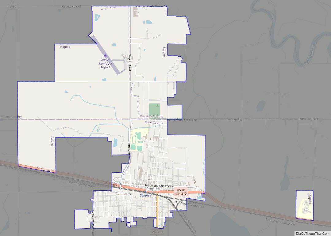
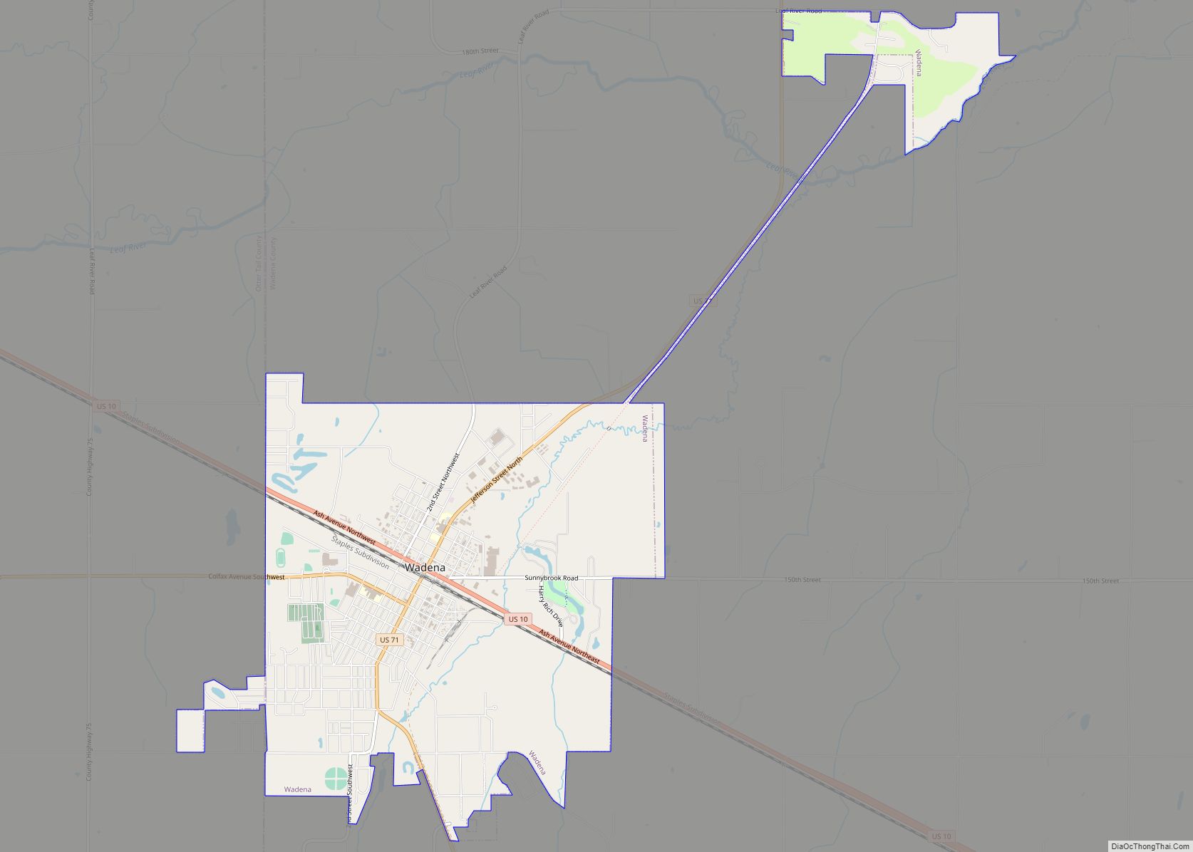
Sebeka Road Map
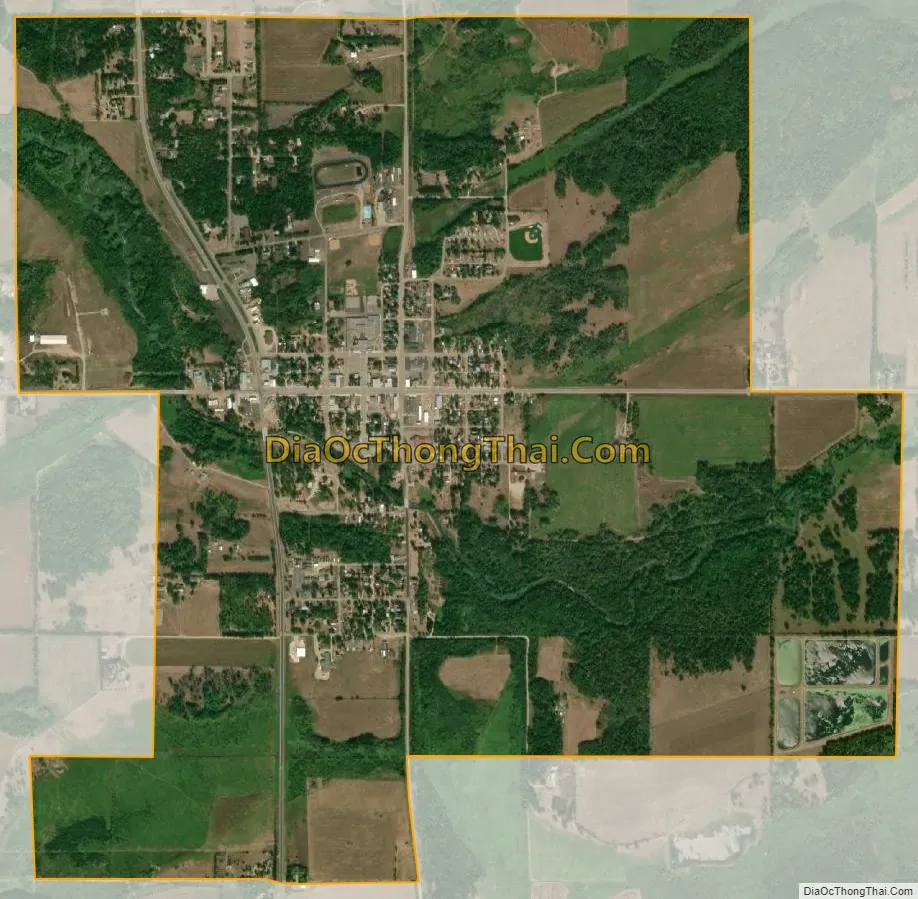
Sebeka city Satellite Map
Geography
According to the United States Census Bureau, the city has a total area of 2.47 square miles (6.40 km), all of it land.
The Redeye River flows through the city.
See also
Map of Minnesota State and its subdivision:- Aitkin
- Anoka
- Becker
- Beltrami
- Benton
- Big Stone
- Blue Earth
- Brown
- Carlton
- Carver
- Cass
- Chippewa
- Chisago
- Clay
- Clearwater
- Cook
- Cottonwood
- Crow Wing
- Dakota
- Dodge
- Douglas
- Faribault
- Fillmore
- Freeborn
- Goodhue
- Grant
- Hennepin
- Houston
- Hubbard
- Isanti
- Itasca
- Jackson
- Kanabec
- Kandiyohi
- Kittson
- Koochiching
- Lac qui Parle
- Lake
- Lake of the Woods
- Lake Superior
- Le Sueur
- Lincoln
- Lyon
- Mahnomen
- Marshall
- Martin
- McLeod
- Meeker
- Mille Lacs
- Morrison
- Mower
- Murray
- Nicollet
- Nobles
- Norman
- Olmsted
- Otter Tail
- Pennington
- Pine
- Pipestone
- Polk
- Pope
- Ramsey
- Red Lake
- Redwood
- Renville
- Rice
- Rock
- Roseau
- Saint Louis
- Scott
- Sherburne
- Sibley
- Stearns
- Steele
- Stevens
- Swift
- Todd
- Traverse
- Wabasha
- Wadena
- Waseca
- Washington
- Watonwan
- Wilkin
- Winona
- Wright
- Yellow Medicine
- Alabama
- Alaska
- Arizona
- Arkansas
- California
- Colorado
- Connecticut
- Delaware
- District of Columbia
- Florida
- Georgia
- Hawaii
- Idaho
- Illinois
- Indiana
- Iowa
- Kansas
- Kentucky
- Louisiana
- Maine
- Maryland
- Massachusetts
- Michigan
- Minnesota
- Mississippi
- Missouri
- Montana
- Nebraska
- Nevada
- New Hampshire
- New Jersey
- New Mexico
- New York
- North Carolina
- North Dakota
- Ohio
- Oklahoma
- Oregon
- Pennsylvania
- Rhode Island
- South Carolina
- South Dakota
- Tennessee
- Texas
- Utah
- Vermont
- Virginia
- Washington
- West Virginia
- Wisconsin
- Wyoming