St. Hilaire is a city in section 6 of River Falls Township in Pennington County, Minnesota, United States. The population was 273 at the 2020 census.
| Name: | St. Hilaire city |
|---|---|
| LSAD Code: | 25 |
| LSAD Description: | city (suffix) |
| State: | Minnesota |
| County: | Pennington County |
| Founded: | Incorporated |
| Elevation: | 1,089 ft (332 m) |
| Total Area: | 0.84 sq mi (2.18 km²) |
| Land Area: | 0.78 sq mi (2.03 km²) |
| Water Area: | 0.06 sq mi (0.16 km²) |
| Total Population: | 273 |
| Population Density: | 349.10/sq mi (134.77/km²) |
| ZIP code: | 56754 |
| Area code: | 218 |
| FIPS code: | 2757022 |
| GNISfeature ID: | 0650607 |
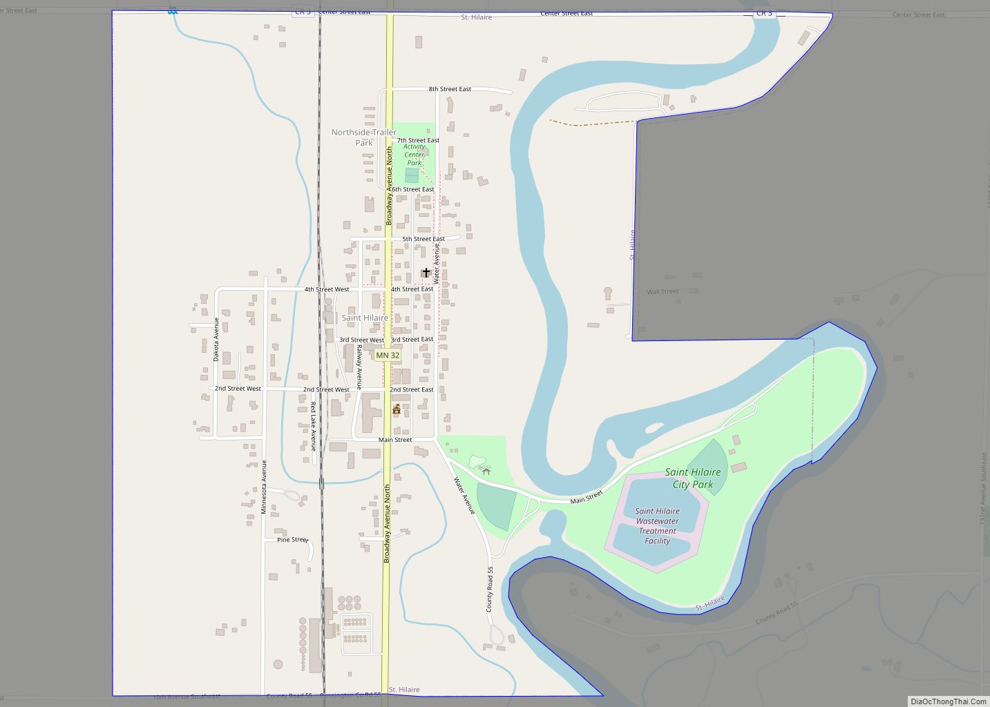
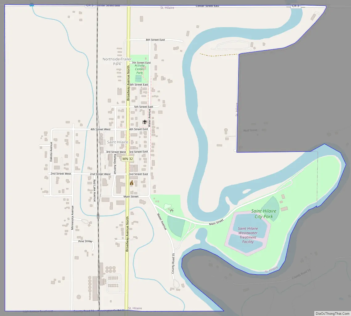
Online Interactive Map
Click on ![]() to view map in "full screen" mode.
to view map in "full screen" mode.
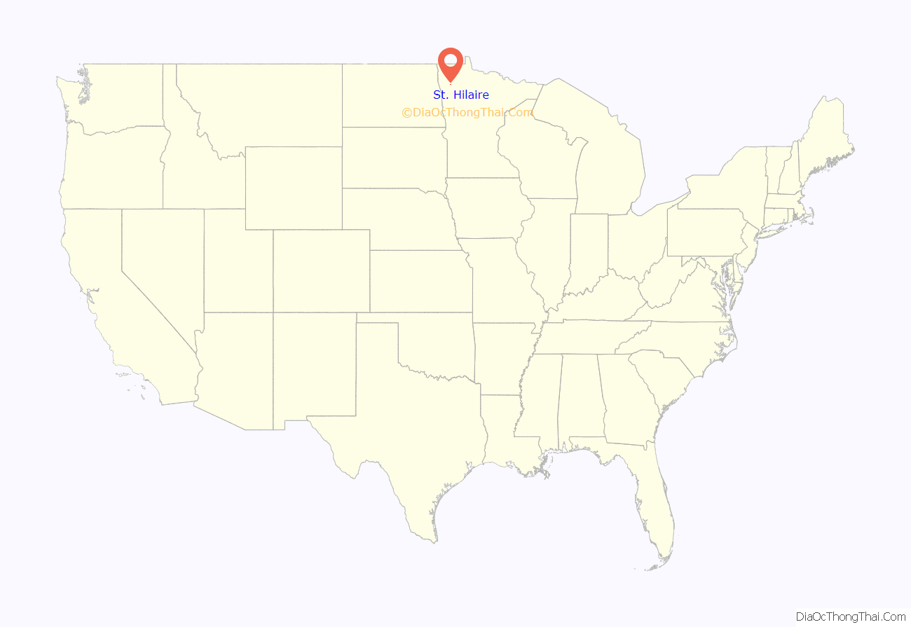
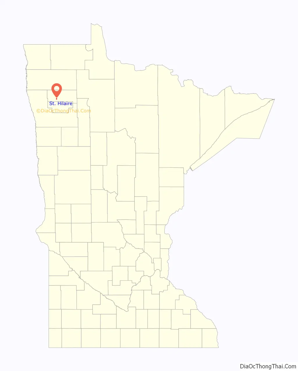
St. Hilaire location map. Where is St. Hilaire city?
History
St. Hilaire was platted in 1882 and incorporated as a village on the auspicious date of July 4, 1883. Also on that date, St. Hilaire had rail service for the first time, as the Great Northern Railway opened a branch line from Crookston, Minnesota through Shirley, seven miles north of Crookston, Dorothy and Ives Station, to St. Hilaire.
St. Hilaire received its name in one of three ways:
- A Frenchman named St. Hilaire lived in a shack by the Red Lake River, selling items like gunpowder and tobacco, and when an item was needed, residents would “go to St. Hilaire” for it, and the name stuck.
- A Frenchman named Arthur Yvernault bought land on which the townsite was then platted and named for his hometown in France.
- It was named by Hon. Frank Ives for the French Statesman and author Jules Barthélemy-Saint-Hilaire, who was born in Paris, August 19, 1805, and died November 24, 1895. Frank Ives was a judge in Crookston, MN, which was the county seat of Polk County (of which Pennington was then a part) and his son, Harry Ives, was the postmaster when the St. Hilaire post office began in 1882 while still part of Polk County. Frank Ives owned land in St. Hilaire, but never lived there. This third possibility was favored by historian Warren Upham, and by extension by the Minnesota Historical Society.
Harry Ives was also the publisher of the St. Hilaire Spectator, the first newspaper to serve this community. The Spectator was published from 1883 to 1942, when it closed and sold its subscription list to the Thief River Falls Times.
St. Hilaire Road Map
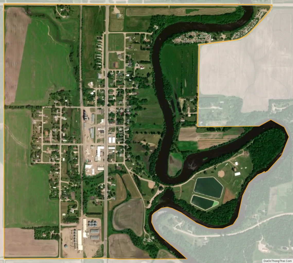
St. Hilaire city Satellite Map
Geography
According to the United States Census Bureau, the city has a total area of 0.83 square miles (2.15 km), of which 0.77 square miles (1.99 km) is land and 0.06 square miles (0.16 km) is water.
See also
Map of Minnesota State and its subdivision:- Aitkin
- Anoka
- Becker
- Beltrami
- Benton
- Big Stone
- Blue Earth
- Brown
- Carlton
- Carver
- Cass
- Chippewa
- Chisago
- Clay
- Clearwater
- Cook
- Cottonwood
- Crow Wing
- Dakota
- Dodge
- Douglas
- Faribault
- Fillmore
- Freeborn
- Goodhue
- Grant
- Hennepin
- Houston
- Hubbard
- Isanti
- Itasca
- Jackson
- Kanabec
- Kandiyohi
- Kittson
- Koochiching
- Lac qui Parle
- Lake
- Lake of the Woods
- Lake Superior
- Le Sueur
- Lincoln
- Lyon
- Mahnomen
- Marshall
- Martin
- McLeod
- Meeker
- Mille Lacs
- Morrison
- Mower
- Murray
- Nicollet
- Nobles
- Norman
- Olmsted
- Otter Tail
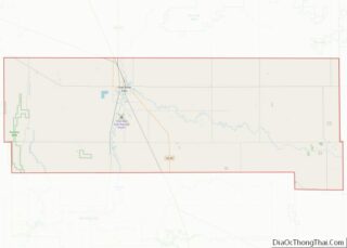
- Pennington
- Pine
- Pipestone
- Polk
- Pope
- Ramsey
- Red Lake
- Redwood
- Renville
- Rice
- Rock
- Roseau
- Saint Louis
- Scott
- Sherburne
- Sibley
- Stearns
- Steele
- Stevens
- Swift
- Todd
- Traverse
- Wabasha
- Wadena
- Waseca
- Washington
- Watonwan
- Wilkin
- Winona
- Wright
- Yellow Medicine
- Alabama
- Alaska
- Arizona
- Arkansas
- California
- Colorado
- Connecticut
- Delaware
- District of Columbia
- Florida
- Georgia
- Hawaii
- Idaho
- Illinois
- Indiana
- Iowa
- Kansas
- Kentucky
- Louisiana
- Maine
- Maryland
- Massachusetts
- Michigan
- Minnesota
- Mississippi
- Missouri
- Montana
- Nebraska
- Nevada
- New Hampshire
- New Jersey
- New Mexico
- New York
- North Carolina
- North Dakota
- Ohio
- Oklahoma
- Oregon
- Pennsylvania
- Rhode Island
- South Carolina
- South Dakota
- Tennessee
- Texas
- Utah
- Vermont
- Virginia
- Washington
- West Virginia
- Wisconsin
- Wyoming