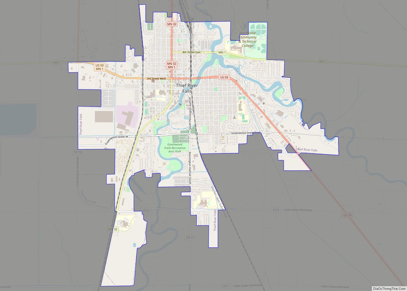
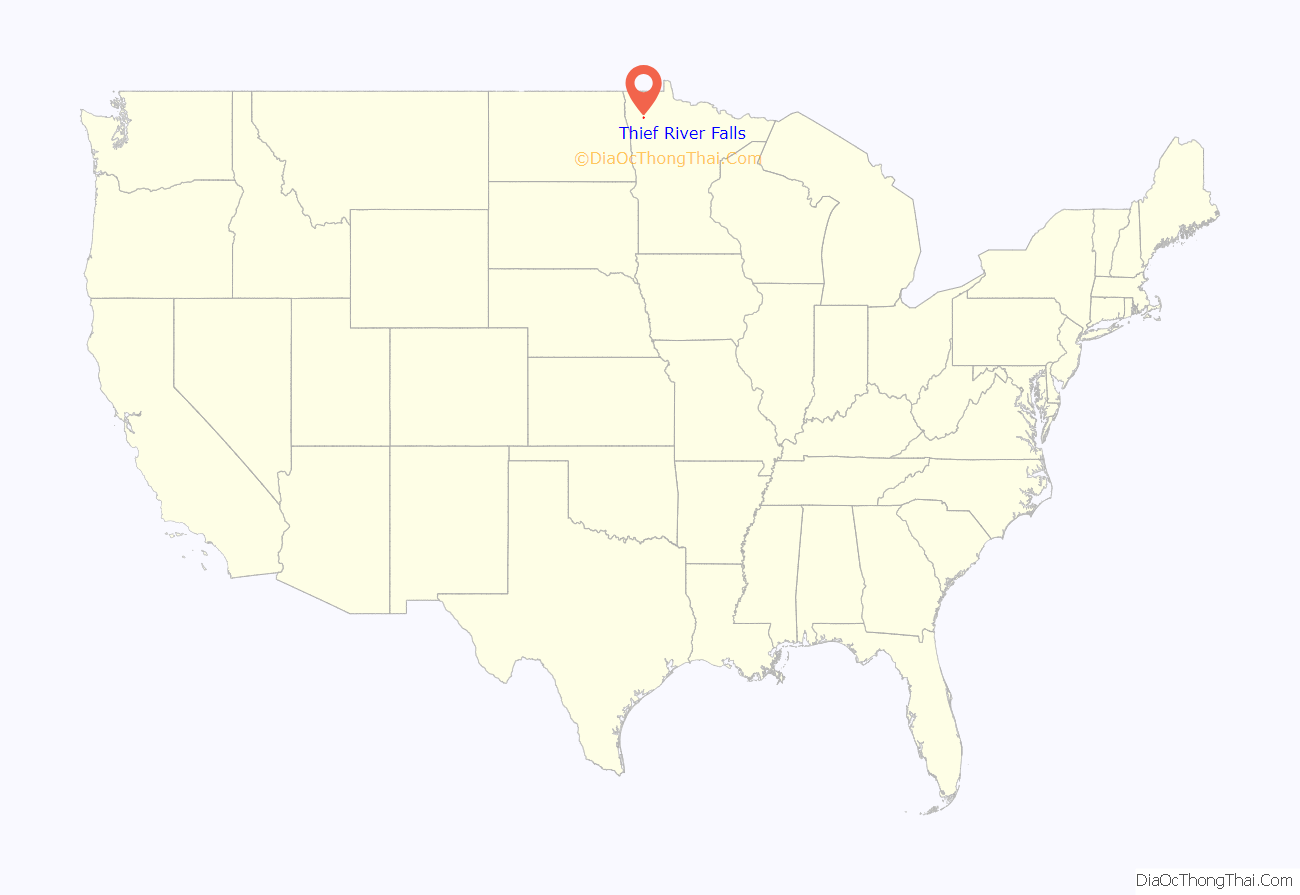
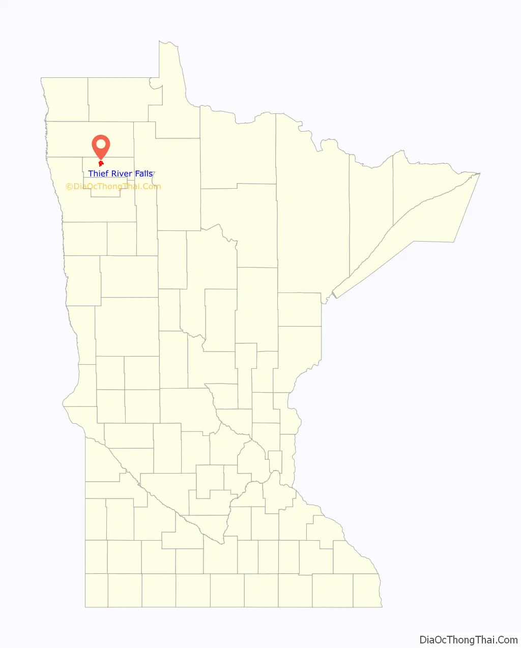
Thief River Falls, sometimes referred to as Thief River or abbreviated as TRF, is a city in Pennington County in the northwest portion of the U.S. state of Minnesota. The population was 8,749 at the 2020 census. Thief River Falls is the county seat for Pennington County.
| Name: | Thief River Falls city |
|---|---|
| LSAD Code: | 25 |
| LSAD Description: | city (suffix) |
| State: | Minnesota |
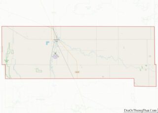
| County: | Pennington County |
| Elevation: | 1,132 ft (345 m) |
| Total Area: | 6.12 sq mi (15.85 km²) |
| Land Area: | 5.92 sq mi (15.34 km²) |
| Water Area: | 0.19 sq mi (0.50 km²) |
| Total Population: | 8,749 |
| Population Density: | 1,476.87/sq mi (570.25/km²) |
| ZIP code: | 56701 |
| Area code: | 218 |
| FIPS code: | 2764570 |
| GNISfeature ID: | 0653129 |
| Website: | citytrf.net |
Online Interactive Map
Click on ![]() to view map in "full screen" mode.
to view map in "full screen" mode.
Thief River Falls location map. Where is Thief River Falls city?
History
Thief River Falls takes its name from a geographic feature, the falls of the Red Lake River at its confluence with the Thief River. The name of the river is a loose translation of the Ojibwe phrase Gimood-akiwi ziibi, literally, the “Stolen-land river” or “Thieving-land river”, which originated when a band of Dakota Indians occupied a secret encampment along the river, hence “stealing” the land, before being discovered and routed by the neighboring Ojibwe. In the Treaty of Old Crossing of 1863, the Moose Dung’s Indian Reservation was established on the west bank of the Thief River, at its confluence with Red Lake River. This Indian Reservation was dissolved in 1904 and their population incorporated as part of the Red Lake Band of Chippewa.
Thief River Falls marked the limit of navigation on the Red Lake River. The eponymous town site was established in 1887 and later incorporated as a city in 1896. Thief River Falls first developed as a lumber-milling town. It is located in a major agriculture area because of the rich soil left by ancient Glacial Lake Agassiz. The Great Northern and the Soo Line railroads brought prosperity when Thief River Falls became a center for shipping wheat.
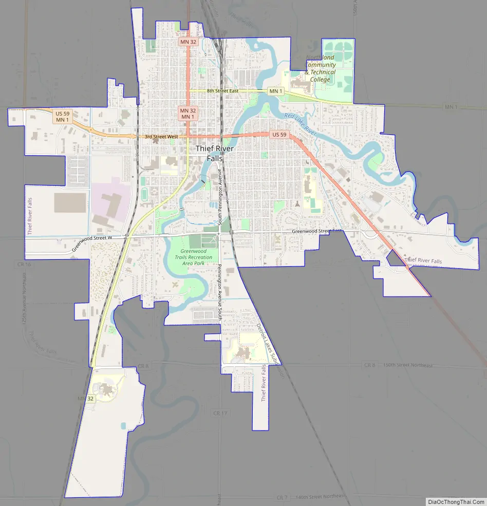
Thief River Falls Road Map
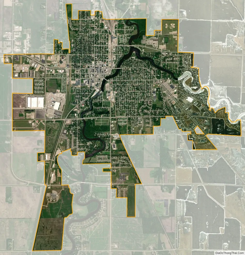
Thief River Falls city Satellite Map
Geography
According to the United States Census Bureau, the city has a total area of 5.21 square miles (13.49 km), of which 5.02 square miles (13.00 km) is land and 0.19 square miles (0.49 km) is water.
Thief River Falls is located at the confluence of the Red Lake and Thief rivers. U.S. Highway 59 and Minnesota State Highways 1 and 32 are the three main routes in the community. Thief River Falls is located approximately 70 miles (110 km) south of the Canada–United States border and 52 miles (84 km) northeast of Grand Forks, North Dakota, in the northwest region of Minnesota.
Climate
Thief River Falls has a humid continental climate (Dwb) with warm to hot summers and cold to severely cold winters.
See also
Map of Minnesota State and its subdivision:- Aitkin
- Anoka
- Becker
- Beltrami
- Benton
- Big Stone
- Blue Earth
- Brown
- Carlton
- Carver
- Cass
- Chippewa
- Chisago
- Clay
- Clearwater
- Cook
- Cottonwood
- Crow Wing
- Dakota
- Dodge
- Douglas
- Faribault
- Fillmore
- Freeborn
- Goodhue
- Grant
- Hennepin
- Houston
- Hubbard
- Isanti
- Itasca
- Jackson
- Kanabec
- Kandiyohi
- Kittson
- Koochiching
- Lac qui Parle
- Lake
- Lake of the Woods
- Lake Superior
- Le Sueur
- Lincoln
- Lyon
- Mahnomen
- Marshall
- Martin
- McLeod
- Meeker
- Mille Lacs
- Morrison
- Mower
- Murray
- Nicollet
- Nobles
- Norman
- Olmsted
- Otter Tail
- Pennington
- Pine
- Pipestone
- Polk
- Pope
- Ramsey
- Red Lake
- Redwood
- Renville
- Rice
- Rock
- Roseau
- Saint Louis
- Scott
- Sherburne
- Sibley
- Stearns
- Steele
- Stevens
- Swift
- Todd
- Traverse
- Wabasha
- Wadena
- Waseca
- Washington
- Watonwan
- Wilkin
- Winona
- Wright
- Yellow Medicine
- Alabama
- Alaska
- Arizona
- Arkansas
- California
- Colorado
- Connecticut
- Delaware
- District of Columbia
- Florida
- Georgia
- Hawaii
- Idaho
- Illinois
- Indiana
- Iowa
- Kansas
- Kentucky
- Louisiana
- Maine
- Maryland
- Massachusetts
- Michigan
- Minnesota
- Mississippi
- Missouri
- Montana
- Nebraska
- Nevada
- New Hampshire
- New Jersey
- New Mexico
- New York
- North Carolina
- North Dakota
- Ohio
- Oklahoma
- Oregon
- Pennsylvania
- Rhode Island
- South Carolina
- South Dakota
- Tennessee
- Texas
- Utah
- Vermont
- Virginia
- Washington
- West Virginia
- Wisconsin
- Wyoming