Hewlett Bay Park is a village in the Town of Hempstead in Nassau County, on the South Shore of Long Island, in New York. The population was 404 at the 2010 census.
The area, like Back/Old Lawrence is unique because its rural affluence is similar in character to the more well known Gold Coast of the North Shore instead of being more urbanized like the rest of the South Shore of Nassau County.
Hewlett Bay Park is usually included as one of the Five Towns in the southwestern corner of Nassau County. In the context of the Five Towns, “The Hewletts” or “Hewlett” is often used to refer collectively to the hamlet of Hewlett, together with the villages of Hewlett Bay Park, Hewlett Harbor and Hewlett Neck. The Five Towns is usually said to comprise the villages of Lawrence and Cedarhurst, the hamlets of Woodmere and Inwood, and “The Hewletts”, along with Woodsburgh.
| Name: | Hewlett Bay Park village |
|---|---|
| LSAD Code: | 47 |
| LSAD Description: | village (suffix) |
| State: | New York |
| County: | Nassau County |
| Incorporated: | 1928 |
| Elevation: | 10 ft (3 m) |
| Total Area: | 0.36 sq mi (0.93 km²) |
| Land Area: | 0.34 sq mi (0.87 km²) |
| Water Area: | 0.02 sq mi (0.06 km²) |
| Total Population: | 494 |
| Population Density: | 1,461.54/sq mi (565.02/km²) |
| ZIP code: | 11557 |
| Area code: | 516 |
| FIPS code: | 3634297 |
| GNISfeature ID: | 0952662 |
| Website: | hewlettbayparkny.gov |
Online Interactive Map
Click on ![]() to view map in "full screen" mode.
to view map in "full screen" mode.
Hewlett Bay Park location map. Where is Hewlett Bay Park village?


History
Hewlett Bay Park incorporated as a village in 1928.
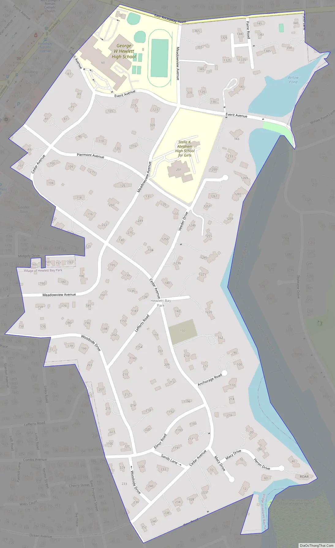
Hewlett Bay Park Road Map
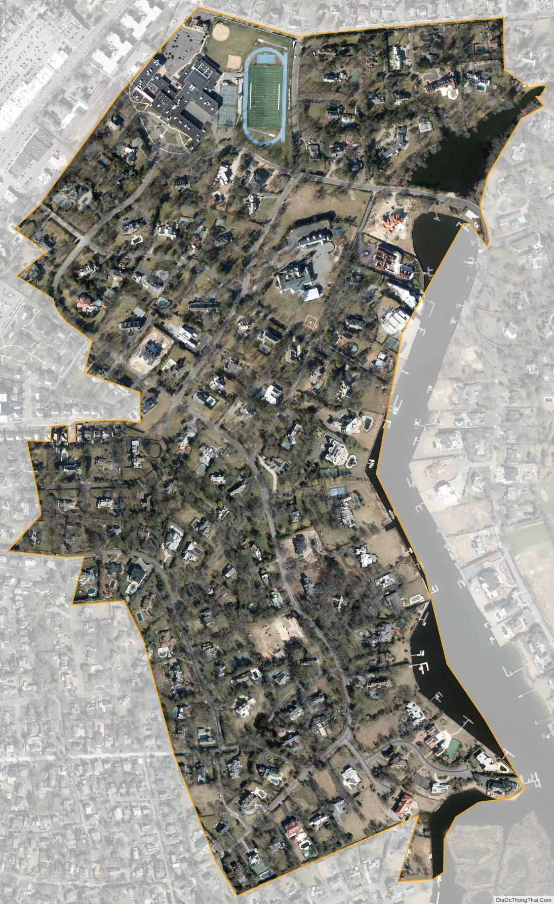
Hewlett Bay Park city Satellite Map
Geography
According to the United States Census Bureau, the village has a total area of 0.4 square miles (1.0 km), of which 0.3 square miles (0.78 km) is land and 0.04 square miles (0.10 km), or 5.41%, is water.
See also
Map of New York State and its subdivision:- Albany
- Allegany
- Bronx
- Broome
- Cattaraugus
- Cayuga
- Chautauqua
- Chemung
- Chenango
- Clinton
- Columbia
- Cortland
- Delaware
- Dutchess
- Erie
- Essex
- Franklin
- Fulton
- Genesee
- Greene
- Hamilton
- Herkimer
- Jefferson
- Kings
- Lake Ontario
- Lewis
- Livingston
- Madison
- Monroe
- Montgomery
- Nassau
- New York
- Niagara
- Oneida
- Onondaga
- Ontario
- Orange
- Orleans
- Oswego
- Otsego
- Putnam
- Queens
- Rensselaer
- Richmond
- Rockland
- Saint Lawrence
- Saratoga
- Schenectady
- Schoharie
- Schuyler
- Seneca
- Steuben
- Suffolk
- Sullivan
- Tioga
- Tompkins
- Ulster
- Warren
- Washington
- Wayne
- Westchester
- Wyoming
- Yates
- Alabama
- Alaska
- Arizona
- Arkansas
- California
- Colorado
- Connecticut
- Delaware
- District of Columbia
- Florida
- Georgia
- Hawaii
- Idaho
- Illinois
- Indiana
- Iowa
- Kansas
- Kentucky
- Louisiana
- Maine
- Maryland
- Massachusetts
- Michigan
- Minnesota
- Mississippi
- Missouri
- Montana
- Nebraska
- Nevada
- New Hampshire
- New Jersey
- New Mexico
- New York
- North Carolina
- North Dakota
- Ohio
- Oklahoma
- Oregon
- Pennsylvania
- Rhode Island
- South Carolina
- South Dakota
- Tennessee
- Texas
- Utah
- Vermont
- Virginia
- Washington
- West Virginia
- Wisconsin
- Wyoming


