Tappan (/təˈpæn/ tə-PAN) is a hamlet and census-designated place in the town of Orangetown, Rockland County, New York. It is located northwest of Alpine, New Jersey, north of Northvale, New Jersey and Rockleigh, New Jersey, northeast of Old Tappan, New Jersey, east/southeast of Nauraushaun and Pearl River, south of Orangeburg, southwest of Sparkill, and west of Palisades; Tappan shares a border with each. The population was 6,673, according to the 2020 census.
| Name: | Tappan CDP |
|---|---|
| LSAD Code: | 57 |
| LSAD Description: | CDP (suffix) |
| State: | New York |
| County: | Rockland County |
| Elevation: | 46 ft (14 m) |
| Total Area: | 2.76 sq mi (7.16 km²) |
| Land Area: | 2.76 sq mi (7.14 km²) |
| Water Area: | 0.01 sq mi (0.02 km²) |
| Total Population: | 6,673 |
| Population Density: | 2,420.38/sq mi (934.42/km²) |
| ZIP code: | 10983 |
| Area code: | 845 |
| FIPS code: | 3673154 |
| GNISfeature ID: | 0967057 |
Online Interactive Map
Click on ![]() to view map in "full screen" mode.
to view map in "full screen" mode.
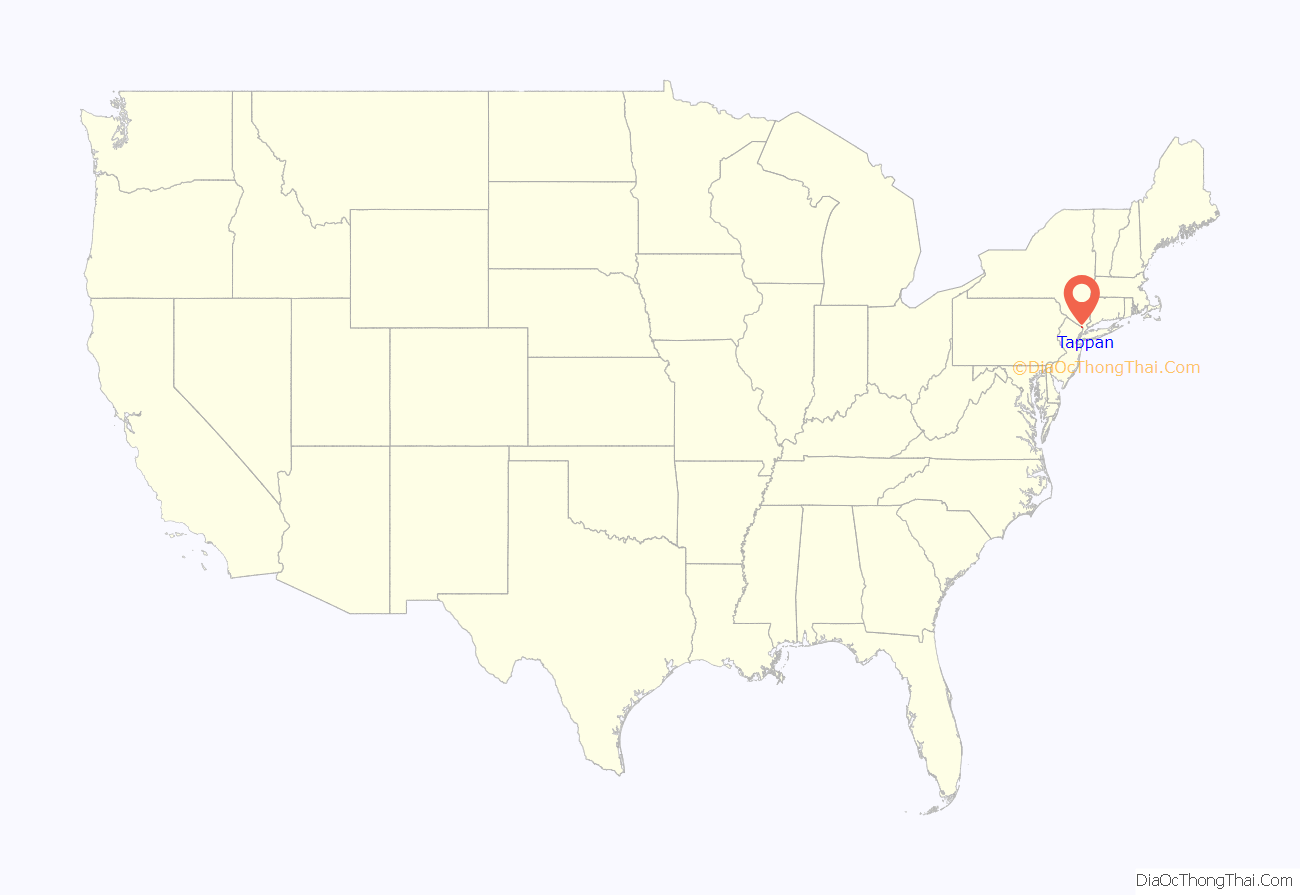
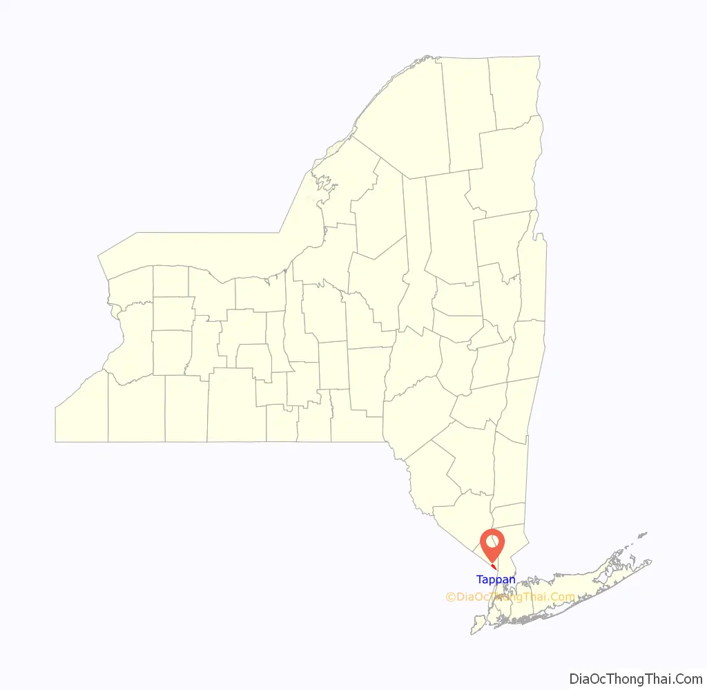
Tappan location map. Where is Tappan CDP?
History
Early history
The Tappan tribe were a Lenape people who inhabited the region radiating from the Hudson Palisades and the New York – New Jersey Highlands at the time of European colonization in the 17th century. “Tappan” is derived from the Lenape word “tuphanne” thought to mean “cold water.”
The first Orange County courthouse was built in 1691 in Tappan, though by 1737, sessions alternated between Tappan and Goshen. The first school house in Rockland County was built in 1711 in Tappan. It was used as a school until 1860. There would not be another school in the county until late in the 18th century.
American Revolution
The Orangetown Resolutions were adopted in 1774 at the home of Yoast Mabie. The Dutch colonial house was built by his brother Casparus Mabie in Tappan. When Great Britain imposed duties on the colonies and closed the port of Boston, local inhabitants passed resolutions calling for a boycott of British imports and exports on Monday, July 4, 1774, two years to the day before the Declaration of Independence was proclaimed.
British Major John André, who conspired with Benedict Arnold to allow the takeover of West Point by the British, was captured in 1780 in Tarrytown on his way back to the British lines with the plans of the fort’s fortifications. Major André was brought to Tappan, confined at Caspurus Mabie’s home, known as “Mabie’s Inn,” and brought to trial at the Reformed Church of Tappan; he was found guilty of espionage, hanged, and buried nearby.
Strickland, Major André’s executioner, who was confined at the camp in Tappan as a dangerous Tory during André’s trial, was granted liberty for accepting the duty of hangman and returned to his home in the Ramapo Valley or Smith’s Cove. Joshua Hett Smith, accused of conspiring with Major André, was also brought to trial at the Reformed Church of Tappan. The trial lasted four weeks and ended in Smith’s acquittal.
General George Washington, who in 1789 became the first president of the United States, used the 1700 DeWint House, Rockland County’s oldest existing structure, as his headquarters four times between 1780 and 1783, and dined at Mabie’s Inn during the American Revolution. Today the house known as Mabie’s Inn is a restaurant operating as The Old 76 House.
Recent history
- Cereo, an early commercially produced baby food, was manufactured in the early 1900s by Macy Deming at the Haring Adams (Deming) House.
- The Tappan Fire Department’s 100th anniversary was celebrated on October 13, 2007, with a Mardi Gras-style parade, complete with beaded necklaces and confetti. The Budweiser Clydesdale horses made an appearance.
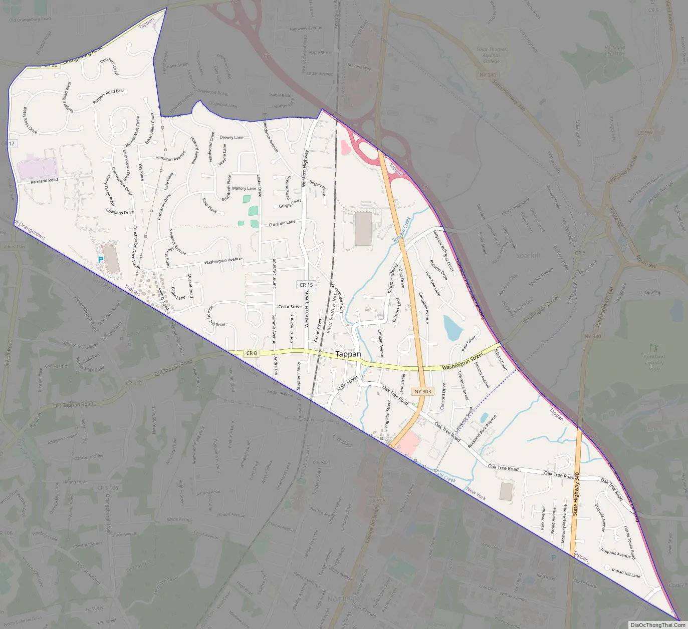
Tappan Road Map
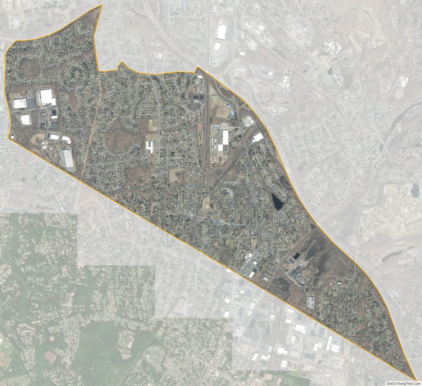
Tappan city Satellite Map
Geography
Tappan is located at 41°1′33″N 73°57′4″W / 41.02583°N 73.95111°W / 41.02583; -73.95111 (41.025897, −73.951180).
According to the United States Census Bureau, the region has a total area of 2.8 square miles (7.3 km), all land.
See also
Map of New York State and its subdivision:- Albany
- Allegany
- Bronx
- Broome
- Cattaraugus
- Cayuga
- Chautauqua
- Chemung
- Chenango
- Clinton
- Columbia
- Cortland
- Delaware
- Dutchess
- Erie
- Essex
- Franklin
- Fulton
- Genesee
- Greene
- Hamilton
- Herkimer
- Jefferson
- Kings
- Lake Ontario
- Lewis
- Livingston
- Madison
- Monroe
- Montgomery
- Nassau
- New York
- Niagara
- Oneida
- Onondaga
- Ontario
- Orange
- Orleans
- Oswego
- Otsego
- Putnam
- Queens
- Rensselaer
- Richmond
- Rockland
- Saint Lawrence
- Saratoga
- Schenectady
- Schoharie
- Schuyler
- Seneca
- Steuben
- Suffolk
- Sullivan
- Tioga
- Tompkins
- Ulster
- Warren
- Washington
- Wayne
- Westchester
- Wyoming
- Yates
- Alabama
- Alaska
- Arizona
- Arkansas
- California
- Colorado
- Connecticut
- Delaware
- District of Columbia
- Florida
- Georgia
- Hawaii
- Idaho
- Illinois
- Indiana
- Iowa
- Kansas
- Kentucky
- Louisiana
- Maine
- Maryland
- Massachusetts
- Michigan
- Minnesota
- Mississippi
- Missouri
- Montana
- Nebraska
- Nevada
- New Hampshire
- New Jersey
- New Mexico
- New York
- North Carolina
- North Dakota
- Ohio
- Oklahoma
- Oregon
- Pennsylvania
- Rhode Island
- South Carolina
- South Dakota
- Tennessee
- Texas
- Utah
- Vermont
- Virginia
- Washington
- West Virginia
- Wisconsin
- Wyoming


