Yonkers (/ˈjɒŋkərz/) is a city in Westchester County, New York, and a suburb of New York City. Developed along the Hudson River, it is the third most populous city in the state of New York, after New York City and Buffalo. The population of Yonkers was 211,569 as enumerated in the 2020 United States Census. It is classified as an inner suburb of New York City, located directly to the north of the Bronx and approximately 2.4 miles (4 km) north of Marble Hill, Manhattan, the northernmost point in Manhattan.
Yonkers’s downtown is centered on a plaza known as Getty Square, where the municipal government is located. The downtown area also houses significant local businesses and nonprofit organizations. It serves as a major retail hub for Yonkers and the northwest Bronx.
The city is home to several attractions, including access to the Hudson River; Tibbetts Brook Park, with its public pool with slides and lazy river and two-mile walking loop; Untermyer Park; the Hudson River Museum; the Saw Mill River daylighting, wherein a parking lot was removed to uncover the Nepperkamack (Saw Mill River); the Science Barge; and Sherwood House. Yonkers Raceway, a harness racing track, renovated its grounds and clubhouse, and added legalized video slot machine gambling in 2006 to become a “racino” named Empire City. In more recent years, Yonkers has undergone progressive gentrification.
Major shopping areas are located in Getty Square, on South Broadway, at the Cross County Shopping Center and Westchester’s Ridge Hill, and along Central Park Avenue, informally called “Central Avenue” by area residents, a name it takes officially a few miles north in White Plains. Yonkers is considered a City of Seven Hills (its hills including Park, Nodine, Ridge, Cross, Locust, Glen, and Church Hills).
| Name: | Yonkers city |
|---|---|
| LSAD Code: | 25 |
| LSAD Description: | city (suffix) |
| State: | New York |
| County: | Westchester County |
| Founded: | 1646 (village) |
| Incorporated: | 1872 (city) |
| Elevation: | 82 ft (25 m) |
| Total Area: | 20.27 sq mi (52.49 km²) |
| Land Area: | 18.01 sq mi (46.63 km²) |
| Water Area: | 2.26 sq mi (5.85 km²) |
| Total Population: | 211,569 |
| Population Density: | 11,749.92/sq mi (4,536.75/km²) |
| Area code: | 914 |
| FIPS code: | 3684000 |
| GNISfeature ID: | 0971828 |
| Website: | www.yonkersny.gov |
Online Interactive Map
Click on ![]() to view map in "full screen" mode.
to view map in "full screen" mode.
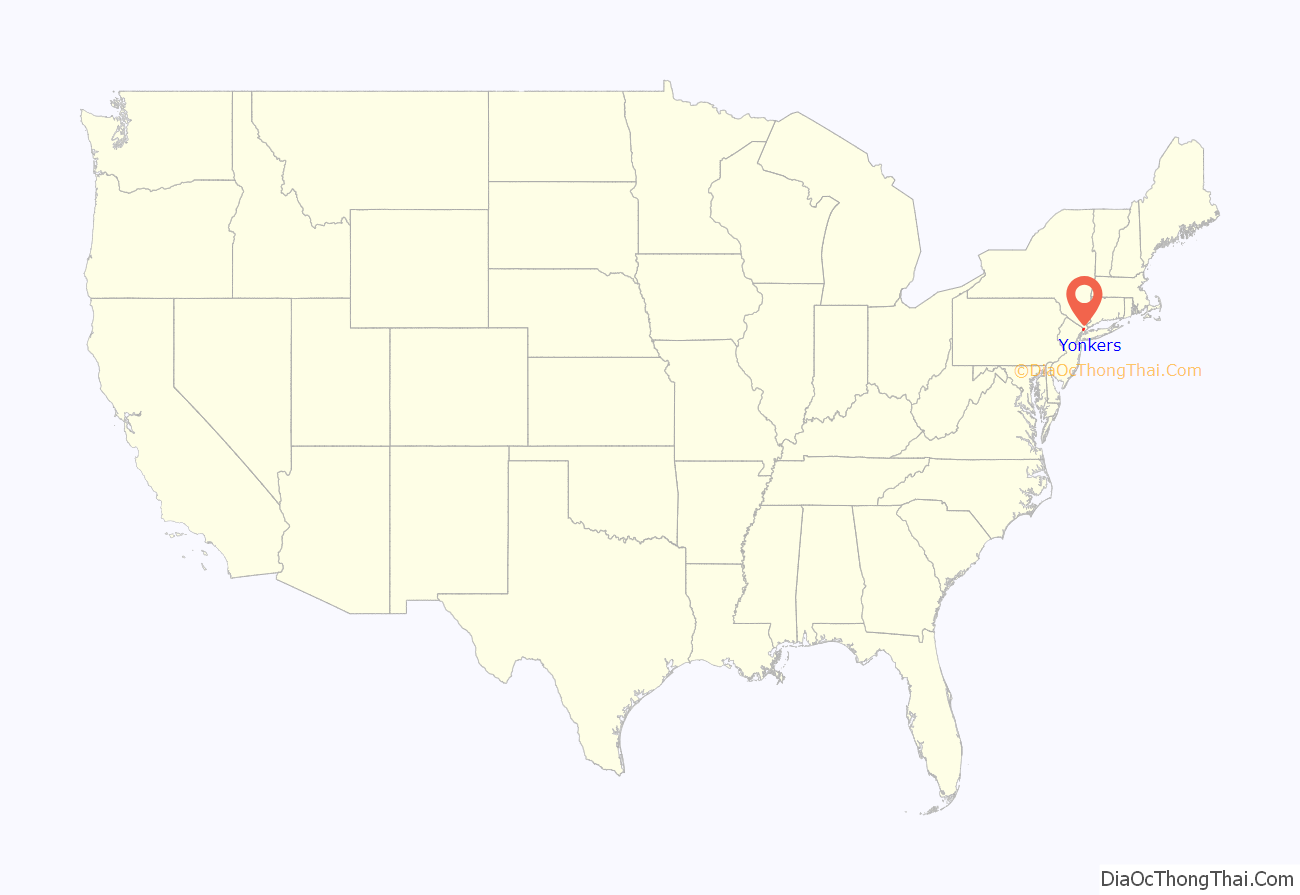
Yonkers location map. Where is Yonkers city?
History
Early years
The indigenous village of Nappeckamack was located near the Neperah stream (now Saw Mill River) flowed into the Shatemuck (Hudson River). The land on which the city is built was once part of a Dutch 24,000-acre (97-square-kilometer) land grant called Colen Donck. It ran from the current Manhattan-Bronx border at Marble Hill northwards for 12 miles (19 km), and from the Hudson River eastwards to the Bronx River. In July 1645, the area was granted to Adriaen van der Donck, the patroon of Colendonck. Van der Donck was known locally as the Jonkheer — etymologically, “young gentleman”, a Dutch honorific title derived from the old Dutch jonk (young) and heer (“lord”); in effect meaning “Esquire”. Jonkheer was shortened to Jonker (possessive Jonkers), from which the name “Yonkers” is directly derived. Van der Donck built a saw mill near where the confluence of Nepperhan Creek and the Hudson lies. The Nepperhan is now also known as the Saw Mill River. Van der Donck was killed in the Peach War. His wife, Mary Doughty, was taken captive by Native Americans and later ransomed.
Near the site of Van Der Donck’s mill is Philipse Manor Hall, a Colonial-era manor house owned by Dutch colonists. Today the manor is preserved and operated as a museum and archive, offering many glimpses into life before the American Revolution. The original structure (later enlarged) was built around 1682 by workmen and slaves for Frederick Philipse and his wife Margaret Hardenbroeck de Vries. Philipse was a wealthy Dutchman who by the time of his death had amassed an enormous estate, which encompassed the entire modern City of Yonkers, as well as several other Hudson River towns. Philipse’s great-grandson, Frederick Philipse III, was a prominent Loyalist during the American Revolution. He had many economic ties to English businessmen, which also resulted in political ties. Because of his political leanings, he was forced to flee to England. The American colonists in New York state confiscated all the lands and property that belonged to the Philipse family and sold it.
19th century
For its first two centuries, Yonkers was a small farming town producing peaches, apples, potatoes, oats, wheat and other agricultural goods to be shipped to New York City along the Hudson. Water power allowed the creation of new manufacturing jobs only in the 19th century.
Yonkers’s growth rested largely on the development of industry. In 1853, Elisha Otis invented the first safety elevator and the Otis Elevator Company opened the first elevator factory in the world on the banks of the Hudson near what is now Vark Street. In the 1880s it relocated to larger quarters (now adapted and used as the Yonkers Public Library). Around the same time, the Alexander Smith and Sons Carpet Company (in the Saw Mill River Valley) expanded to 45 buildings, 800 looms, and more than 4,000 workers. It was known as one of the premier carpet-producing centers in the world.
The Village of Yonkers was incorporated in the western part of the Town of Yonkers in 1854, and the village was incorporated as a city in 1872. In 1873, the southern part of the Town of Yonkers, outside the City of Yonkers, was separated as the Town of Kingsbridge. This included the current neighborhoods of Kingsbridge and Riverdale, as well as Woodlawn Cemetery and Woodlawn Heights. In 1874, the Town of Kingsbridge was annexed by New York City as part of The Bronx. In 1898, Yonkers (along with Brooklyn, Queens, and Staten Island) voted on a referendum to determine if they wanted to become part of New York City. While the results were positive elsewhere, the returns were so negative in Yonkers and neighboring Mount Vernon that those two areas were not included in the consolidated city and remained independent. Still, some residents call Yonkers “the Sixth Borough”, referring to its location on the New York City border, its urban character, and the failed merger vote.
During the American Civil War, 254 Yonkers residents joined the U.S. Army and Navy. They enlisted primarily in four different regiments. These included the 6th New York Heavy Artillery, the 5th New York Volunteer Infantry, the 17th New York Volunteers, and the 15th NY National Guard. During the New York City Draft Riots, Yonkers formed the Home Guards. This force of constables was formed to protect Yonkers from rioting that was feared to spread from New York City, but it never did. In total, seventeen Yonkers residents were killed during the Civil War.
From 1888, the New York City and Northern Railway Company (later the New York Central Railroad) connected Yonkers to Manhattan and points north. A three-mile spur to Getty Square operated until 1943.
Aside from being a manufacturing center, Yonkers played a key role in the development of sports recreation in the United States. In 1888, Scottish-born John Reid founded the first golf course in the United States, Saint Andrew’s Golf Club, in Yonkers.
20th century
Bakelite, the first completely synthetic plastic, was invented c. 1906 in Yonkers by Leo Baekeland, and manufactured there until the late 1920s. Today, two of the former Alexander Smith and Sons Carpet Company loft buildings located at 540 and 578 Nepperhan Avenue have been repurposed to house the YoHo Artist Community. This collective group of artists works out of private studios there.
During World War I, a total of 6,909 Yonkers residents entered military service. This was approximately seven percent of the population. Most Yonkers men joined either the 27th Division or the 77th Division. In total, 137 Yonkers residents were killed during the war. Among the survivors of the USS President Lincoln, a Navy transport ship sunk during the war, were seventeen sailors from Yonkers.
Civilians helped in the war effort by joining organizations such as the American Red Cross. In 1916, there were 126 people in the Yonkers chapter of the Red Cross. By the end of the war, 15,358 Yonkers residents were members of the chapter. Mostly women, they prepared surgical dressings, created hospital garments for the wounded, and knit articles of clothing for refugees and soldiers. Besides joining the Red Cross, residents of Yonkers donated to various war drives. The total amount raised for these drives was $19,255,255.
Early in the 20th century, Yonkers also hosted a brass era automobile maker, Colt Runabout Company. Although the vehicle reportedly performed well, the company went under. Yonkers was the headquarters of the Waring Hat Company, at the time the nation’s largest hat manufacturer. During World War II, the city’s factories were converted to produce items for the war effort, such as tents and blankets by the Alexander Smith and Sons Carpet Factory, and tanks by the Otis Elevator factory. After World War II, however, increased competition from less expensive imports resulted in a decline in manufacturing in Yonkers, and numerous industrial jobs were lost. The Alexander Smith Carpet Company, one of the city’s largest employers, ceased operation during a labor dispute in June 1954.
In 1983, the Otis Elevator Factory finally closed its doors. With the loss of such jobs, Yonkers became primarily a residential city. Some neighborhoods, such as Crestwood and Park Hill, became popular with wealthy New Yorkers who wished to live outside Manhattan without giving up urban conveniences. Yonkers’s excellent transportation infrastructure, including three commuter railroad lines (now two: the Harlem and Hudson Lines), and five parkways and thruways, made it a desirable city in which to live. It is a 15-minute drive from Manhattan and has numerous prewar homes and apartment buildings. Yonkers’s manufacturing sector has also shown a resurgence in the early 21st century.
On January 4, 1940, Yonkers resident Edwin Howard Armstrong transmitted the first FM radio broadcast (on station W2XCR) from the Yonkers home of C.R. Runyon, a co-experimenter. Yonkers had the longest running pirate radio station, owned by Allan Weiner, which operated during the 1970s through the 1980s.
In 1942, a short subway connection was planned between Getty Square and the IRT Broadway–Seventh Avenue Line, which terminates in Riverdale at 242nd Street slightly south of the city line. The plan was dropped.
In 1960, the Census Bureau reported Yonkers’s population as 95.8% white and 4.0% black. The city’s struggles with racial discrimination and segregation were highlighted in a decades-long federal lawsuit. After a 1985 decision and an unsuccessful appeal, Yonkers’s schools were integrated in 1988. Federal judge Leonard B. Sand ruled that Yonkers had engaged in institutional segregation in housing and school policies for over 40 years. He tied the illegal concentration of public housing and private housing discrimination to the city’s resistance to ending racial isolation in its public schools.
In the 1980s and 1990s, Yonkers developed a national reputation for racial tension, based on a long-term battle between the city and the NAACP over the building of subsidized low-income housing projects in the city. The city planned to use federal funding for urban renewal efforts within Downtown Yonkers exclusively; other groups, led by the NAACP, believed that the resulting concentration of low-income housing in traditionally poor neighborhoods would perpetuate poverty. Although the City of Yonkers had been warned in 1971 by the United States Department of Housing and Urban Development against further building of low-income housing in west Yonkers, it continued to support subsidized housing in this area between 1972 and 1977.
Yonkers gained national/international attention during the summer of 1988, when it backed out of its previous agreement to build promised municipal public housing in the eastern portions of the city, an agreement it had made in a consent decree after losing an appeal in 1987. After its reversal, the city was found in contempt of the federal courts. Judge Sand imposed a fine on Yonkers which started at $100 and doubled every day, capped at $1 million per day by an appeals court, until the city capitulated to the federally mandated plan.
Yonkers remained in contempt of court until September 9, 1988. The City Council relented in the wake of having to close the library and cutback on sanitation measures because of paying the fines. It also was considering having to make massive city layoffs which would have adversely affected its ability to provide services to the upper classes it was trying to retain. First-term mayor Nicholas C. Wasicsko fought to save the city from financial disaster and bring about unity. Yonkers’s youngest mayor (elected at age 28), Wasicsko struggled in city politics. His term was stigmatized as the “Balkanization of Yonkers”. He succeeded in helping to end the city’s contempt of the courts, but was voted out of office as a result. His story is the subject of a miniseries called Show Me a Hero, which aired on HBO in 2015. It was adapted from the 1999 nonfiction book of the same name by former New York Times writer, Lisa Belkin.
A Kawasaki railroad cars assembly plant opened in 1986 in the former Otis plant. It produces the new R142A, R143, R160B, and R188 cars for the New York City Subway, and the PA4 and PA5 series for PATH.
21st century
In the 2000s, some areas of Yonkers that border similar neighborhoods in Riverdale, Bronx began seeing an influx of Orthodox Jews. Subsequently, Riverdale Hatzalah Volunteer Ambulance Service began serving some neighborhoods in the southwest section of the city. There is also a small Jewish cemetery, the Sherwood Park Cemetery.
Yonkers Road Map
Yonkers city Satellite Map
Geography
The city is spread out over hills rising from near sea level at the eastern bank of the Hudson River to 416 feet (127 m) at Sacred Heart Church, whose spire can be seen from Long Island, New York City, and New Jersey.
The city occupies 20.3 square miles (53 km), including 18.1 square miles (47 km) of land and 2.2 square miles (5.7 km) (11.02%) of water, according to the United States Census Bureau. The Bronx River separates Yonkers from Mount Vernon, Tuckahoe, Eastchester, Bronxville, and Scarsdale to the east. The town of Greenburgh is to the north, and the Hudson River forms the western border.
On the south, Yonkers borders the Riverdale, Woodlawn, and Wakefield sections of The Bronx. In addition, the southernmost point of Yonkers is 2 miles (3 kilometres) north of the northernmost point of Manhattan when measured from Broadway & Caryl Avenue in Yonkers to Broadway & West 228th Street in the Marble Hill section of Manhattan.
Much of the city developed around the Saw Mill River. This enters Yonkers from the north and flows into the Hudson River in the Getty Square neighborhood. Portions of the Saw Mill River that were earlier buried in flumes beneath parking lots are being uncovered, or “daylighted”. This promotes the restoration of habitat for plants, fish and other fauna, as well as an understanding of where the Native Americans camped in Spring and Summer months.
The gentilic for residents is alternately Yonkersonian, Yonkersite, or Yonk.
See also
Map of New York State and its subdivision:- Albany
- Allegany
- Bronx
- Broome
- Cattaraugus
- Cayuga
- Chautauqua
- Chemung
- Chenango
- Clinton
- Columbia
- Cortland
- Delaware
- Dutchess
- Erie
- Essex
- Franklin
- Fulton
- Genesee
- Greene
- Hamilton
- Herkimer
- Jefferson
- Kings
- Lake Ontario
- Lewis
- Livingston
- Madison
- Monroe
- Montgomery
- Nassau
- New York
- Niagara
- Oneida
- Onondaga
- Ontario
- Orange
- Orleans
- Oswego
- Otsego
- Putnam
- Queens
- Rensselaer
- Richmond
- Rockland
- Saint Lawrence
- Saratoga
- Schenectady
- Schoharie
- Schuyler
- Seneca
- Steuben
- Suffolk
- Sullivan
- Tioga
- Tompkins
- Ulster
- Warren
- Washington
- Wayne
- Westchester
- Wyoming
- Yates
- Alabama
- Alaska
- Arizona
- Arkansas
- California
- Colorado
- Connecticut
- Delaware
- District of Columbia
- Florida
- Georgia
- Hawaii
- Idaho
- Illinois
- Indiana
- Iowa
- Kansas
- Kentucky
- Louisiana
- Maine
- Maryland
- Massachusetts
- Michigan
- Minnesota
- Mississippi
- Missouri
- Montana
- Nebraska
- Nevada
- New Hampshire
- New Jersey
- New Mexico
- New York
- North Carolina
- North Dakota
- Ohio
- Oklahoma
- Oregon
- Pennsylvania
- Rhode Island
- South Carolina
- South Dakota
- Tennessee
- Texas
- Utah
- Vermont
- Virginia
- Washington
- West Virginia
- Wisconsin
- Wyoming
