Munroe Falls is a city in east-central Summit County, Ohio, United States, along the Cuyahoga River. The population was 5,044 at the 2020 census. It is a suburb of Akron and is part of the Akron metropolitan area.
| Name: | Munroe Falls city |
|---|---|
| LSAD Code: | 25 |
| LSAD Description: | city (suffix) |
| State: | Ohio |
| County: | Summit County |
| Founded: | 1838 |
| Elevation: | 1,030 ft (314 m) |
| Total Area: | 2.86 sq mi (7.41 km²) |
| Land Area: | 2.77 sq mi (7.17 km²) |
| Water Area: | 0.09 sq mi (0.24 km²) |
| Total Population: | 5,044 |
| Population Density: | 1,821.60/sq mi (703.22/km²) |
| ZIP code: | 44262 |
| Area code: | 330, 234 |
| FIPS code: | 3953312 |
| GNISfeature ID: | 1065085 |
| Website: | munroefalls.com |
Online Interactive Map
Click on ![]() to view map in "full screen" mode.
to view map in "full screen" mode.
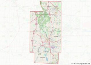
Munroe Falls location map. Where is Munroe Falls city?


History
Like much of the Connecticut Western Reserve, the area that makes up present-day Munroe Falls was previously inhabited by various tribes of American Indians. When the Western Reserve began being surveyed in 1796, what is now Munroe Falls was mostly in the southern part of the survey township Town 3, Range 10 (later to be Stow Township), then a part of Washington County before being placed in the new Jefferson County the following year. In 1800, it was made part of Trumbull County, which followed the boundaries of the Western Reserve, and in 1808, the area was made part of Portage County. The first settlers in present-day Munroe Falls, a group of around 40 people including Francis Kelsey and William Stow, came in 1809. William Stow built a log house to serve as his residence at what is now the northwest corner of Ohio State Route 91 and Munroe Falls Avenue. Kelsey built a sawmill on the south side of the Cuyahoga River and a gristmill was built on the north side. The initial name of the new village was Kelsey’s Mills (also Kelsey Mills). The first school in Munroe Falls was built in 1816. In 1817 a wooden dam was built to provide power for both mills and the name of the village was changed to Florence. Around 1836, William and Edmund Munroe (also spelled Monroe) from Boston arrived and purchased the two mills and approximately 250 acres (101 ha) of land around them to lay out a new village, which they named Munroe Falls. The village was incorporated October 26, 1838. The Munroes had great plans for the village to become a center of commerce and an important city, but these plans never worked out. The “Munroe Falls Manufacturing Co.” was granted a charter by the Ohio Legislature in April, 1837 in order to cultivate and manufacture cotton, flour, paper, silk, sugar and wool, including machinery and tools towards these purposes. The keys to their plans were to found a silk industry, which involved cultivating mulberry trees and silkworms. The trees thrived, the worms did not. Shortly after its founding the Munroe Falls Manufacturing Co. founded a bank, which issued various, unbacked currency. For the next few years the local economy thrived under the nearly unlimited credit afforded to its customers by the Company and its Bank, but ultimately the macroeconomics of the period prevailed, and both the Company and Bank failed, leaving many local residents holding worthless currency. After about 10 years, which included the economic instability of the Panic of 1837, the Munroes, who had arrived wealthy, defaulted to many of the creditors and the properties they owned were taken over by other individuals.
The Pennsylvania and Ohio Canal opened in 1840 and passed through Munroe Falls, the first boats landing on August 6 of that year arriving from New Castle, Pennsylvania. It closed around 1870. Also in 1840, Munroe Falls was made part of the new Summit County. In 1866, the old gristmill was purchased by the Cleveland Paper Company and refitted for paper manufacturing. The building burned down approximately 1–2 years later and the present factory – today owned by Sonoco Products – was built on the same site. In 1884 railroad tracks were laid in the former canal bed as part of a single line owned by the Pittsburgh and Western Railroad. These tracks were doubled in 1900 following the purchase of the railroad by Baltimore and Ohio Railroad.
In 1921 the community applied for and was granted village status. This action was taken in order to avoid becoming a part of neighboring Stow, which was applying for similar status and had included sections of Munroe Falls in its application. Finding that as a village there was not enough population to maintain self-sufficiency, the village held city officer elections for the first time in 1925 in order to revoke the village charter and receive county services.
The village got a new town hall in the 1960s. This building, which continues to serve as City Hall, was constructed in 1885 to serve as the Munroe Falls Schoolhouse, serving its original purpose until 1916.
Munroe Falls converted to city status in 1991.
In the early 2000s, the Ohio Environmental Protection Agency (EPA) and Summit County determined that the oxygen levels were too low in the Cuyahoga River, due mostly to the stagnant pool behind the Munroe Falls dam. The solution was to lower the dam, which dated to 1903. Eventually, the entire dam was removed after workers discovered a natural ledge underneath the existing dam. This project, begun in August 2005 and completed in October 2006, was part of a larger project along much of the river in the city that included cleanup and restoration.
Munroe Falls is also home to SGS Tool Company, the worlds’ largest manufacturer of round solid carbide cutting tools. SGS Tool Company’s corporate headquarters and R&D centers are located in Munroe Falls, while their manufacturing operations are located in Cuyahoga Falls. SGS is the largest employer in Munroe Falls, and is the largest percentage of the corporate tax base.
Munroe Falls Road Map
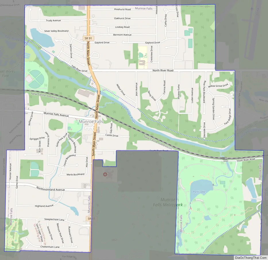
Munroe Falls city Satellite Map

Geography
Munroe Falls is located in eastern Summit County adjacent to the cities of Stow to the north, Tallmadge to the south, and Cuyahoga Falls to the west with the village of Silver Lake on the northwest. It was formed from parts of the now-defunct Stow and Tallmadge townships.
According to the United States Census Bureau, the city has a total area of 2.81 square miles (7.28 km), of which 2.72 square miles (7.04 km) is land and 0.09 square miles (0.23 km) is water.
See also
Map of Ohio State and its subdivision:- Adams
- Allen
- Ashland
- Ashtabula
- Athens
- Auglaize
- Belmont
- Brown
- Butler
- Carroll
- Champaign
- Clark
- Clermont
- Clinton
- Columbiana
- Coshocton
- Crawford
- Cuyahoga
- Darke
- Defiance
- Delaware
- Erie
- Fairfield
- Fayette
- Franklin
- Fulton
- Gallia
- Geauga
- Greene
- Guernsey
- Hamilton
- Hancock
- Hardin
- Harrison
- Henry
- Highland
- Hocking
- Holmes
- Huron
- Jackson
- Jefferson
- Knox
- Lake
- Lake Erie
- Lawrence
- Licking
- Logan
- Lorain
- Lucas
- Madison
- Mahoning
- Marion
- Medina
- Meigs
- Mercer
- Miami
- Monroe
- Montgomery
- Morgan
- Morrow
- Muskingum
- Noble
- Ottawa
- Paulding
- Perry
- Pickaway
- Pike
- Portage
- Preble
- Putnam
- Richland
- Ross
- Sandusky
- Scioto
- Seneca
- Shelby
- Stark
- Summit
- Trumbull
- Tuscarawas
- Union
- Van Wert
- Vinton
- Warren
- Washington
- Wayne
- Williams
- Wood
- Wyandot
- Alabama
- Alaska
- Arizona
- Arkansas
- California
- Colorado
- Connecticut
- Delaware
- District of Columbia
- Florida
- Georgia
- Hawaii
- Idaho
- Illinois
- Indiana
- Iowa
- Kansas
- Kentucky
- Louisiana
- Maine
- Maryland
- Massachusetts
- Michigan
- Minnesota
- Mississippi
- Missouri
- Montana
- Nebraska
- Nevada
- New Hampshire
- New Jersey
- New Mexico
- New York
- North Carolina
- North Dakota
- Ohio
- Oklahoma
- Oregon
- Pennsylvania
- Rhode Island
- South Carolina
- South Dakota
- Tennessee
- Texas
- Utah
- Vermont
- Virginia
- Washington
- West Virginia
- Wisconsin
- Wyoming