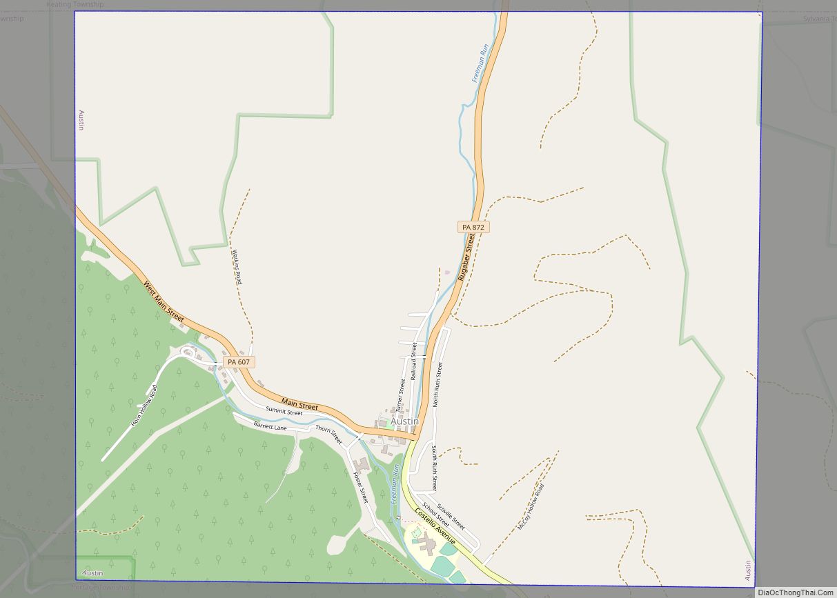
Austin is a borough along the Freeman Run (river) in southwestern Potter County, Pennsylvania, United States. The population was 482 at the 2020 census.
| Name: | Austin borough |
|---|---|
| LSAD Code: | 21 |
| LSAD Description: | borough (suffix) |
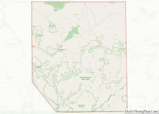
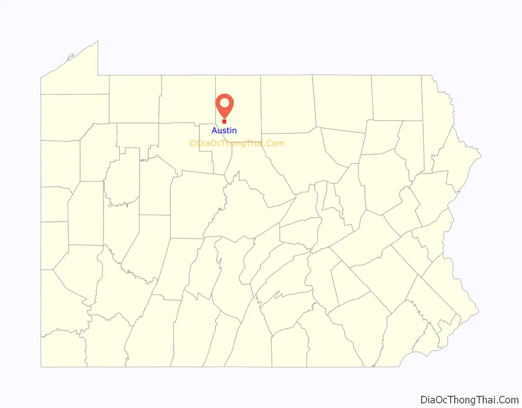
| State: | Pennsylvania |
| County: | Potter County |
| Total Area: | 4.04 sq mi (10.47 km²) |
| Land Area: | 4.04 sq mi (10.47 km²) |
| Water Area: | 0.00 sq mi (0.00 km²) |
| Total Population: | 482 |
| Population Density: | 119.28/sq mi (46.05/km²) |
| ZIP code: | 16720 |
| Area code: | 814 |
| FIPS code: | 4203576 |
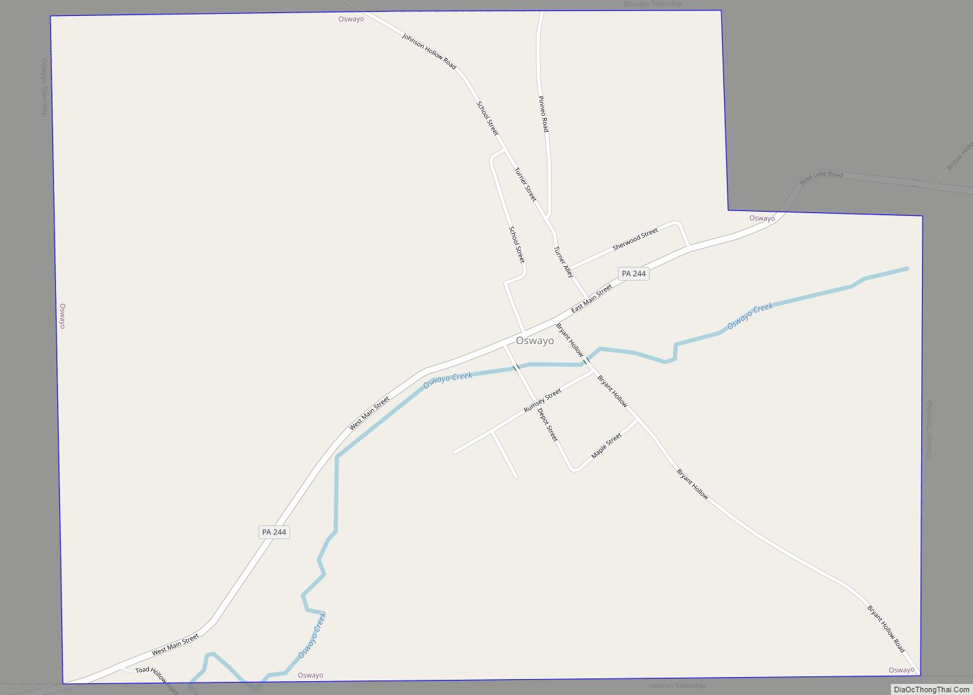
Online Interactive Map
Click on ![]() to view map in "full screen" mode.
to view map in "full screen" mode.
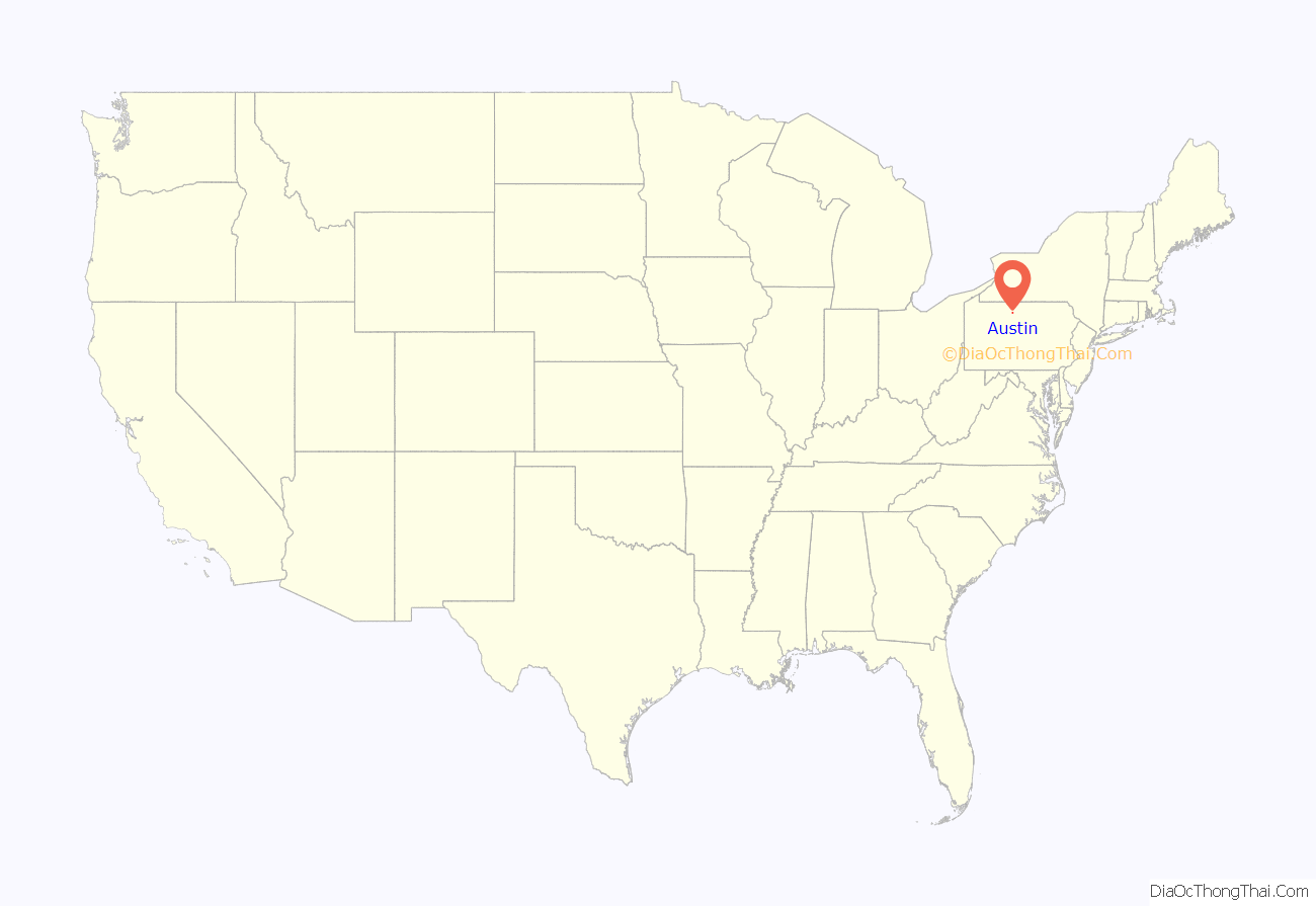
Austin location map. Where is Austin borough?
History
In September 1856, Edward Orramel Austin came to Freeman Run. He fell in love with the area and began to build a village. From then on, he lived his entire life in the valley. He served in the Civil War and returned to his valley after. His dream grew until his town, at one period, was one of the largest in Potter County. At the time of his death in 1908, the town of Austin was at its most productive with paper mills and saw mills as well. He lived to see a great dream come true. Two years later, nearly the entire town was swept away when the great dam built by the Bayless Pulp and Paper Company failed to hold back its 500,000,000+ gallons of water. The home of E.O. Austin went with it.
The building is a replica of E.O. Austin’s house of the 1800’s. It is in almost the exact spot as it was before the flood of 1911. The inside of the home is a museum filled with memorabilia from Austin and the surrounding areas (Wharton, Keating Summit and Odin). The goal of “The New, Oldest Home in Austin” is to preserve our own town’s history – past, present, and future.
The Austin Dam also known as the Bayless Dam, was a concrete gravity dam that served the Bayless Pulp and Paper Mill. Built in 1909, It was the largest dam of its type in Pennsylvania at the time. The catastrophic failure of the dam on September 30, 1911 caused significant destruction including much of the town and loss of 78 lives in Freeman Run Valley below the dam.
Austin Dam ruins- Austin, PA
Austin Dam ruins- Austin, PA
The town was rebuilt, under the slogan “the town too tough to die”. This was later changed to “the best town by a dam site”.
On November 9, 2021, Kate Crosby, aka Kaitlyn Crosby Wolfel, won the mayoral election against Jim Setzer. They received 38 and 30 votes, respectively. On July 7, 2021, Crosby pleaded guilty for the felony crime of aggravated assault by vehicle on December 21, 2014, which resulted in the death of 62-year-old David Croyle and the maiming of 25-year-old Patrick Hornung. Both men were struck by Crosby’s vehicle while walking along Old West Creek Road, Shippen Township, Cameron County. The Potter Leader-Enterprise wrote that Crosby’s felony conviction may render her ineligible to hold office as mayor, because the Pennsylvania Constitution bars anyone convicted of an “infamous crime” from holding office in Pennsylvania. Once in office, the DA or attorney general would need to file a quo warranto to remove her. On June 7, 2022, the Austin Borough Council following Judge Stephen Minor’s court decision to remove Kate Crosby as mayor of Austin and Andy Dynda as a councilman. Council President Jesse Valenti announced that he would serve as interim mayor. During a special meeting on June 30, the Austin borough council unanimously appointed James Setzer as mayor and Shannon Housler as councilwoman to fill the existing vacancies.
Austin Road Map
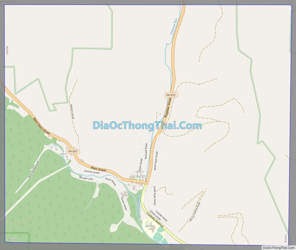
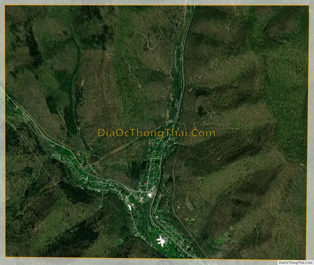
Austin city Satellite Map
Geography
Austin is located at 41°37′51″N 78°5′37″W / 41.63083°N 78.09361°W / 41.63083; -78.09361 (41.630781, -78.093590).
According to the United States Census Bureau, the borough has a total area of 4.0 square miles (10.4 km), all land.
See also
Map of Pennsylvania State and its subdivision:- Adams
- Allegheny
- Armstrong
- Beaver
- Bedford
- Berks
- Blair
- Bradford
- Bucks
- Butler
- Cambria
- Cameron
- Carbon
- Centre
- Chester
- Clarion
- Clearfield
- Clinton
- Columbia
- Crawford
- Cumberland
- Dauphin
- Delaware
- Elk
- Erie
- Fayette
- Forest
- Franklin
- Fulton
- Greene
- Huntingdon
- Indiana
- Jefferson
- Juniata
- Lackawanna
- Lancaster
- Lawrence
- Lebanon
- Lehigh
- Luzerne
- Lycoming
- Mc Kean
- Mercer
- Mifflin
- Monroe
- Montgomery
- Montour
- Northampton
- Northumberland
- Perry
- Philadelphia
- Pike
- Potter
- Schuylkill
- Snyder
- Somerset
- Sullivan
- Susquehanna
- Tioga
- Union
- Venango
- Warren
- Washington
- Wayne
- Westmoreland
- Wyoming
- York
- Alabama
- Alaska
- Arizona
- Arkansas
- California
- Colorado
- Connecticut
- Delaware
- District of Columbia
- Florida
- Georgia
- Hawaii
- Idaho
- Illinois
- Indiana
- Iowa
- Kansas
- Kentucky
- Louisiana
- Maine
- Maryland
- Massachusetts
- Michigan
- Minnesota
- Mississippi
- Missouri
- Montana
- Nebraska
- Nevada
- New Hampshire
- New Jersey
- New Mexico
- New York
- North Carolina
- North Dakota
- Ohio
- Oklahoma
- Oregon
- Pennsylvania
- Rhode Island
- South Carolina
- South Dakota
- Tennessee
- Texas
- Utah
- Vermont
- Virginia
- Washington
- West Virginia
- Wisconsin
- Wyoming