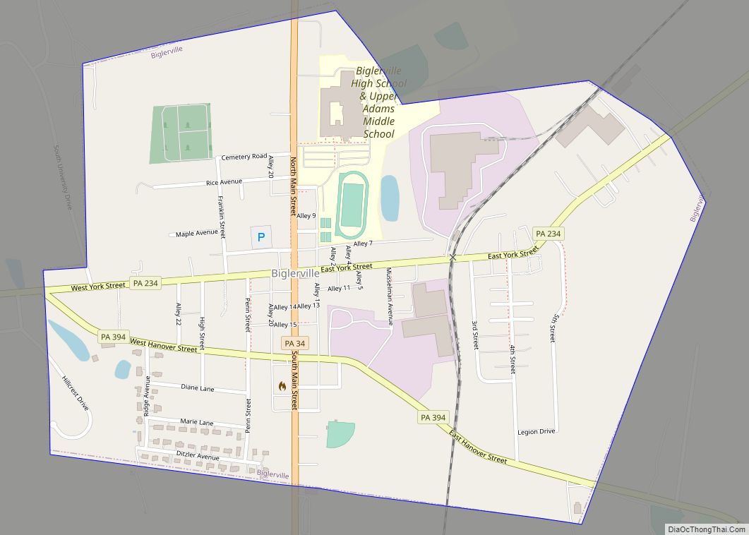
Biglerville is a borough in Adams County, Pennsylvania, United States. The population was 1,225 at the 2020 census. The National Apple Museum is located on West Hanover St. in Biglerville. The borough is home to Biglerville High School.
| Name: | Biglerville borough |
|---|---|
| LSAD Code: | 21 |
| LSAD Description: | borough (suffix) |
| State: | Pennsylvania |
| County: | Adams County |
| Incorporated: | 1903 |
| Elevation: | 640 ft (200 m) |
| Total Area: | 0.65 sq mi (1.69 km²) |
| Land Area: | 0.65 sq mi (1.69 km²) |
| Water Area: | 0.00 sq mi (0.01 km²) |
| Total Population: | 1,225 |
| Population Density: | 1,881.72/sq mi (726.55/km²) |
| FIPS code: | 4206296 |
Online Interactive Map
Click on ![]() to view map in "full screen" mode.
to view map in "full screen" mode.
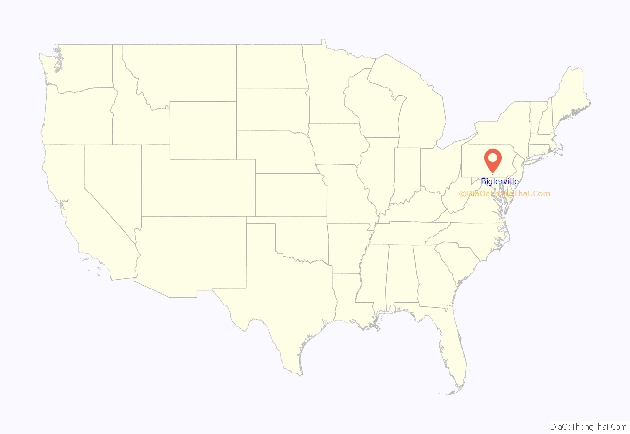
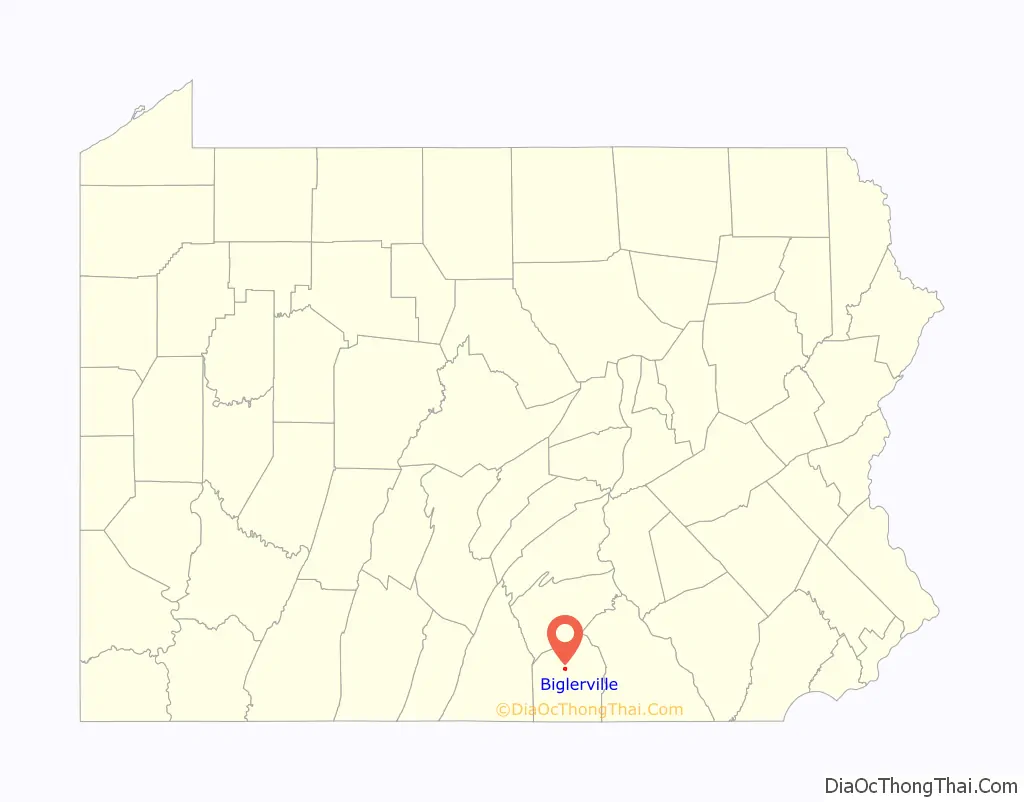
Biglerville location map. Where is Biglerville borough?
History
Originally named Middletown, it was renamed Biglerville in 1903 after William Bigler, the 12th Governor of Pennsylvania. The Thomas Brothers Store was added to the National Register of Historic Places in 2008.
Biglerville Road Map
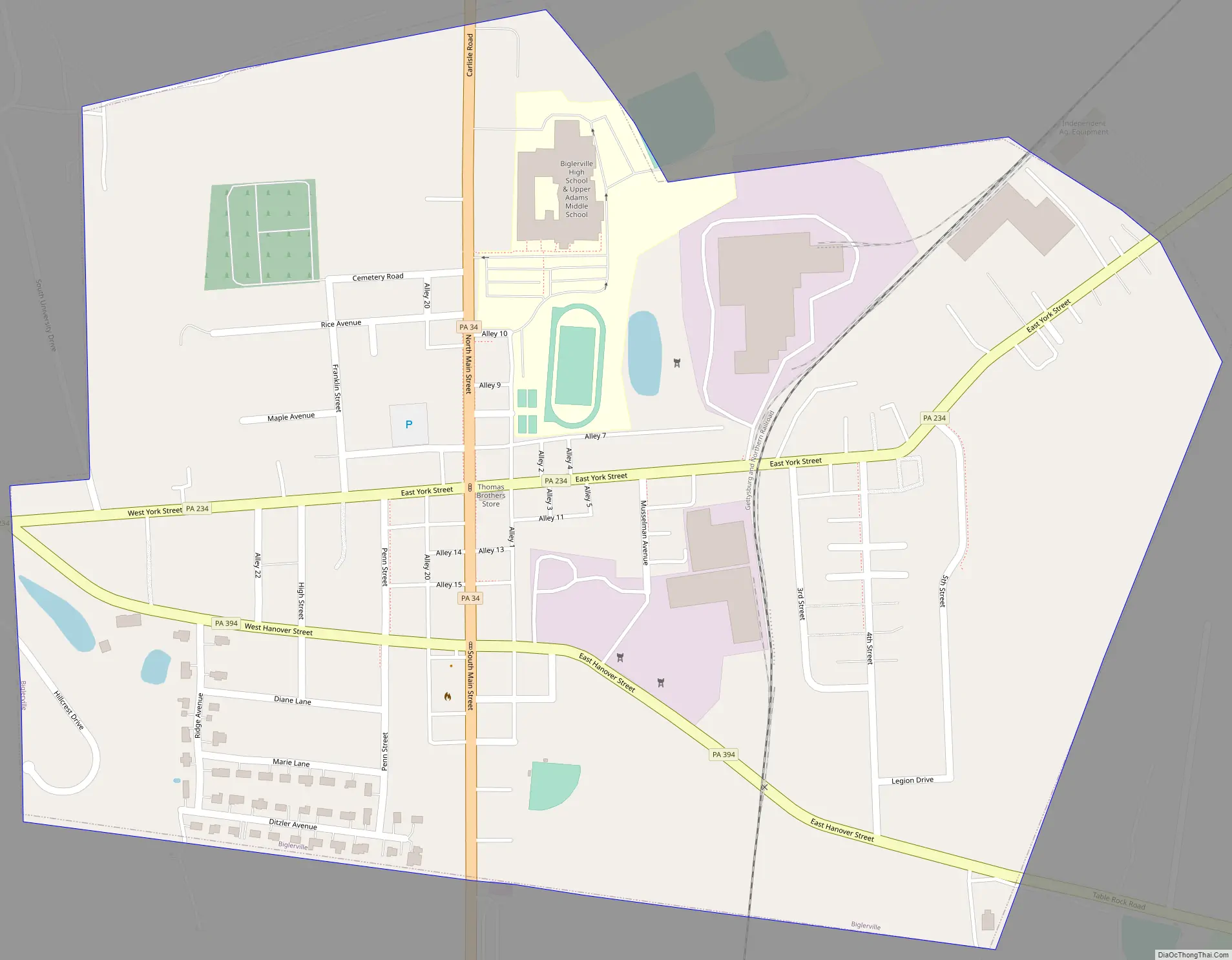
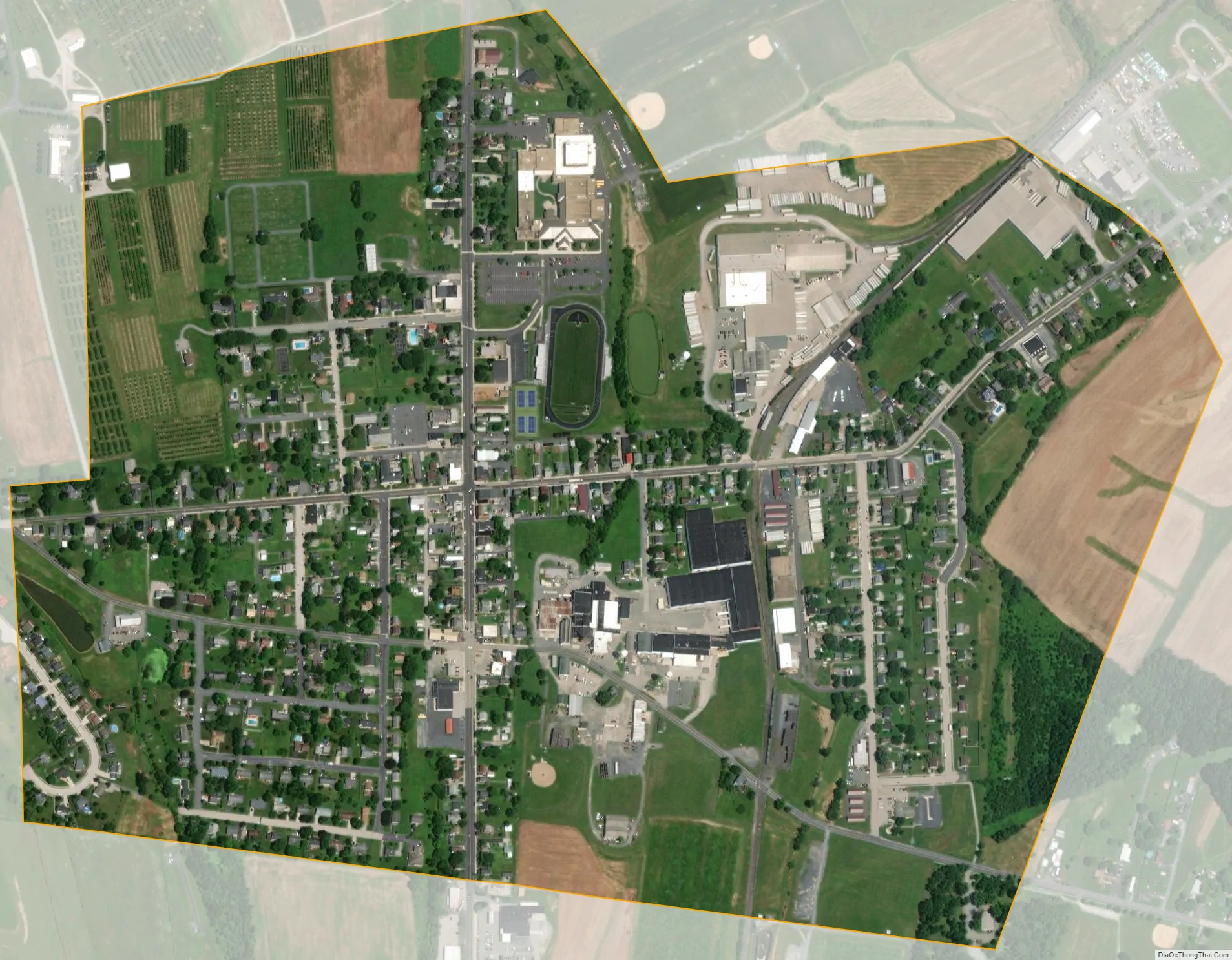
Biglerville city Satellite Map
Geography
Biglerville is located at 39°55′49″N 77°14′49″W / 39.93028°N 77.24694°W / 39.93028; -77.24694 (39.930238, -77.246932). According to the U.S. Census Bureau, the borough has a total area of 0.6 square miles (1.6 km), all land.
Climate
See also
Map of Pennsylvania State and its subdivision:- Adams
- Allegheny
- Armstrong
- Beaver
- Bedford
- Berks
- Blair
- Bradford
- Bucks
- Butler
- Cambria
- Cameron
- Carbon
- Centre
- Chester
- Clarion
- Clearfield
- Clinton
- Columbia
- Crawford
- Cumberland
- Dauphin
- Delaware
- Elk
- Erie
- Fayette
- Forest
- Franklin
- Fulton
- Greene
- Huntingdon
- Indiana
- Jefferson
- Juniata
- Lackawanna
- Lancaster
- Lawrence
- Lebanon
- Lehigh
- Luzerne
- Lycoming
- Mc Kean
- Mercer
- Mifflin
- Monroe
- Montgomery
- Montour
- Northampton
- Northumberland
- Perry
- Philadelphia
- Pike
- Potter
- Schuylkill
- Snyder
- Somerset
- Sullivan
- Susquehanna
- Tioga
- Union
- Venango
- Warren
- Washington
- Wayne
- Westmoreland
- Wyoming
- York
- Alabama
- Alaska
- Arizona
- Arkansas
- California
- Colorado
- Connecticut
- Delaware
- District of Columbia
- Florida
- Georgia
- Hawaii
- Idaho
- Illinois
- Indiana
- Iowa
- Kansas
- Kentucky
- Louisiana
- Maine
- Maryland
- Massachusetts
- Michigan
- Minnesota
- Mississippi
- Missouri
- Montana
- Nebraska
- Nevada
- New Hampshire
- New Jersey
- New Mexico
- New York
- North Carolina
- North Dakota
- Ohio
- Oklahoma
- Oregon
- Pennsylvania
- Rhode Island
- South Carolina
- South Dakota
- Tennessee
- Texas
- Utah
- Vermont
- Virginia
- Washington
- West Virginia
- Wisconsin
- Wyoming