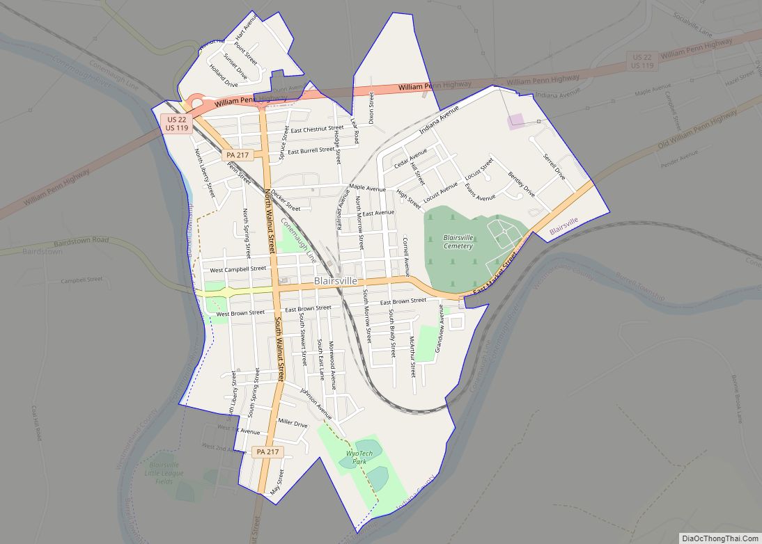
Blairsville is a borough in Indiana County, Pennsylvania, United States, located 42 miles (68 km) east of Pittsburgh, and on the Conemaugh River. As of the 2020 census it had a population of 3,252.
| Name: | Blairsville borough |
|---|---|
| LSAD Code: | 21 |
| LSAD Description: | borough (suffix) |
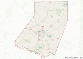
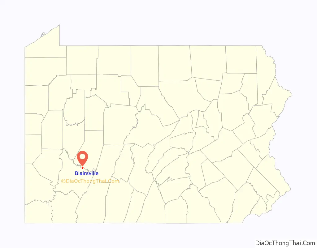
| State: | Pennsylvania |
| County: | Indiana County |
| Incorporated: | 1825 |
| Elevation: | 1,010 ft (310 m) |
| Total Area: | 1.41 sq mi (3.66 km²) |
| Land Area: | 1.41 sq mi (3.66 km²) |
| Water Area: | 0.00 sq mi (0.00 km²) |
| Total Population: | 3,214 |
| Population Density: | 2,272.98/sq mi (877.33/km²) |
| ZIP code: | 15717 |
| Area code: | 724 |
| FIPS code: | 4206904 |
| Website: | blairsvilleboropa.com |
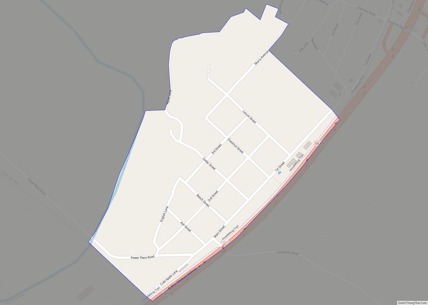
Online Interactive Map
Click on ![]() to view map in "full screen" mode.
to view map in "full screen" mode.
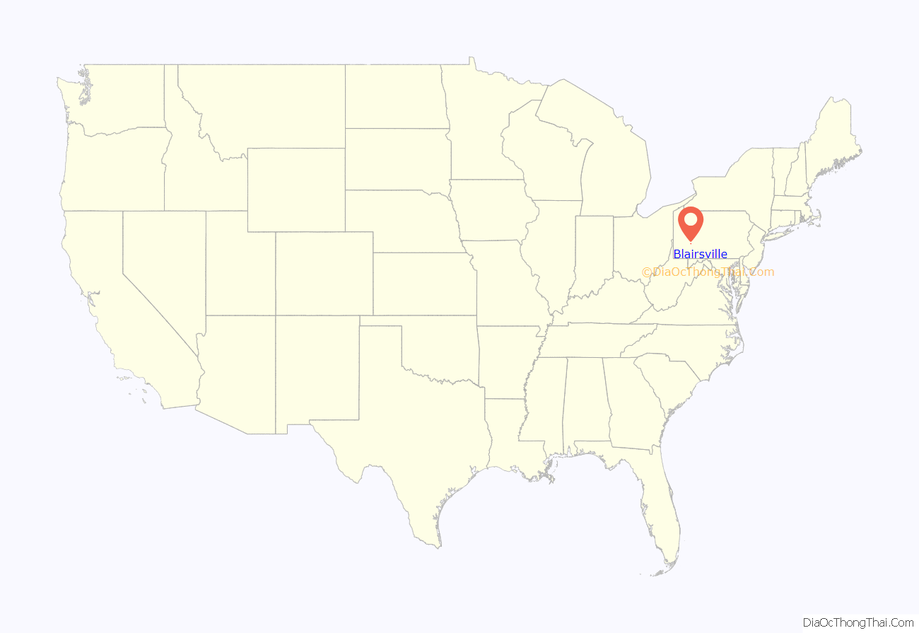
Blairsville location map. Where is Blairsville borough?
History
Blairsville was settled in 1818 and incorporated in 1825. In the past, railway shops, foundries, machine shops, enameling plants, and manufactories of plate glass and lumber employed the residents. It was the seat of Blairsville College, a Presbyterian institution opened in 1851. Just outside of the city limits in Burrell Township, auto and diesel repair trade school New Village Institute has operated since 2021.
The Blairsville Armory and St. Peter’s Episcopal Church and Rectory are listed on the National Register of Historic Places.
In 1902, the countryside around Blairsville became one of the first in Pennsylvania to have a woman, Anna J. Devers, appointed as a Rural Free Delivery carrier, delivering mail from the Blairsville Post Office.
M. C. Eignus (1844–1941), Illinois state representative, was born in Blairsville.
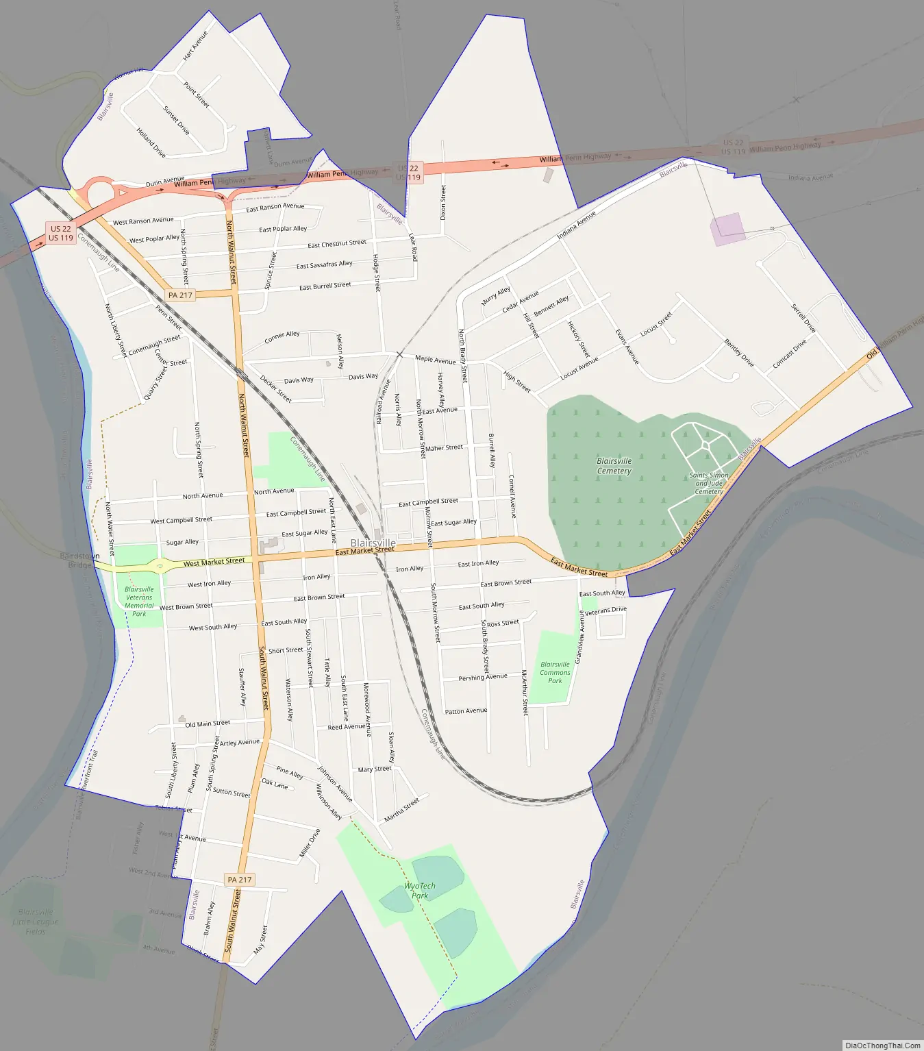
Blairsville Road Map
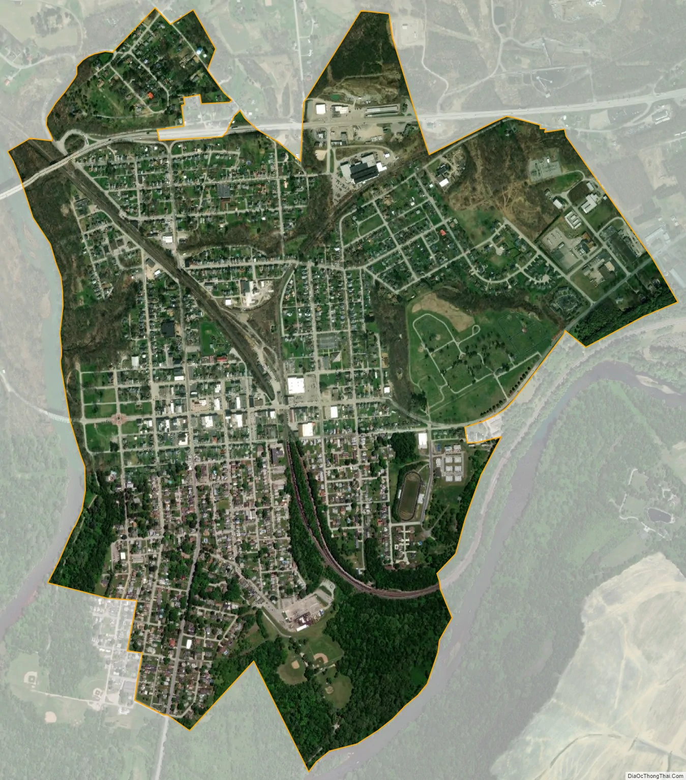
Blairsville city Satellite Map
Geography
Blairsville is located in the southern portion of Indiana County, bordered by the Conemaugh River, Westmoreland County to the south and west and Burrell Township to the north and east.
According to the United States Census Bureau, the borough has a total area of 1.41 square miles (3.66 km), all land.
See also
Map of Pennsylvania State and its subdivision:- Adams
- Allegheny
- Armstrong
- Beaver
- Bedford
- Berks
- Blair
- Bradford
- Bucks
- Butler
- Cambria
- Cameron
- Carbon
- Centre
- Chester
- Clarion
- Clearfield
- Clinton
- Columbia
- Crawford
- Cumberland
- Dauphin
- Delaware
- Elk
- Erie
- Fayette
- Forest
- Franklin
- Fulton
- Greene
- Huntingdon
- Indiana
- Jefferson
- Juniata
- Lackawanna
- Lancaster
- Lawrence
- Lebanon
- Lehigh
- Luzerne
- Lycoming
- Mc Kean
- Mercer
- Mifflin
- Monroe
- Montgomery
- Montour
- Northampton
- Northumberland
- Perry
- Philadelphia
- Pike
- Potter
- Schuylkill
- Snyder
- Somerset
- Sullivan
- Susquehanna
- Tioga
- Union
- Venango
- Warren
- Washington
- Wayne
- Westmoreland
- Wyoming
- York
- Alabama
- Alaska
- Arizona
- Arkansas
- California
- Colorado
- Connecticut
- Delaware
- District of Columbia
- Florida
- Georgia
- Hawaii
- Idaho
- Illinois
- Indiana
- Iowa
- Kansas
- Kentucky
- Louisiana
- Maine
- Maryland
- Massachusetts
- Michigan
- Minnesota
- Mississippi
- Missouri
- Montana
- Nebraska
- Nevada
- New Hampshire
- New Jersey
- New Mexico
- New York
- North Carolina
- North Dakota
- Ohio
- Oklahoma
- Oregon
- Pennsylvania
- Rhode Island
- South Carolina
- South Dakota
- Tennessee
- Texas
- Utah
- Vermont
- Virginia
- Washington
- West Virginia
- Wisconsin
- Wyoming