Blooming Valley is a borough in Crawford County, Pennsylvania, United States. The population was 344 at the 2020 census, up from 337 at the 2010 census.
| Name: | Blooming Valley borough |
|---|---|
| LSAD Code: | 21 |
| LSAD Description: | borough (suffix) |
| State: | Pennsylvania |
| County: | Crawford County |
| Founded: | 1845 |
| Total Area: | 2.04 sq mi (5.28 km²) |
| Land Area: | 2.02 sq mi (5.23 km²) |
| Water Area: | 0.02 sq mi (0.06 km²) |
| Total Population: | 344 |
| Population Density: | 170.47/sq mi (65.81/km²) |
| Area code: | 814 |
| FIPS code: | 4207120 |
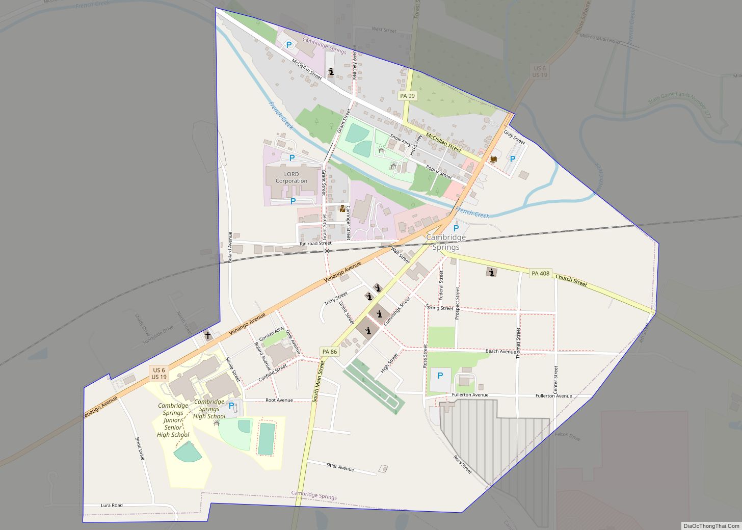
Online Interactive Map
Click on ![]() to view map in "full screen" mode.
to view map in "full screen" mode.
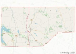
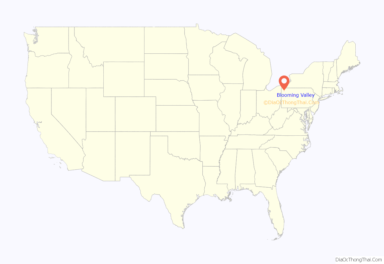
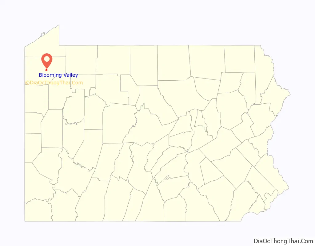
Blooming Valley location map. Where is Blooming Valley borough?
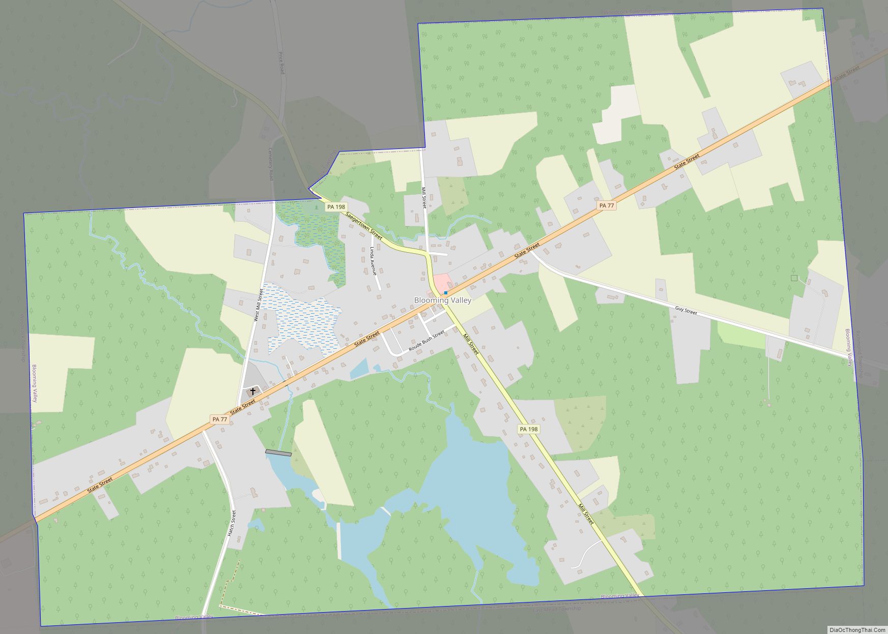
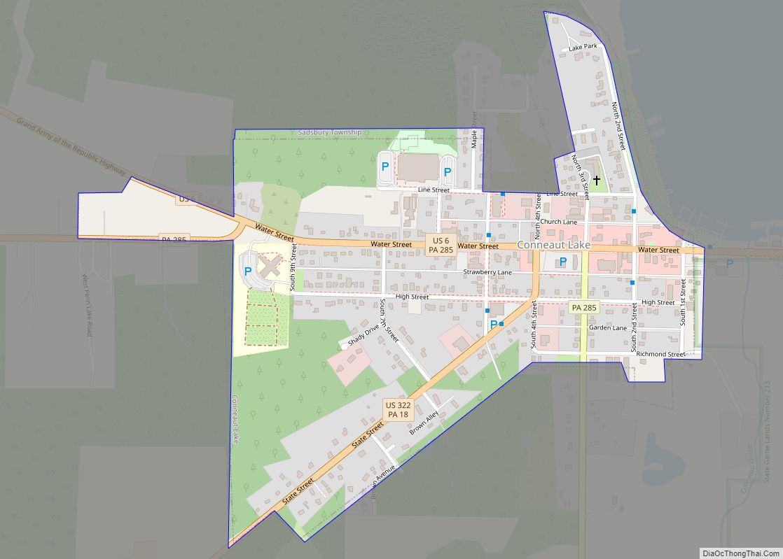
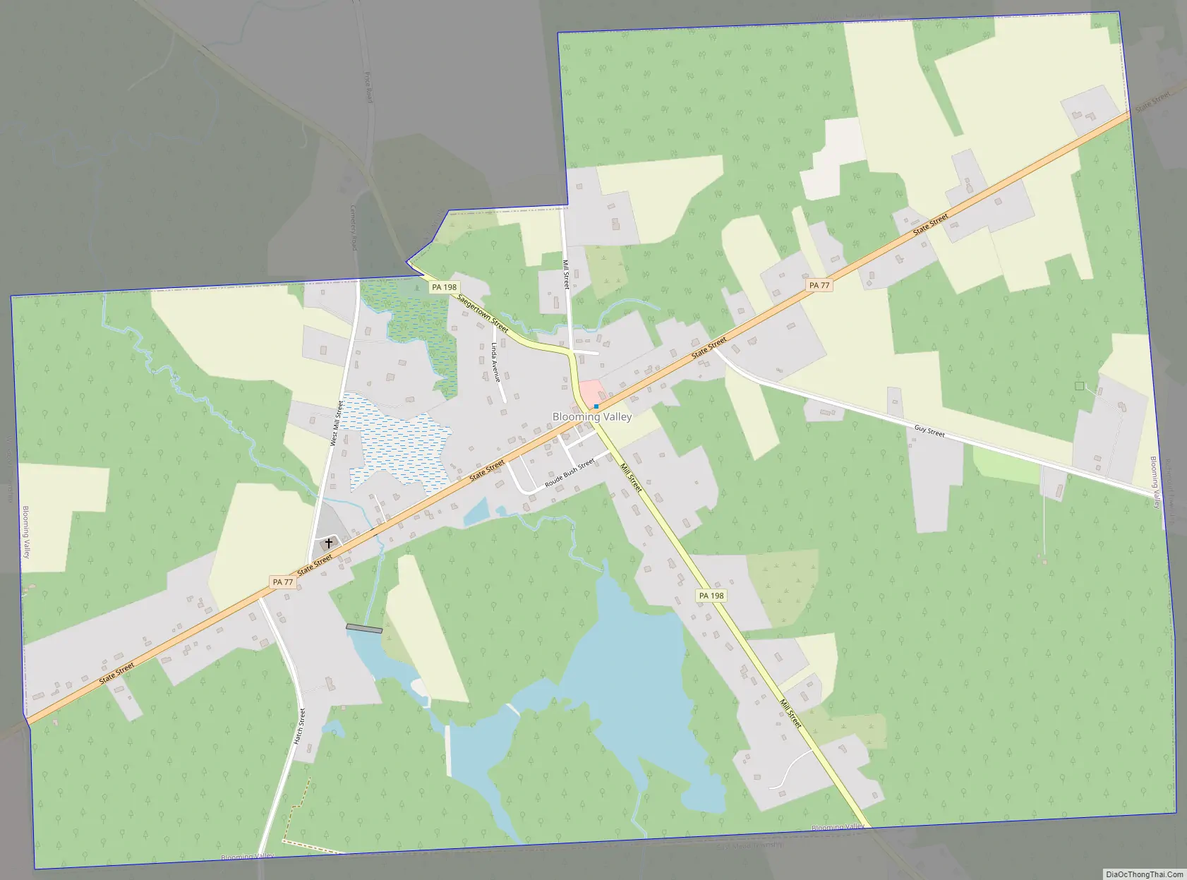
Blooming Valley Road Map
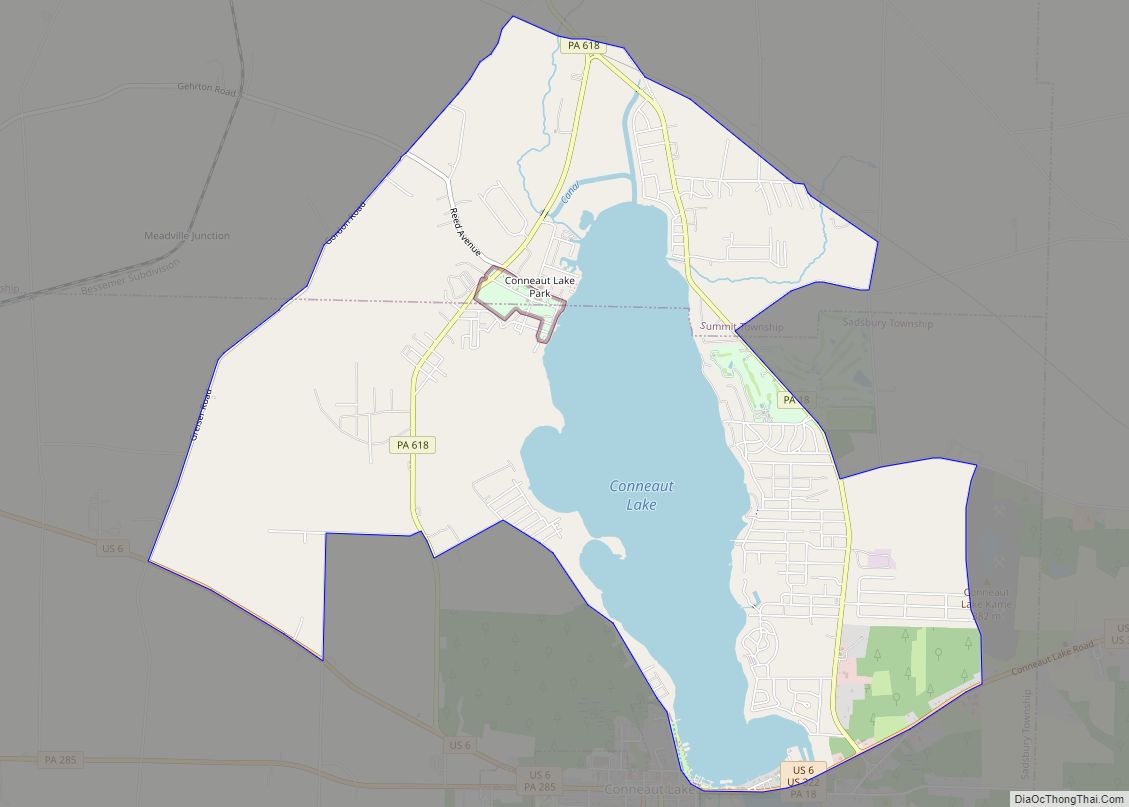
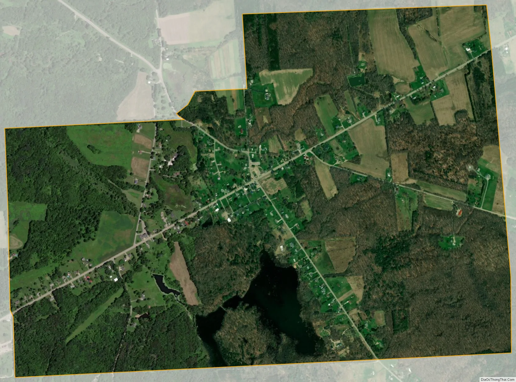
Blooming Valley city Satellite Map
Geography
Blooming Valley is located near the geographic center of Crawford County at 41°40′49″N 80°2′32″W / 41.68028°N 80.04222°W / 41.68028; -80.04222 (41.680217, -80.042107). It is bordered to the north and west by Woodcock Township, to the east by Richmond and Randolph townships, and to the south by East Mead Township.
Pennsylvania Routes 77 and 198 intersect in the center of town. PA 77 leads southwest 6 miles (10 km) to Meadville, the county seat, and northeast 30 miles (48 km) to Corry. PA 198 leads northwest 7 miles (11 km) to Saegertown and southeast 6 miles (10 km) to Guys Mills.
According to the United States Census Bureau, the borough has a total area of 1.97 square miles (5.09 km), of which 1.94 square miles (5.03 km) is land and 0.02 square miles (0.06 km), or 1.13%, is water.
Natural features
The Borough of Blooming Valley lies on the divide between Blooming Valley Run and Sugar Creek, whose waters eventually flow to French Creek. The two streams are separated by a swampy area. The elevation of the borough ranges from 1,219 ft (372 m) at Blooming Valley Run to 1,530 ft (470 m) near the eastern boundary.
See also
Map of Pennsylvania State and its subdivision:- Adams
- Allegheny
- Armstrong
- Beaver
- Bedford
- Berks
- Blair
- Bradford
- Bucks
- Butler
- Cambria
- Cameron
- Carbon
- Centre
- Chester
- Clarion
- Clearfield
- Clinton
- Columbia
- Crawford
- Cumberland
- Dauphin
- Delaware
- Elk
- Erie
- Fayette
- Forest
- Franklin
- Fulton
- Greene
- Huntingdon
- Indiana
- Jefferson
- Juniata
- Lackawanna
- Lancaster
- Lawrence
- Lebanon
- Lehigh
- Luzerne
- Lycoming
- Mc Kean
- Mercer
- Mifflin
- Monroe
- Montgomery
- Montour
- Northampton
- Northumberland
- Perry
- Philadelphia
- Pike
- Potter
- Schuylkill
- Snyder
- Somerset
- Sullivan
- Susquehanna
- Tioga
- Union
- Venango
- Warren
- Washington
- Wayne
- Westmoreland
- Wyoming
- York
- Alabama
- Alaska
- Arizona
- Arkansas
- California
- Colorado
- Connecticut
- Delaware
- District of Columbia
- Florida
- Georgia
- Hawaii
- Idaho
- Illinois
- Indiana
- Iowa
- Kansas
- Kentucky
- Louisiana
- Maine
- Maryland
- Massachusetts
- Michigan
- Minnesota
- Mississippi
- Missouri
- Montana
- Nebraska
- Nevada
- New Hampshire
- New Jersey
- New Mexico
- New York
- North Carolina
- North Dakota
- Ohio
- Oklahoma
- Oregon
- Pennsylvania
- Rhode Island
- South Carolina
- South Dakota
- Tennessee
- Texas
- Utah
- Vermont
- Virginia
- Washington
- West Virginia
- Wisconsin
- Wyoming