Bonneauville is a borough in Adams County, Pennsylvania, United States. The population was 1,758 at the 2020 census.
| Name: | Bonneauville borough |
|---|---|
| LSAD Code: | 21 |
| LSAD Description: | borough (suffix) |
| State: | Pennsylvania |
| County: | Adams County |
| Incorporated: | 1961 |
| Elevation: | 600 ft (200 m) |
| Total Area: | 0.97 sq mi (2.50 km²) |
| Land Area: | 0.97 sq mi (2.50 km²) |
| Water Area: | 0.00 sq mi (0.00 km²) |
| Total Population: | 1,758 |
| Population Density: | 1,819.88/sq mi (702.48/km²) |
| Area code: | 717 |
| FIPS code: | 4207560 |
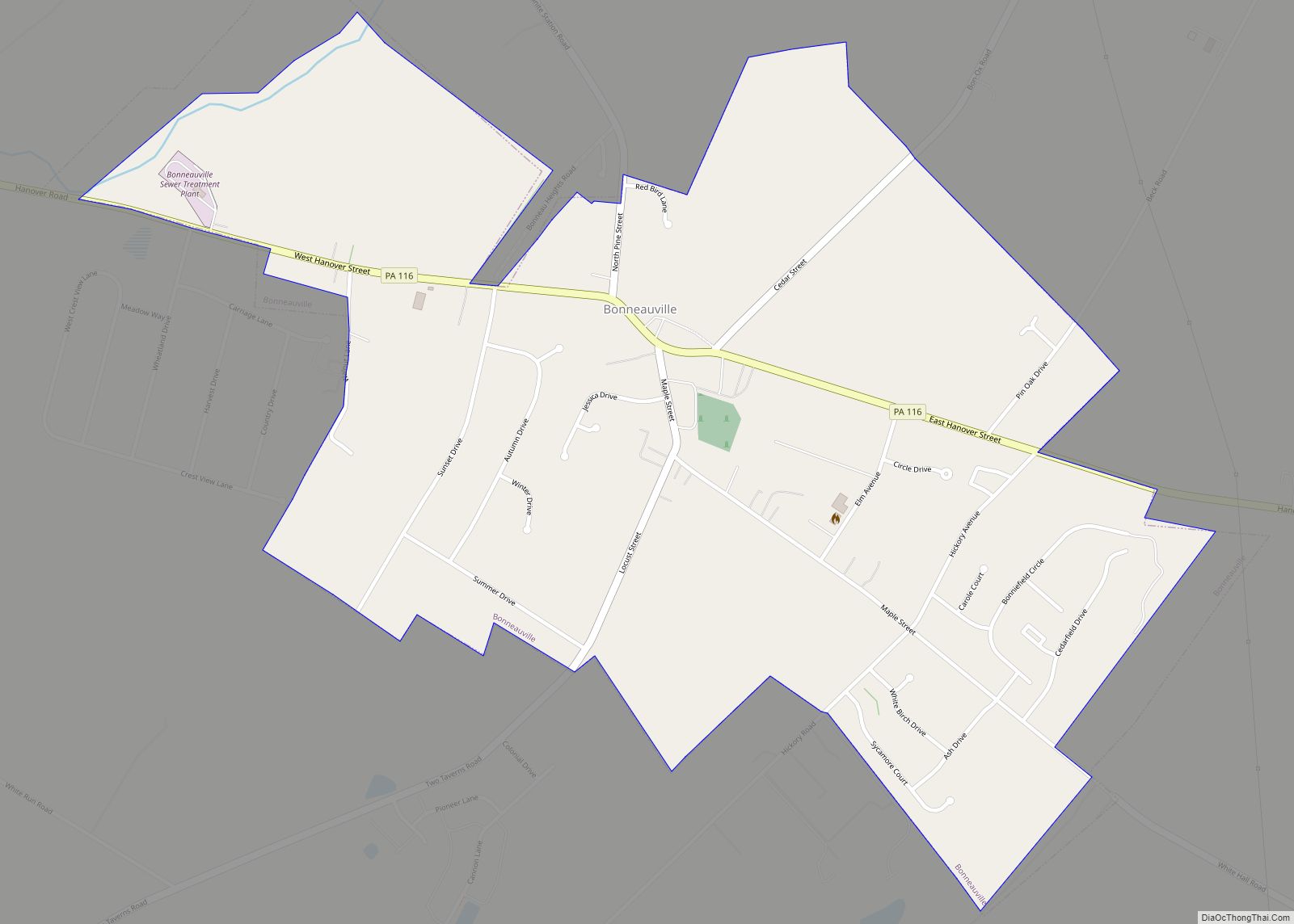
Online Interactive Map
Click on ![]() to view map in "full screen" mode.
to view map in "full screen" mode.
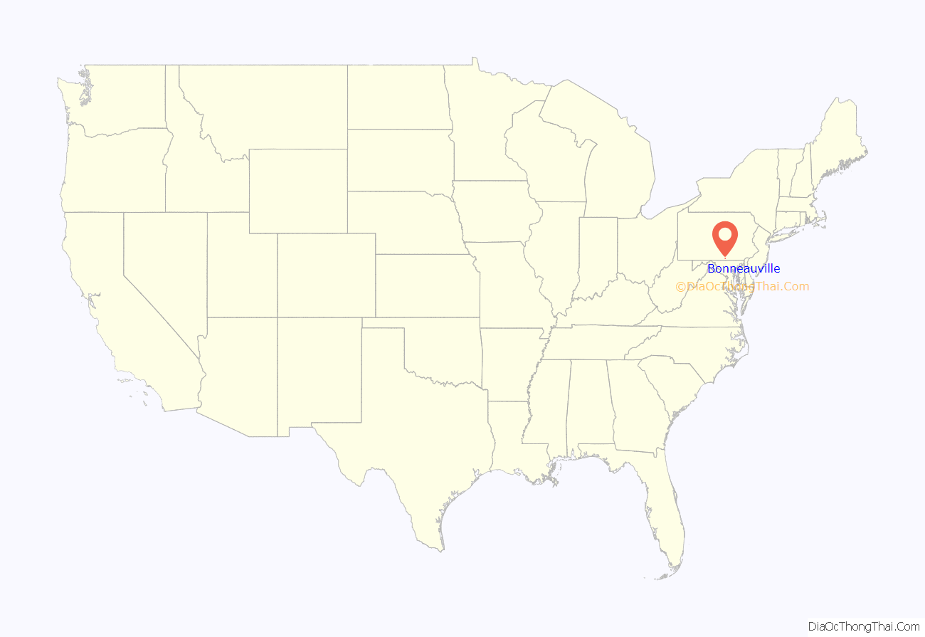
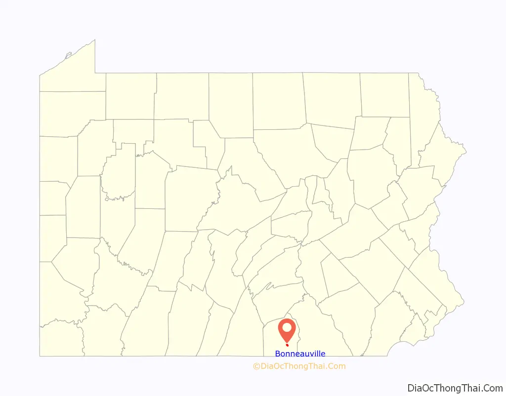
Bonneauville location map. Where is Bonneauville borough?
History
The town’s name prior to its 1961 incorporation was “Bonnaughtown” (alternate spelling “Bonnoughtown”), a German name consistent with the area’s history of German immigration. The original name appears in journals of officers and soldiers who passed through the town during the Gettysburg Campaign of the Civil War.
Bonneauville Road Map
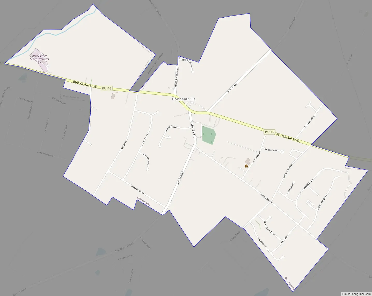
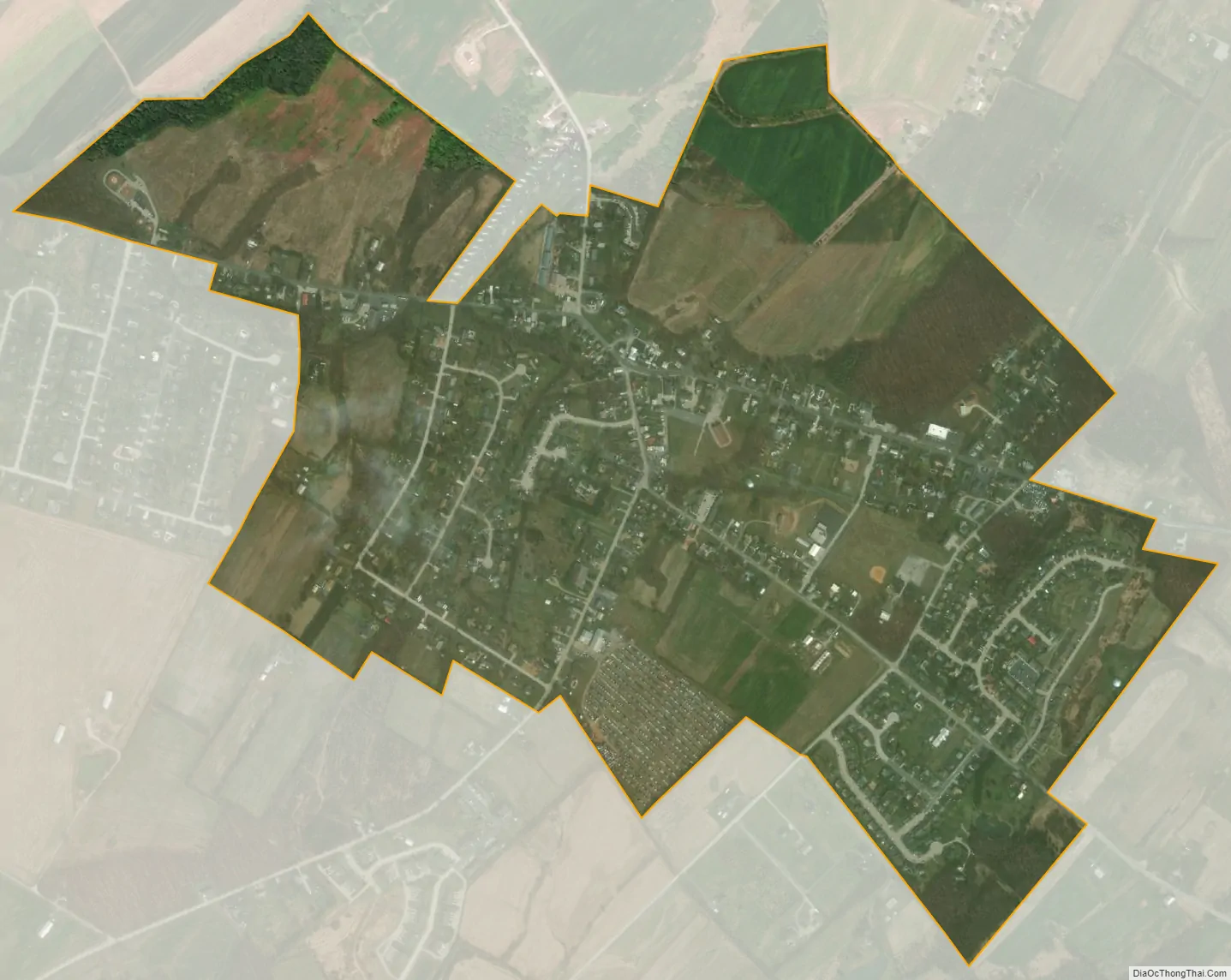
Bonneauville city Satellite Map
Geography
Bonneauville is located at 39°48′41″N 77°8′12″W / 39.81139°N 77.13667°W / 39.81139; -77.13667 (39.811513, -77.136537). According to the U.S. Census Bureau, the borough has a total area of 1.0 square mile (2.6 km), all land.
See also
Map of Pennsylvania State and its subdivision:- Adams
- Allegheny
- Armstrong
- Beaver
- Bedford
- Berks
- Blair
- Bradford
- Bucks
- Butler
- Cambria
- Cameron
- Carbon
- Centre
- Chester
- Clarion
- Clearfield
- Clinton
- Columbia
- Crawford
- Cumberland
- Dauphin
- Delaware
- Elk
- Erie
- Fayette
- Forest
- Franklin
- Fulton
- Greene
- Huntingdon
- Indiana
- Jefferson
- Juniata
- Lackawanna
- Lancaster
- Lawrence
- Lebanon
- Lehigh
- Luzerne
- Lycoming
- Mc Kean
- Mercer
- Mifflin
- Monroe
- Montgomery
- Montour
- Northampton
- Northumberland
- Perry
- Philadelphia
- Pike
- Potter
- Schuylkill
- Snyder
- Somerset
- Sullivan
- Susquehanna
- Tioga
- Union
- Venango
- Warren
- Washington
- Wayne
- Westmoreland
- Wyoming
- York
- Alabama
- Alaska
- Arizona
- Arkansas
- California
- Colorado
- Connecticut
- Delaware
- District of Columbia
- Florida
- Georgia
- Hawaii
- Idaho
- Illinois
- Indiana
- Iowa
- Kansas
- Kentucky
- Louisiana
- Maine
- Maryland
- Massachusetts
- Michigan
- Minnesota
- Mississippi
- Missouri
- Montana
- Nebraska
- Nevada
- New Hampshire
- New Jersey
- New Mexico
- New York
- North Carolina
- North Dakota
- Ohio
- Oklahoma
- Oregon
- Pennsylvania
- Rhode Island
- South Carolina
- South Dakota
- Tennessee
- Texas
- Utah
- Vermont
- Virginia
- Washington
- West Virginia
- Wisconsin
- Wyoming