Boyertown (Pennsylvania Dutch: Boyerschteddel) is a borough in Berks County, Pennsylvania. The population was 4,055 at the 2010 census. Boyertown is known for the many painted fiberglass bears that can be found throughout the town and borough.
| Name: | Boyertown borough |
|---|---|
| LSAD Code: | 21 |
| LSAD Description: | borough (suffix) |
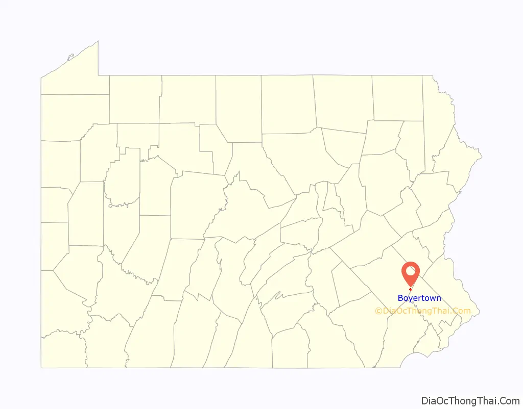
| State: | Pennsylvania |
| County: | Berks County |
| Elevation: | 407 ft (124 m) |
| Total Area: | 0.77 sq mi (2.00 km²) |
| Land Area: | 0.77 sq mi (2.00 km²) |
| Water Area: | 0.00 sq mi (0.00 km²) |
| Total Population: | 4,264 |
| Population Density: | 5,516.17/sq mi (2,128.96/km²) |
| ZIP code: | 19512 |
| Area code: | 610 |
| FIPS code: | 4207960 |
| Website: | boyertownborough.org |
Online Interactive Map
Click on ![]() to view map in "full screen" mode.
to view map in "full screen" mode.
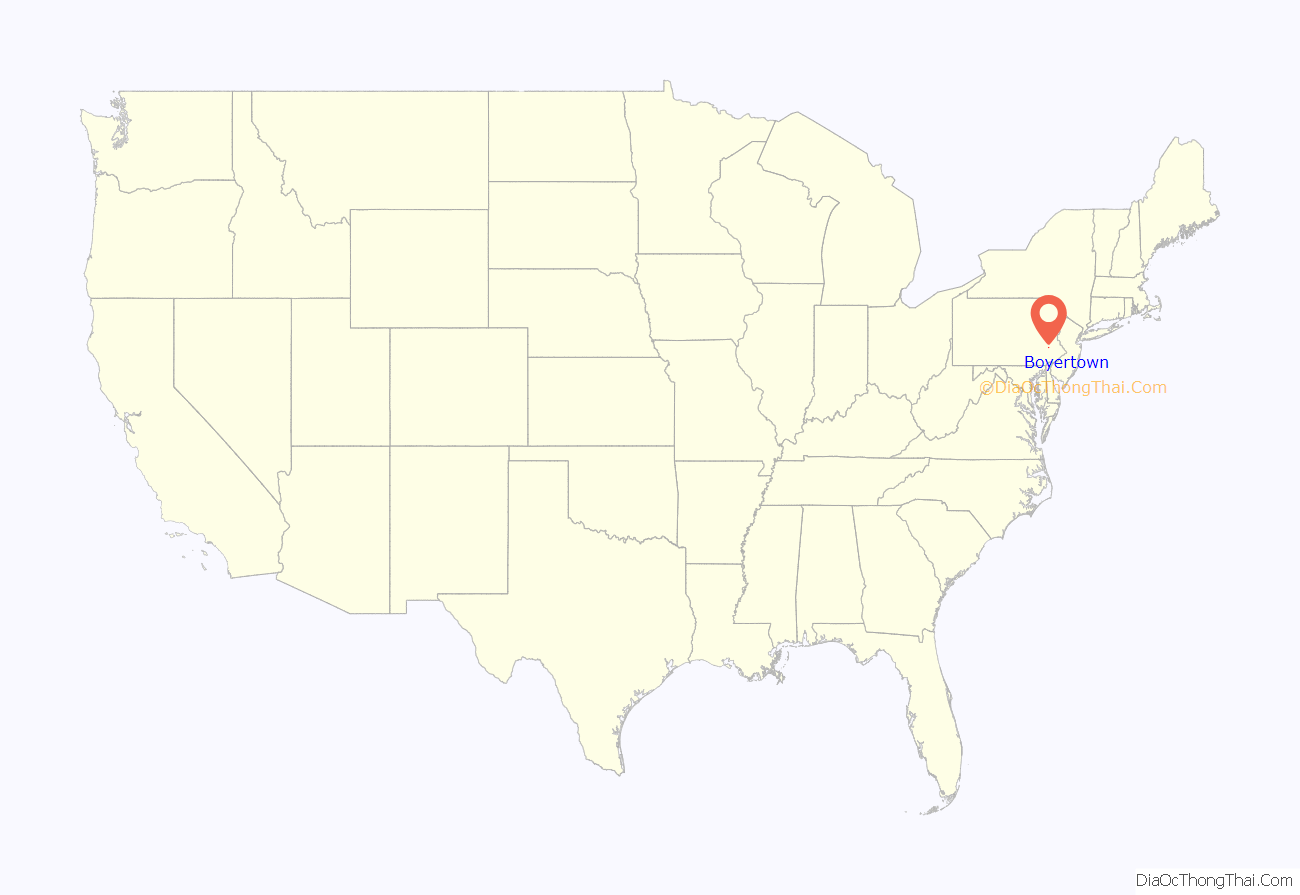
Boyertown location map. Where is Boyertown borough?
History
A post office called Boyertown has been in operation since 1828. The community was named for its founders, brothers Henry and Daniel Boyer.
In 1908, Boyertown was the site of the Rhoads Opera House fire.
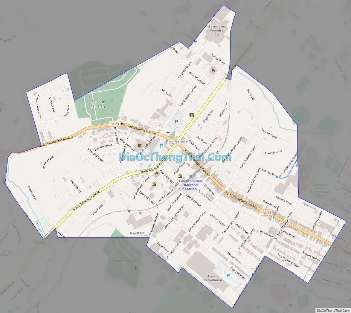
Boyertown Road Map
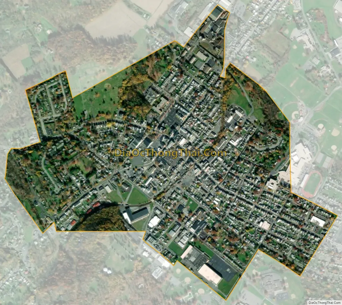
Boyertown city Satellite Map
Geography
Boyertown is located along the southeastern border of Berks County. It is bordered on the north, west, and south by Colebrookdale Township, and to the southeast by Douglass Township in Montgomery County.
Boyertown is included in the Reading metropolitan statistical area, which is part the Philadelphia-Reading-Camden combined statistical area.
According to the U.S. Census Bureau, Boyertown has a total area of 0.77 square miles (2.0 km), all land. It has a hot-summer humid continental climate (Dfa) and average monthly temperatures range from 30.0 °F in January to 74.7 °F in July. The hardiness zone is 6b.
See also
Map of Pennsylvania State and its subdivision:- Adams
- Allegheny
- Armstrong
- Beaver
- Bedford
- Berks
- Blair
- Bradford
- Bucks
- Butler
- Cambria
- Cameron
- Carbon
- Centre
- Chester
- Clarion
- Clearfield
- Clinton
- Columbia
- Crawford
- Cumberland
- Dauphin
- Delaware
- Elk
- Erie
- Fayette
- Forest
- Franklin
- Fulton
- Greene
- Huntingdon
- Indiana
- Jefferson
- Juniata
- Lackawanna
- Lancaster
- Lawrence
- Lebanon
- Lehigh
- Luzerne
- Lycoming
- Mc Kean
- Mercer
- Mifflin
- Monroe
- Montgomery
- Montour
- Northampton
- Northumberland
- Perry
- Philadelphia
- Pike
- Potter
- Schuylkill
- Snyder
- Somerset
- Sullivan
- Susquehanna
- Tioga
- Union
- Venango
- Warren
- Washington
- Wayne
- Westmoreland
- Wyoming
- York
- Alabama
- Alaska
- Arizona
- Arkansas
- California
- Colorado
- Connecticut
- Delaware
- District of Columbia
- Florida
- Georgia
- Hawaii
- Idaho
- Illinois
- Indiana
- Iowa
- Kansas
- Kentucky
- Louisiana
- Maine
- Maryland
- Massachusetts
- Michigan
- Minnesota
- Mississippi
- Missouri
- Montana
- Nebraska
- Nevada
- New Hampshire
- New Jersey
- New Mexico
- New York
- North Carolina
- North Dakota
- Ohio
- Oklahoma
- Oregon
- Pennsylvania
- Rhode Island
- South Carolina
- South Dakota
- Tennessee
- Texas
- Utah
- Vermont
- Virginia
- Washington
- West Virginia
- Wisconsin
- Wyoming


