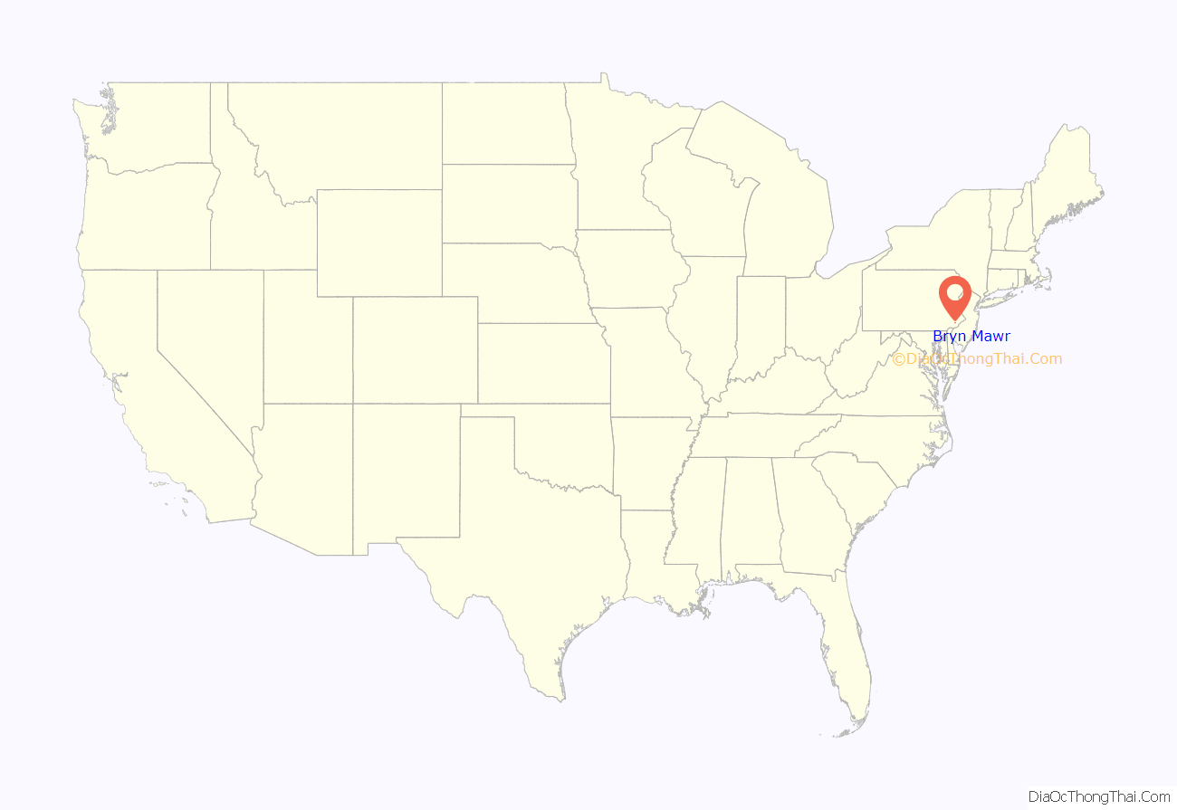
Bryn Mawr (pronounced /ˌbrɪnˈmɑːr/ brin-mowr, from Welsh for ‘big hill’) is a census-designated place (CDP) located across three townships: Radnor Township and Haverford Township in Delaware County, and Lower Merion Township in Montgomery County, Pennsylvania, United States. It is located just west of Philadelphia along Lancaster Avenue, also known as U.S. Route 30.
Bryn Mawr is located toward the center of what is known as the Main Line, a group of affluent Philadelphia suburban villages stretching from the city limits to Malvern. They became home to sprawling country estates belonging to Philadelphia’s wealthiest families during the Gilded Age, and over the decades became a bastion of old money. As of the 2020 census, it had a population of 5,879. Bryn Mawr is home to Bryn Mawr College.
| Name: | Bryn Mawr CDP |
|---|---|
| LSAD Code: | 57 |
| LSAD Description: | CDP (suffix) |
| State: | Pennsylvania |
| County: | Montgomery County |
| Elevation: | 420 ft (130 m) |
| Total Area: | 0.96 sq mi (2.48 km²) |
| Land Area: | 0.96 sq mi (2.48 km²) |
| Water Area: | 0.00 sq mi (0.00 km²) |
| Total Population: | 5,879 |
| Population Density: | 6,143.16/sq mi (2,371.54/km²) |
| ZIP code: | 19010 |
| FIPS code: | 4209728 |
Online Interactive Map
Click on ![]() to view map in "full screen" mode.
to view map in "full screen" mode.
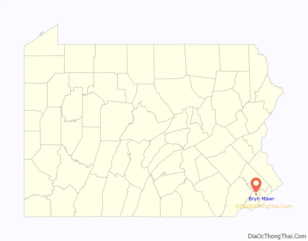
Bryn Mawr location map. Where is Bryn Mawr CDP?
History
Bryn Mawr is named after an estate near Dolgellau in Wales that belonged to Rowland Ellis, a Welsh Quaker who emigrated in 1686 to Pennsylvania to escape religious persecution.
Until 1869 and the construction of the Pennsylvania Railroad’s Main Line, the town, located in the old Welsh Tract, was known as Humphreysville, named for early settlers of the Humphreys family. The town was renamed by railroad agent William H. Wilson after he acquired on behalf of the railroad the 283 acres (1.15 km) that now compose Bryn Mawr.
To encourage visitors the railroad constructed the Bryn Mawr Hotel adjacent to the new station, which opened in 1872. After a fire destroyed the original building, a distinctive new hotel was designed by architect Frank Furness, was and built in 1889. The second hotel building is currently occupied by The Baldwin School and was added to the National Register of Historic Places in 1979.
In 1893, the first hospital, Bryn Mawr Hospital, was built on the Main Line by Dr. George Gerhard. Glenays, a historic home dating to 1859, was listed on the National Register of Historic Places in 1977.
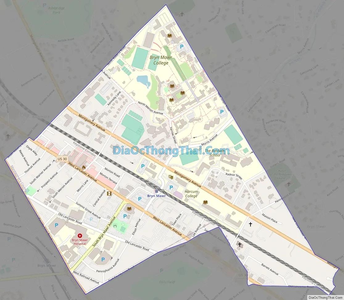
Bryn Mawr Road Map
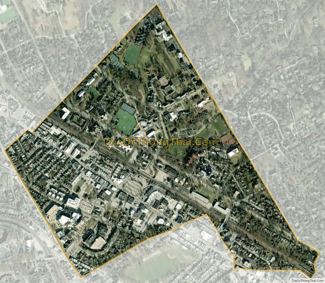
Bryn Mawr city Satellite Map
Geography
Bryn Mawr is located at 40°1′16″N 75°19′01″W / 40.02111°N 75.31694°W / 40.02111; -75.31694 (40.021022, −75.316901). According to the U.S. Census Bureau, Bryn Mawr has a total area of 0.6 square miles (1.6 km), all land, some of which is in Lower Merion Township in Montgomery County.
However, the Bryn Mawr ZIP Code of 19010 covers a larger area. As a result, the geographic term Bryn Mawr is often used in a sense that includes not only the CDP, but also other areas that share the ZIP Code. These other areas include the community of Rosemont within Lower Merion Township and Radnor Township, and various other areas within Lower Merion Township, Radnor Township, and Haverford Township. Bryn Mawr is a part of the Philadelphia Main Line, a string of picturesque towns located along a railroad that connects Philadelphia with points west. Some other Main Line communities include Ardmore, Wynnewood, Narberth, Bala Cynwyd and Villanova
See also
Map of Pennsylvania State and its subdivision:- Adams
- Allegheny
- Armstrong
- Beaver
- Bedford
- Berks
- Blair
- Bradford
- Bucks
- Butler
- Cambria
- Cameron
- Carbon
- Centre
- Chester
- Clarion
- Clearfield
- Clinton
- Columbia
- Crawford
- Cumberland
- Dauphin
- Delaware
- Elk
- Erie
- Fayette
- Forest
- Franklin
- Fulton
- Greene
- Huntingdon
- Indiana
- Jefferson
- Juniata
- Lackawanna
- Lancaster
- Lawrence
- Lebanon
- Lehigh
- Luzerne
- Lycoming
- Mc Kean
- Mercer
- Mifflin
- Monroe
- Montgomery
- Montour
- Northampton
- Northumberland
- Perry
- Philadelphia
- Pike
- Potter
- Schuylkill
- Snyder
- Somerset
- Sullivan
- Susquehanna
- Tioga
- Union
- Venango
- Warren
- Washington
- Wayne
- Westmoreland
- Wyoming
- York
- Alabama
- Alaska
- Arizona
- Arkansas
- California
- Colorado
- Connecticut
- Delaware
- District of Columbia
- Florida
- Georgia
- Hawaii
- Idaho
- Illinois
- Indiana
- Iowa
- Kansas
- Kentucky
- Louisiana
- Maine
- Maryland
- Massachusetts
- Michigan
- Minnesota
- Mississippi
- Missouri
- Montana
- Nebraska
- Nevada
- New Hampshire
- New Jersey
- New Mexico
- New York
- North Carolina
- North Dakota
- Ohio
- Oklahoma
- Oregon
- Pennsylvania
- Rhode Island
- South Carolina
- South Dakota
- Tennessee
- Texas
- Utah
- Vermont
- Virginia
- Washington
- West Virginia
- Wisconsin
- Wyoming


