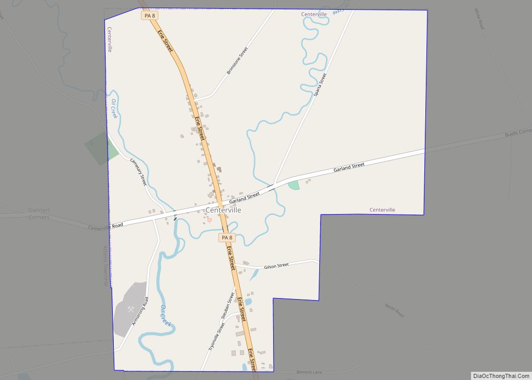
Centerville is a borough in Crawford County, Pennsylvania, United States. The population was 178 at the 2020 census, down from 218 at the 2010 census. It was established in 1812.
| Name: | Centerville borough |
|---|---|
| LSAD Code: | 21 |
| LSAD Description: | borough (suffix) |
| State: | Pennsylvania |
| County: | Crawford County |
| Founded: | 1812 |
| Total Area: | 1.75 sq mi (4.52 km²) |
| Land Area: | 1.75 sq mi (4.52 km²) |
| Water Area: | 0.00 sq mi (0.00 km²) |
| Total Population: | 178 |
| Population Density: | 102.01/sq mi (39.38/km²) |
| Area code: | 814 |
| FIPS code: | 4212184 |
| GNISfeature ID: | 1215132 |
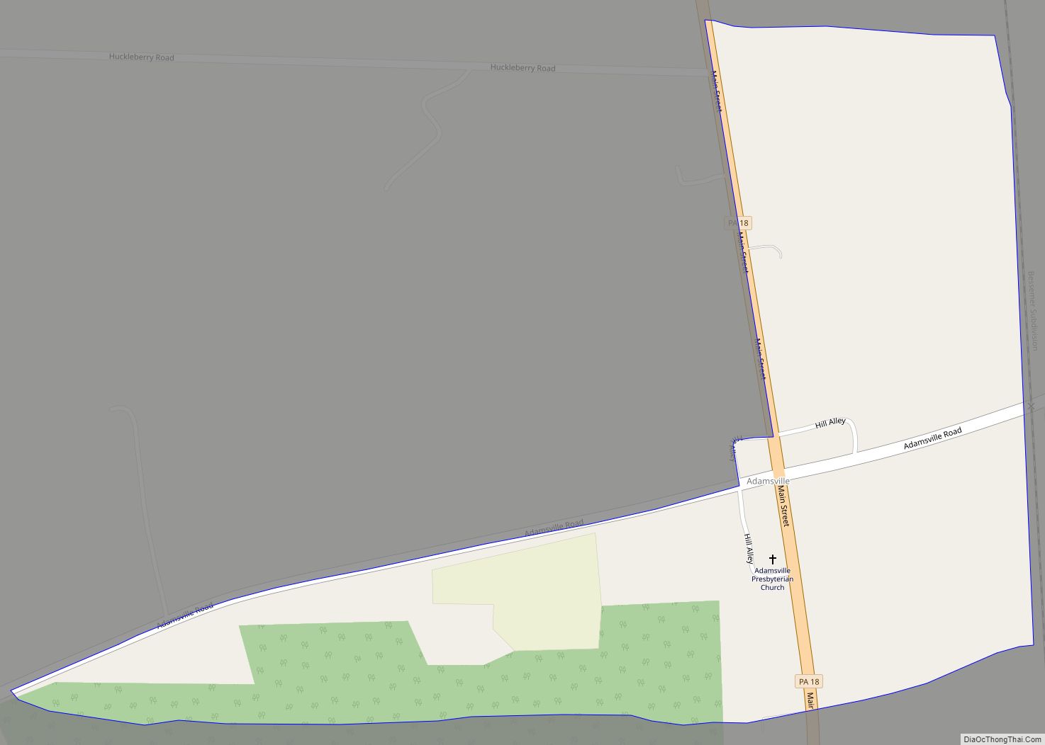
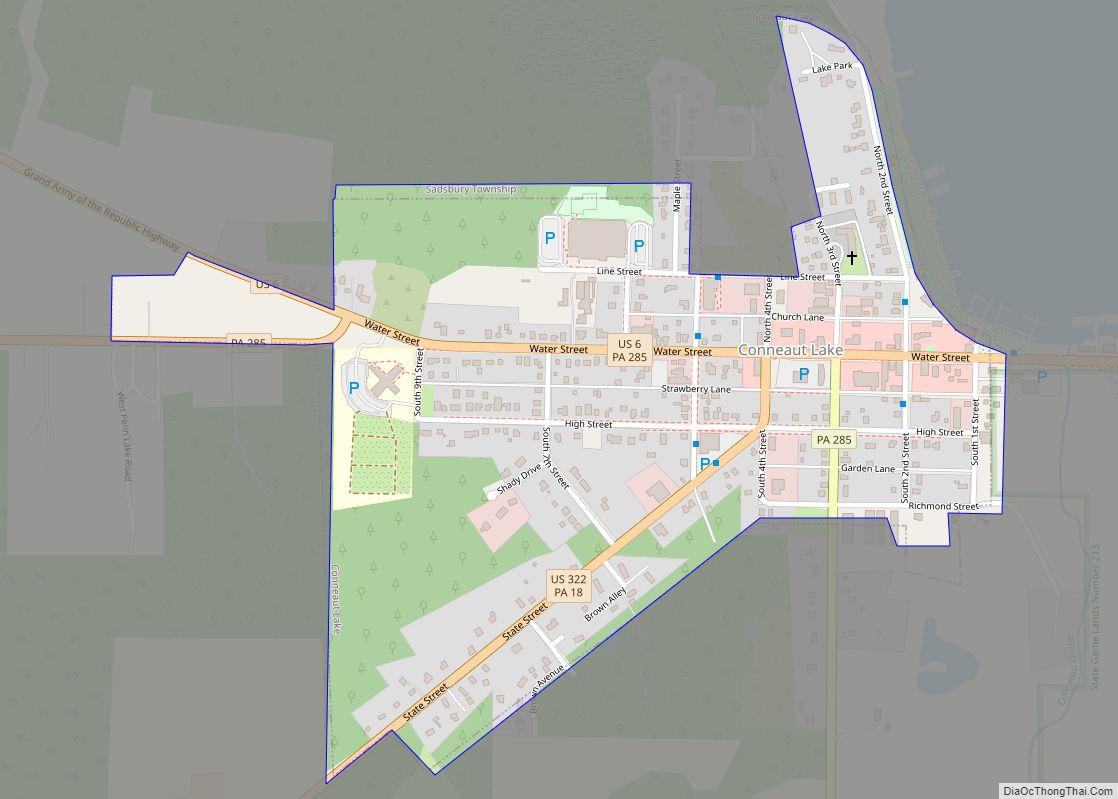
Online Interactive Map
Click on ![]() to view map in "full screen" mode.
to view map in "full screen" mode.
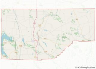
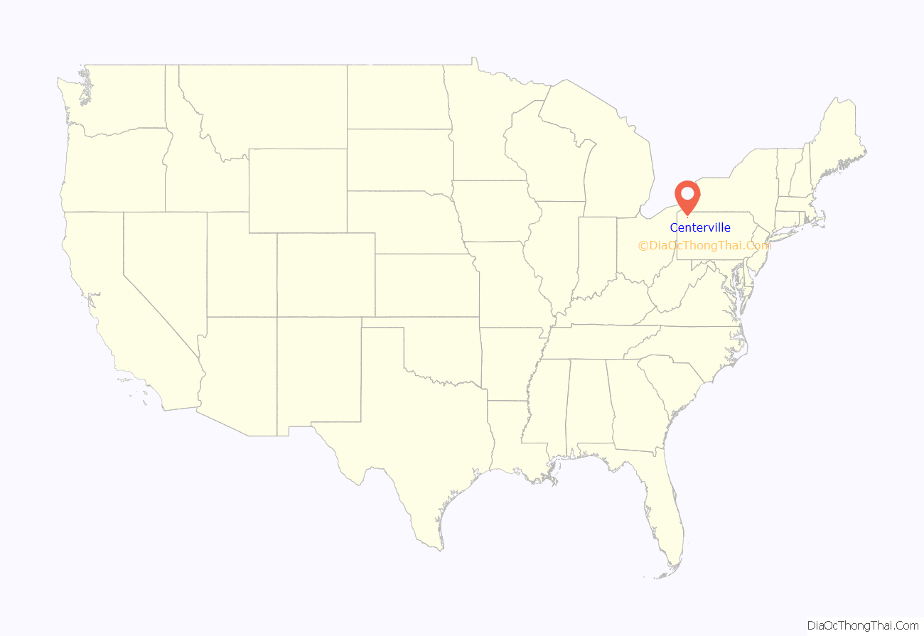
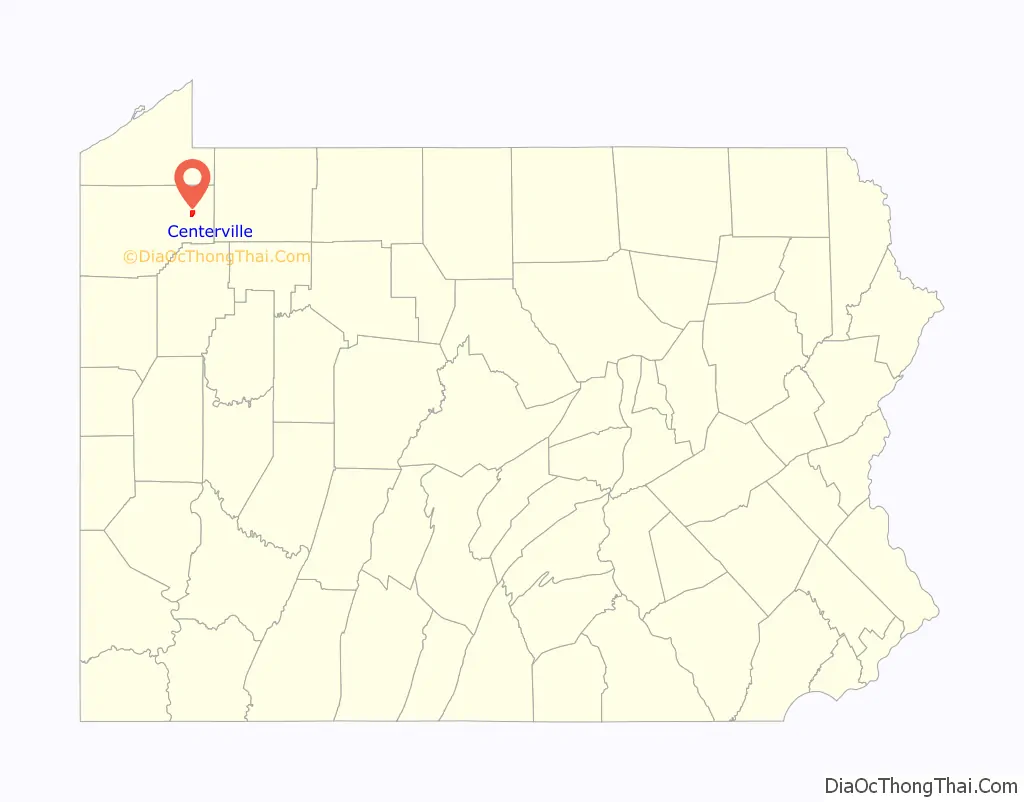
Centerville location map. Where is Centerville borough?
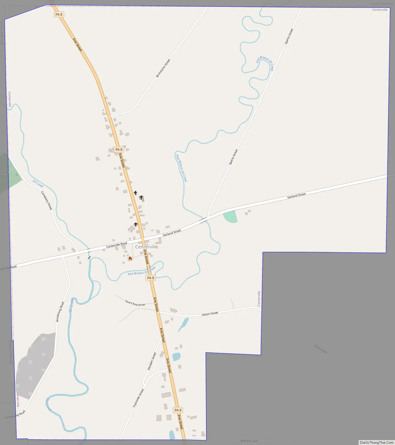
Centerville Road Map
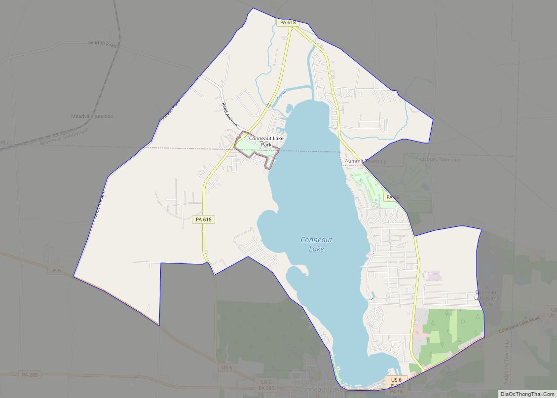
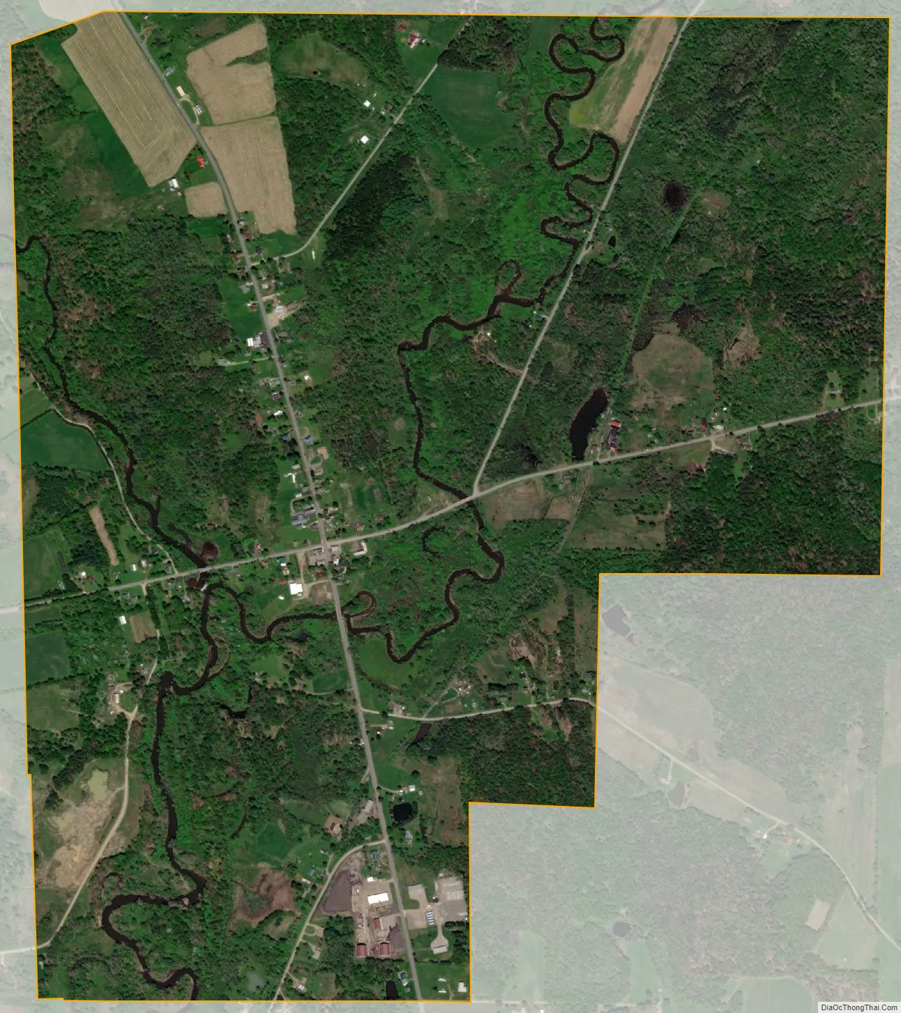
Centerville city Satellite Map
Geography
Centerville is located in eastern Crawford County at 41°44′11″N 79°45′39″W / 41.73639°N 79.76083°W / 41.73639; -79.76083 (41.736376, -79.760965). It is bordered by Rome Township to the north, east, and south; by Steuben Township to the southwest; and by Athens Township to the west.
According to the United States Census Bureau, the borough has a total area of 1.8 square miles (4.6 km), all land.
Natural features
Centerville Borough is located just north of the southern terminal moraine for glaciation in northwestern Pennsylvania. The borough is drained by Oil Creek, a southward-flowing tributary of the Allegheny River, which runs through the western side of town and East Branch Oil Creek, which enters the borough from the northeast and joins the main creek west of the borough center. The lowest elevation in Centerville is 1,260 ft (380 m), where Oil Creek flows south from the borough. The highest elevation is 1,510 ft (460 m) at the northern borough boundary.
Major Roads
Pennsylvania Route 8 passes through Centerville, leading north 12 miles (19 km) to Union City and south 9 miles (14 km) to Titusville.
See also
Map of Pennsylvania State and its subdivision:- Adams
- Allegheny
- Armstrong
- Beaver
- Bedford
- Berks
- Blair
- Bradford
- Bucks
- Butler
- Cambria
- Cameron
- Carbon
- Centre
- Chester
- Clarion
- Clearfield
- Clinton
- Columbia
- Crawford
- Cumberland
- Dauphin
- Delaware
- Elk
- Erie
- Fayette
- Forest
- Franklin
- Fulton
- Greene
- Huntingdon
- Indiana
- Jefferson
- Juniata
- Lackawanna
- Lancaster
- Lawrence
- Lebanon
- Lehigh
- Luzerne
- Lycoming
- Mc Kean
- Mercer
- Mifflin
- Monroe
- Montgomery
- Montour
- Northampton
- Northumberland
- Perry
- Philadelphia
- Pike
- Potter
- Schuylkill
- Snyder
- Somerset
- Sullivan
- Susquehanna
- Tioga
- Union
- Venango
- Warren
- Washington
- Wayne
- Westmoreland
- Wyoming
- York
- Alabama
- Alaska
- Arizona
- Arkansas
- California
- Colorado
- Connecticut
- Delaware
- District of Columbia
- Florida
- Georgia
- Hawaii
- Idaho
- Illinois
- Indiana
- Iowa
- Kansas
- Kentucky
- Louisiana
- Maine
- Maryland
- Massachusetts
- Michigan
- Minnesota
- Mississippi
- Missouri
- Montana
- Nebraska
- Nevada
- New Hampshire
- New Jersey
- New Mexico
- New York
- North Carolina
- North Dakota
- Ohio
- Oklahoma
- Oregon
- Pennsylvania
- Rhode Island
- South Carolina
- South Dakota
- Tennessee
- Texas
- Utah
- Vermont
- Virginia
- Washington
- West Virginia
- Wisconsin
- Wyoming