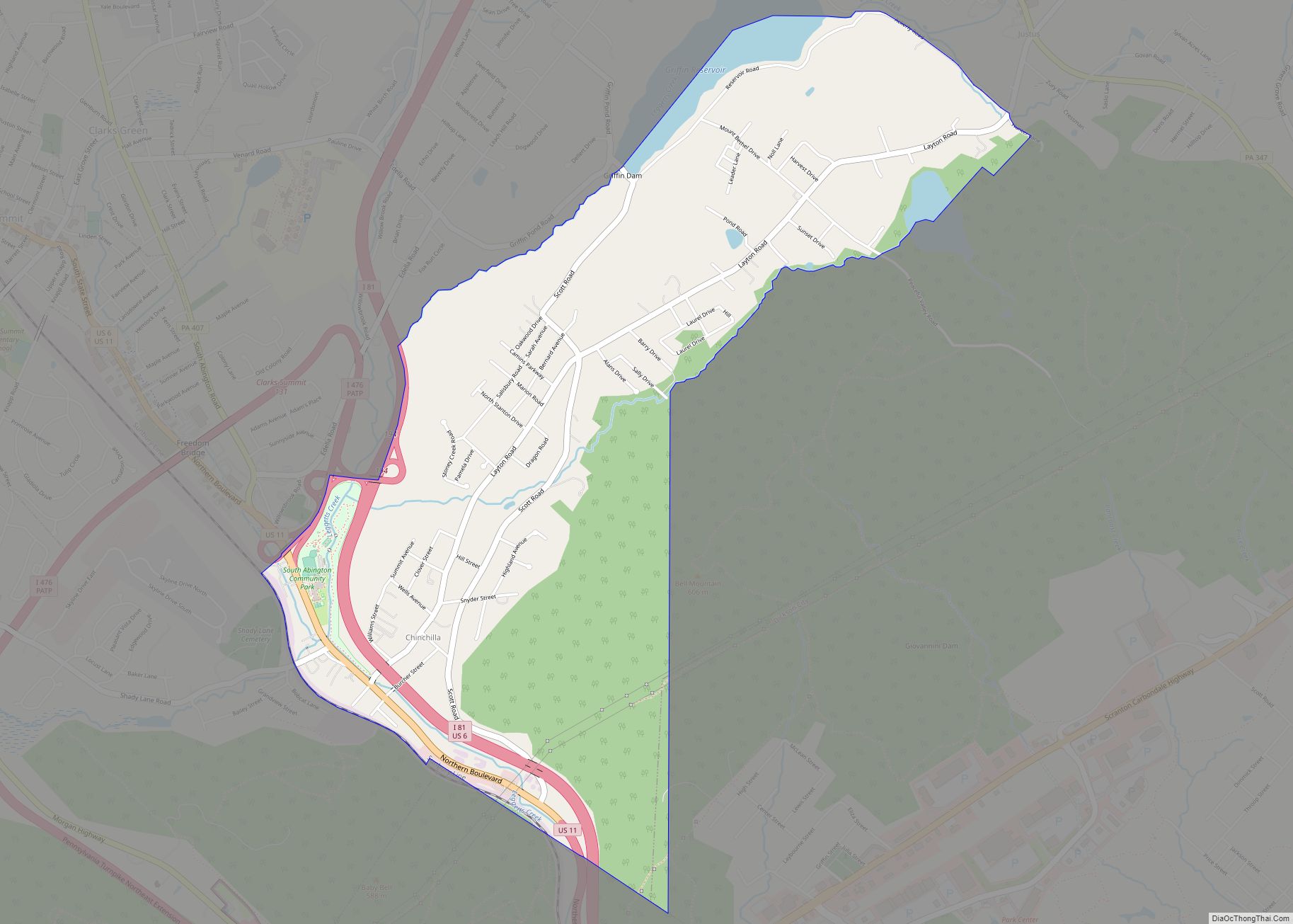
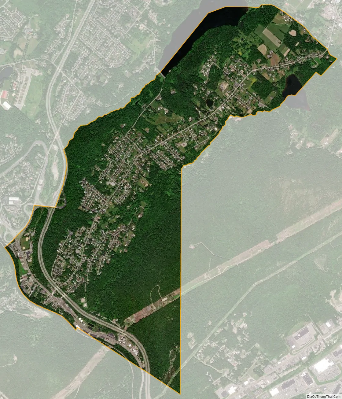
Chinchilla is a village and census-designated place in Scott and South Abington townships, Lackawanna County, Pennsylvania, United States. The CDP’s population was 2,098 at the time of the 2010 United States Census. It was known as “Leach’s Flats” until supposedly renamed by a female postmaster in the 1880 after her chinchilla-fur shawl. Chinchilla is located in the gorge of Leggetts Creek, which flows southward into the Lackawanna River on the north side of Scranton. Interstate 81, U.S. Route 6/11 and the Norfolk Southern Railroad (former Lackawanna Railroad) use the gorge between Scranton and Clarks Summit. Chinchilla has its own post office, with ZIP Code 18410.
| Name: | Chinchilla CDP |
|---|---|
| LSAD Code: | 57 |
| LSAD Description: | CDP (suffix) |
| State: | Pennsylvania |
| County: | Lackawanna County |
| Elevation: | 1,165 ft (355 m) |
| Total Area: | 2.58 sq mi (6.70 km²) |
| Land Area: | 2.50 sq mi (6.49 km²) |
| Water Area: | 0.08 sq mi (0.21 km²) |
| Total Population: | 1,959 |
| Population Density: | 782.04/sq mi (301.90/km²) |
| ZIP code: | De facto 18411 (Clarks Summit) |
| Area code: | 570 |
| FIPS code: | 4213480 |
Online Interactive Map
Click on ![]() to view map in "full screen" mode.
to view map in "full screen" mode.
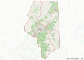
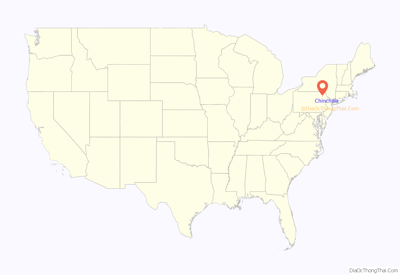
Chinchilla location map. Where is Chinchilla CDP?
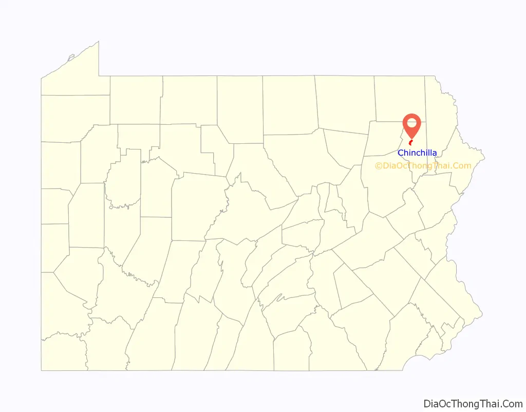
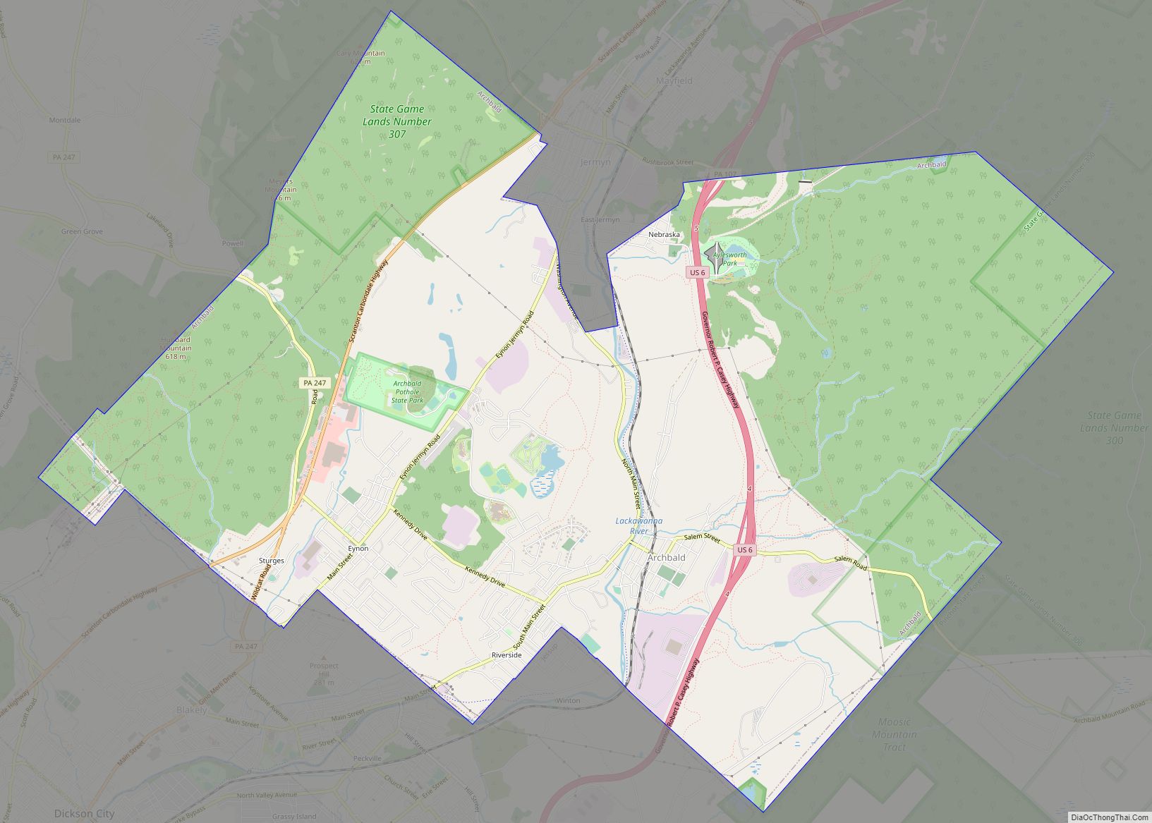
Chinchilla Road Map
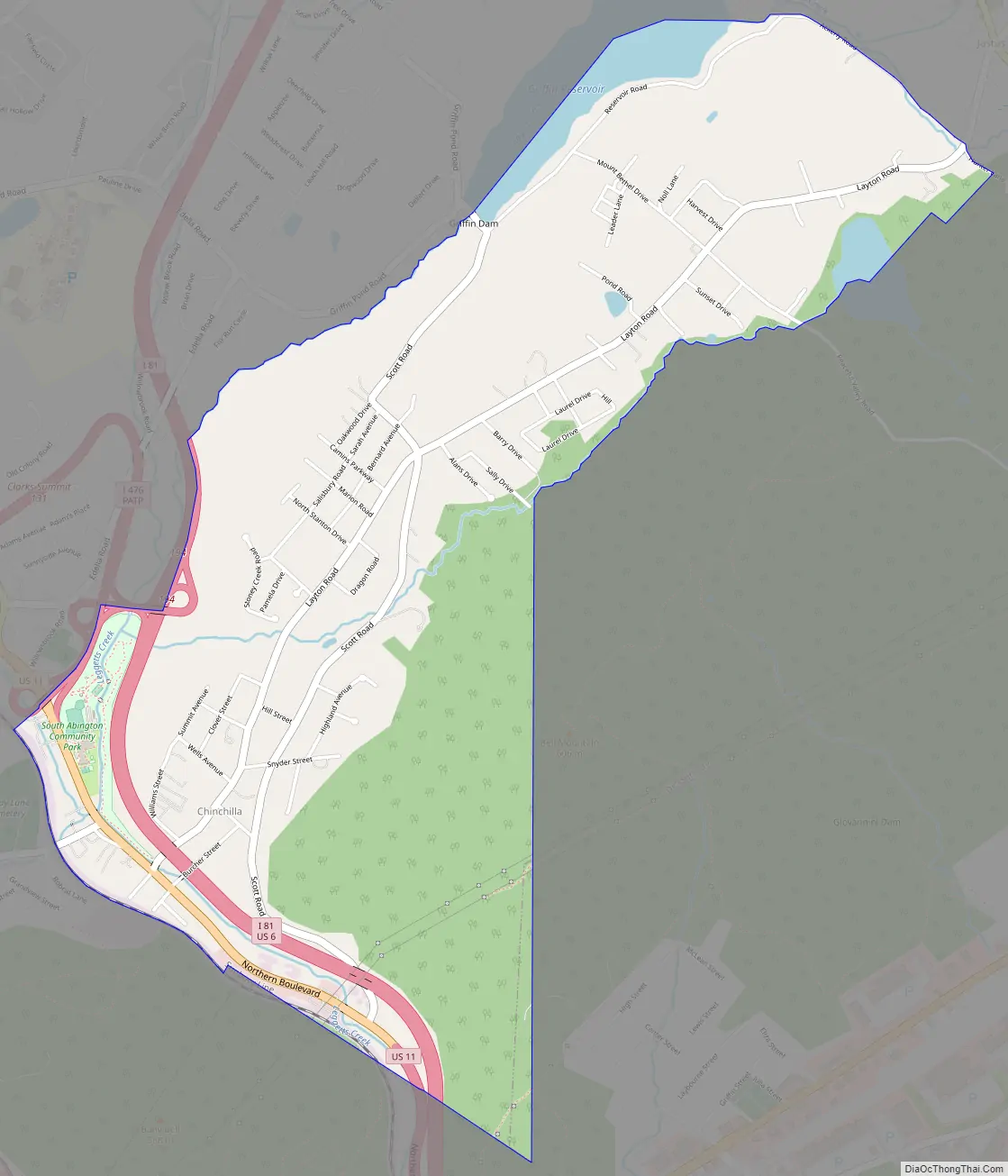
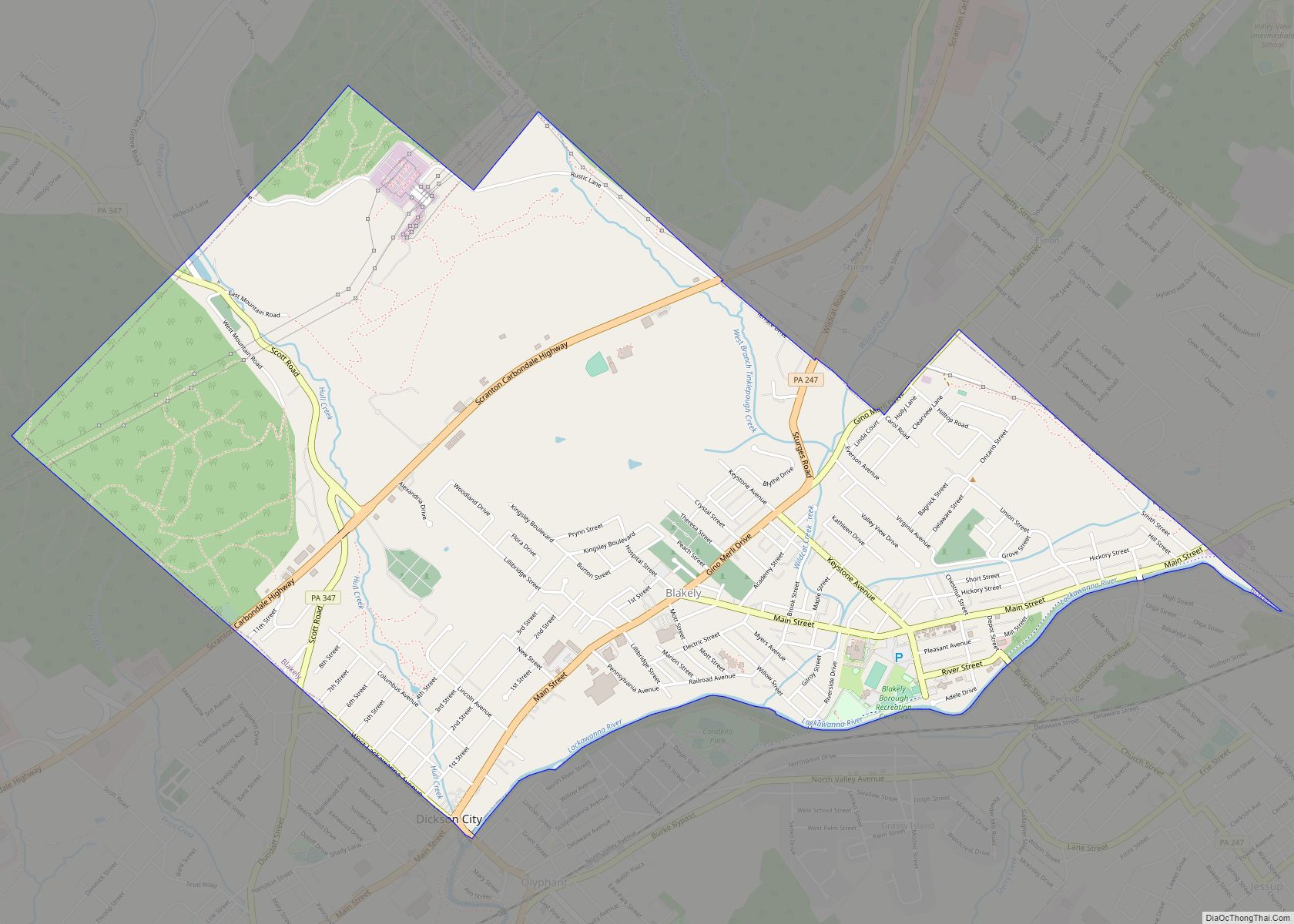
Chinchilla city Satellite Map
See also
Map of Pennsylvania State and its subdivision:- Adams
- Allegheny
- Armstrong
- Beaver
- Bedford
- Berks
- Blair
- Bradford
- Bucks
- Butler
- Cambria
- Cameron
- Carbon
- Centre
- Chester
- Clarion
- Clearfield
- Clinton
- Columbia
- Crawford
- Cumberland
- Dauphin
- Delaware
- Elk
- Erie
- Fayette
- Forest
- Franklin
- Fulton
- Greene
- Huntingdon
- Indiana
- Jefferson
- Juniata
- Lackawanna
- Lancaster
- Lawrence
- Lebanon
- Lehigh
- Luzerne
- Lycoming
- Mc Kean
- Mercer
- Mifflin
- Monroe
- Montgomery
- Montour
- Northampton
- Northumberland
- Perry
- Philadelphia
- Pike
- Potter
- Schuylkill
- Snyder
- Somerset
- Sullivan
- Susquehanna
- Tioga
- Union
- Venango
- Warren
- Washington
- Wayne
- Westmoreland
- Wyoming
- York
- Alabama
- Alaska
- Arizona
- Arkansas
- California
- Colorado
- Connecticut
- Delaware
- District of Columbia
- Florida
- Georgia
- Hawaii
- Idaho
- Illinois
- Indiana
- Iowa
- Kansas
- Kentucky
- Louisiana
- Maine
- Maryland
- Massachusetts
- Michigan
- Minnesota
- Mississippi
- Missouri
- Montana
- Nebraska
- Nevada
- New Hampshire
- New Jersey
- New Mexico
- New York
- North Carolina
- North Dakota
- Ohio
- Oklahoma
- Oregon
- Pennsylvania
- Rhode Island
- South Carolina
- South Dakota
- Tennessee
- Texas
- Utah
- Vermont
- Virginia
- Washington
- West Virginia
- Wisconsin
- Wyoming