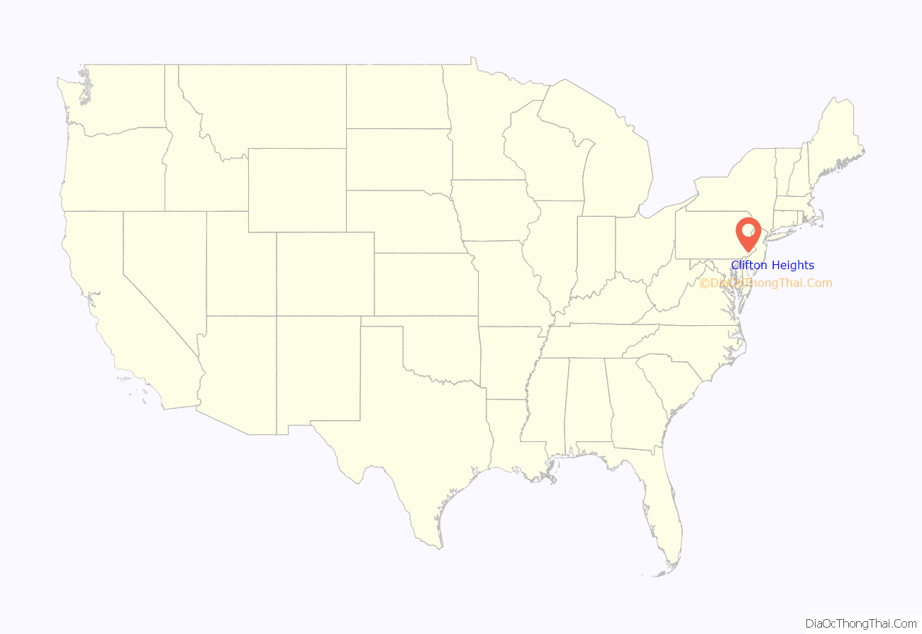
Clifton Heights is a borough in Delaware County, Pennsylvania, United States, located on Darby Creek 5 miles (8 km) west of downtown Philadelphia. As of the 2010 census, the population was 6,652.
| Name: | Clifton Heights borough |
|---|---|
| LSAD Code: | 21 |
| LSAD Description: | borough (suffix) |
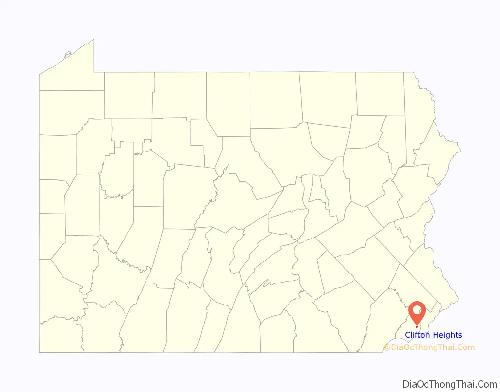
| State: | Pennsylvania |
| County: | Delaware County |
| Elevation: | 157 ft (48 m) |
| Total Area: | 0.63 sq mi (1.63 km²) |
| Land Area: | 0.63 sq mi (1.63 km²) |
| Water Area: | 0.00 sq mi (0.00 km²) |
| Total Population: | 6,863 |
| Population Density: | 10,893.65/sq mi (4,203.85/km²) |
| ZIP code: | 19018 |
| Area code: | 610 and 484 |
| FIPS code: | 4214264 |
| Website: | www.cliftonheightsboro.com |
Online Interactive Map
Click on ![]() to view map in "full screen" mode.
to view map in "full screen" mode.
Clifton Heights location map. Where is Clifton Heights borough?
History
The population of the borough was 1,820 in 1890, 3,155 in 1910, and reached a maximum of 10,268 in 1960.
Clifton Heights is the birthplace of the glam rock band Cinderella. Clifton Heights is the home of Rosati Water Ice, the first Italian ice company in the US.
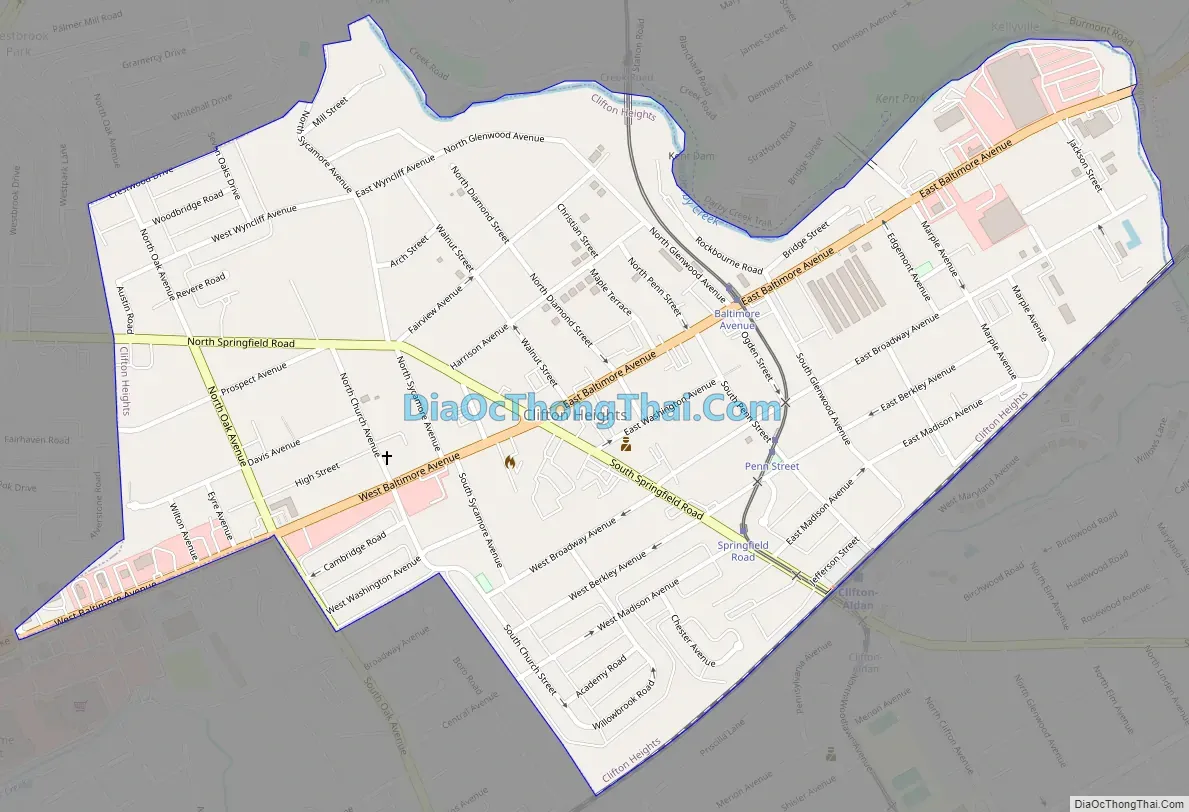
Clifton Heights Road Map
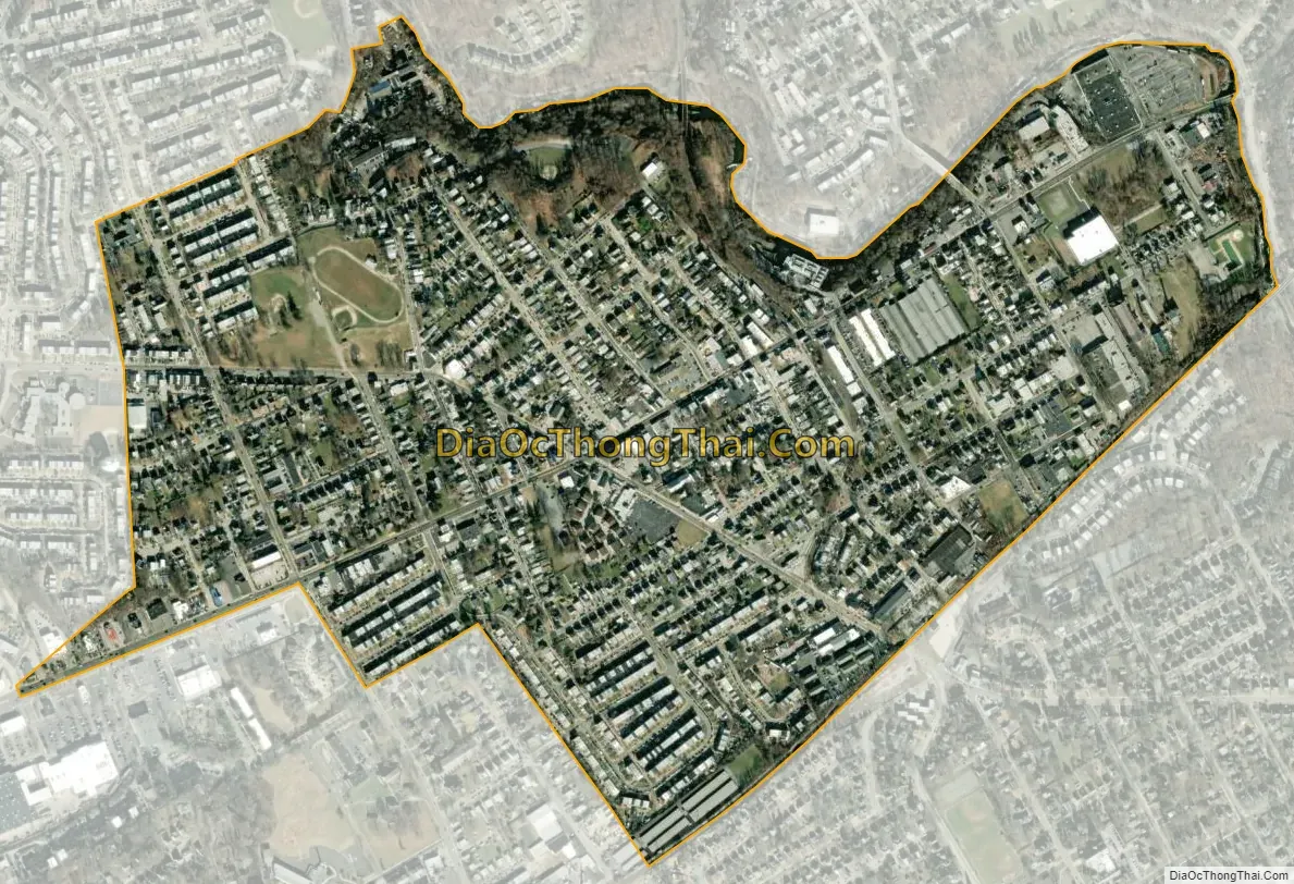
Clifton Heights city Satellite Map
Geography
Clifton Heights is located in eastern Delaware County at 39°55′45″N 75°17′45″W / 39.92917°N 75.29583°W / 39.92917; -75.29583 (39.929062, -75.295760). It is bordered to the northeast by the borough of Lansdowne, to the southeast by the borough of Aldan, and to the west, north, and southeast by Upper Darby Township.
Clifton Heights is bordered by Darby Creek to the west.
According to the United States Census Bureau, the borough has a total area of 0.62 square miles (1.6 km), all land.
See also
Map of Pennsylvania State and its subdivision:- Adams
- Allegheny
- Armstrong
- Beaver
- Bedford
- Berks
- Blair
- Bradford
- Bucks
- Butler
- Cambria
- Cameron
- Carbon
- Centre
- Chester
- Clarion
- Clearfield
- Clinton
- Columbia
- Crawford
- Cumberland
- Dauphin
- Delaware
- Elk
- Erie
- Fayette
- Forest
- Franklin
- Fulton
- Greene
- Huntingdon
- Indiana
- Jefferson
- Juniata
- Lackawanna
- Lancaster
- Lawrence
- Lebanon
- Lehigh
- Luzerne
- Lycoming
- Mc Kean
- Mercer
- Mifflin
- Monroe
- Montgomery
- Montour
- Northampton
- Northumberland
- Perry
- Philadelphia
- Pike
- Potter
- Schuylkill
- Snyder
- Somerset
- Sullivan
- Susquehanna
- Tioga
- Union
- Venango
- Warren
- Washington
- Wayne
- Westmoreland
- Wyoming
- York
- Alabama
- Alaska
- Arizona
- Arkansas
- California
- Colorado
- Connecticut
- Delaware
- District of Columbia
- Florida
- Georgia
- Hawaii
- Idaho
- Illinois
- Indiana
- Iowa
- Kansas
- Kentucky
- Louisiana
- Maine
- Maryland
- Massachusetts
- Michigan
- Minnesota
- Mississippi
- Missouri
- Montana
- Nebraska
- Nevada
- New Hampshire
- New Jersey
- New Mexico
- New York
- North Carolina
- North Dakota
- Ohio
- Oklahoma
- Oregon
- Pennsylvania
- Rhode Island
- South Carolina
- South Dakota
- Tennessee
- Texas
- Utah
- Vermont
- Virginia
- Washington
- West Virginia
- Wisconsin
- Wyoming


