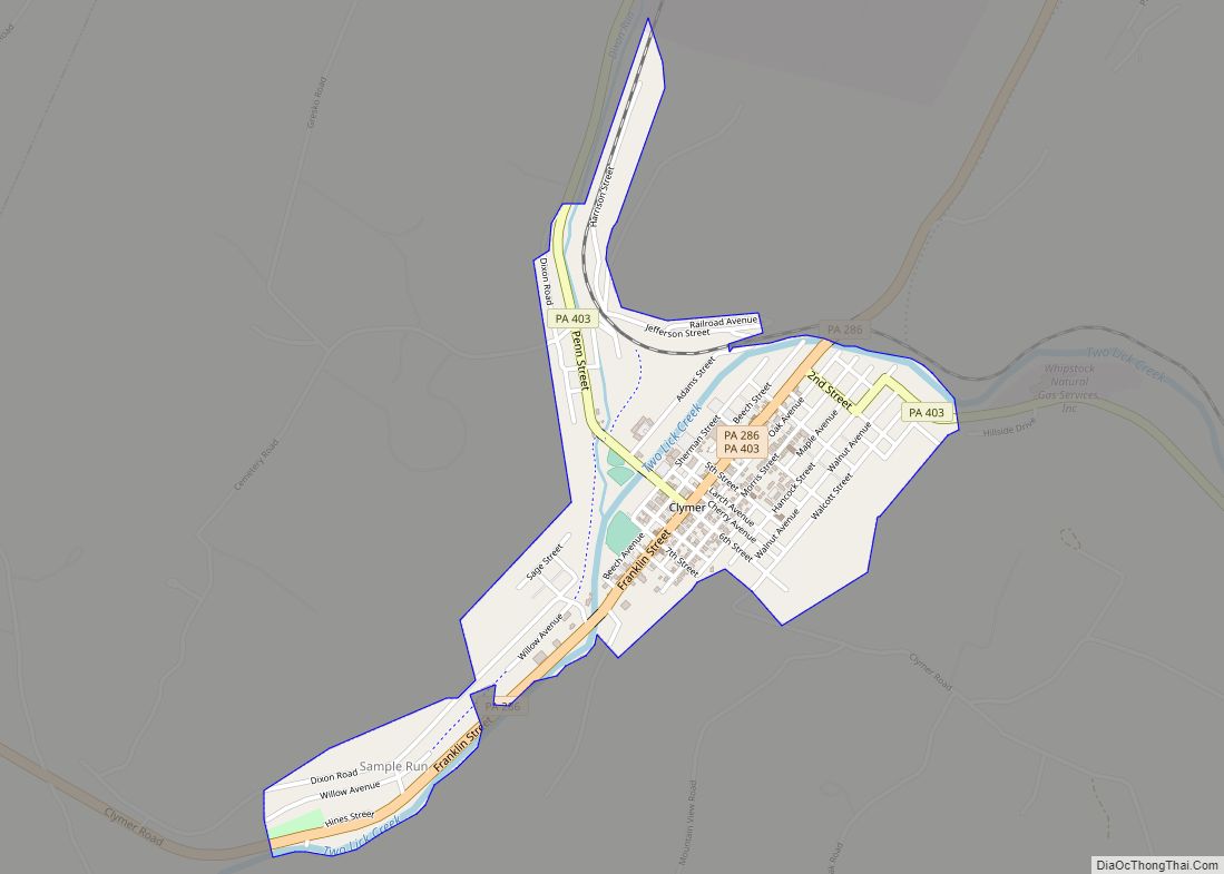
Clymer is a borough in Indiana County, Pennsylvania, United States. The population was 1,336 at the 2020 census. The community was named after William Bingham Clymer, grandson of George Clymer, one of the signers of the United States Declaration of Independence. William Clymer sold the land the borough is situated on to Thomas White (Namesake of White Township) in the 1830s. Most of Clymer’s family died in a tragic sea accident in 1878, which made national news and inspired the name. It is surrounded by but separate from Cherryhill Township.
| Name: | Clymer borough |
|---|---|
| LSAD Code: | 21 |
| LSAD Description: | borough (suffix) |
| State: | Pennsylvania |
| County: | Indiana County |
| Incorporated: | 1908 |
| Total Area: | 0.59 sq mi (1.52 km²) |
| Land Area: | 0.57 sq mi (1.47 km²) |
| Water Area: | 0.02 sq mi (0.05 km²) |
| Total Population: | 1,321 |
| Population Density: | 2,321.62/sq mi (895.97/km²) |
| Area code: | 724 |
| FIPS code: | 4214520 |
| Website: | clymerpa.com |
Online Interactive Map
Click on ![]() to view map in "full screen" mode.
to view map in "full screen" mode.
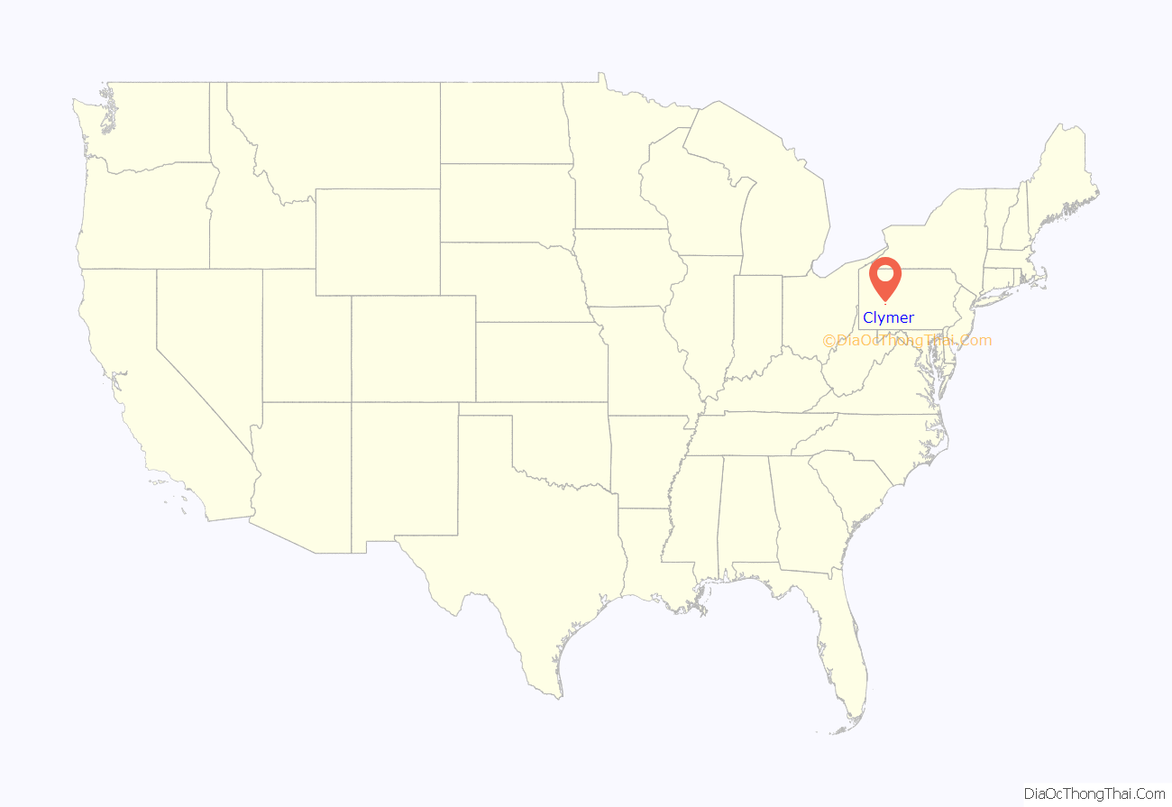
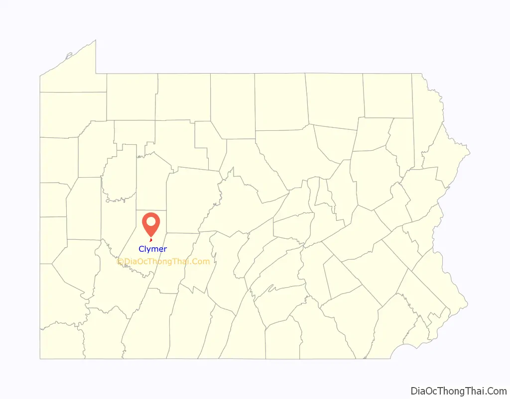
Clymer location map. Where is Clymer borough?
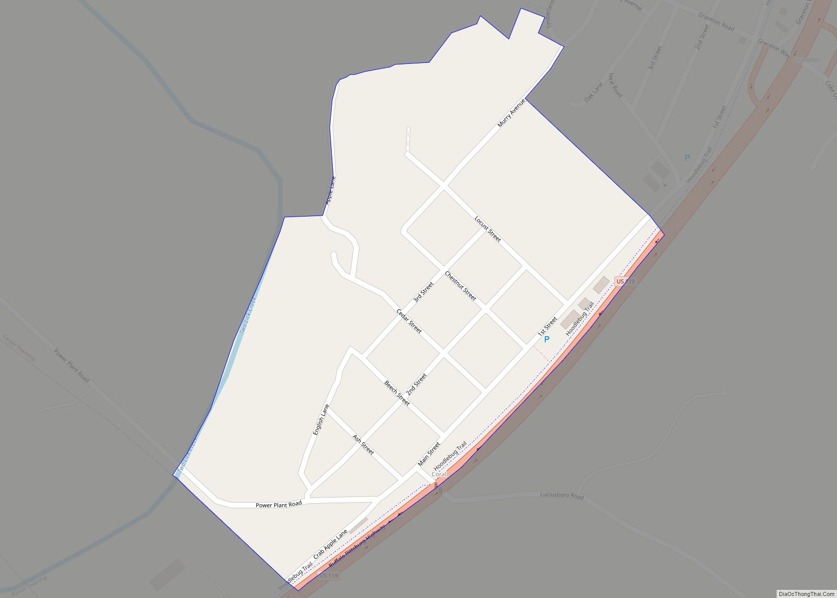
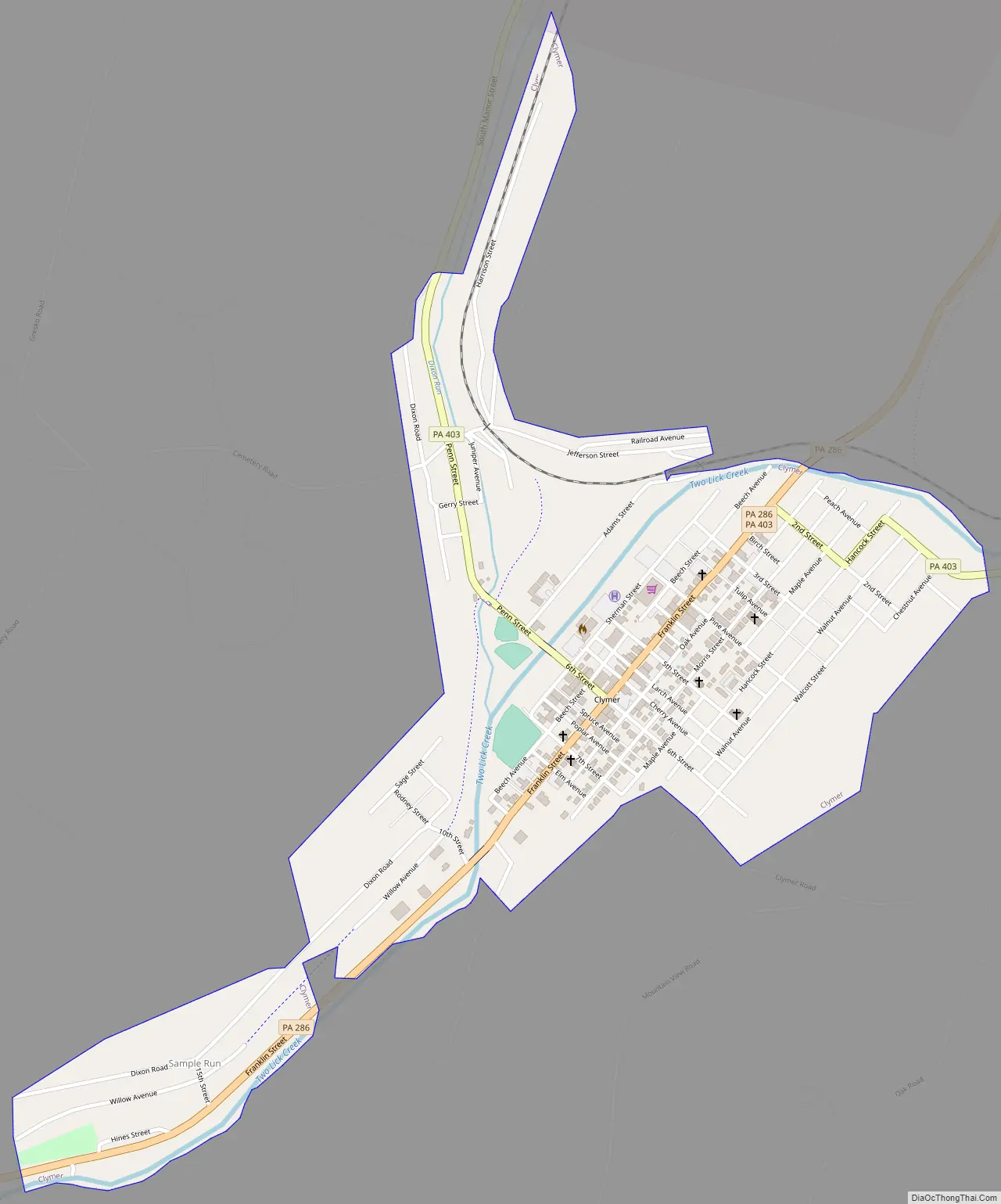
Clymer Road Map
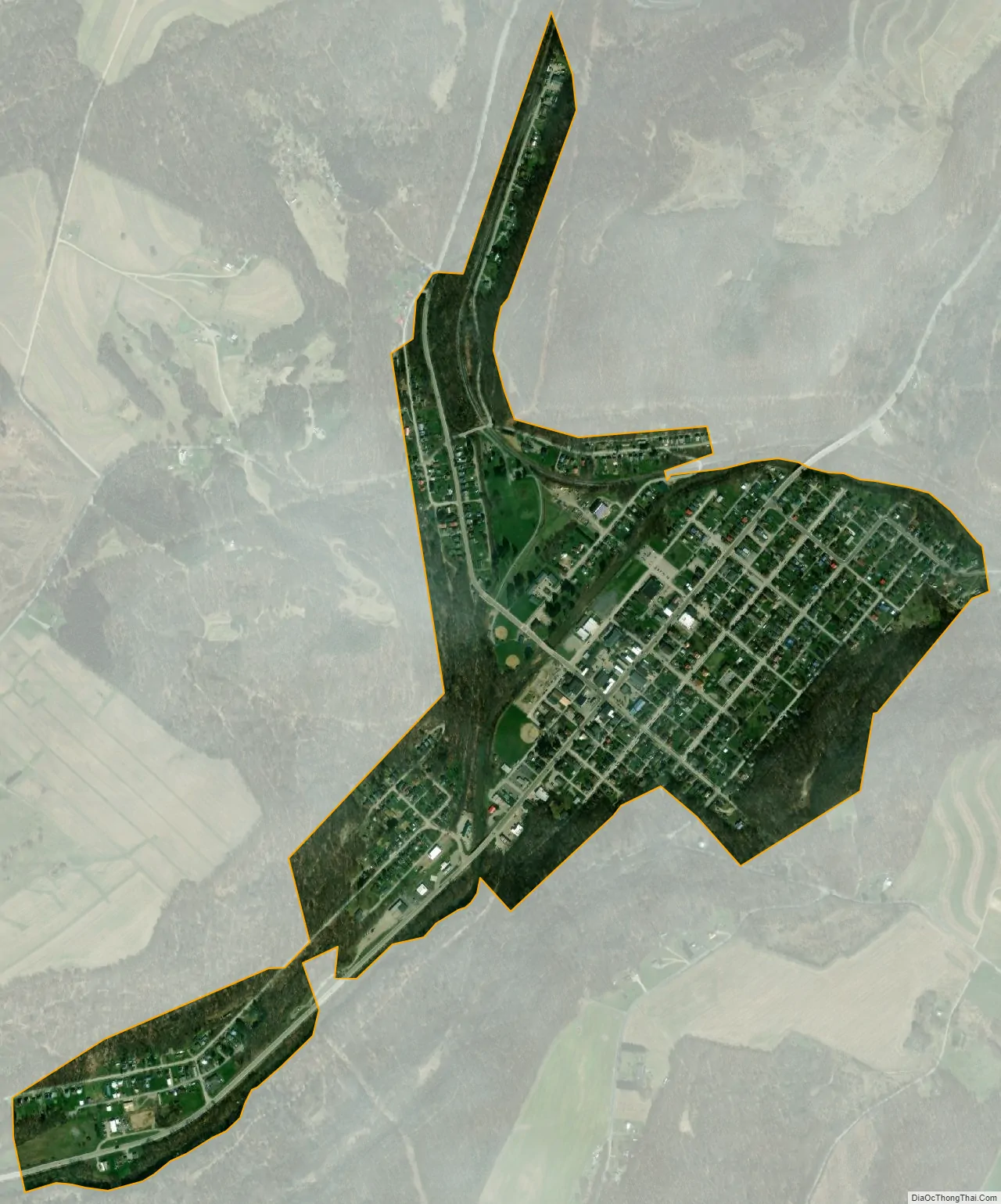
Clymer city Satellite Map
Geography
Clymer is located at 40°40′8″N 79°0′43″W / 40.66889°N 79.01194°W / 40.66889; -79.01194 (40.668977, -79.011925).
According to the United States Census Bureau, the borough has a total area of 0.6 square miles (1.6 km), all land.
See also
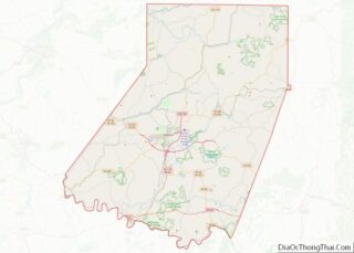
Map of Pennsylvania State and its subdivision:- Adams
- Allegheny
- Armstrong
- Beaver
- Bedford
- Berks
- Blair
- Bradford
- Bucks
- Butler
- Cambria
- Cameron
- Carbon
- Centre
- Chester
- Clarion
- Clearfield
- Clinton
- Columbia
- Crawford
- Cumberland
- Dauphin
- Delaware
- Elk
- Erie
- Fayette
- Forest
- Franklin
- Fulton
- Greene
- Huntingdon
- Indiana
- Jefferson
- Juniata
- Lackawanna
- Lancaster
- Lawrence
- Lebanon
- Lehigh
- Luzerne
- Lycoming
- Mc Kean
- Mercer
- Mifflin
- Monroe
- Montgomery
- Montour
- Northampton
- Northumberland
- Perry
- Philadelphia
- Pike
- Potter
- Schuylkill
- Snyder
- Somerset
- Sullivan
- Susquehanna
- Tioga
- Union
- Venango
- Warren
- Washington
- Wayne
- Westmoreland
- Wyoming
- York
- Alabama
- Alaska
- Arizona
- Arkansas
- California
- Colorado
- Connecticut
- Delaware
- District of Columbia
- Florida
- Georgia
- Hawaii
- Idaho
- Illinois
- Indiana
- Iowa
- Kansas
- Kentucky
- Louisiana
- Maine
- Maryland
- Massachusetts
- Michigan
- Minnesota
- Mississippi
- Missouri
- Montana
- Nebraska
- Nevada
- New Hampshire
- New Jersey
- New Mexico
- New York
- North Carolina
- North Dakota
- Ohio
- Oklahoma
- Oregon
- Pennsylvania
- Rhode Island
- South Carolina
- South Dakota
- Tennessee
- Texas
- Utah
- Vermont
- Virginia
- Washington
- West Virginia
- Wisconsin
- Wyoming