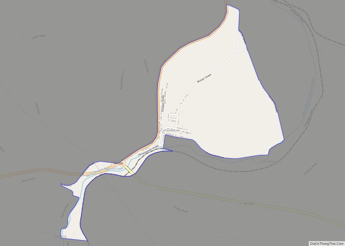
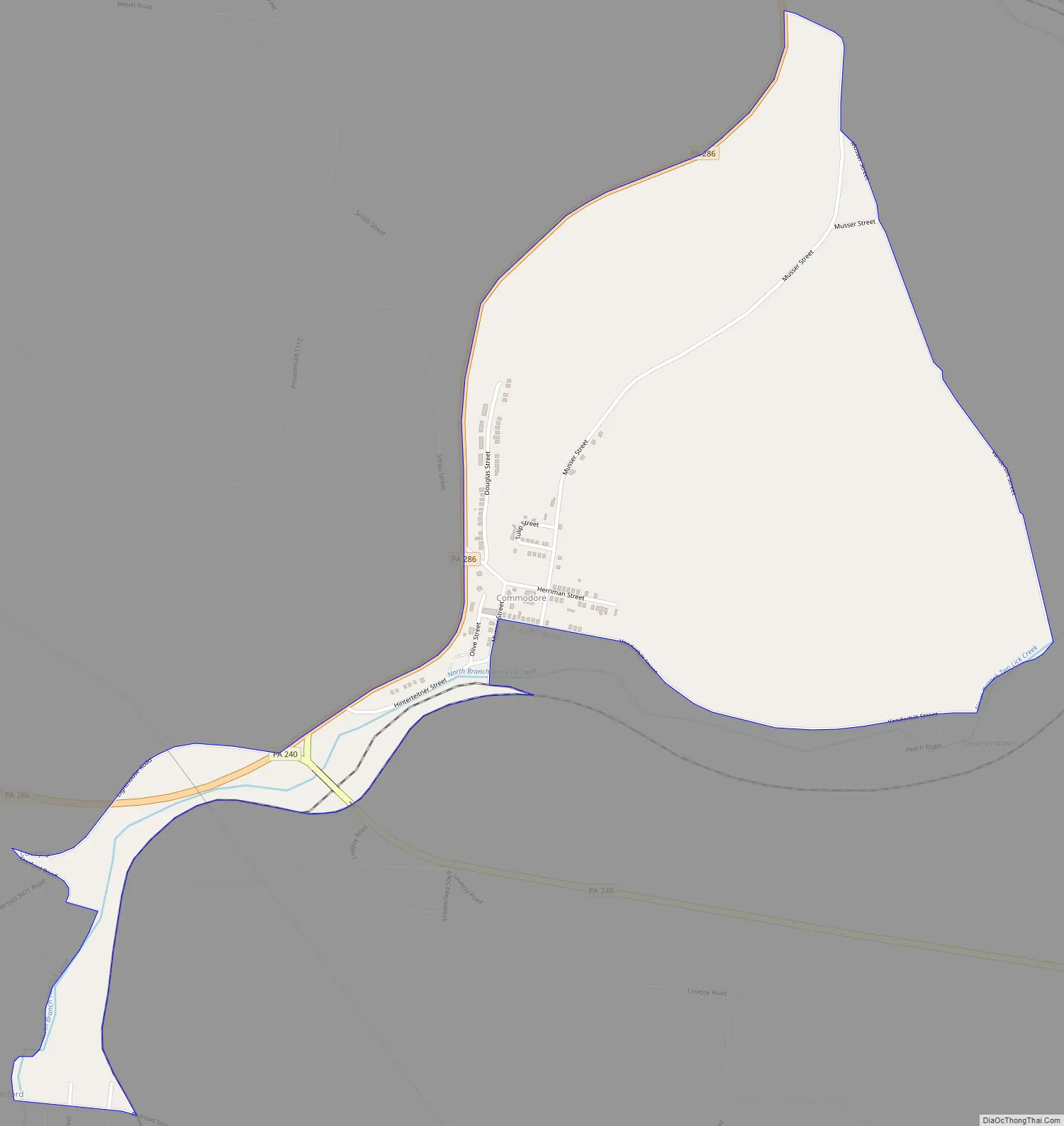
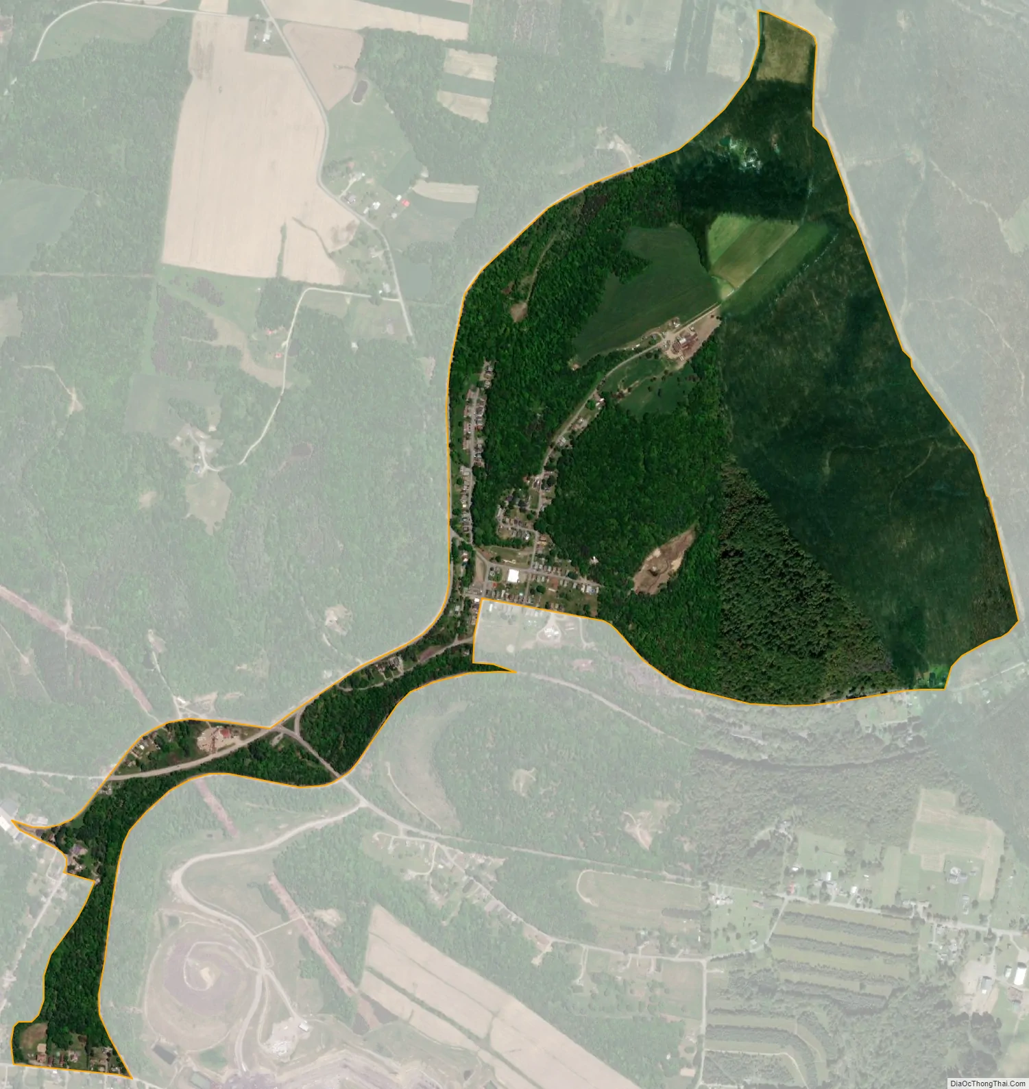
Commodore is a census-designated place (CDP) in Green Township, Indiana County, Pennsylvania, United States. The population was 331 at the 2010 census.
| Name: | Commodore CDP |
|---|---|
| LSAD Code: | 57 |
| LSAD Description: | CDP (suffix) |
| State: | Pennsylvania |
| County: | Indiana County |
| Elevation: | 1,420 ft (430 m) |
| Total Area: | 0.84 sq mi (2.17 km²) |
| Land Area: | 0.83 sq mi (2.16 km²) |
| Water Area: | 0.01 sq mi (0.01 km²) |
| Total Population: | 284 |
| Population Density: | 341.35/sq mi (131.72/km²) |
| ZIP code: | 15729 |
| FIPS code: | 4215464 |
| GNISfeature ID: | 1172267 |
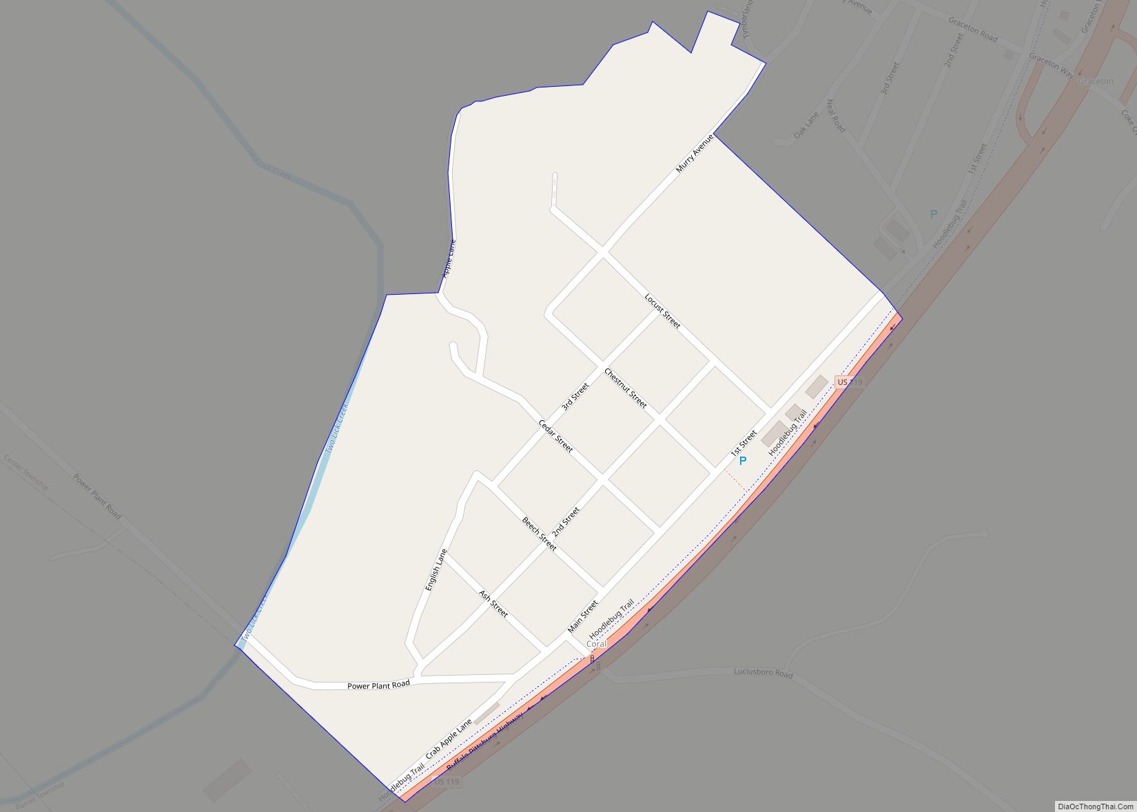
Online Interactive Map
Click on ![]() to view map in "full screen" mode.
to view map in "full screen" mode.
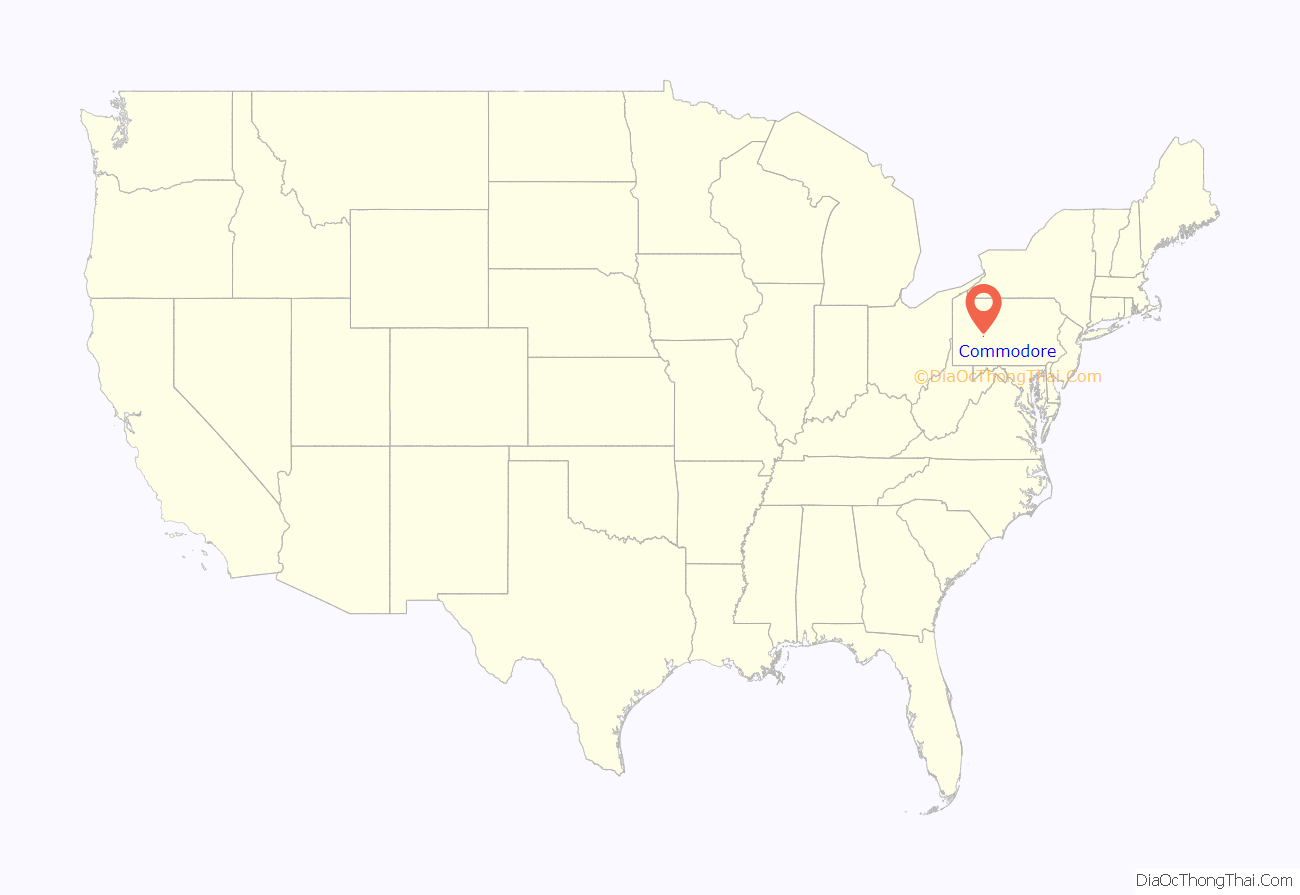
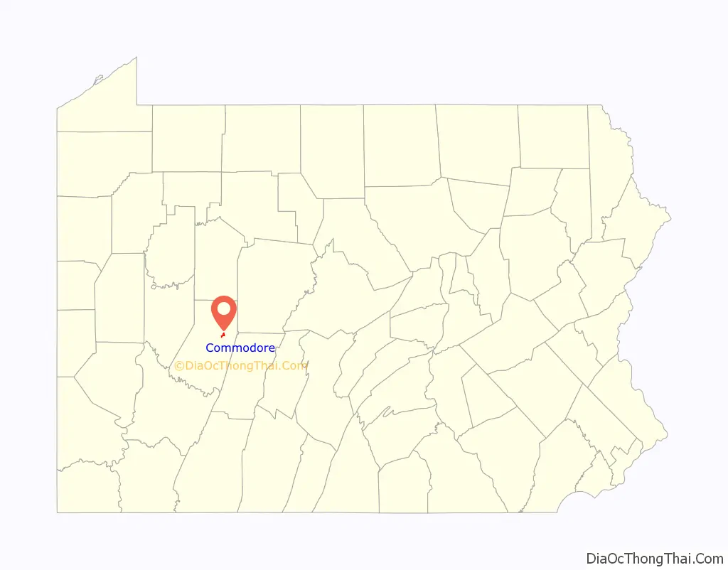
Commodore location map. Where is Commodore CDP?
History
Commodore was founded in 1919 by the Clearfield Bituminous Coal Corporation, a subsidiary of the New York Central Railroad. It was named in honor of Commodore Cornelius Vanderbilt, founder of that railroad. (Vanderbilt was known by the nickname or unofficial rank of Commodore due to his background as a riverboat owner.)
The town was created as a “model town”, with a higher caliber of worker housing than other coal mining communities. Houses were constructed of concrete block, not wood. Also, the houses had toilets and the community had a sewer system, which were unusual in comparison to neighboring mining communities.
Streets were named after executives of the coal company: F.E. Herriman (President), John Fisher (Vice President), H.B. Douglas (Assistant to the President), A.J. Musser (General Manager), and H.J. Hinterleitner (General Superintendent). The town and its initial buildings were designed by Paul Gill, an engineer of the coal company.
The community was added to the National Register of Historic Places as Commodore Historic District on August 26, 1994. The national Historic district has 94 contributing buildings.
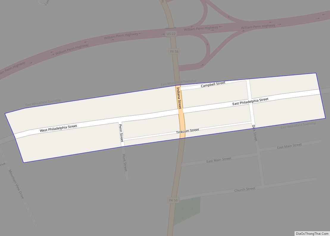
Commodore Road Map
Commodore city Satellite Map
Geography
Commodore is located at 40°42′38″N 78°56′45″W / 40.71056°N 78.94583°W / 40.71056; -78.94583 (40.710694, -78.945857).
According to the United States Census Bureau, the CDP has a total area of 0.8 square miles (2.1 km), all land.
See also
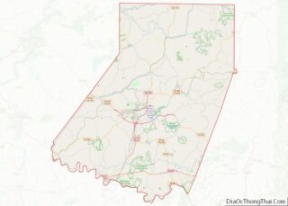
Map of Pennsylvania State and its subdivision:- Adams
- Allegheny
- Armstrong
- Beaver
- Bedford
- Berks
- Blair
- Bradford
- Bucks
- Butler
- Cambria
- Cameron
- Carbon
- Centre
- Chester
- Clarion
- Clearfield
- Clinton
- Columbia
- Crawford
- Cumberland
- Dauphin
- Delaware
- Elk
- Erie
- Fayette
- Forest
- Franklin
- Fulton
- Greene
- Huntingdon
- Indiana
- Jefferson
- Juniata
- Lackawanna
- Lancaster
- Lawrence
- Lebanon
- Lehigh
- Luzerne
- Lycoming
- Mc Kean
- Mercer
- Mifflin
- Monroe
- Montgomery
- Montour
- Northampton
- Northumberland
- Perry
- Philadelphia
- Pike
- Potter
- Schuylkill
- Snyder
- Somerset
- Sullivan
- Susquehanna
- Tioga
- Union
- Venango
- Warren
- Washington
- Wayne
- Westmoreland
- Wyoming
- York
- Alabama
- Alaska
- Arizona
- Arkansas
- California
- Colorado
- Connecticut
- Delaware
- District of Columbia
- Florida
- Georgia
- Hawaii
- Idaho
- Illinois
- Indiana
- Iowa
- Kansas
- Kentucky
- Louisiana
- Maine
- Maryland
- Massachusetts
- Michigan
- Minnesota
- Mississippi
- Missouri
- Montana
- Nebraska
- Nevada
- New Hampshire
- New Jersey
- New Mexico
- New York
- North Carolina
- North Dakota
- Ohio
- Oklahoma
- Oregon
- Pennsylvania
- Rhode Island
- South Carolina
- South Dakota
- Tennessee
- Texas
- Utah
- Vermont
- Virginia
- Washington
- West Virginia
- Wisconsin
- Wyoming