Connoquenessing is a borough in Butler County, Pennsylvania, United States. The population was 528 at the 2010 census.
| Name: | Connoquenessing borough |
|---|---|
| LSAD Code: | 21 |
| LSAD Description: | borough (suffix) |
| State: | Pennsylvania |
| County: | Butler County |
| Incorporated: | 1848 |
| Total Area: | 1.35 sq mi (3.51 km²) |
| Land Area: | 1.35 sq mi (3.51 km²) |
| Water Area: | 0.00 sq mi (0.00 km²) |
| Total Population: | 668 |
| Population Density: | 492.99/sq mi (190.32/km²) |
| FIPS code: | 4215808 |
| Website: | connoquenessingboro.com |
Online Interactive Map
Click on ![]() to view map in "full screen" mode.
to view map in "full screen" mode.
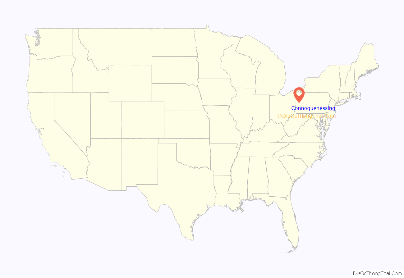
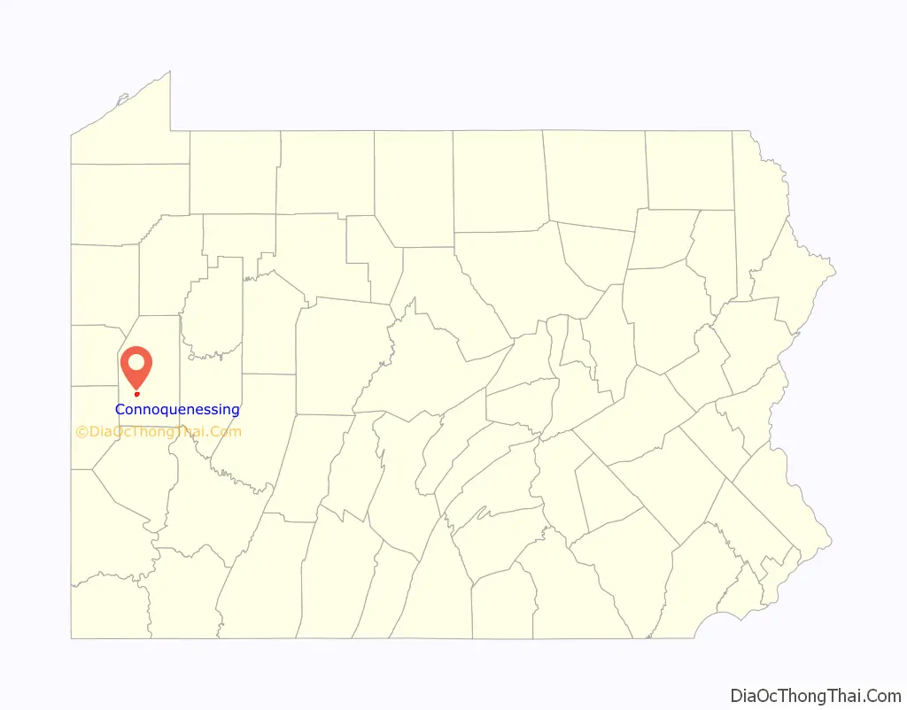
Connoquenessing location map. Where is Connoquenessing borough?
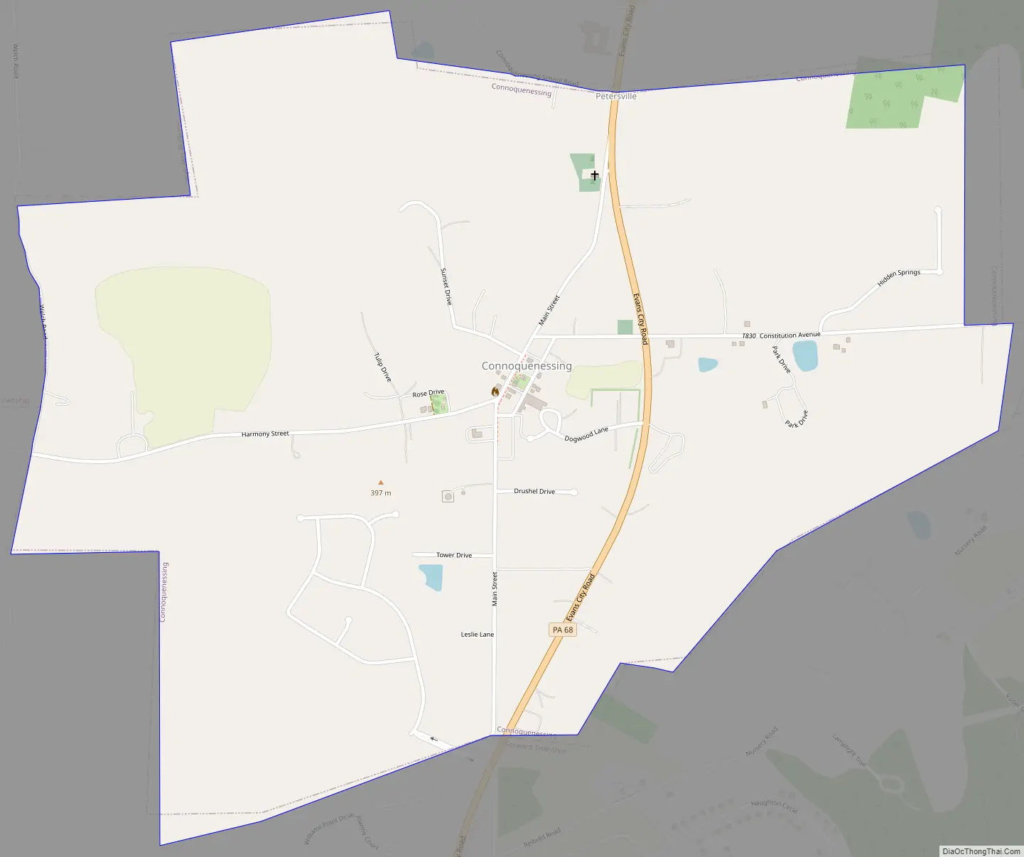
Connoquenessing Road Map
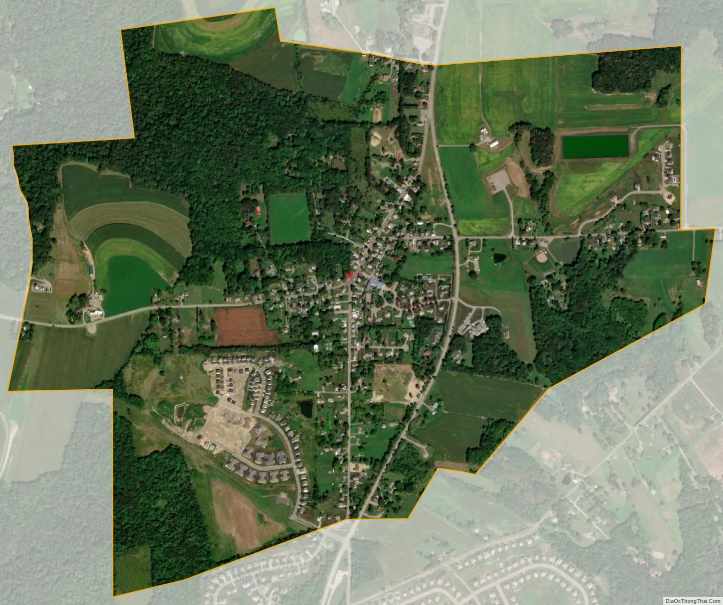
Connoquenessing city Satellite Map
Geography
Connoquenessing is located southwest of the center of Butler County at 40°49′5″N 80°0′49″W / 40.81806°N 80.01361°W / 40.81806; -80.01361 (40.818096, -80.013708). It is bordered by Connoquenessing Township to the north, east, and west, and by Forward Township to the south, east, and west. The borough takes its name from Connoquenessing Creek, a Beaver River tributary which flows through a valley just south of the borough.
Pennsylvania Route 68 passes through the borough, leading northeast 8 miles (13 km) to Butler, the county seat, and southwest 4.6 miles (7.4 km) to Evans City.
According to the United States Census Bureau, the borough has a total area of 1.4 square miles (3.5 km), all land.
See also
Map of Pennsylvania State and its subdivision:- Adams
- Allegheny
- Armstrong
- Beaver
- Bedford
- Berks
- Blair
- Bradford
- Bucks
- Butler
- Cambria
- Cameron
- Carbon
- Centre
- Chester
- Clarion
- Clearfield
- Clinton
- Columbia
- Crawford
- Cumberland
- Dauphin
- Delaware
- Elk
- Erie
- Fayette
- Forest
- Franklin
- Fulton
- Greene
- Huntingdon
- Indiana
- Jefferson
- Juniata
- Lackawanna
- Lancaster
- Lawrence
- Lebanon
- Lehigh
- Luzerne
- Lycoming
- Mc Kean
- Mercer
- Mifflin
- Monroe
- Montgomery
- Montour
- Northampton
- Northumberland
- Perry
- Philadelphia
- Pike
- Potter
- Schuylkill
- Snyder
- Somerset
- Sullivan
- Susquehanna
- Tioga
- Union
- Venango
- Warren
- Washington
- Wayne
- Westmoreland
- Wyoming
- York
- Alabama
- Alaska
- Arizona
- Arkansas
- California
- Colorado
- Connecticut
- Delaware
- District of Columbia
- Florida
- Georgia
- Hawaii
- Idaho
- Illinois
- Indiana
- Iowa
- Kansas
- Kentucky
- Louisiana
- Maine
- Maryland
- Massachusetts
- Michigan
- Minnesota
- Mississippi
- Missouri
- Montana
- Nebraska
- Nevada
- New Hampshire
- New Jersey
- New Mexico
- New York
- North Carolina
- North Dakota
- Ohio
- Oklahoma
- Oregon
- Pennsylvania
- Rhode Island
- South Carolina
- South Dakota
- Tennessee
- Texas
- Utah
- Vermont
- Virginia
- Washington
- West Virginia
- Wisconsin
- Wyoming


