Coraopolis (/ˌkoʊriˈɒpəlɪs/) is a borough in Allegheny County, Pennsylvania, United States. The population was 5,559 at the 2020 census. It is a suburb of the Pittsburgh metropolitan area.
Coraopolis is located west of Pittsburgh along the Ohio River and to the east of the Pittsburgh International Airport. The borough has steep topography, numerous brick streets and many large, old houses. Dick’s Sporting Goods is headquartered in Coraopolis, as is the American Bridge Company.
| Name: | Coraopolis borough |
|---|---|
| LSAD Code: | 21 |
| LSAD Description: | borough (suffix) |
| State: | Pennsylvania |
| County: | Allegheny County |
| Total Area: | 1.46 sq mi (3.79 km²) |
| Land Area: | 1.33 sq mi (3.44 km²) |
| Water Area: | 0.13 sq mi (0.35 km²) |
| Total Population: | 5,559 |
| Population Density: | 4,179.70/sq mi (1,613.71/km²) |
| ZIP code: | 15108 |
| Area code: | 412 |
| FIPS code: | 4216144 |
Online Interactive Map
Click on ![]() to view map in "full screen" mode.
to view map in "full screen" mode.
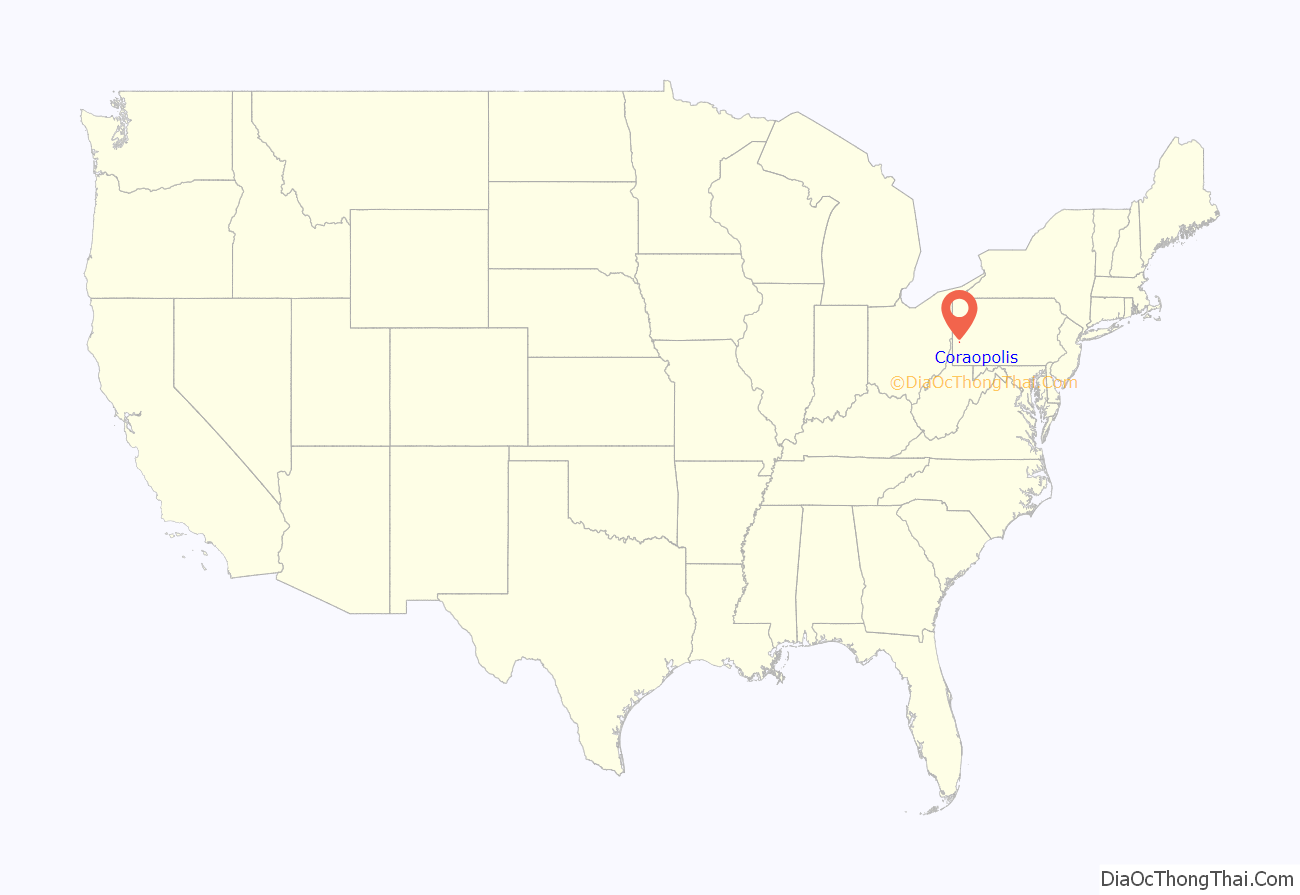
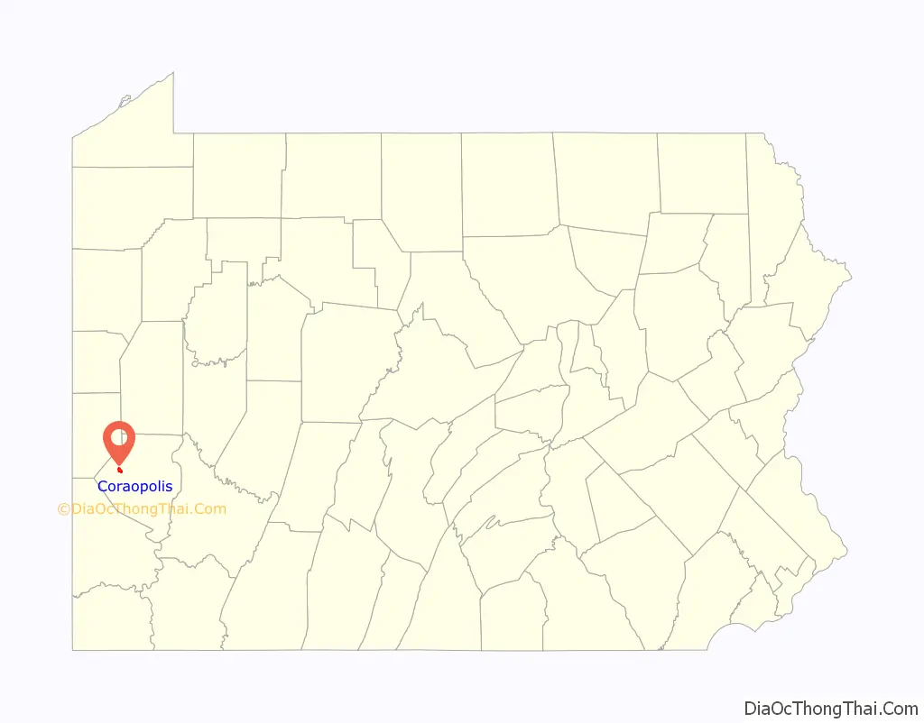
Coraopolis location map. Where is Coraopolis borough?
History
Early history
On April 3, 1769, Andrew Montour, an Indian interpreter who had provided service to English settlers during the French and Indian War, was granted a land patent for approximately 350 acres (1.4 km) of what would later become the borough of Coraopolis and Neville Island. However, there is no evidence that Montour ever lived on this tract. The first permanent white settler in Coraopolis was Capt. Robert Vance, who settled in the vicinity of Montour’s tract around 1773, just prior to the beginning of the American Revolution. Vance, a Virginian, had been a member of the regiment commanded by George Washington at the Braddock expedition during the French and Indian War. For the protection of himself and his neighbors, of whom several arrived within a few years, Vance had a log stockade built with a stone blockhouse to protect the area against Indian raids. This was known as Vance Fort (or Fort Vance). The site of the fort was around present-day Broadway and Chestnut streets, near Second Avenue. Over time the community grew and developed, and it became known as Middletown in the 1800s, either because it was situated midway between Pittsburgh and Beaver, Pennsylvania, or perhaps after an early settler named Alexander Middleton who supposedly ran “Middleton’s Tavern” in the area.
One of the most important early industries in the area was begun by the Watson family, English immigrants who arrived in America in 1830. The Watsons built a sawmill on the site of the former municipal building on Fifth Avenue. Later, they operated a much larger grist mill on the river bank at Mill Street, until 1887.
Founding
The borough was incorporated on June 7, 1886. It was previously known as a village under the name of Middletown, while the post office name was Vancefort. It was established in August 1861, and changed to Coraopolis in March 1886. Legend has it that the borough was named for a member of the Watson family, Cora Watson, who was born on February 2, 1870. However, an old newspaper uncovered by longtime resident and local historian Dr. Frank Braden, Jr. suggests it more likely took the appellation from a Greek word for “maiden city”. According to page 7 of the book Coraopolis, by Gia Tatone, Coraopolis Historical Society (2007), “The newspaper [Dr. Frank Braden, Jr. uncovered] was simply called the News and was published in Coraopolis, Pennsylvania, on June 5, 1897. The newspaper discusses the confusion that was occurring with the post offices in regard to the name Middletown, because several other areas in the state of Pennsylvania shared the same name. With a borough now being established, the Reverend Josiah Dillon, a pioneer clergyman, suggested the name to be changed to Coraopolis. Dillon knew Greek and was also the first burgess (mayor) at the time. So he suggested combining Kore meaning ‘maiden’ and opolis meaning ‘city’ (‘maiden city’) to achieve Koreopolis. However, when Greek letters and pronunciation were turned to English, it is said the spelling therefore accidentally got changed.” The History of Pennsylvania, Page 1577, indicates that the city was built on land, then owned, by James Harvey McCabe and when the borough charter was granted, he was elected first burgess. “and, under his careful and interested administration the departments of the new government and were, in an astonishing short time, working with great lubricity and resulting high efficiency. As he took the lead in the matter of establishing the new form of government, so it was his energetic championing of the projected laying of the tracks of the Pittsburg and Lake Erie through thr borough that made that enterprise possible, his active assistance in securing rights of way being an important factor in its success.”
Growth to modern day
Community development in Coraopolis moved along gradually with the building of the Pittsburgh and Lake Erie Railroad in 1877. Several Coraopolis residents were stockholders in this enterprise. In 1890, oil was discovered at both ends of the borough, which briefly stimulated a population boom. The effects did not last long, however, as the oil supplies were found to be rather modest.
In 1892, community development took off with the construction of the first high-speed electric street railway in the United States. The railway was scheduled to run up to 40 mph, going from Coraopolis, over Neville Island and to McKees Rocks. Along with the railway came Consolidated Lamp and Glass Company to Coraopolis, moving from its location in Fostoria, Ohio. Consolidated Glass employed up to 350 people, and was located in Coraopolis from 1895 until 1963. Other Coraopolis residents worked for the new industries established on Neville Island.
Coraopolis’ first municipal building was built in 1897 on State Avenue and was used until 1929, when next building was constructed on Fifth Ave. Coraopolis dedicated a new municipal complex on Fourth Ave in 2017 that houses all municipal departments, including the police and fire stations.
Two significant contributions to modern educational practice took place in the area. In 1955, Dr. Harry Houtz published a six-year study in the National Education Journal demonstrating that phonics was a more effective way of teaching reading, and in 1957, Herbert Snell published his study of performance-based academic tracking in junior high, which became widely adopted. Coraopolis and Neville Township merged their schools to form Cornell School District in 1971, and all students reported to the new Cornell Educational Center in 1976.
Coraopolis is the birthplace of actors Michael Keaton and S. William Hinzman. Jerry Gibson, a Negro league baseball player, played here for the Coraopolis Grays. The corporate headquarters for Dick’s Sporting Goods is located in Corapolis.
Coraopolis is experiencing a period of revitalization highlighted by new storefront businesses and façade improvements in the central business district. In 2017, two new brewpubs, a craft distillery, a coffee shop, a restaurant, and several other small businesses opened their doors. Coraopolis also shares a new athletic complex with neighboring Robinson and Moon Townships that will feature soccer, rugby, and lacrosse fields, when completed. The 1896 Richardsonian Romanesque train station is also being restored, and will become a community center and event space once completed.
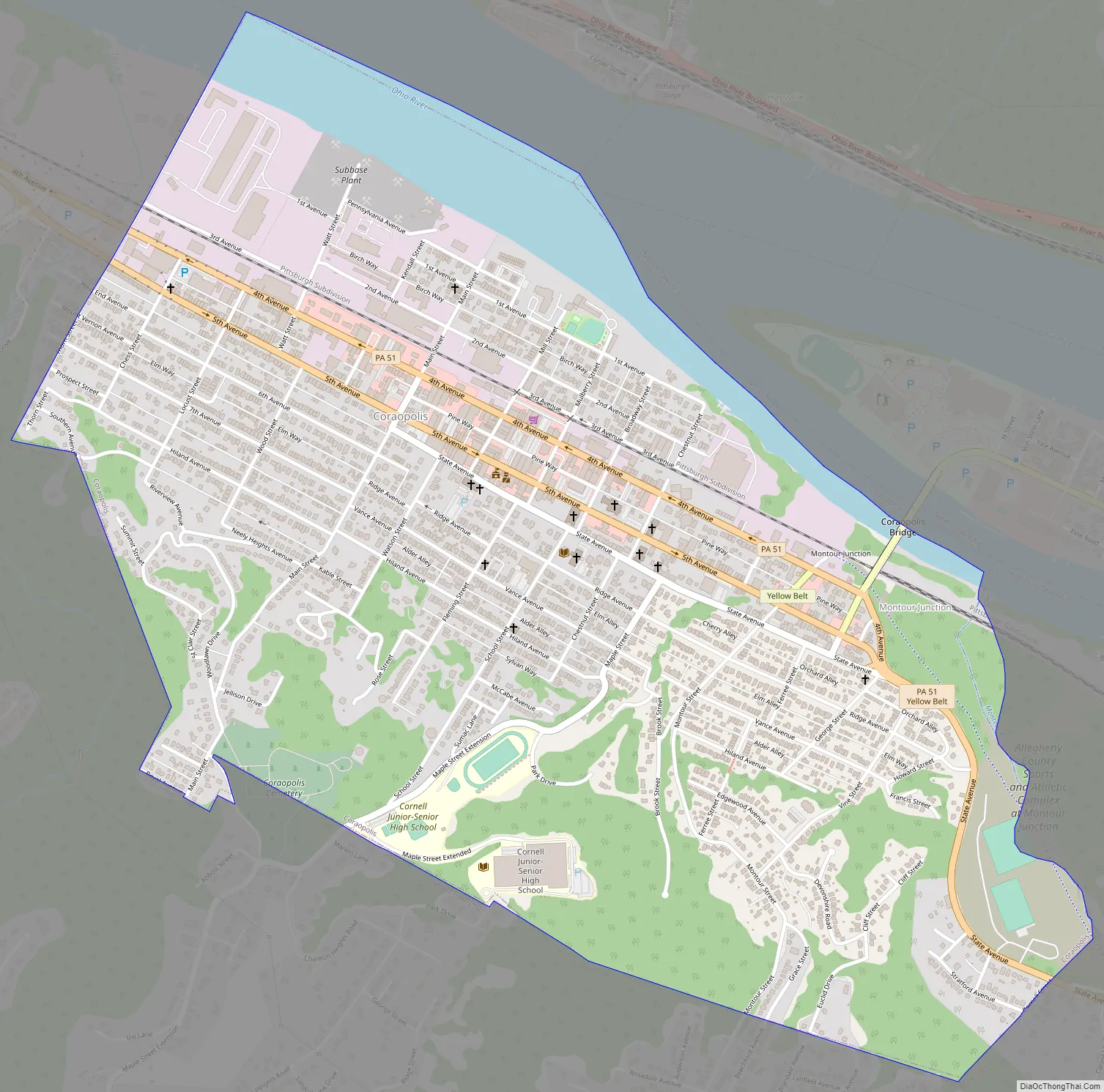
Coraopolis Road Map
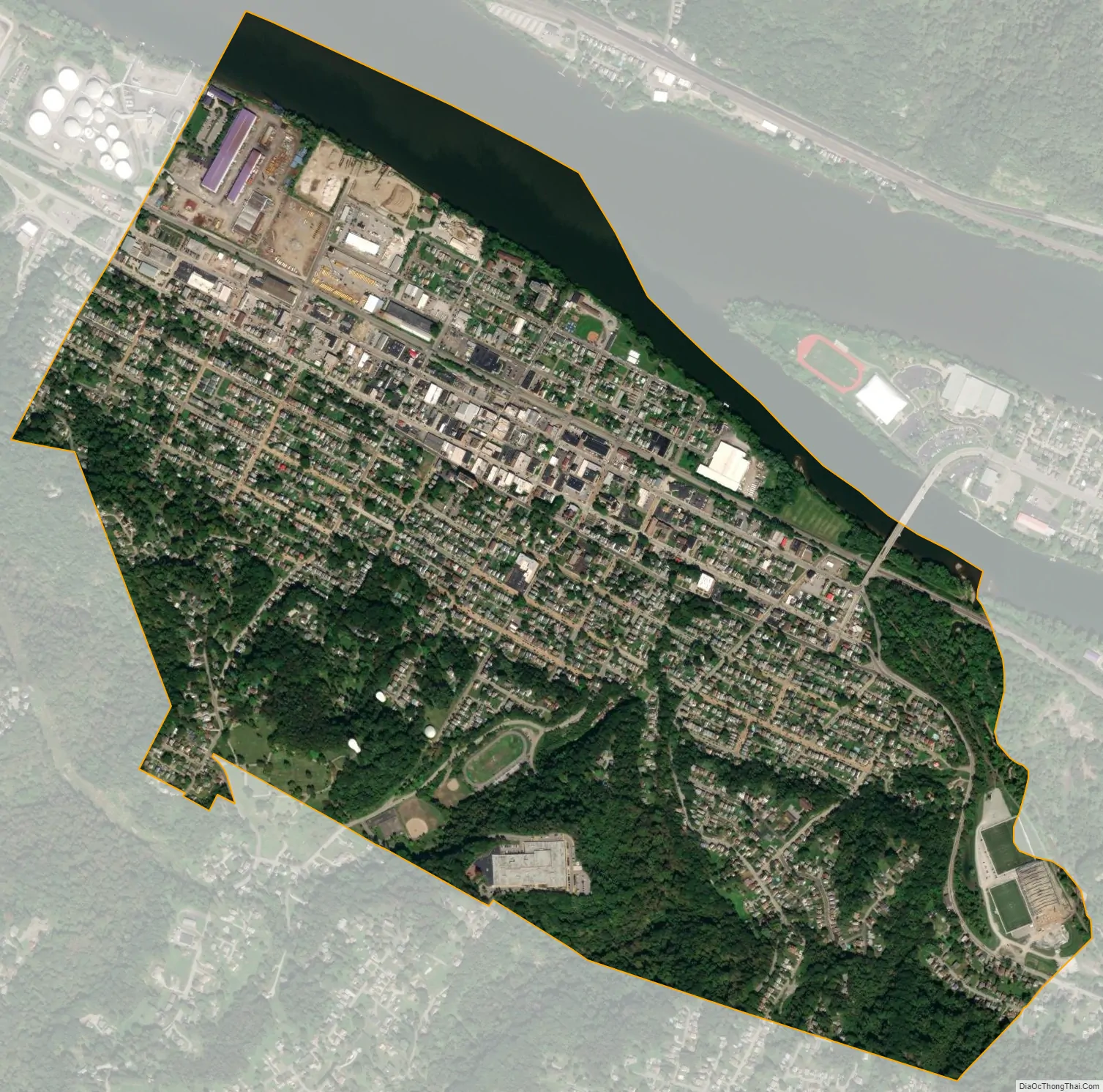
Coraopolis city Satellite Map
Geography
Coraopolis is located at 40°30′57″N 80°9′46″W / 40.51583°N 80.16278°W / 40.51583; -80.16278 (40.515818, -80.162791). According to the U.S. Census Bureau, the borough has a total area of 1.5 square miles (3.9 km), of which 1.3 square miles (3.4 km) is land and 0.1 square miles (0.26 km), or 9.46%, is water.
Surrounding and adjacent communities
Situated along the southern bank of the Ohio River, Coraopolis has two land borders, including Moon Township to the south and west and Robinson Township to the southeast. Across the Ohio River’s back channel, Coraopolis is connected to Neville Island (Neville Township) via the Coraopolis Bridge to the northeast and is adjacent to the boroughs of Haysville, Glen Osborne, and Sewickley across the Ohio River’s confluence at the northeast end of Neville Island.
See also
Map of Pennsylvania State and its subdivision:- Adams
- Allegheny
- Armstrong
- Beaver
- Bedford
- Berks
- Blair
- Bradford
- Bucks
- Butler
- Cambria
- Cameron
- Carbon
- Centre
- Chester
- Clarion
- Clearfield
- Clinton
- Columbia
- Crawford
- Cumberland
- Dauphin
- Delaware
- Elk
- Erie
- Fayette
- Forest
- Franklin
- Fulton
- Greene
- Huntingdon
- Indiana
- Jefferson
- Juniata
- Lackawanna
- Lancaster
- Lawrence
- Lebanon
- Lehigh
- Luzerne
- Lycoming
- Mc Kean
- Mercer
- Mifflin
- Monroe
- Montgomery
- Montour
- Northampton
- Northumberland
- Perry
- Philadelphia
- Pike
- Potter
- Schuylkill
- Snyder
- Somerset
- Sullivan
- Susquehanna
- Tioga
- Union
- Venango
- Warren
- Washington
- Wayne
- Westmoreland
- Wyoming
- York
- Alabama
- Alaska
- Arizona
- Arkansas
- California
- Colorado
- Connecticut
- Delaware
- District of Columbia
- Florida
- Georgia
- Hawaii
- Idaho
- Illinois
- Indiana
- Iowa
- Kansas
- Kentucky
- Louisiana
- Maine
- Maryland
- Massachusetts
- Michigan
- Minnesota
- Mississippi
- Missouri
- Montana
- Nebraska
- Nevada
- New Hampshire
- New Jersey
- New Mexico
- New York
- North Carolina
- North Dakota
- Ohio
- Oklahoma
- Oregon
- Pennsylvania
- Rhode Island
- South Carolina
- South Dakota
- Tennessee
- Texas
- Utah
- Vermont
- Virginia
- Washington
- West Virginia
- Wisconsin
- Wyoming


