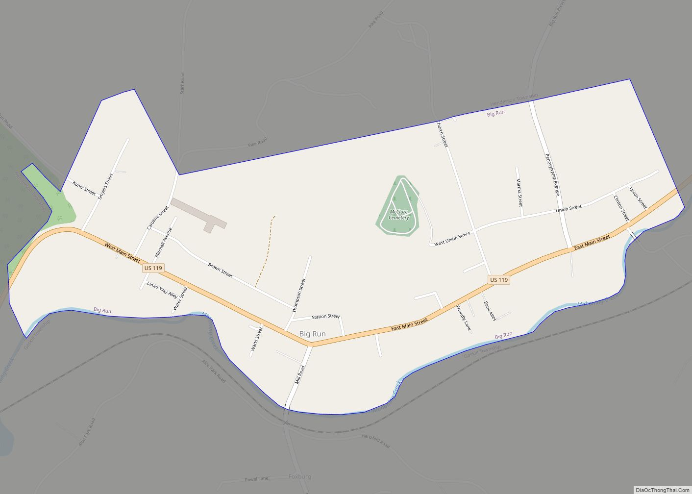
Crenshaw is an unincorporated community and census-designated place in Snyder Township, Jefferson County in the U.S. state of Pennsylvania. It is approximately 2 miles (3 km) east of the borough of Brockway on U.S. Route 219. As of the 2010 census, the population was 468 residents.
| Name: | Crenshaw CDP |
|---|---|
| LSAD Code: | 57 |
| LSAD Description: | CDP (suffix) |
| State: | Pennsylvania |
| County: | Jefferson County |
| Elevation: | 1,480 ft (450 m) |
| Total Area: | 1.12 sq mi (2.89 km²) |
| Land Area: | 1.09 sq mi (2.84 km²) |
| Water Area: | 0.02 sq mi (0.05 km²) |
| Total Population: | 423 |
| Population Density: | 386.30/sq mi (149.11/km²) |
| FIPS code: | 4217040 |
| GNISfeature ID: | 2630002 |
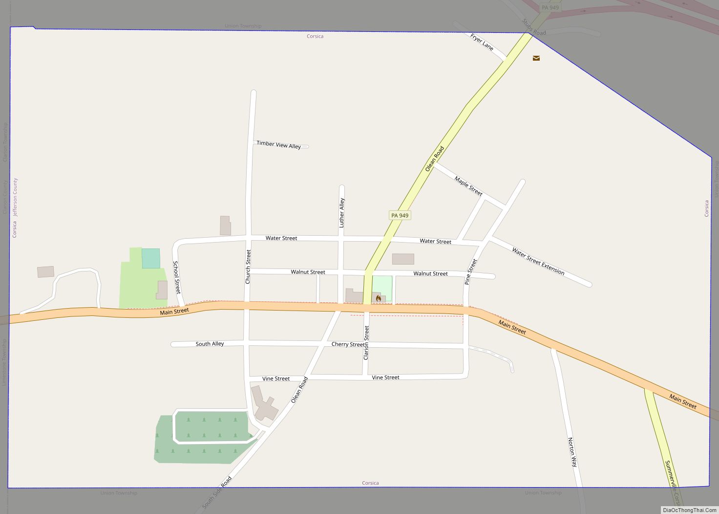
Online Interactive Map
Click on ![]() to view map in "full screen" mode.
to view map in "full screen" mode.
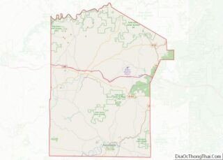
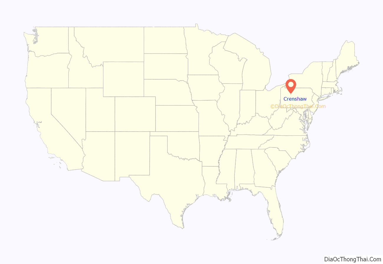
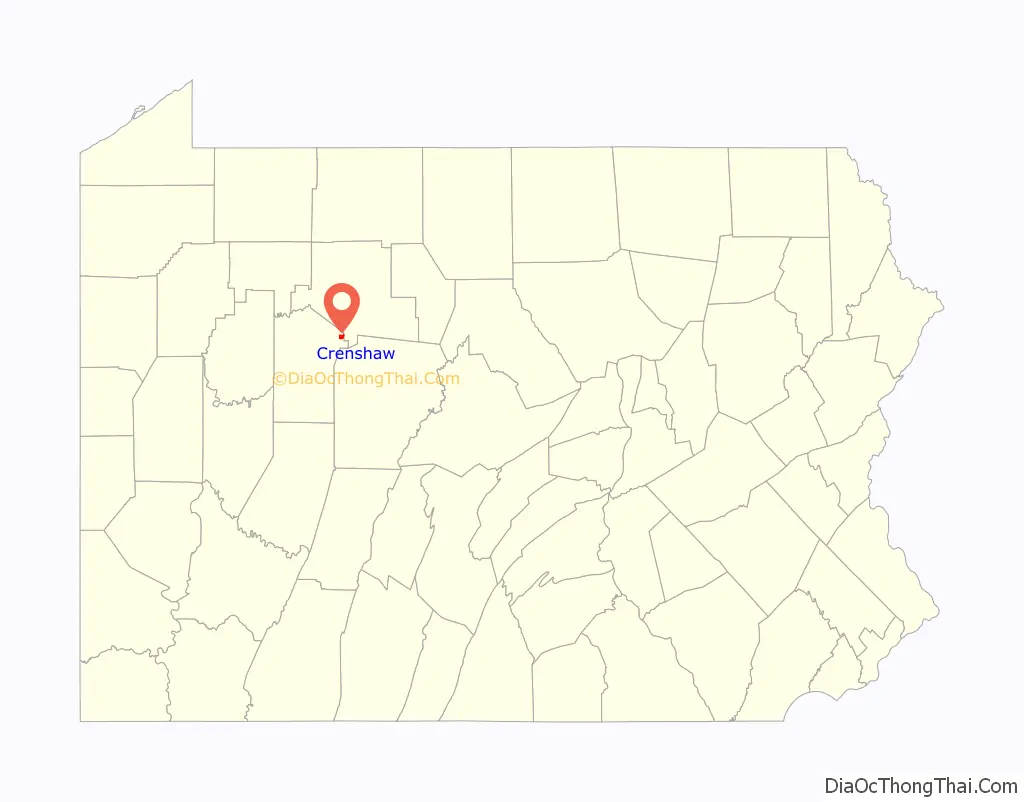
Crenshaw location map. Where is Crenshaw CDP?
History
The railroad was extended to Crenshaw around 1882. A post office was established at Crenshaw in 1886, and remained in operation until 1967.
Crenshaw Road Map
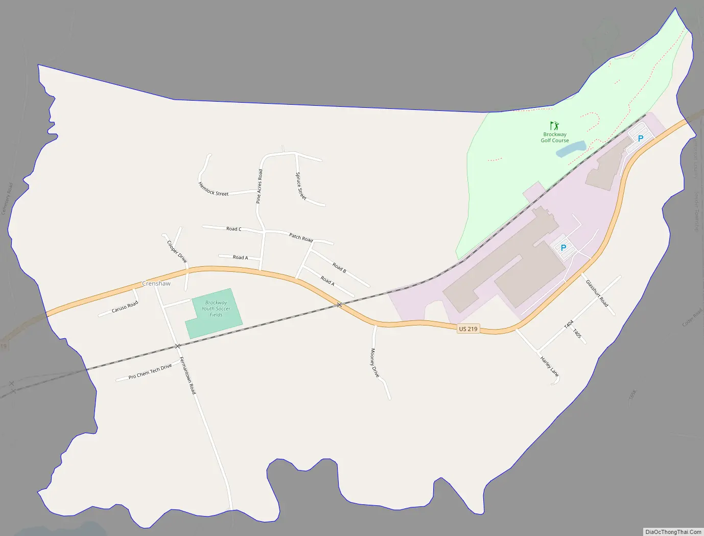
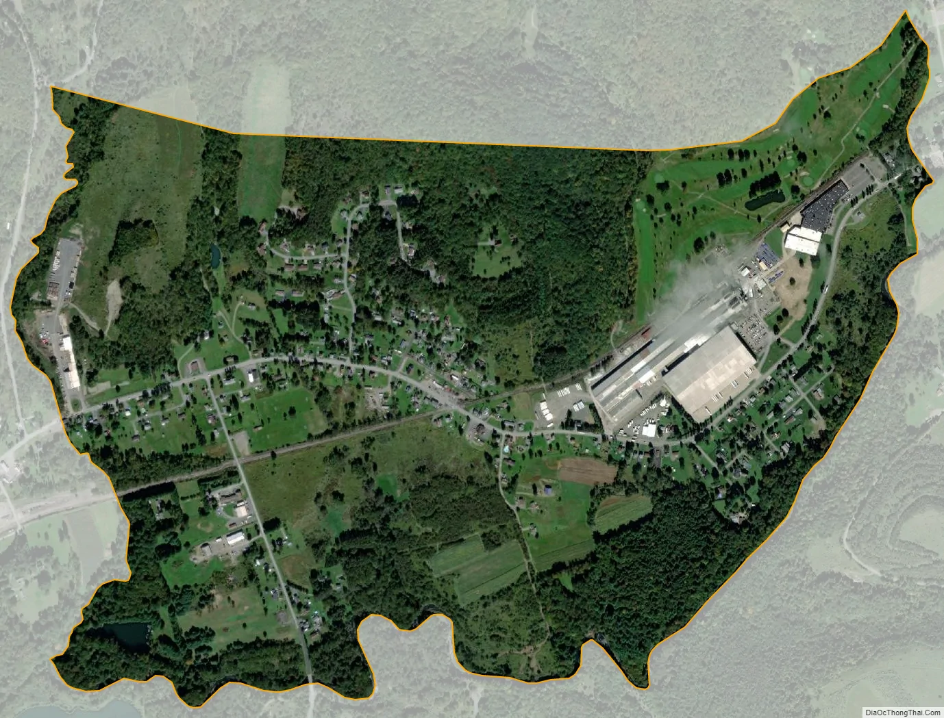
Crenshaw city Satellite Map
See also
Map of Pennsylvania State and its subdivision:- Adams
- Allegheny
- Armstrong
- Beaver
- Bedford
- Berks
- Blair
- Bradford
- Bucks
- Butler
- Cambria
- Cameron
- Carbon
- Centre
- Chester
- Clarion
- Clearfield
- Clinton
- Columbia
- Crawford
- Cumberland
- Dauphin
- Delaware
- Elk
- Erie
- Fayette
- Forest
- Franklin
- Fulton
- Greene
- Huntingdon
- Indiana
- Jefferson
- Juniata
- Lackawanna
- Lancaster
- Lawrence
- Lebanon
- Lehigh
- Luzerne
- Lycoming
- Mc Kean
- Mercer
- Mifflin
- Monroe
- Montgomery
- Montour
- Northampton
- Northumberland
- Perry
- Philadelphia
- Pike
- Potter
- Schuylkill
- Snyder
- Somerset
- Sullivan
- Susquehanna
- Tioga
- Union
- Venango
- Warren
- Washington
- Wayne
- Westmoreland
- Wyoming
- York
- Alabama
- Alaska
- Arizona
- Arkansas
- California
- Colorado
- Connecticut
- Delaware
- District of Columbia
- Florida
- Georgia
- Hawaii
- Idaho
- Illinois
- Indiana
- Iowa
- Kansas
- Kentucky
- Louisiana
- Maine
- Maryland
- Massachusetts
- Michigan
- Minnesota
- Mississippi
- Missouri
- Montana
- Nebraska
- Nevada
- New Hampshire
- New Jersey
- New Mexico
- New York
- North Carolina
- North Dakota
- Ohio
- Oklahoma
- Oregon
- Pennsylvania
- Rhode Island
- South Carolina
- South Dakota
- Tennessee
- Texas
- Utah
- Vermont
- Virginia
- Washington
- West Virginia
- Wisconsin
- Wyoming