Darby is a borough in Delaware County, Pennsylvania, United States. The borough is located along Darby Creek 5 miles (8.0 km) southwest of Center City Philadelphia. The borough of Darby is distinct from the nearby municipality of Darby Township.
| Name: | Darby borough |
|---|---|
| LSAD Code: | 21 |
| LSAD Description: | borough (suffix) |
| State: | Pennsylvania |
| County: | Delaware County |
| Elevation: | 79 ft (24 m) |
| Total Area: | 0.84 sq mi (2.18 km²) |
| Land Area: | 0.84 sq mi (2.18 km²) |
| Water Area: | 0.00 sq mi (0.00 km²) |
| Total Population: | 10,715 |
| Population Density: | 12,725.65/sq mi (4,912.05/km²) |
| ZIP code: | 19023 |
| FIPS code: | 4218152 |
| Website: | www.darbyborough.com |
Online Interactive Map
Click on ![]() to view map in "full screen" mode.
to view map in "full screen" mode.
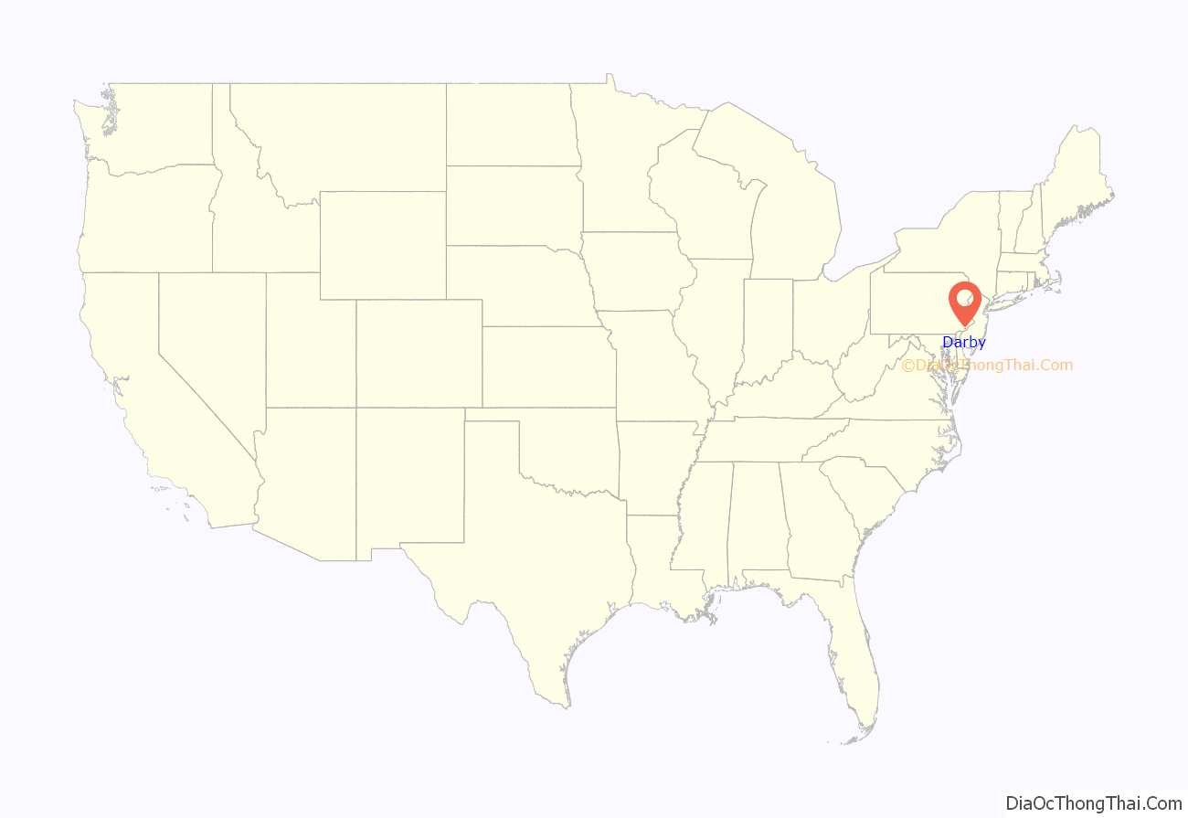
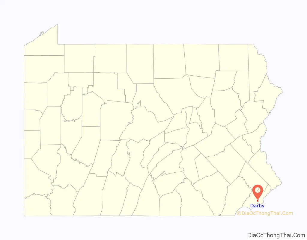
Darby location map. Where is Darby borough?
History
Darby was settled in 1682 by seven Quaker families led by abolitionist & fair trade avocate John Blunston. The name Darby is derived from the English city of Derby (pronounced “Darby”), the county town of Derbyshire (pronounced “Darbyshire”), the origin of many early settlers. Incorporated on May 3, 1853, it had 3,429 residents in 1900, 6,305 in 1910, 10,334 in 1940, and 10,687 at the 2010 census.
Darby founder John Blunston immigrated to Pennsylvania in October 1682. He was involved in real estate, agriculture, and goods trading. An early Quaker settler, Blunston was a close associate of William Penn and an active political figure in early Pennsylvania. He first served in the Colonial Assembly from 1683 to 1688. In this early stage of provincial government, Blunston became a strong proponent for the rights of the Assembly. In 1685 Blunston was appointed to a committee that argued against the Provincial Council’s practice of enacting laws without legislative approval. In the same year, Blunston led the Assembly in their attempt to impeach Chief Justice Nicholas More. Blunston returned to the Assembly for the 1695 term. During his second period of service in the Assembly, he was elected the 12th Speaker of the Assembly on May 10, 1697. He was re-elected Speaker on May 10, 1699, and again on May 10, 1700. During this time he was instrumental in drafting a new frame of government for the Province. He retired from the Assembly after the 1701 term.
In addition to Blunston’s service in the Assembly, he served as a Provincial Councilor starting in 1700 and ending in 1723. He served as justice of the peace for Chester County from 1684 to 1693 and again from 1695 to 1703. He was also actively involved with Darby Quaker Meeting House in Chester County (now Delaware County), and was one of the Quakers who fought to cease the slave trade amongst Friends. He called upon purchasers to boycott products made by slaves as stolen products, thus advocating what we would call today a “Fair Trade” policy. He represented the Chester Quarterly Meeting at the Philadelphia Yearly Meeting of Friends 17 times between 1688 and 1715.
Darby is home to the fifth-oldest all-volunteer Fire Department and the Darby Free Library, one of the oldest libraries in the United States, founded in 1743.The Darby Friends Burial Ground is the oldest Cemetery in Pennsylvania in continuous use, opened in 1682.
The first temperance society in Pennsylvania, of which a record has been found was that of “Darby Association for Discouraging the Unnecessary Use of Spirituous Liquors” organized in Delaware County in 1819, at the Darby Friends Meetinghouse. (Pg 20 Temperance Movement Prior to the Civil War, Asa Earl Martin; The PA Magazine of History & Biography, 1925 Vol 49 #3)
In 1833, three of the founding fourteen women to create the Pennsylvania Female Anti Slavery Society were members of the Darby Friends Meeting.
Violent racial incidents hit all over the country as part of the 1919 Red Summer. The Darby 1919 lynching attempt was the attempted lynching of Samuel Gorman of Darby on July 23, 1919. Samuel Gorman, a 17-year-old black boy, was sent to jail for the alleged murder of William E. Taylor.
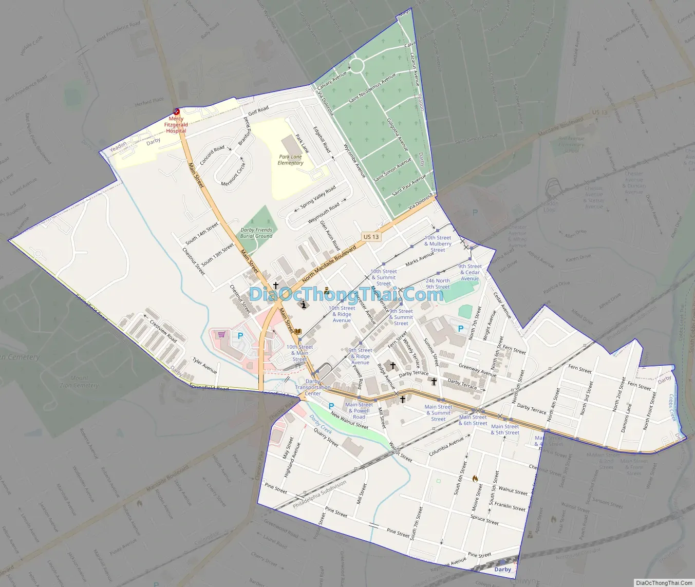
Darby Road Map
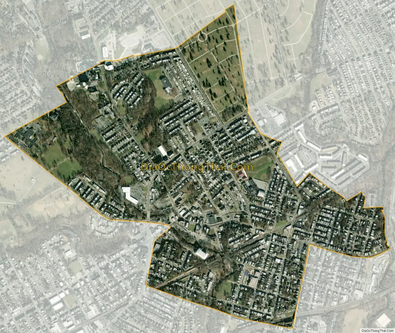
Darby city Satellite Map
Geography
Darby has a total area of 0.8 square miles (2.1 km), all land. It has a humid subtropical climate (Cfa) and average monthly temperatures range from 33.6 °F in January to 78.3 °F in July.
See also
Map of Pennsylvania State and its subdivision:- Adams
- Allegheny
- Armstrong
- Beaver
- Bedford
- Berks
- Blair
- Bradford
- Bucks
- Butler
- Cambria
- Cameron
- Carbon
- Centre
- Chester
- Clarion
- Clearfield
- Clinton
- Columbia
- Crawford
- Cumberland
- Dauphin
- Delaware
- Elk
- Erie
- Fayette
- Forest
- Franklin
- Fulton
- Greene
- Huntingdon
- Indiana
- Jefferson
- Juniata
- Lackawanna
- Lancaster
- Lawrence
- Lebanon
- Lehigh
- Luzerne
- Lycoming
- Mc Kean
- Mercer
- Mifflin
- Monroe
- Montgomery
- Montour
- Northampton
- Northumberland
- Perry
- Philadelphia
- Pike
- Potter
- Schuylkill
- Snyder
- Somerset
- Sullivan
- Susquehanna
- Tioga
- Union
- Venango
- Warren
- Washington
- Wayne
- Westmoreland
- Wyoming
- York
- Alabama
- Alaska
- Arizona
- Arkansas
- California
- Colorado
- Connecticut
- Delaware
- District of Columbia
- Florida
- Georgia
- Hawaii
- Idaho
- Illinois
- Indiana
- Iowa
- Kansas
- Kentucky
- Louisiana
- Maine
- Maryland
- Massachusetts
- Michigan
- Minnesota
- Mississippi
- Missouri
- Montana
- Nebraska
- Nevada
- New Hampshire
- New Jersey
- New Mexico
- New York
- North Carolina
- North Dakota
- Ohio
- Oklahoma
- Oregon
- Pennsylvania
- Rhode Island
- South Carolina
- South Dakota
- Tennessee
- Texas
- Utah
- Vermont
- Virginia
- Washington
- West Virginia
- Wisconsin
- Wyoming


