Derry is a borough in Westmoreland County in the Commonwealth of Pennsylvania, United States, 45 miles (72 km) east of Pittsburgh. The Borough of Derry, consisting of the town area, should not be confused with Derry Township, which is a separate municipality surrounding the borough. The population was 2,637 at the 2020 census.
| Name: | Derry borough |
|---|---|
| LSAD Code: | 21 |
| LSAD Description: | borough (suffix) |
| State: | Pennsylvania |
| County: | Westmoreland County |
| Incorporated: | October 22, 1881 |
| Elevation: | 1,171 ft (357 m) |
| Total Area: | 0.80 sq mi (2.06 km²) |
| Land Area: | 0.77 sq mi (2.00 km²) |
| Water Area: | 0.02 sq mi (0.06 km²) |
| Total Population: | 2,639 |
| Population Density: | 3,418.39/sq mi (1,320.00/km²) |
| Area code: | 724, 878 |
| FIPS code: | 4218960 |
Online Interactive Map
Click on ![]() to view map in "full screen" mode.
to view map in "full screen" mode.
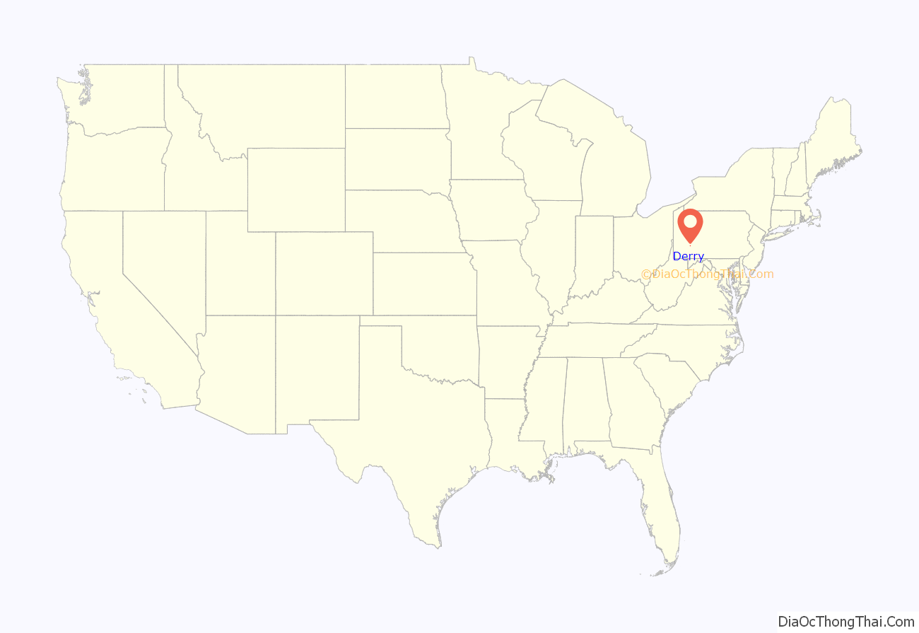
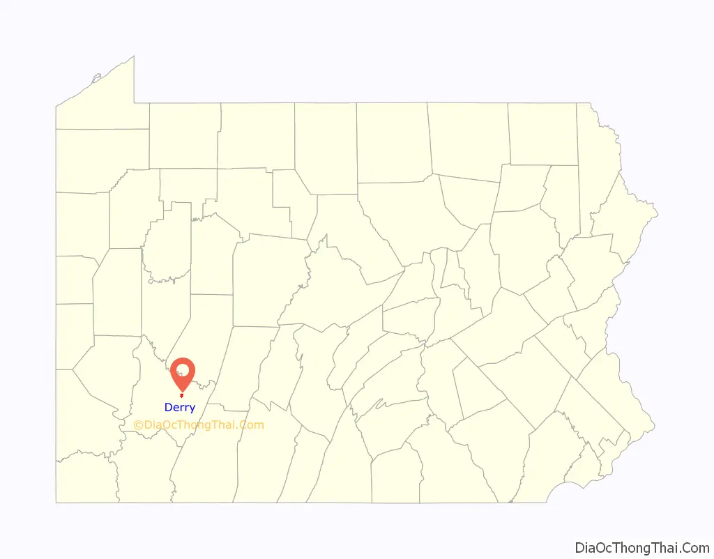
Derry location map. Where is Derry borough?
History
Derry, originally known as Derry Station, was created in 1852 to serve the Pennsylvania Railroad. It was named after the village on PA Route 982 originally known as Derry and now known as New Derry (even though it is older than the community being discussed here). The original “Derry” in Westmoreland County, Pennsylvania, was named after the City of Derry in Ulster, the northern province in Ireland, because the area’s first non-Native American inhabitants were Scotch-Irish (also known as Ulster-Scots).
Derry was ideally suited for major railroad facilities because of its ready access to water from McGee Run (essential in the era of steam locomotives) and because it sits atop a slight summit along the railroad right-of-way. In Derry’s heyday in the late 1800s, it had four hotels, mainly to serve railroad workers, as well as a roundhouse for locomotive maintenance and a massive railroad yard. Derry was incorporated as a borough on October 22, 1881.
Also, Derry served as the terminal for Pittsburgh commuter trains until 1964, when the Pennsylvania Railroad ceased operating its commuter service. The annual Railroad Days Festival serves to remind residents of Derry’s railroading heritage.
Little remains of Derry’s railroading boom, although some might notice an unused railroad right-of-way that extends from Derry westward to PA Route 981, running slightly north but parallel to the currently-used railroad tracks. This was an ill-fated project known as the Derry-Donohoe-Jeannette bypass, in which the Pennsylvania Railroad attempted to build a new main line that would avoid the curves and slopes of the existing main line, bypassing Latrobe and Greensburg. Construction of the bypass began in the 1920s, including a large trestle near Bradenville, but the new route was never completed.
Derry and Latrobe were also linked by the Westmoreland County Railway Company which was an interurban (long-distance trolley) operating from 1904 to 1932.
A helicopter crash into a crowd assembled for a festival at St. Joseph’s Catholic Church in Derry killed eight people and injured 18 others on Labor Day, 1978. The railroad crossing in downtown Derry has also been the site of other fatal accidents.
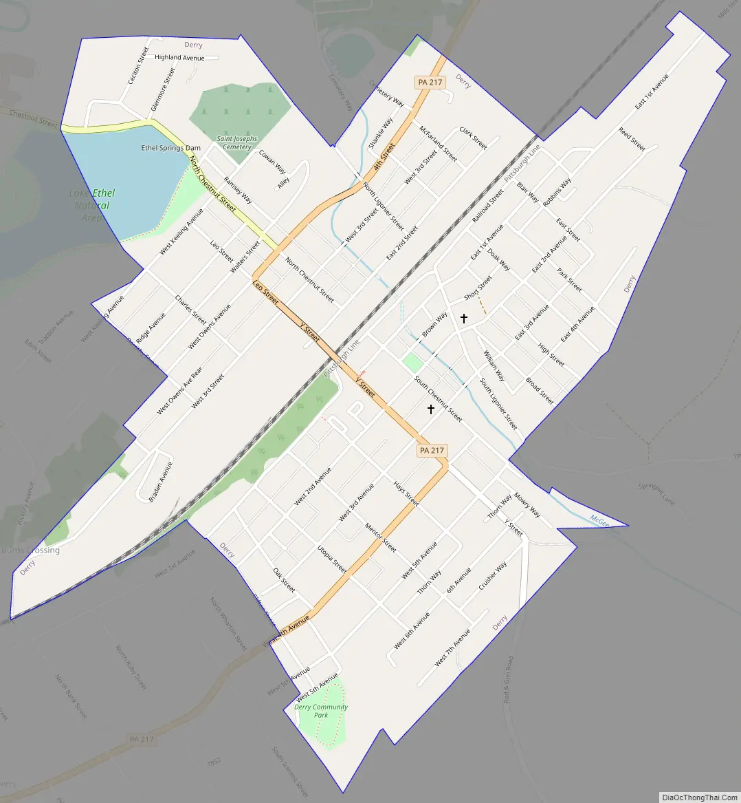
Derry Road Map
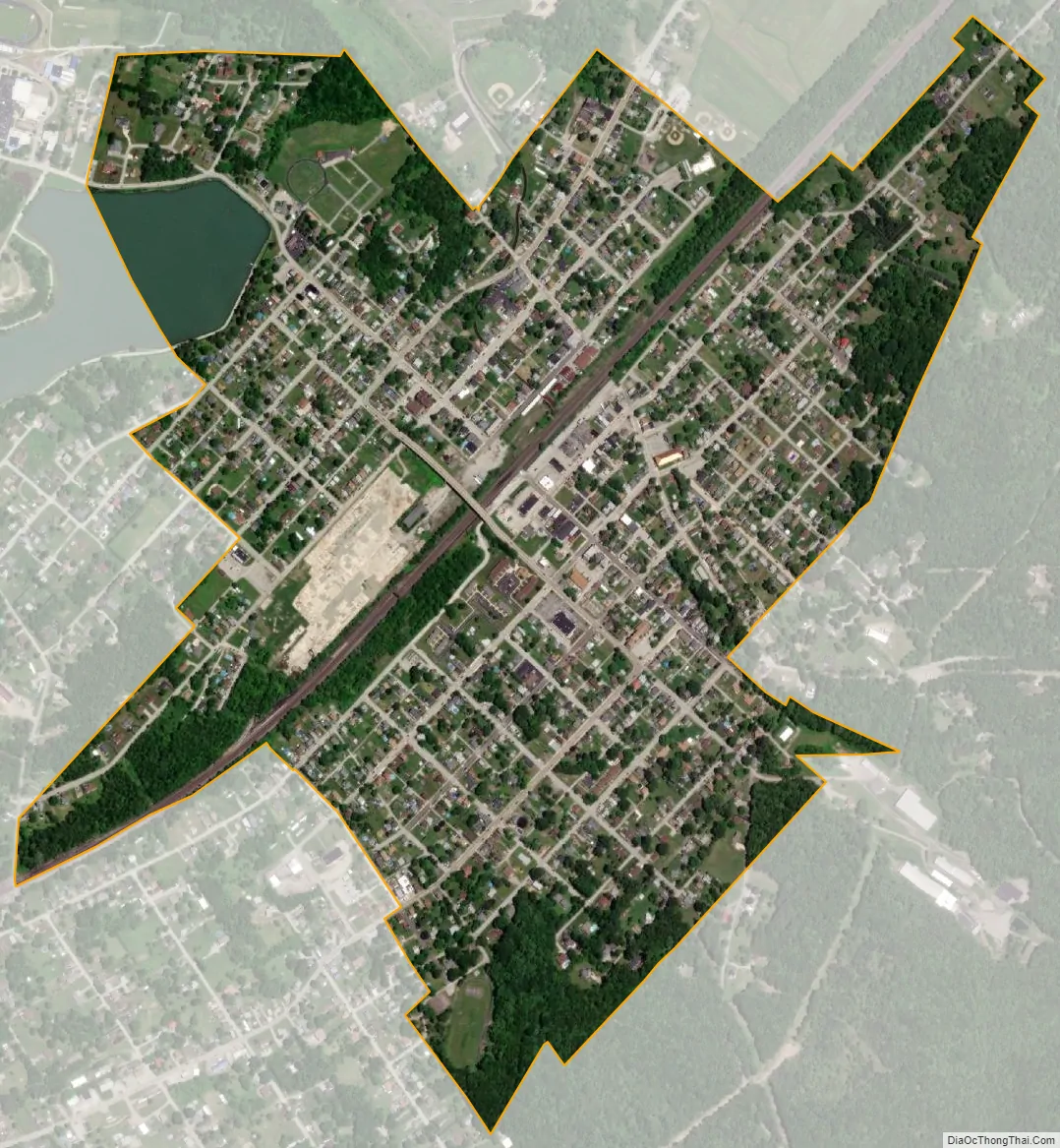
Derry city Satellite Map
Geography
Derry is located at 40°19′59″N 79°18′4″W / 40.33306°N 79.30111°W / 40.33306; -79.30111 (40.333037, -79.301011). According to the United States Census Bureau, the borough has a total area of 0.8 square miles (2.1 km), of which 0.8 square miles (2.1 km) is land and 0.04 square miles (0.10 km) (2.41%) is water.
Climate
The climate in this area is characterized by hot, humid summers and generally mild to cool winters. According to the Köppen Climate Classification system, Derry has a humid subtropical climate, abbreviated “Cfa” on climate maps.
See also
Map of Pennsylvania State and its subdivision:- Adams
- Allegheny
- Armstrong
- Beaver
- Bedford
- Berks
- Blair
- Bradford
- Bucks
- Butler
- Cambria
- Cameron
- Carbon
- Centre
- Chester
- Clarion
- Clearfield
- Clinton
- Columbia
- Crawford
- Cumberland
- Dauphin
- Delaware
- Elk
- Erie
- Fayette
- Forest
- Franklin
- Fulton
- Greene
- Huntingdon
- Indiana
- Jefferson
- Juniata
- Lackawanna
- Lancaster
- Lawrence
- Lebanon
- Lehigh
- Luzerne
- Lycoming
- Mc Kean
- Mercer
- Mifflin
- Monroe
- Montgomery
- Montour
- Northampton
- Northumberland
- Perry
- Philadelphia
- Pike
- Potter
- Schuylkill
- Snyder
- Somerset
- Sullivan
- Susquehanna
- Tioga
- Union
- Venango
- Warren
- Washington
- Wayne
- Westmoreland
- Wyoming
- York
- Alabama
- Alaska
- Arizona
- Arkansas
- California
- Colorado
- Connecticut
- Delaware
- District of Columbia
- Florida
- Georgia
- Hawaii
- Idaho
- Illinois
- Indiana
- Iowa
- Kansas
- Kentucky
- Louisiana
- Maine
- Maryland
- Massachusetts
- Michigan
- Minnesota
- Mississippi
- Missouri
- Montana
- Nebraska
- Nevada
- New Hampshire
- New Jersey
- New Mexico
- New York
- North Carolina
- North Dakota
- Ohio
- Oklahoma
- Oregon
- Pennsylvania
- Rhode Island
- South Carolina
- South Dakota
- Tennessee
- Texas
- Utah
- Vermont
- Virginia
- Washington
- West Virginia
- Wisconsin
- Wyoming


