Drexel Hill is a neighborhood and census-designated place (CDP) located in Upper Darby, Pennsylvania, United States. The population was 29,181 at the 2020 census, an increase over the figure of 28,043 tabulated in 2010, and accounting for over one-third of Upper Darby’s population.
| Name: | Drexel Hill CDP |
|---|---|
| LSAD Code: | 57 |
| LSAD Description: | CDP (suffix) |
| State: | Pennsylvania |
| County: | Delaware County |
| Elevation: | 246 ft (75 m) |
| Total Area: | 3.2 sq mi (8 km²) |
| Land Area: | 3.2 sq mi (8 km²) |
| Water Area: | 0.0 sq mi (0 km²) |
| Total Population: | 28,043 |
| Population Density: | 8,800/sq mi (3,400/km²) |
| ZIP code: | 19026 |
| FIPS code: | 4219920 |
Online Interactive Map
Click on ![]() to view map in "full screen" mode.
to view map in "full screen" mode.
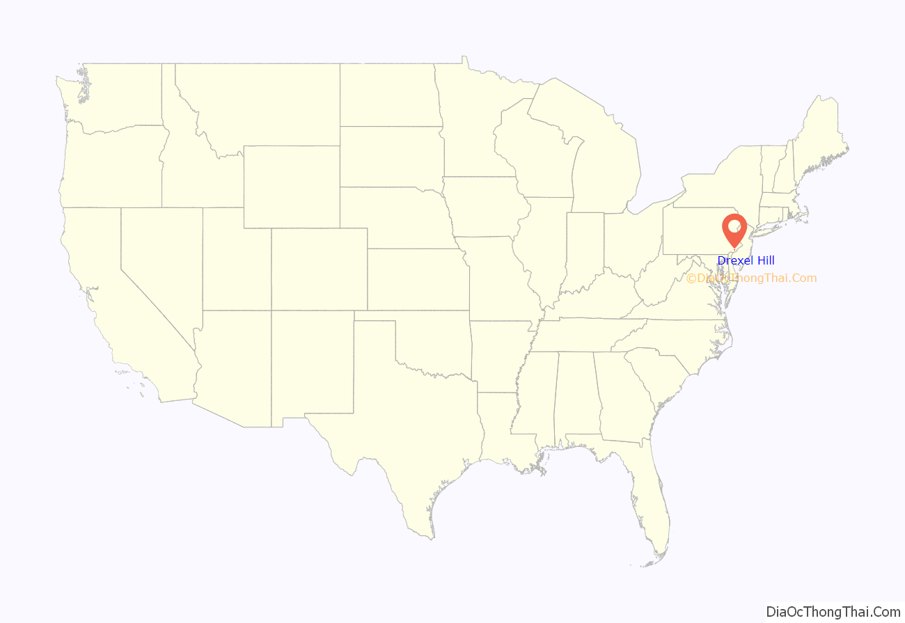
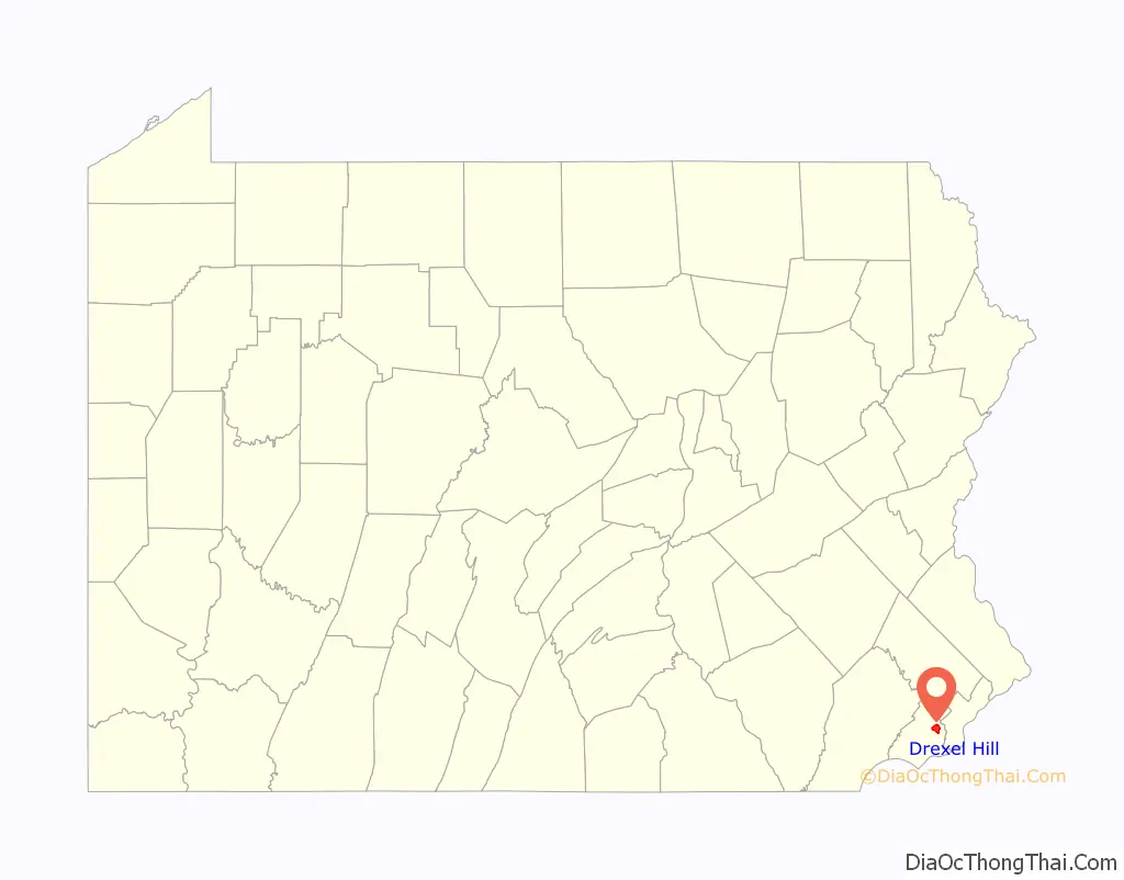
Drexel Hill location map. Where is Drexel Hill CDP?
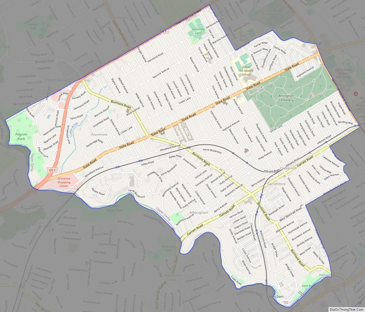
Drexel Hill Road Map
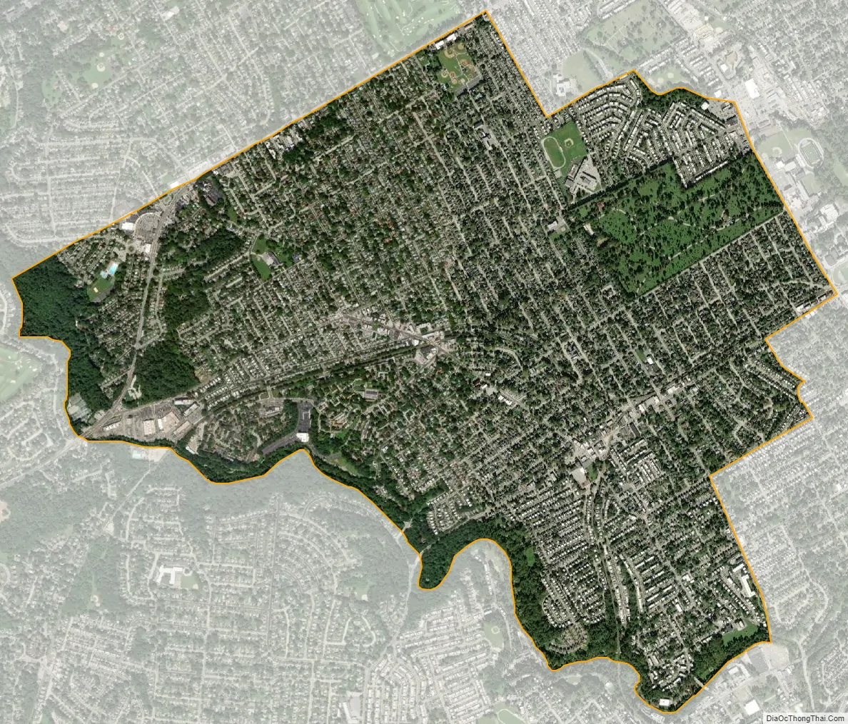
Drexel Hill city Satellite Map
Geography
Drexel Hill is located in the western part of Upper Darby Township at 39°57′00″N 75°18′7″W / 39.95000°N 75.30194°W / 39.95000; -75.30194 (39.949962, -75.301841). The neighborhood is eight miles from Center City, Philadelphia and is bordered to the north by Haverford Township, to the east by the Kirklyn, Highland Park, Beverly Hills, and Bywood neighborhoods of Upper Darby, to the southeast by the borough of Lansdowne, to the south by the borough of Clifton Heights and the Westbrook Park neighborhood of Upper Darby, and to the southwest by Springfield Township. Darby Creek forms the southwestern/southern border of the CDP. U.S. Route 1 (Township Line Road) runs through the northwestern corner of the CDP and forms most of its northern border with Haverford Township.
The CDP has a total area of 3.2 square miles (8.3 km), all land.
See also
Map of Pennsylvania State and its subdivision:- Adams
- Allegheny
- Armstrong
- Beaver
- Bedford
- Berks
- Blair
- Bradford
- Bucks
- Butler
- Cambria
- Cameron
- Carbon
- Centre
- Chester
- Clarion
- Clearfield
- Clinton
- Columbia
- Crawford
- Cumberland
- Dauphin
- Delaware
- Elk
- Erie
- Fayette
- Forest
- Franklin
- Fulton
- Greene
- Huntingdon
- Indiana
- Jefferson
- Juniata
- Lackawanna
- Lancaster
- Lawrence
- Lebanon
- Lehigh
- Luzerne
- Lycoming
- Mc Kean
- Mercer
- Mifflin
- Monroe
- Montgomery
- Montour
- Northampton
- Northumberland
- Perry
- Philadelphia
- Pike
- Potter
- Schuylkill
- Snyder
- Somerset
- Sullivan
- Susquehanna
- Tioga
- Union
- Venango
- Warren
- Washington
- Wayne
- Westmoreland
- Wyoming
- York
- Alabama
- Alaska
- Arizona
- Arkansas
- California
- Colorado
- Connecticut
- Delaware
- District of Columbia
- Florida
- Georgia
- Hawaii
- Idaho
- Illinois
- Indiana
- Iowa
- Kansas
- Kentucky
- Louisiana
- Maine
- Maryland
- Massachusetts
- Michigan
- Minnesota
- Mississippi
- Missouri
- Montana
- Nebraska
- Nevada
- New Hampshire
- New Jersey
- New Mexico
- New York
- North Carolina
- North Dakota
- Ohio
- Oklahoma
- Oregon
- Pennsylvania
- Rhode Island
- South Carolina
- South Dakota
- Tennessee
- Texas
- Utah
- Vermont
- Virginia
- Washington
- West Virginia
- Wisconsin
- Wyoming


