Dushore is a borough in Sullivan County, Pennsylvania, United States. The population was 450 at the 2020 census. Dushore is home to Sullivan County’s only traffic light.
| Name: | Dushore borough |
|---|---|
| LSAD Code: | 21 |
| LSAD Description: | borough (suffix) |
| State: | Pennsylvania |
| County: | Sullivan County |
| Elevation: | 1,450 ft (440 m) |
| Total Area: | 0.80 sq mi (2.08 km²) |
| Land Area: | 0.79 sq mi (2.04 km²) |
| Water Area: | 0.02 sq mi (0.04 km²) |
| Total Population: | 451 |
| Population Density: | 572.34/sq mi (220.93/km²) |
| Area code: | 570 |
| FIPS code: | 4220528 |
Online Interactive Map
Click on ![]() to view map in "full screen" mode.
to view map in "full screen" mode.
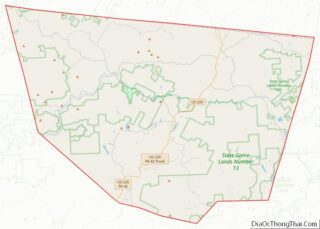
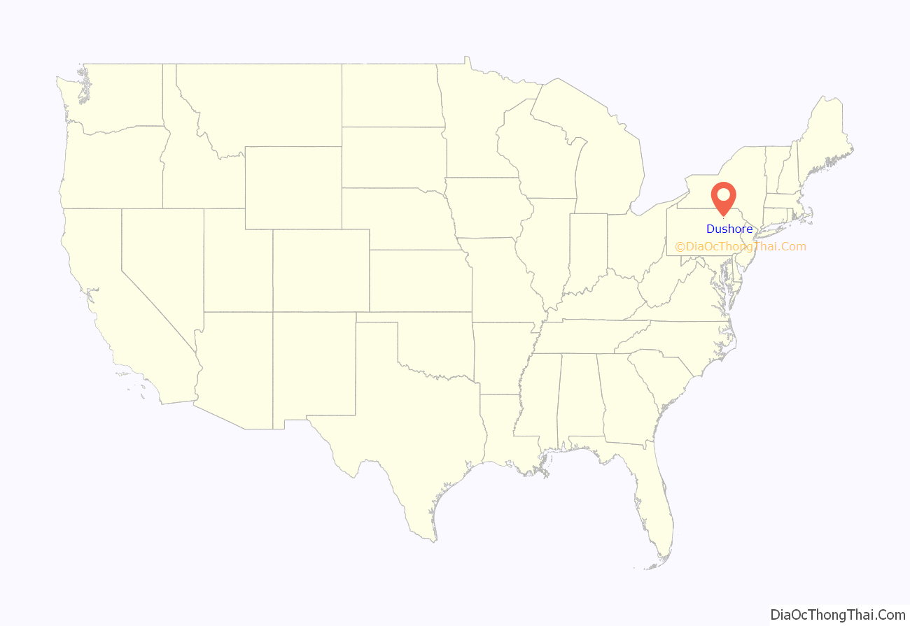
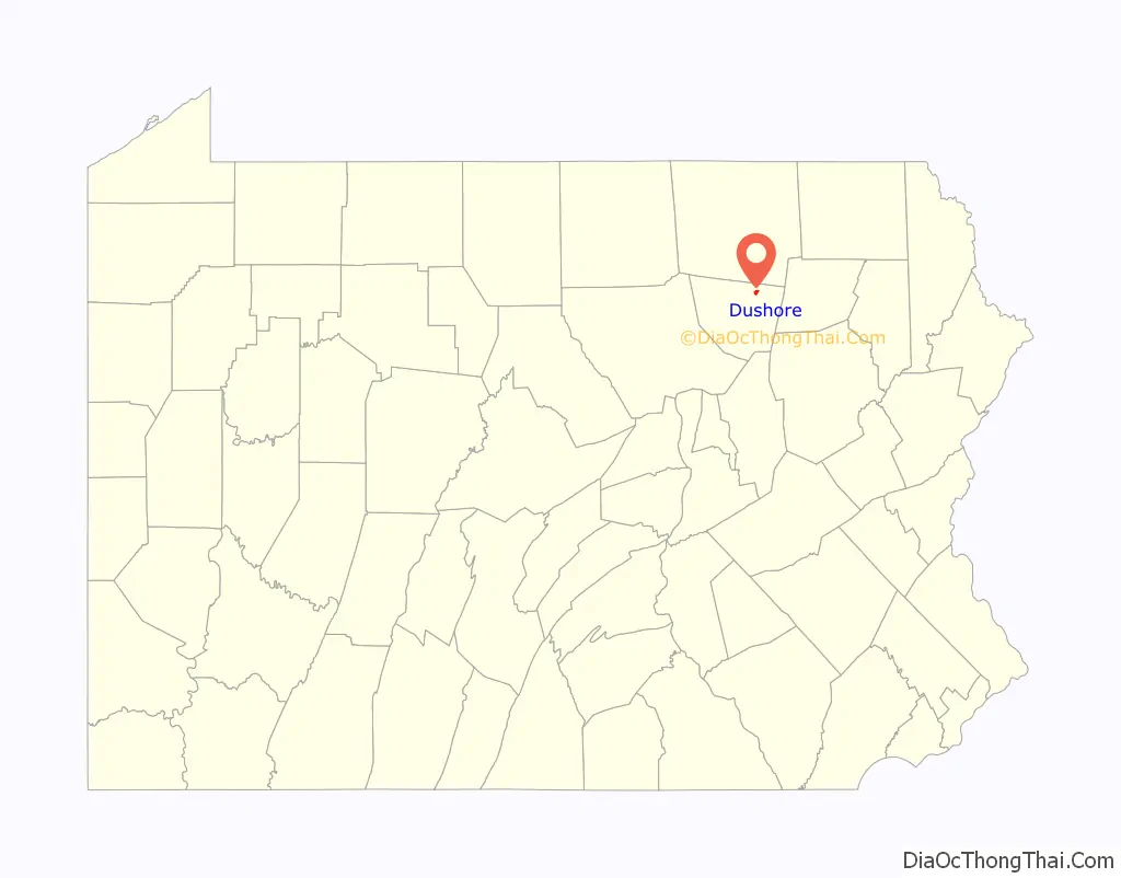
Dushore location map. Where is Dushore borough?
History
The first permanent settler in the Dushore area was General Cornwallace Jackson, who settled there in 1825. The community itself, however, was founded by and named for the French navy captain Aristide Aubert Dupetit-Thouars. Dushore was incorporated from Cherry Township in 1859. Until the incorporation Dushore was known as Jackson’s Hollow, Mosier’s Hollow and Headleyville. Dushore has always been known as the center of commerce, business and industry in Sullivan County.
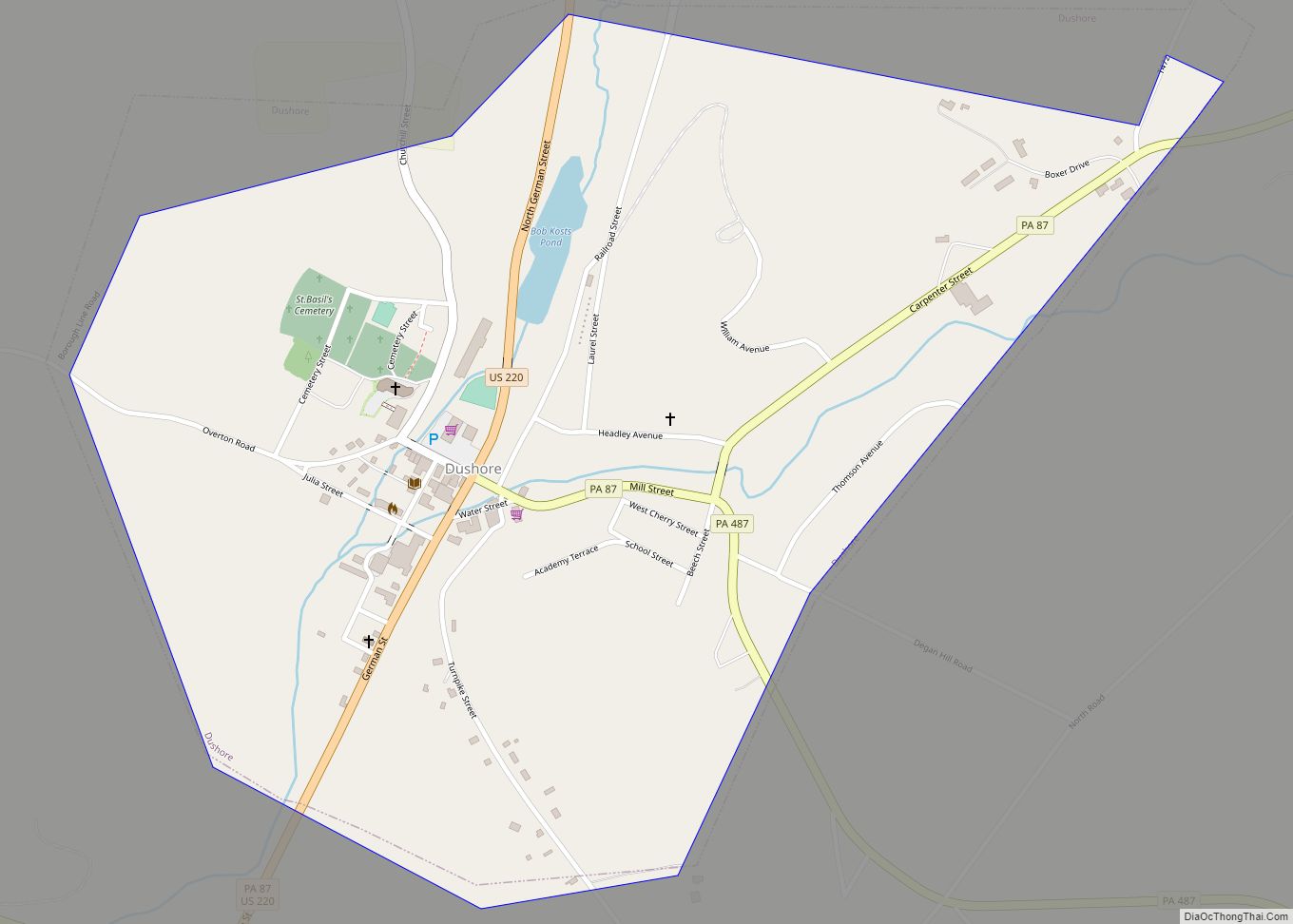
Dushore Road Map
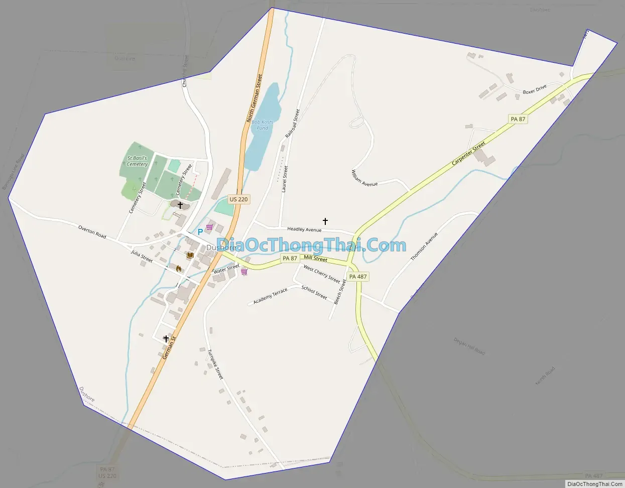
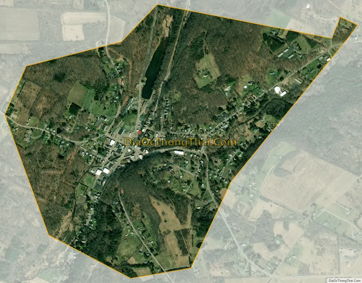
Dushore city Satellite Map
Geography
Dushore is located at 41°31′31″N 76°24′0″W / 41.52528°N 76.40000°W / 41.52528; -76.40000 (41.525227, -76.399924).
According to the United States Census Bureau, the borough has a total area of 0.8-square-mile (2.1 km), of which 0.78-square-mile (2.0 km) is land and 1.28% is water.
See also
Map of Pennsylvania State and its subdivision:- Adams
- Allegheny
- Armstrong
- Beaver
- Bedford
- Berks
- Blair
- Bradford
- Bucks
- Butler
- Cambria
- Cameron
- Carbon
- Centre
- Chester
- Clarion
- Clearfield
- Clinton
- Columbia
- Crawford
- Cumberland
- Dauphin
- Delaware
- Elk
- Erie
- Fayette
- Forest
- Franklin
- Fulton
- Greene
- Huntingdon
- Indiana
- Jefferson
- Juniata
- Lackawanna
- Lancaster
- Lawrence
- Lebanon
- Lehigh
- Luzerne
- Lycoming
- Mc Kean
- Mercer
- Mifflin
- Monroe
- Montgomery
- Montour
- Northampton
- Northumberland
- Perry
- Philadelphia
- Pike
- Potter
- Schuylkill
- Snyder
- Somerset
- Sullivan
- Susquehanna
- Tioga
- Union
- Venango
- Warren
- Washington
- Wayne
- Westmoreland
- Wyoming
- York
- Alabama
- Alaska
- Arizona
- Arkansas
- California
- Colorado
- Connecticut
- Delaware
- District of Columbia
- Florida
- Georgia
- Hawaii
- Idaho
- Illinois
- Indiana
- Iowa
- Kansas
- Kentucky
- Louisiana
- Maine
- Maryland
- Massachusetts
- Michigan
- Minnesota
- Mississippi
- Missouri
- Montana
- Nebraska
- Nevada
- New Hampshire
- New Jersey
- New Mexico
- New York
- North Carolina
- North Dakota
- Ohio
- Oklahoma
- Oregon
- Pennsylvania
- Rhode Island
- South Carolina
- South Dakota
- Tennessee
- Texas
- Utah
- Vermont
- Virginia
- Washington
- West Virginia
- Wisconsin
- Wyoming