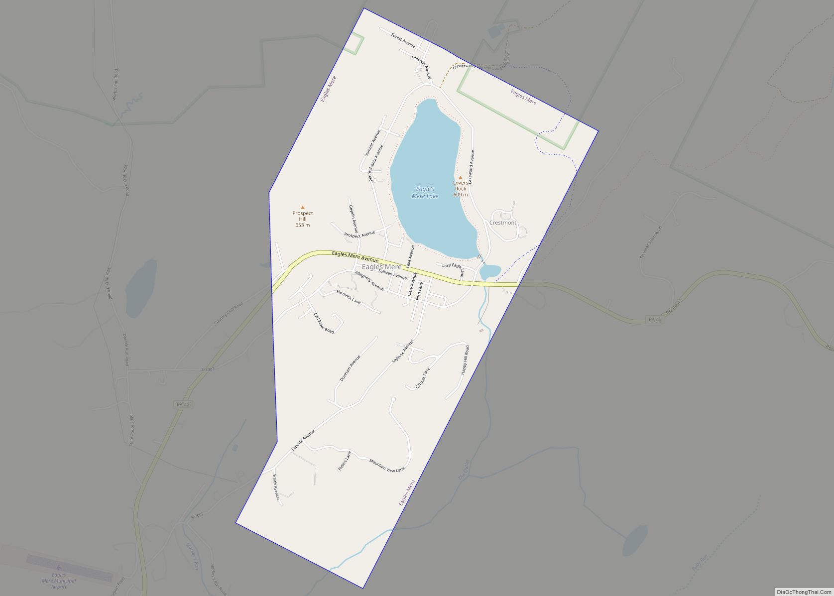
Eagles Mere is a borough in Sullivan County, Pennsylvania, United States. The population was 151 at the 2020 census.
| Name: | Eagles Mere borough |
|---|---|
| LSAD Code: | 21 |
| LSAD Description: | borough (suffix) |
| State: | Pennsylvania |
| County: | Sullivan County |
| Elevation: | 2,061 ft (628 m) |
| Total Area: | 2.24 sq mi (5.81 km²) |
| Land Area: | 2.06 sq mi (5.33 km²) |
| Water Area: | 0.19 sq mi (0.48 km²) 8.44% |
| Total Population: | 148 |
| Population Density: | 71.91/sq mi (27.76/km²) |
| Area code: | 570 |
| FIPS code: | 4220648 |
| Website: | www.eaglesmere.org |
Online Interactive Map
Click on ![]() to view map in "full screen" mode.
to view map in "full screen" mode.
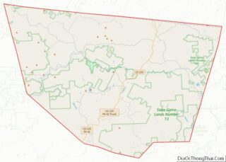
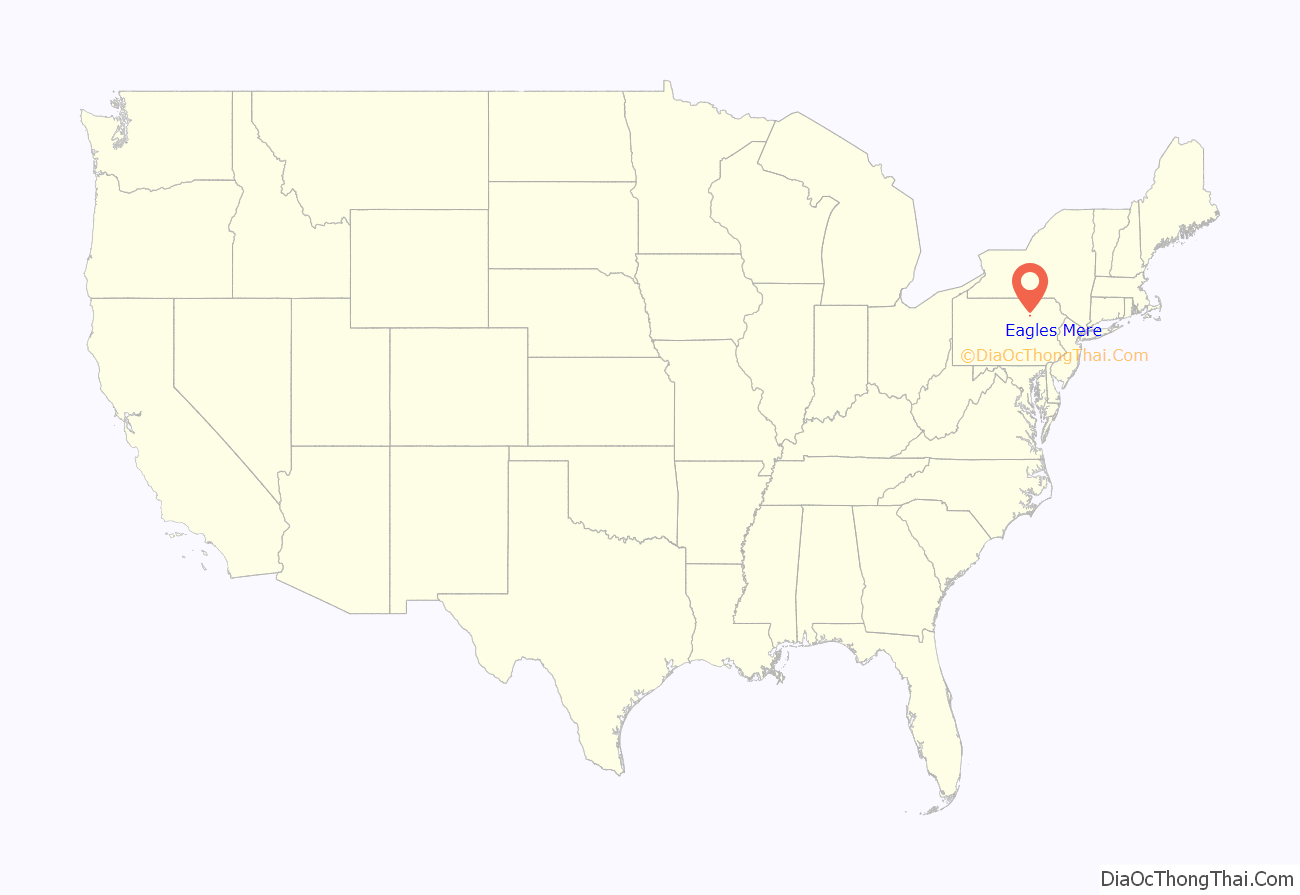
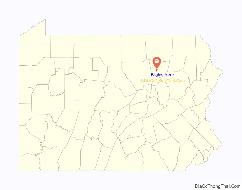
Eagles Mere location map. Where is Eagles Mere borough?
History
Eagles Mere was laid out in 1877 and incorporated in 1899. The Eagles Mere Historic District was added to the National Register of Historic Places in 1996. Eagles Mere’s name literally means “the eagle’s lake”, the word mere being a poetic synonym of “lake”.
Civil engineer Embley S. Chase came in 1886 to oversee its development as a resort town and laid the ground work. He participated in establishing its street plan, water sports carnival, ice toboggan slide, and trail system. He helped organize the borough, design its water and sewer works, electrify it, and plot the bottom of the lake. He helped design the narrow gauge railroad that once connected it to Sonestown.
Among the five large resort hotels serving the area from the 1880s to 1940s was the Forest Inn, opened in 1902. Its guests included General George C. Marshall and theater director Alvina Krause. Lucy McCammon (a faculty member at nearby Bloomsburg State) and Miss Krause (her longtime companion) leased the Inn’s Eagles Mere Playhouse in 1945 and ran it for twenty years; it featured performers such as Patricia Neal, Jimmy Gheen, Charlton Heston, Jennifer Jones, Paula Prentiss, and Richard Benjamin. That troupe is gone, but in 1993 the David A. Dewire Community Center was the site of a nationally recognized summer drama workshop.
Eagles Mere Road Map
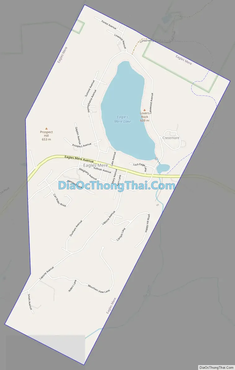
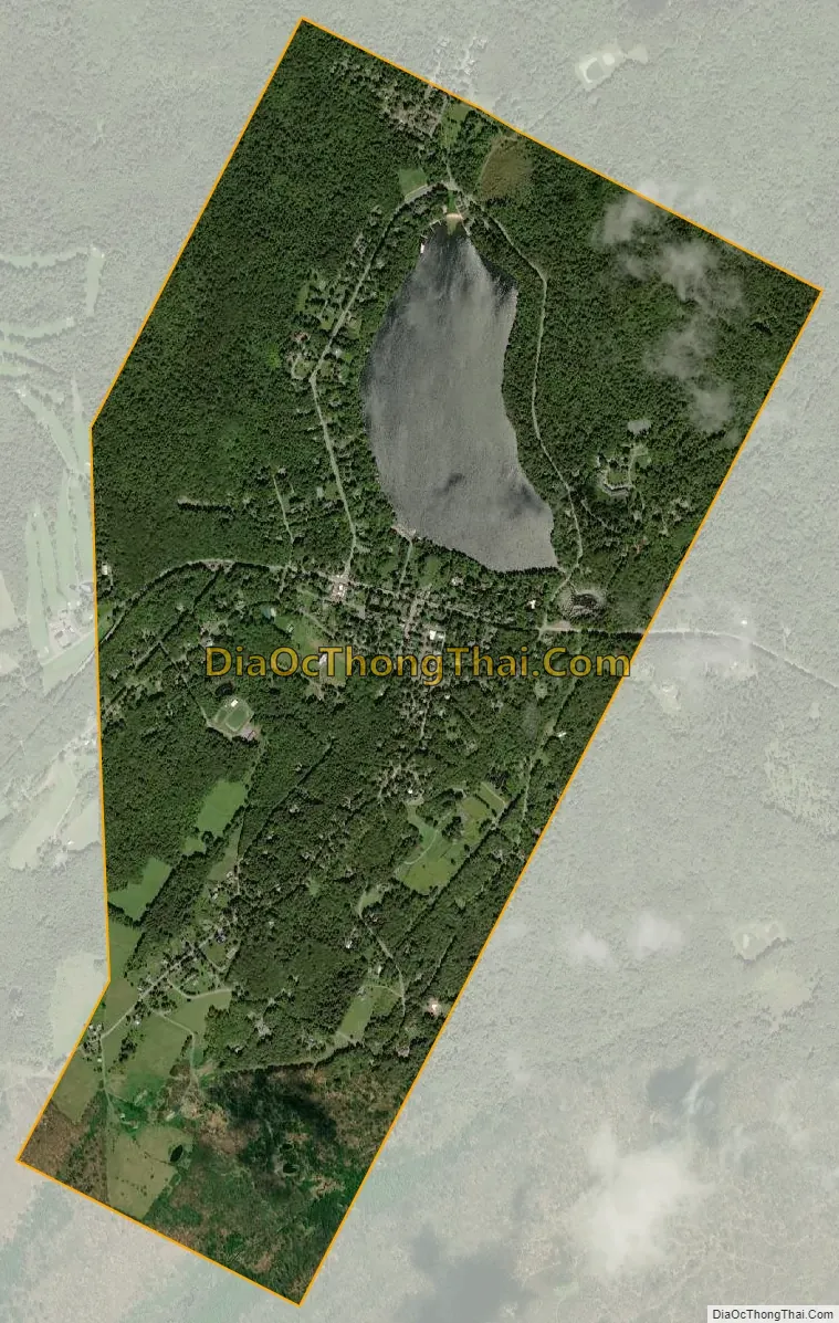
Eagles Mere city Satellite Map
Geography
According to the United States Census Bureau, the borough has a total area of 2.2 square miles (5.7 km), of which 2.0 square miles (5.2 km) is land and 0.2 square miles (0.52 km) (8.44%) is water.
See also
Map of Pennsylvania State and its subdivision:- Adams
- Allegheny
- Armstrong
- Beaver
- Bedford
- Berks
- Blair
- Bradford
- Bucks
- Butler
- Cambria
- Cameron
- Carbon
- Centre
- Chester
- Clarion
- Clearfield
- Clinton
- Columbia
- Crawford
- Cumberland
- Dauphin
- Delaware
- Elk
- Erie
- Fayette
- Forest
- Franklin
- Fulton
- Greene
- Huntingdon
- Indiana
- Jefferson
- Juniata
- Lackawanna
- Lancaster
- Lawrence
- Lebanon
- Lehigh
- Luzerne
- Lycoming
- Mc Kean
- Mercer
- Mifflin
- Monroe
- Montgomery
- Montour
- Northampton
- Northumberland
- Perry
- Philadelphia
- Pike
- Potter
- Schuylkill
- Snyder
- Somerset
- Sullivan
- Susquehanna
- Tioga
- Union
- Venango
- Warren
- Washington
- Wayne
- Westmoreland
- Wyoming
- York
- Alabama
- Alaska
- Arizona
- Arkansas
- California
- Colorado
- Connecticut
- Delaware
- District of Columbia
- Florida
- Georgia
- Hawaii
- Idaho
- Illinois
- Indiana
- Iowa
- Kansas
- Kentucky
- Louisiana
- Maine
- Maryland
- Massachusetts
- Michigan
- Minnesota
- Mississippi
- Missouri
- Montana
- Nebraska
- Nevada
- New Hampshire
- New Jersey
- New Mexico
- New York
- North Carolina
- North Dakota
- Ohio
- Oklahoma
- Oregon
- Pennsylvania
- Rhode Island
- South Carolina
- South Dakota
- Tennessee
- Texas
- Utah
- Vermont
- Virginia
- Washington
- West Virginia
- Wisconsin
- Wyoming