East Lansdowne is a borough in Delaware County, Pennsylvania, United States. The population was 2,668 at the 2010 census.
| Name: | East Lansdowne borough |
|---|---|
| LSAD Code: | 21 |
| LSAD Description: | borough (suffix) |
| State: | Pennsylvania |
| County: | Delaware County |
| Elevation: | 118 ft (36 m) |
| Total Area: | 0.21 sq mi (0.53 km²) |
| Land Area: | 0.21 sq mi (0.53 km²) |
| Water Area: | 0.00 sq mi (0.00 km²) |
| Total Population: | 2,714 |
| Population Density: | 13,174.76/sq mi (5,078.75/km²) |
| ZIP code: | 19050 |
| FIPS code: | 4221384 |
| Website: | www.eastlansdowne.org |
Online Interactive Map
Click on ![]() to view map in "full screen" mode.
to view map in "full screen" mode.
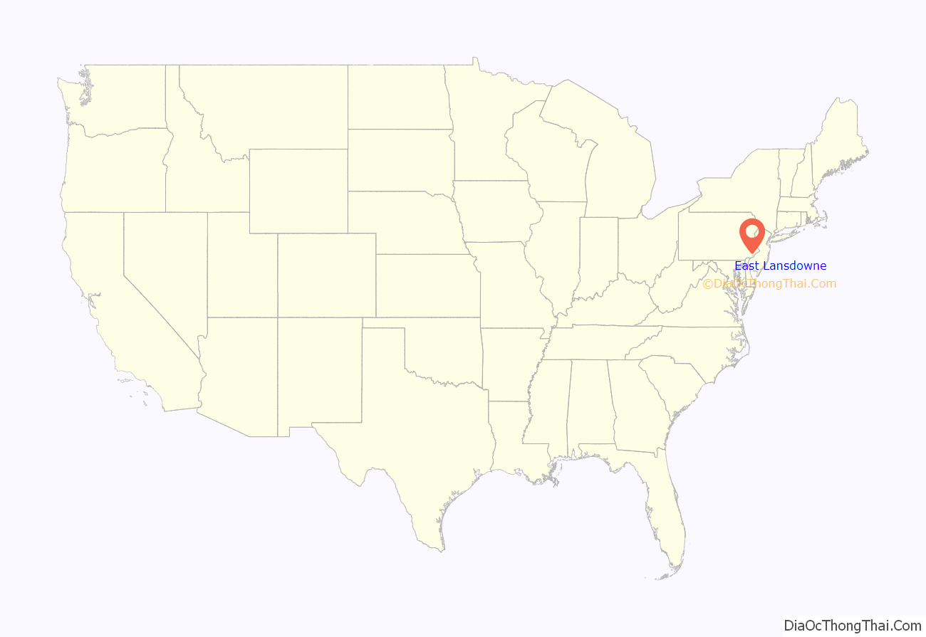
East Lansdowne location map. Where is East Lansdowne borough?
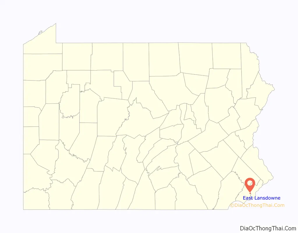
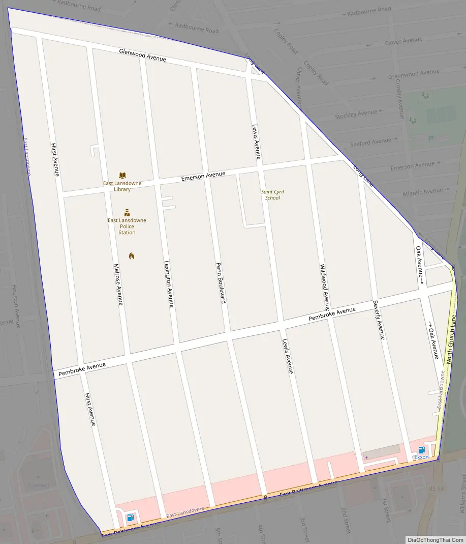
East Lansdowne Road Map
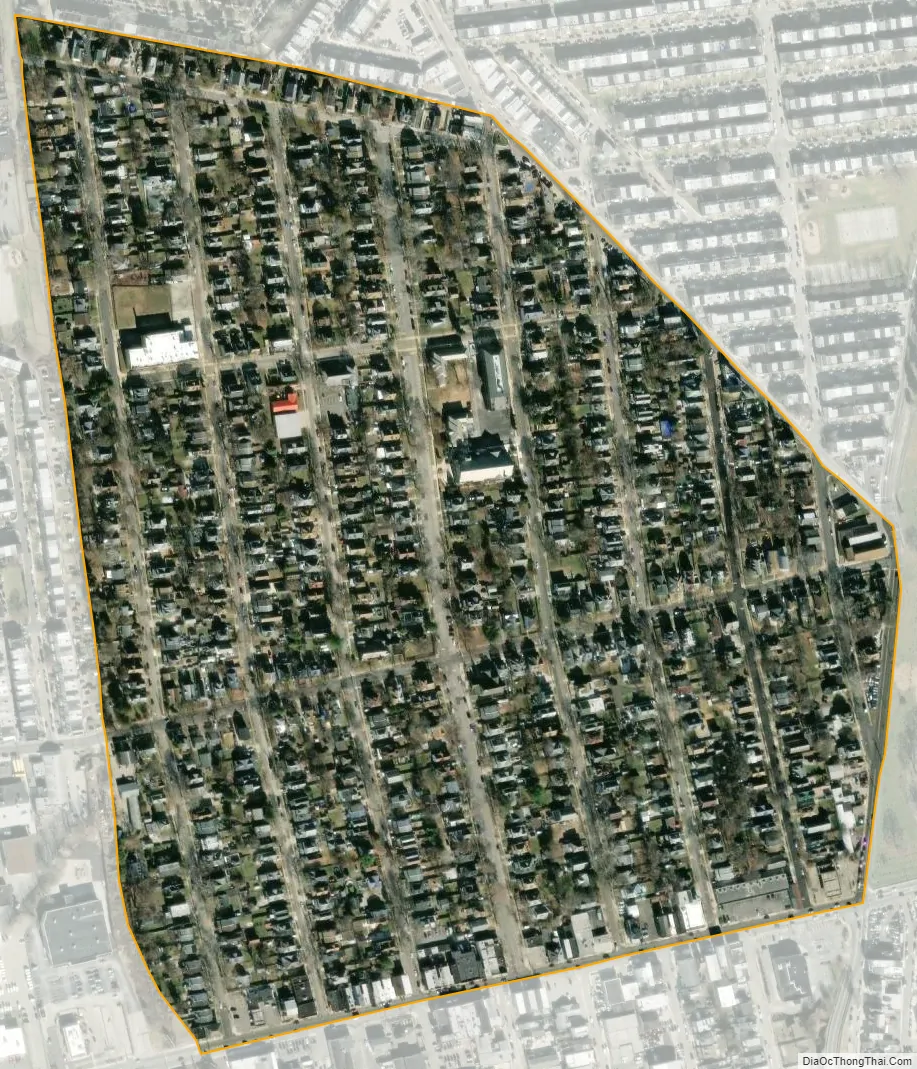
East Lansdowne city Satellite Map
Geography
East Lansdowne is located at 39°56′39″N 75°15′37″W / 39.94417°N 75.26028°W / 39.94417; -75.26028 (39.944162, -75.260253).
According to the United States Census Bureau, the borough has a total area of 0.2 square miles (0.52 km), all land.
East Lansdowne is located about approximately one-half mile west of Southwest Philadelphia and is surrounded by Upper Darby Township, namely the Stonehurst/Stonehurst Hills/69th Street and Fernwood neighborhoods. Union Avenue to the west separates Lansdowne from Upper Darby, while the East Lansdowne border is near Hirst Avenue, leaving a one-block expanse of land that is part of Upper Darby Township. It is the former railroad track that gives East Lansdowne borough’s western boundary that vaguely ovoid shape.
The borough of Yeadon is south of the SEPTA Media/Elwyn Line Railroad tracks, about one block south of East Lansdowne.
See also
Map of Pennsylvania State and its subdivision:- Adams
- Allegheny
- Armstrong
- Beaver
- Bedford
- Berks
- Blair
- Bradford
- Bucks
- Butler
- Cambria
- Cameron
- Carbon
- Centre
- Chester
- Clarion
- Clearfield
- Clinton
- Columbia
- Crawford
- Cumberland
- Dauphin
- Delaware
- Elk
- Erie
- Fayette
- Forest
- Franklin
- Fulton
- Greene
- Huntingdon
- Indiana
- Jefferson
- Juniata
- Lackawanna
- Lancaster
- Lawrence
- Lebanon
- Lehigh
- Luzerne
- Lycoming
- Mc Kean
- Mercer
- Mifflin
- Monroe
- Montgomery
- Montour
- Northampton
- Northumberland
- Perry
- Philadelphia
- Pike
- Potter
- Schuylkill
- Snyder
- Somerset
- Sullivan
- Susquehanna
- Tioga
- Union
- Venango
- Warren
- Washington
- Wayne
- Westmoreland
- Wyoming
- York
- Alabama
- Alaska
- Arizona
- Arkansas
- California
- Colorado
- Connecticut
- Delaware
- District of Columbia
- Florida
- Georgia
- Hawaii
- Idaho
- Illinois
- Indiana
- Iowa
- Kansas
- Kentucky
- Louisiana
- Maine
- Maryland
- Massachusetts
- Michigan
- Minnesota
- Mississippi
- Missouri
- Montana
- Nebraska
- Nevada
- New Hampshire
- New Jersey
- New Mexico
- New York
- North Carolina
- North Dakota
- Ohio
- Oklahoma
- Oregon
- Pennsylvania
- Rhode Island
- South Carolina
- South Dakota
- Tennessee
- Texas
- Utah
- Vermont
- Virginia
- Washington
- West Virginia
- Wisconsin
- Wyoming


