Everett is a borough in Bedford County, Pennsylvania, United States. The population was 1,775 at the 2020 census.
Everett’s original name was Bloody Run, after a creek that was the site of a battle between settlers and Native Americans. The town was renamed in honor of Massachusetts politician and orator Edward Everett.
Bestselling American novelist Dean Koontz was born in Everett.
| Name: | Everett borough |
|---|---|
| LSAD Code: | 21 |
| LSAD Description: | borough (suffix) |
| State: | Pennsylvania |
| County: | Bedford County |
| Incorporated: | 1860 |
| Elevation: | 1,237 ft (377 m) |
| Total Area: | 1.06 sq mi (2.74 km²) |
| Land Area: | 0.98 sq mi (2.54 km²) |
| Water Area: | 0.08 sq mi (0.21 km²) |
| Total Population: | 1,765 |
| Population Density: | 1,801.02/sq mi (695.26/km²) |
| Area code: | 814 |
| FIPS code: | 4224304 |
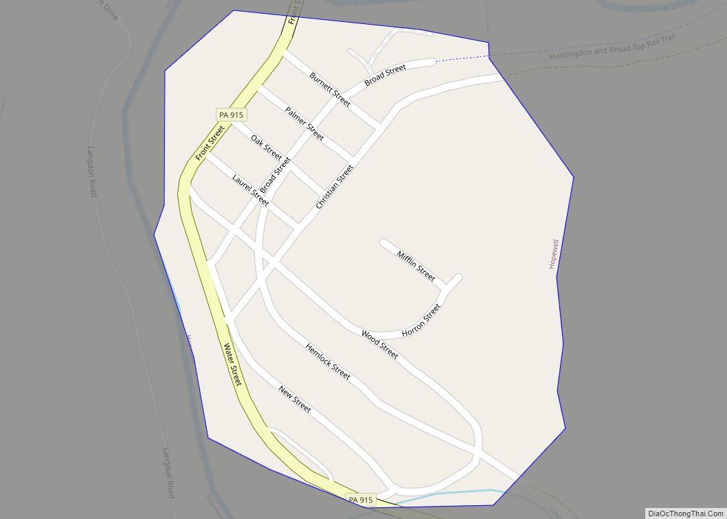
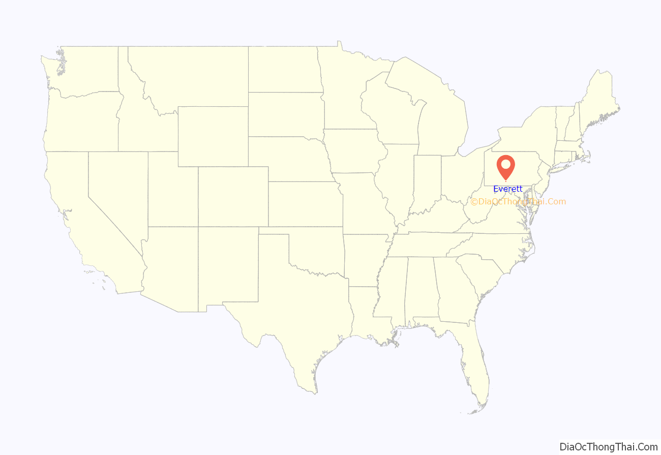
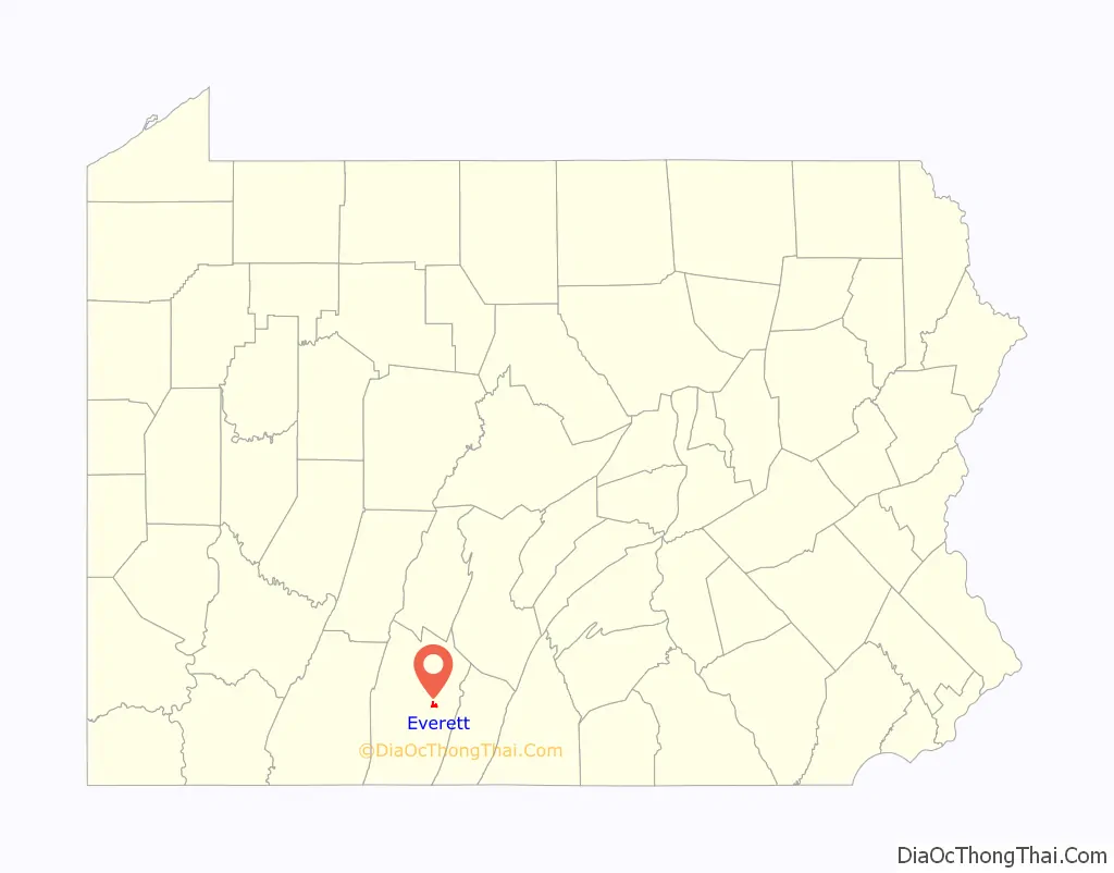
Online Interactive Map
Click on ![]() to view map in "full screen" mode.
to view map in "full screen" mode.
Everett location map. Where is Everett borough?
History
In 1787, Michael Barndollar purchased the land in this area, and laid out a town which was originally called Waynesburg.
This name was never widely used and this small village was incorporated as a borough in November 1860, to be known as Bloody Run. While this name carries with it many interesting stories and much history, the name was changed in February 1873 to Everett.
The Everett Historic District was added to the National Register of Historic Places in 2003.
Mural on building along Main Street in Everett
Everett United Methodist Church, along Main Street
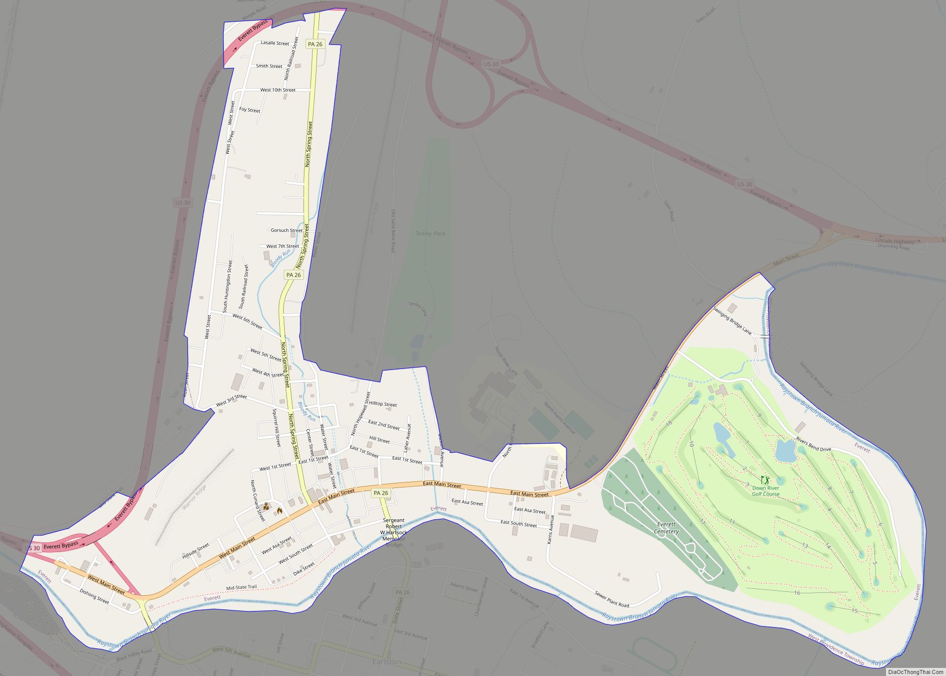
Everett Road Map
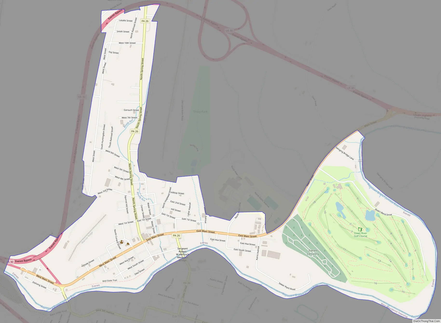
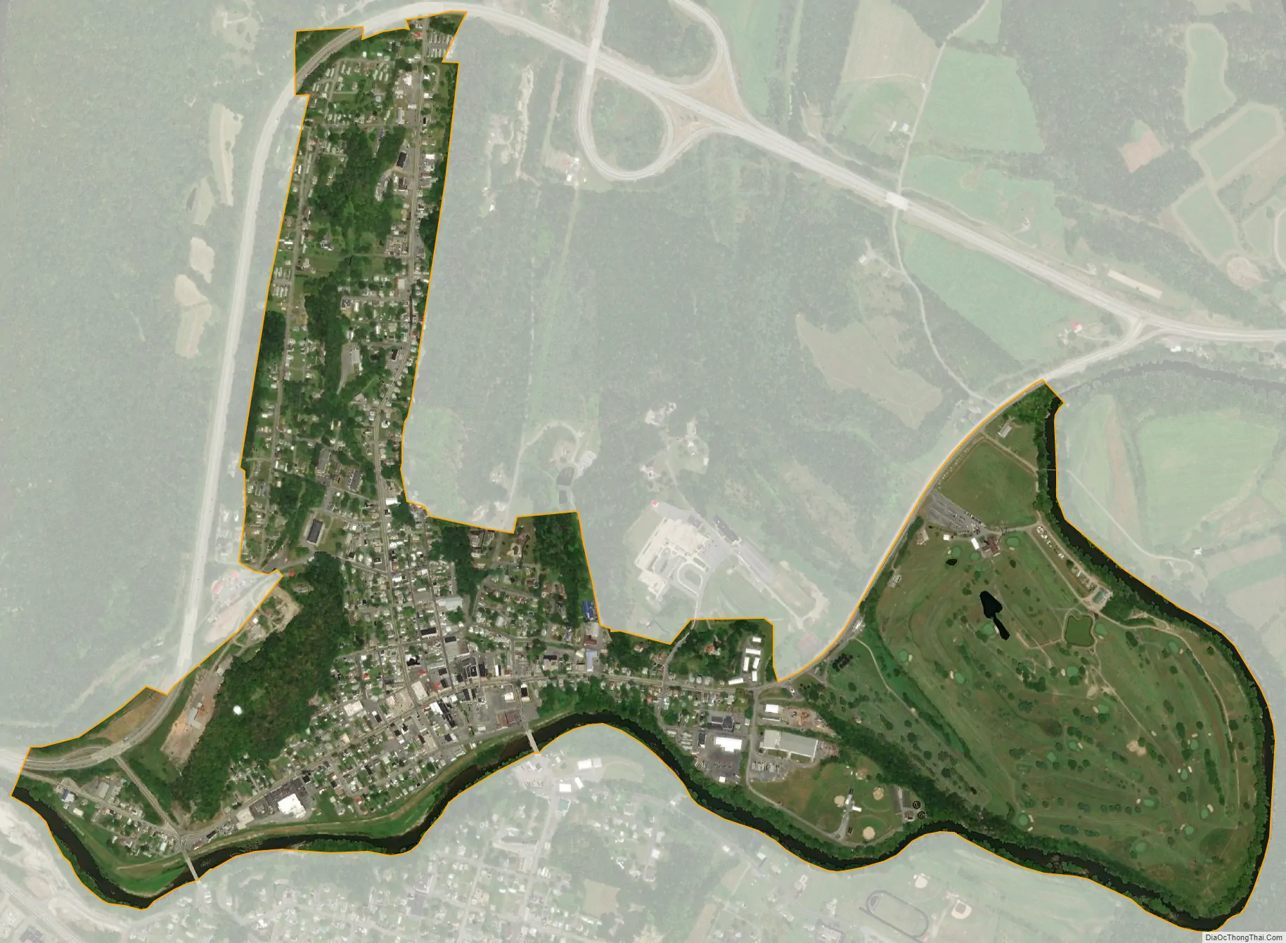
Everett city Satellite Map
Geography
Everett is located in eastern Bedford County at 40°0′51″N 78°22′24″W / 40.01417°N 78.37333°W / 40.01417; -78.37333 (40.014049, -78.373202). It is bordered on the south by the unincorporated community of Earlston.
According to the United States Census Bureau, the borough has a total area of 1.1 square miles (2.8 km), all land.
Located in a valley of the Allegheny Mountains, Everett sits within a natural transportation corridor where the Raystown Branch of the Juniata River has carved a water gap, called The Narrows, through Tussey Mountain. The Alleghenies are a sub-region of the much larger Appalachian Mountains, and cover an area of central Pennsylvania, western Maryland and northern West Virginia. The countryside surrounding Everett is composed mainly of large forested areas, extensive agricultural fields, pasture, small villages, and woodlots.
U.S. Route 30 bypasses the borough along its northern edge. The highway’s former route, the Lincoln Highway (now US-30 Business), passes through the center of town as Main Street. Interstate 76, the Pennsylvania Turnpike, passes just south of the borough but does not provide access, with the nearest exits being Bedford 10 miles (16 km) to the west and Breezewood 8 miles (13 km) to the east.
Pennsylvania’s longest hiking trail, the Mid State Trail, passes directly through the center of town, before continuing on towards nearby Rainsburg.
Climate
See also
Map of Pennsylvania State and its subdivision:- Adams
- Allegheny
- Armstrong
- Beaver
- Bedford
- Berks
- Blair
- Bradford
- Bucks
- Butler
- Cambria
- Cameron
- Carbon
- Centre
- Chester
- Clarion
- Clearfield
- Clinton
- Columbia
- Crawford
- Cumberland
- Dauphin
- Delaware
- Elk
- Erie
- Fayette
- Forest
- Franklin
- Fulton
- Greene
- Huntingdon
- Indiana
- Jefferson
- Juniata
- Lackawanna
- Lancaster
- Lawrence
- Lebanon
- Lehigh
- Luzerne
- Lycoming
- Mc Kean
- Mercer
- Mifflin
- Monroe
- Montgomery
- Montour
- Northampton
- Northumberland
- Perry
- Philadelphia
- Pike
- Potter
- Schuylkill
- Snyder
- Somerset
- Sullivan
- Susquehanna
- Tioga
- Union
- Venango
- Warren
- Washington
- Wayne
- Westmoreland
- Wyoming
- York
- Alabama
- Alaska
- Arizona
- Arkansas
- California
- Colorado
- Connecticut
- Delaware
- District of Columbia
- Florida
- Georgia
- Hawaii
- Idaho
- Illinois
- Indiana
- Iowa
- Kansas
- Kentucky
- Louisiana
- Maine
- Maryland
- Massachusetts
- Michigan
- Minnesota
- Mississippi
- Missouri
- Montana
- Nebraska
- Nevada
- New Hampshire
- New Jersey
- New Mexico
- New York
- North Carolina
- North Dakota
- Ohio
- Oklahoma
- Oregon
- Pennsylvania
- Rhode Island
- South Carolina
- South Dakota
- Tennessee
- Texas
- Utah
- Vermont
- Virginia
- Washington
- West Virginia
- Wisconsin
- Wyoming