Garrett is a borough in Somerset County, Pennsylvania, United States. It is part of the Johnstown, Pennsylvania, Metropolitan Statistical Area. The population was 416 at the 2020 census.
| Name: | Garrett borough |
|---|---|
| LSAD Code: | 21 |
| LSAD Description: | borough (suffix) |
| State: | Pennsylvania |
| County: | Somerset County |
| Incorporated: | 1900 |
| Total Area: | 0.51 sq mi (1.31 km²) |
| Land Area: | 0.51 sq mi (1.31 km²) |
| Water Area: | 0.00 sq mi (0.00 km²) |
| Total Population: | 415 |
| Population Density: | 820.16/sq mi (316.88/km²) |
| Area code: | 814 |
| FIPS code: | 4228520 |
Online Interactive Map
Click on ![]() to view map in "full screen" mode.
to view map in "full screen" mode.
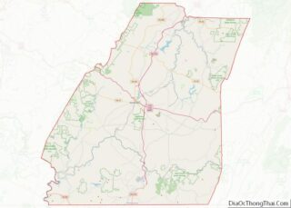
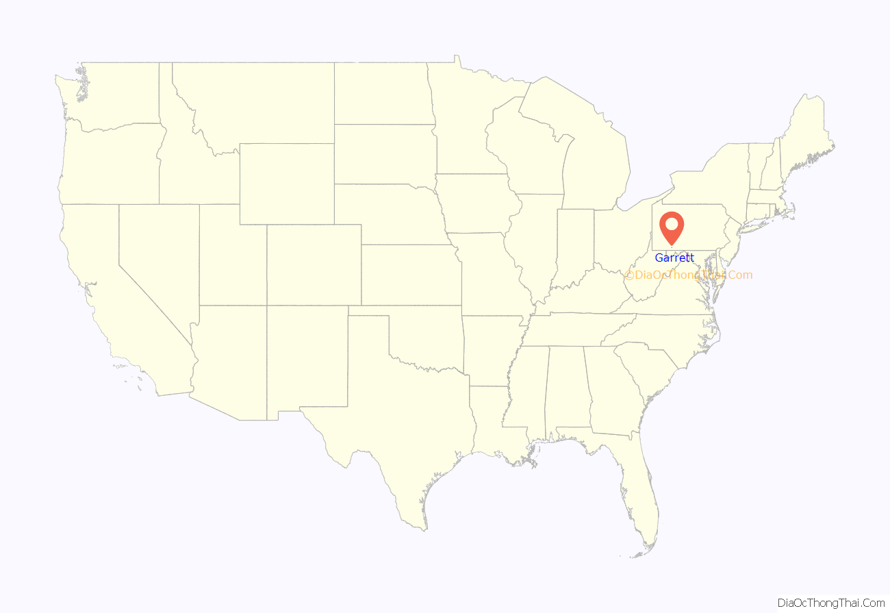
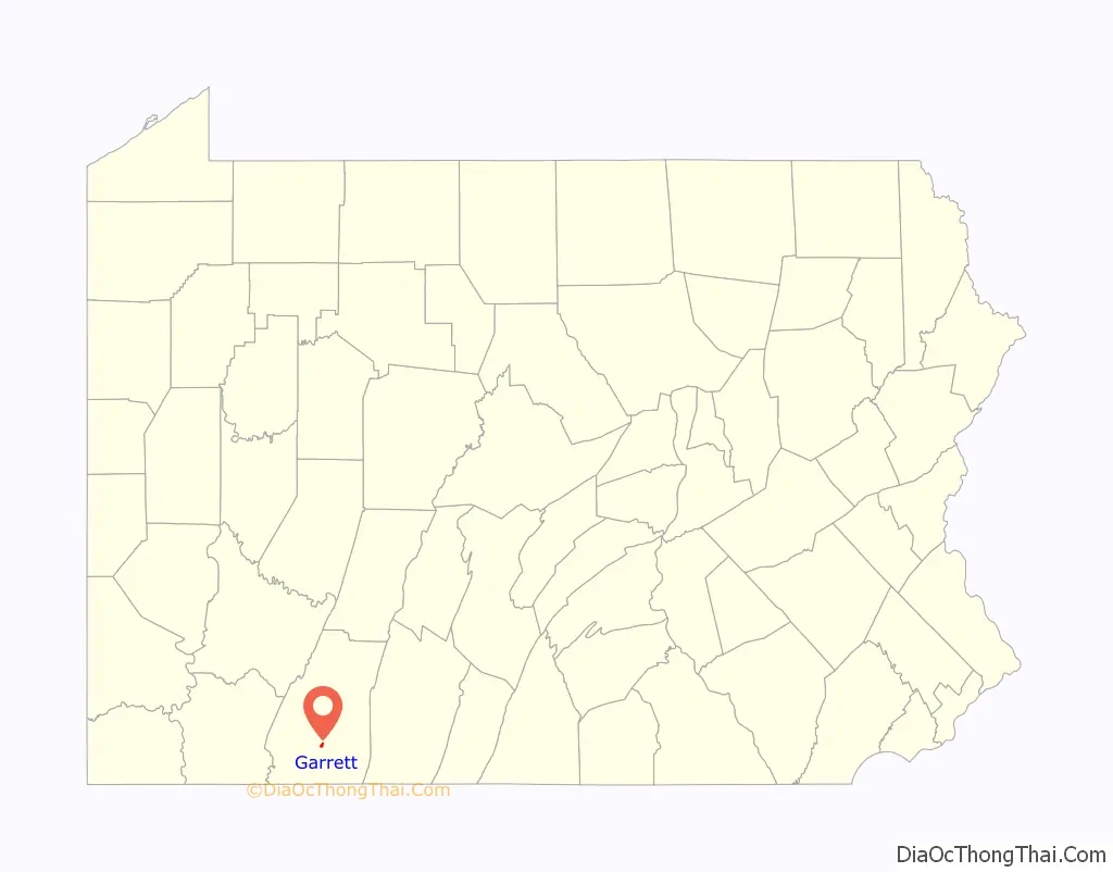
Garrett location map. Where is Garrett borough?
History
Garrett was first settled in 1869 and was incorporated in 1900. Garrett is named for the president of the Baltimore and Ohio Railroad John Work Garrett. John W. Garrett served as president of the Baltimore and Ohio Railroad from 1858–1884 and was born in Baltimore, Maryland, on July 31, 1820. He was the second son of Elizabeth Stouffer and Robert Garrett. He married Rachel Ann Harrison, the daughter of Thomas Harrison, a Baltimore merchant. They had one daughter, Mary and two sons, Robert and Thomas Harrison Garrett.
During the height of the Baltimore & Ohio Railroad, Garrett served as the junction of its Pittsburgh Division with its Berlin branch. The Berlin Branch Railroad was originally built by the Buffalo Valley Railroad Company in 1871. This 8.5 mile branch line connected Berlin to the main B&O line (also known as the Pittsburgh & Connellsville Railroad) as it passed through Garrett, and it was taken over by the B&O itself in 1880. There were seven stations located along the Berlin branch as it ran northeast along the Buffalo Creek valley: Garrett, Burkholder, Buchle, Bitner, Pine Hill, Hanger’s, and Berlin. A view of Garrett appeared in a collection of photographs from along the B&O’s lines that was published in book form in 1872 and digitized by the DeGolyer Library, Southern Methodist University.
The Western Maryland Railroad ran in an East to West direction on the Brooklyn side of Garrett. It is the current site of the Great Allegheny Passage. A 150-mile system of biking and hiking trails connecting Cumberland, Maryland, and Pittsburgh that was constructed on the former Western Maryland railroad bed. The Connellsville Extension of the Western Maryland Railroad was built west from Cumberland, Maryland, to Connellsville, Pennsylvania, beginning around 1906 and was completed in 1912. In 1964, the Chesapeake and Ohio Railway (C&O) and the Baltimore and Ohio Railroad (B&O) jointly filed for permission to acquire control of the Western Maryland Railway with the Interstate Commerce Commission (ICC). In 1973, as part of the Chessie System, the Western Maryland ownership went to C&O and it was operated by the B&O. In 1987, it was merged into the C&O which itself became part of CSX Transportation.
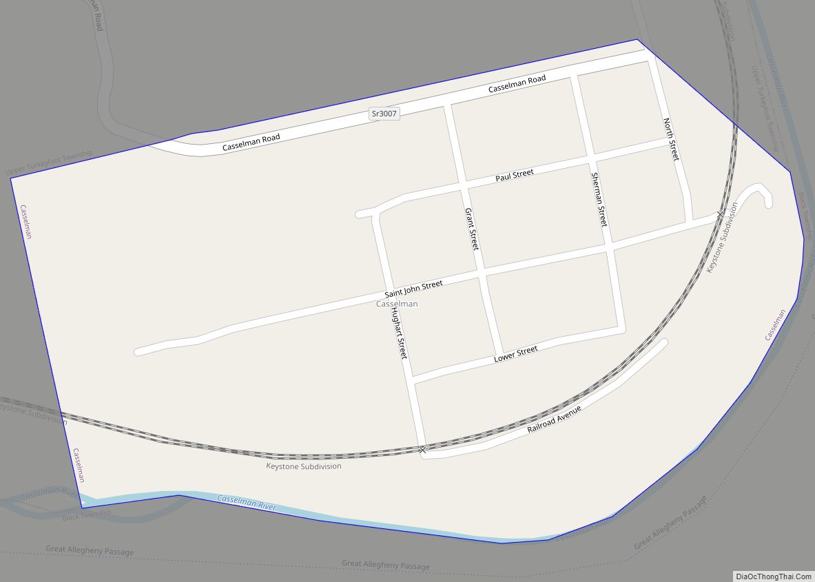
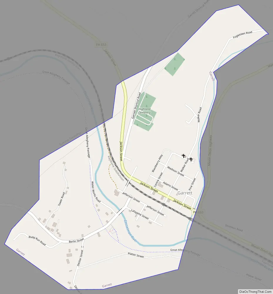
Garrett Road Map
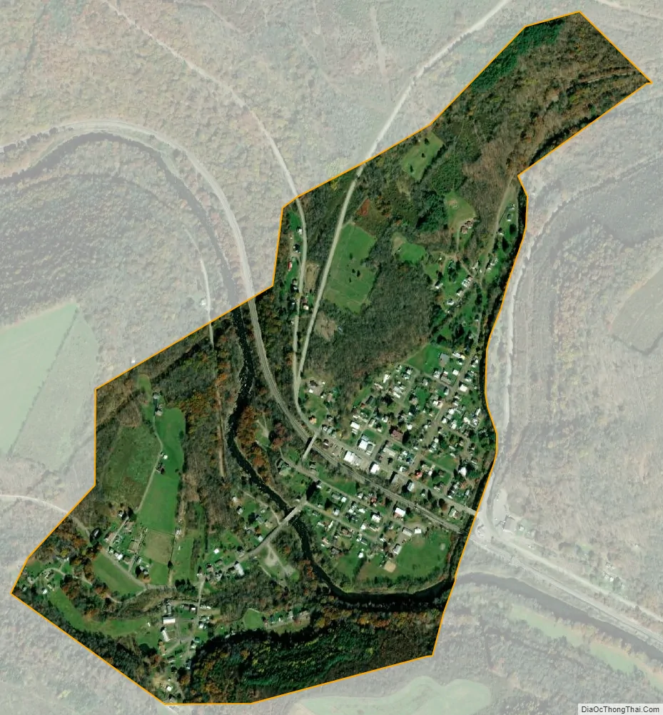
Garrett city Satellite Map
Geography
Garrett is located at 39°51′49″N 79°3′40″W / 39.86361°N 79.06111°W / 39.86361; -79.06111 (39.863563, -79.061159). According to the United States Census Bureau, the borough has a total area of 0.7 square miles (1.8 km), all land. Garrett is located along Summit Township’s border with Brothersvalley Township.
Garrett sits at the confluence of the Buffalo Creek and the Casselman River. The Casselman River is believed to be named for the Landgraviate of Hesse-Kassel or Hesse-Cassel in Germany. An imperial immediacy (German: Reichsfreiheit or Reichsunmittelbarkeit) which was a privileged feudal and political status, a form of statehood, which a city, religious entity or feudal principality of minor lordship could attain within the Holy Roman Empire.
See also
Map of Pennsylvania State and its subdivision:- Adams
- Allegheny
- Armstrong
- Beaver
- Bedford
- Berks
- Blair
- Bradford
- Bucks
- Butler
- Cambria
- Cameron
- Carbon
- Centre
- Chester
- Clarion
- Clearfield
- Clinton
- Columbia
- Crawford
- Cumberland
- Dauphin
- Delaware
- Elk
- Erie
- Fayette
- Forest
- Franklin
- Fulton
- Greene
- Huntingdon
- Indiana
- Jefferson
- Juniata
- Lackawanna
- Lancaster
- Lawrence
- Lebanon
- Lehigh
- Luzerne
- Lycoming
- Mc Kean
- Mercer
- Mifflin
- Monroe
- Montgomery
- Montour
- Northampton
- Northumberland
- Perry
- Philadelphia
- Pike
- Potter
- Schuylkill
- Snyder
- Somerset
- Sullivan
- Susquehanna
- Tioga
- Union
- Venango
- Warren
- Washington
- Wayne
- Westmoreland
- Wyoming
- York
- Alabama
- Alaska
- Arizona
- Arkansas
- California
- Colorado
- Connecticut
- Delaware
- District of Columbia
- Florida
- Georgia
- Hawaii
- Idaho
- Illinois
- Indiana
- Iowa
- Kansas
- Kentucky
- Louisiana
- Maine
- Maryland
- Massachusetts
- Michigan
- Minnesota
- Mississippi
- Missouri
- Montana
- Nebraska
- Nevada
- New Hampshire
- New Jersey
- New Mexico
- New York
- North Carolina
- North Dakota
- Ohio
- Oklahoma
- Oregon
- Pennsylvania
- Rhode Island
- South Carolina
- South Dakota
- Tennessee
- Texas
- Utah
- Vermont
- Virginia
- Washington
- West Virginia
- Wisconsin
- Wyoming