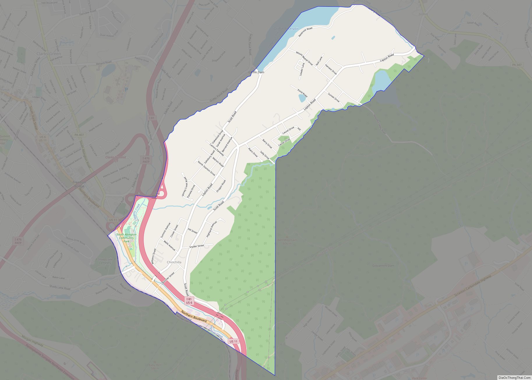
Glenburn is a census-designated place (CDP) in Glenburn Township, Lackawanna County, Pennsylvania, United States. The population was 953 at the 2010 census. It is approximately 10 miles (16 km) north of downtown Scranton, in the growing suburban area known as the “Abingtons”. Glenburn is located north of Clarks Summit and south of Dalton.
| Name: | Glenburn CDP |
|---|---|
| LSAD Code: | 57 |
| LSAD Description: | CDP (suffix) |
| State: | Pennsylvania |
| County: | Lackawanna County |
| Elevation: | 1,165 ft (355 m) |
| Total Area: | 1.80 sq mi (4.66 km²) |
| Land Area: | 1.75 sq mi (4.54 km²) |
| Water Area: | 0.04 sq mi (0.12 km²) |
| Total Population: | 1,148 |
| Population Density: | 654.88/sq mi (252.84/km²) |
| ZIP code: | 18411 |
| Area code: | 570 |
| FIPS code: | 4229496 |
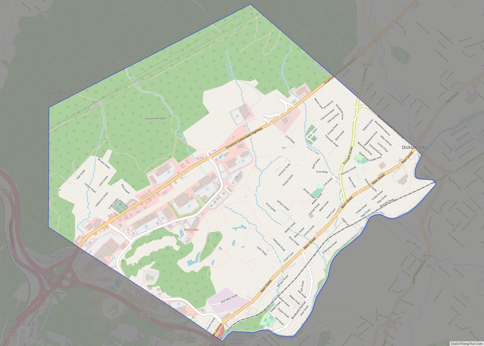
Online Interactive Map
Click on ![]() to view map in "full screen" mode.
to view map in "full screen" mode.
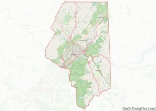
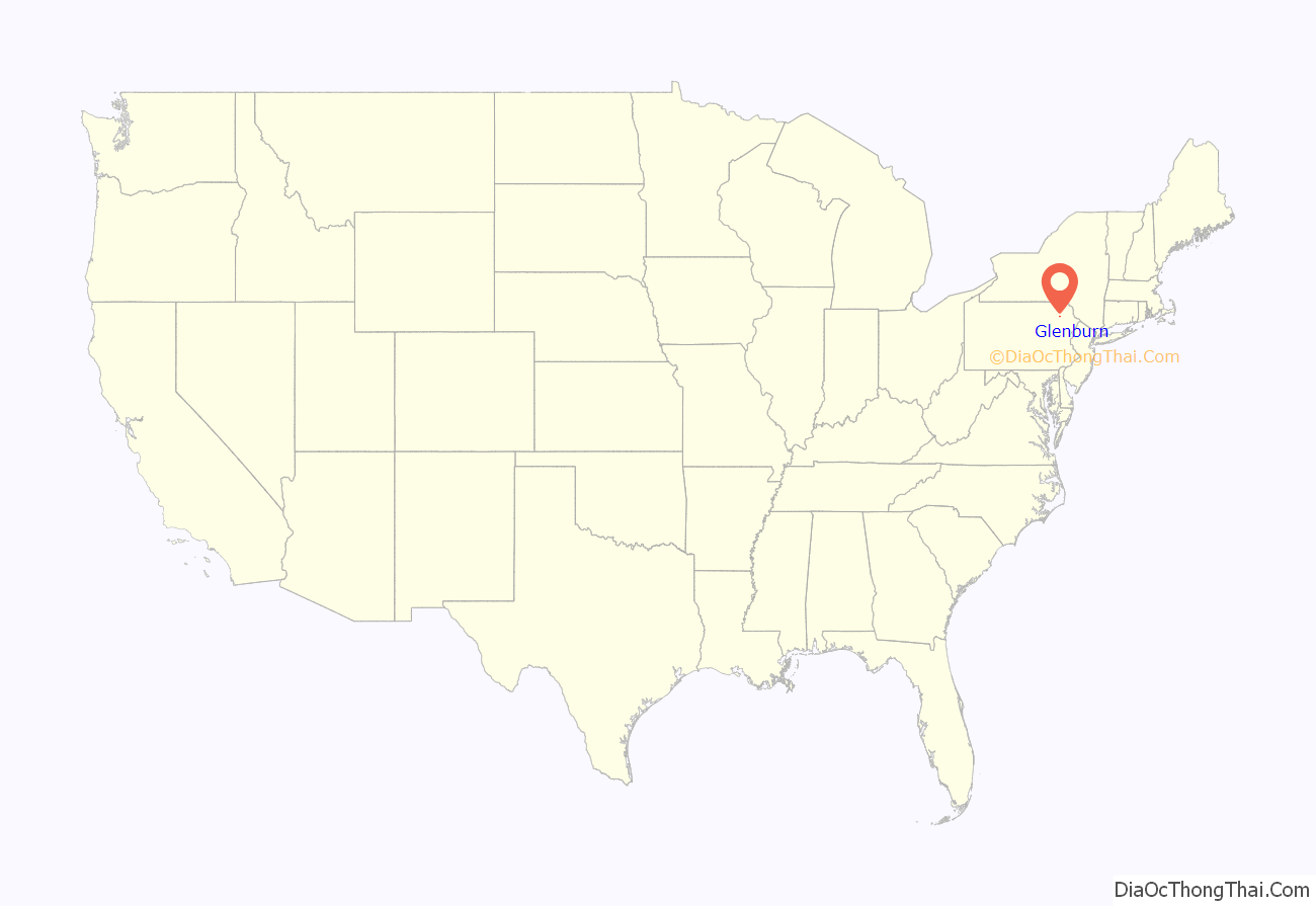
Glenburn location map. Where is Glenburn CDP?
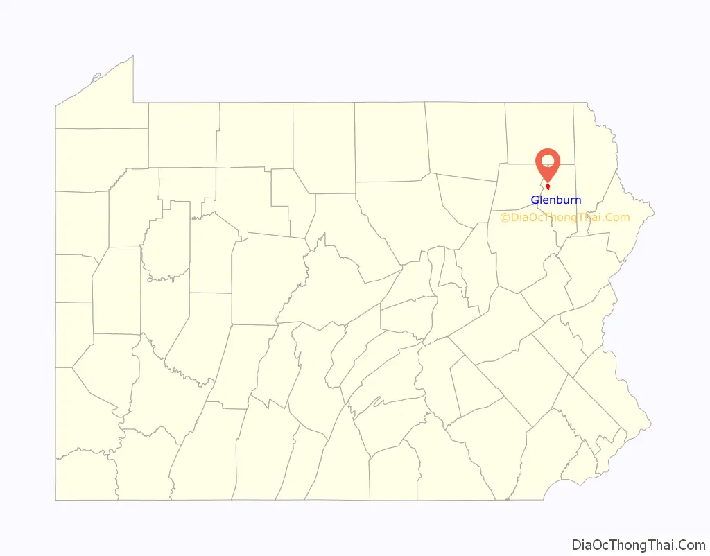
Glenburn Road Map

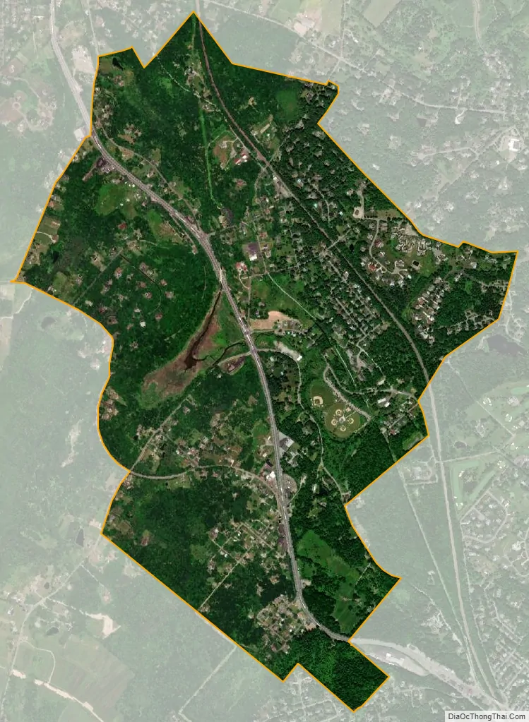
Glenburn city Satellite Map
Geography
Glenburn is located at 41°30′58″N 75°43′27″W / 41.51611°N 75.72417°W / 41.51611; -75.72417 (41.516361, -75.724286). Combined U.S. Route 6/11 (Lackawanna Trail) runs through the community as a four-lane divided highway, leading south to Scranton and north 5 miles (8 km) to Factoryville.
According to the United States Census Bureau, the CDP has a total area of 1.79 square miles (4.6 km), of which 1.75 square miles (4.5 km) are land and 0.04 square miles (0.10 km), or 2.23%, are water. The community is in the valley of the South Branch of Tunkhannock Creek, a north- and west-flowing tributary of the Susquehanna River.
See also
Map of Pennsylvania State and its subdivision:- Adams
- Allegheny
- Armstrong
- Beaver
- Bedford
- Berks
- Blair
- Bradford
- Bucks
- Butler
- Cambria
- Cameron
- Carbon
- Centre
- Chester
- Clarion
- Clearfield
- Clinton
- Columbia
- Crawford
- Cumberland
- Dauphin
- Delaware
- Elk
- Erie
- Fayette
- Forest
- Franklin
- Fulton
- Greene
- Huntingdon
- Indiana
- Jefferson
- Juniata
- Lackawanna
- Lancaster
- Lawrence
- Lebanon
- Lehigh
- Luzerne
- Lycoming
- Mc Kean
- Mercer
- Mifflin
- Monroe
- Montgomery
- Montour
- Northampton
- Northumberland
- Perry
- Philadelphia
- Pike
- Potter
- Schuylkill
- Snyder
- Somerset
- Sullivan
- Susquehanna
- Tioga
- Union
- Venango
- Warren
- Washington
- Wayne
- Westmoreland
- Wyoming
- York
- Alabama
- Alaska
- Arizona
- Arkansas
- California
- Colorado
- Connecticut
- Delaware
- District of Columbia
- Florida
- Georgia
- Hawaii
- Idaho
- Illinois
- Indiana
- Iowa
- Kansas
- Kentucky
- Louisiana
- Maine
- Maryland
- Massachusetts
- Michigan
- Minnesota
- Mississippi
- Missouri
- Montana
- Nebraska
- Nevada
- New Hampshire
- New Jersey
- New Mexico
- New York
- North Carolina
- North Dakota
- Ohio
- Oklahoma
- Oregon
- Pennsylvania
- Rhode Island
- South Carolina
- South Dakota
- Tennessee
- Texas
- Utah
- Vermont
- Virginia
- Washington
- West Virginia
- Wisconsin
- Wyoming