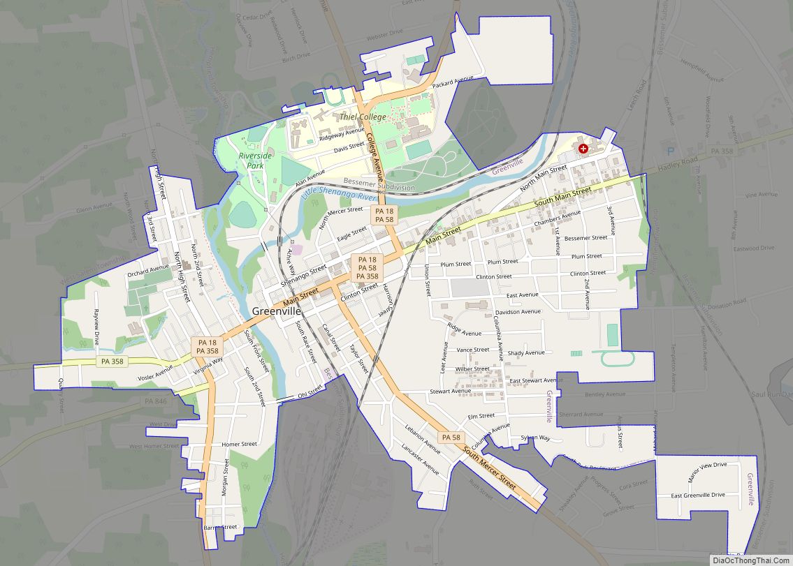
Greenville is a borough with home rule status in northwestern Mercer County, Pennsylvania, United States. Located along the Shenango River, it lies roughly 80 miles from both Pittsburgh and Cleveland. It is 1.89 square miles in area, and had a population of 5,541 as of the 2020 census.
Incorporated as the Borough of West Greenville in 1836, it changed its name to the Borough of Greenville in 1865 and began to operate under a home rule charter on January 1, 2020, under the name of the “Town of Greenville.” The origin of the name is speculated to have come from East Greenville, Pennsylvania. Greenville is part of the Youngstown–Warren metropolitan area, and was designated a financially distressed municipality in 2002 by the Commonwealth of Pennsylvania.
It is home to the Werner Company, the world’s largest manufacturer of step and extension ladders. Other national companies based in Greenville include Bail USA and Athena Study Abroad. A prominent regional bus company based in Greenville is Anderson Coach & Travel.
| Name: | Greenville borough |
|---|---|
| LSAD Code: | 21 |
| LSAD Description: | borough (suffix) |
| State: | Pennsylvania |
| County: | Mercer County |
| Total Area: | 1.89 sq mi (4.89 km²) |
| Land Area: | 1.89 sq mi (4.89 km²) |
| Water Area: | 0.00 sq mi (0.00 km²) |
| Total Population: | 5,540 |
| Population Density: | 2,935.88/sq mi (1,133.58/km²) |
| Area code: | 724 |
| FIPS code: | 4231328 |
| Website: | www.greenvilleborough.com |
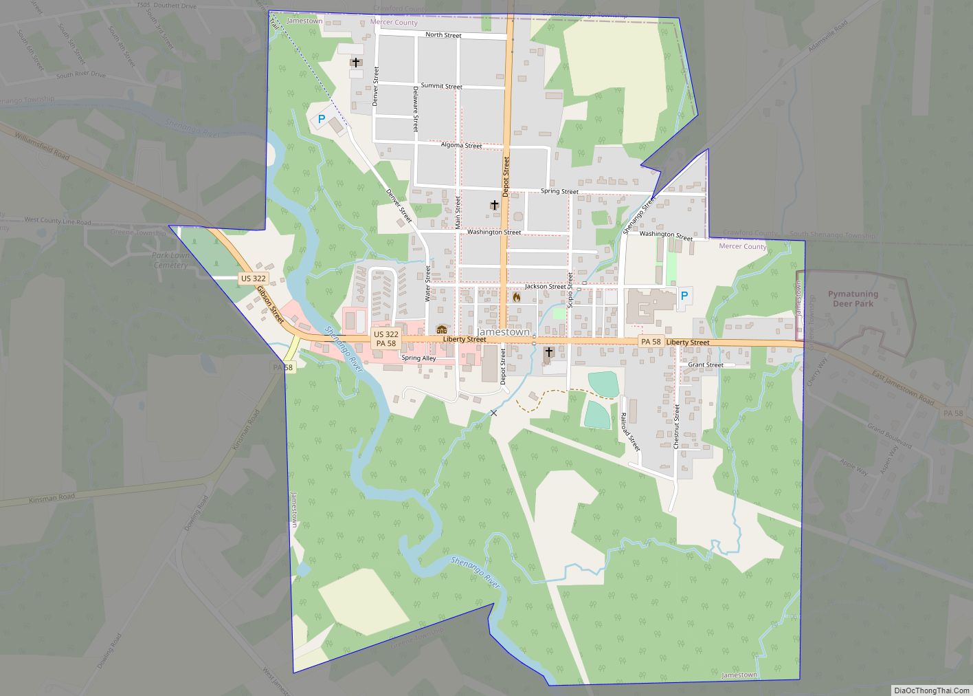
Online Interactive Map
Click on ![]() to view map in "full screen" mode.
to view map in "full screen" mode.
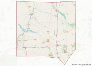
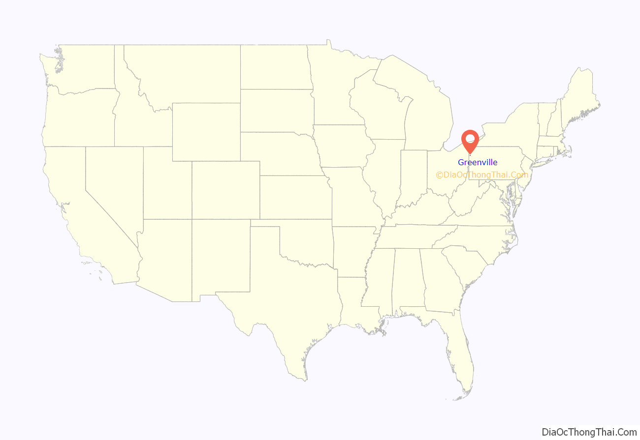
Greenville location map. Where is Greenville borough?
History
Greenville was known for its manufacturing interests, including railroad shops, bridge works, gristmills, a cement-block plant, an automobile factory, foundries and machine shops, saw and planing mills, steelworks, a railroad-car manufacturer, and flour mills. Water power was supplied by the Shenango River.
In 1900, 4,814 people lived in Greenville. That number rose to 5,909 by 1910, and stood at 10,000 in 1940. In 1950 there were 9,210 residents of Greenville. By 2000, the census showed a decline in population to 6,380.
Greenville was designated a financially distressed municipality in 2002 by the Commonwealth of Pennsylvania.
The Greenville Commercial Historic District and Alexander P. and James S. Waugh House are listed on the National Register of Historic Places.
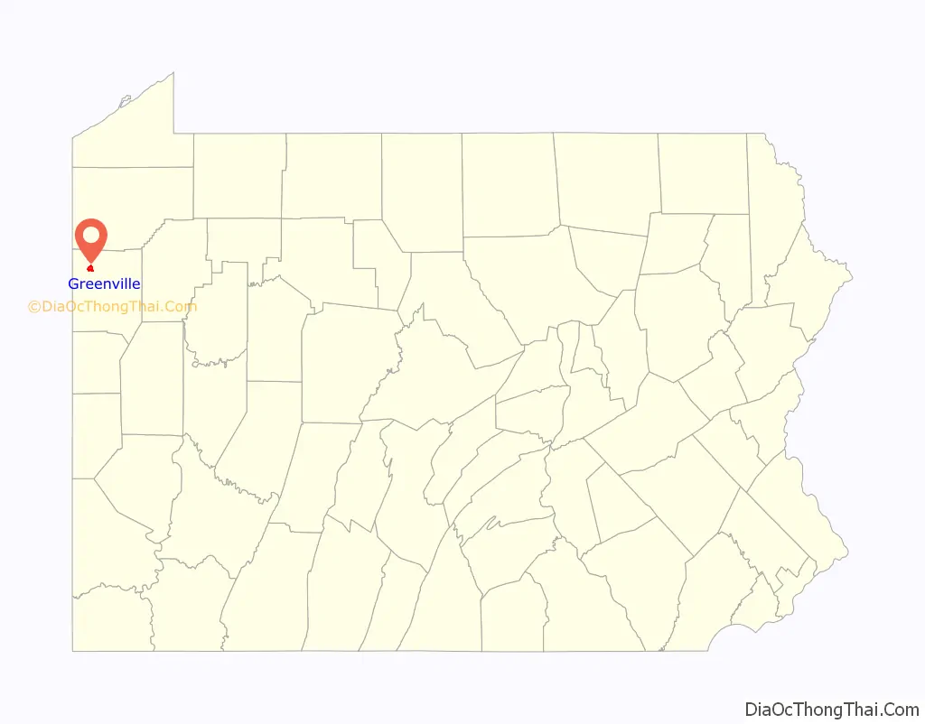
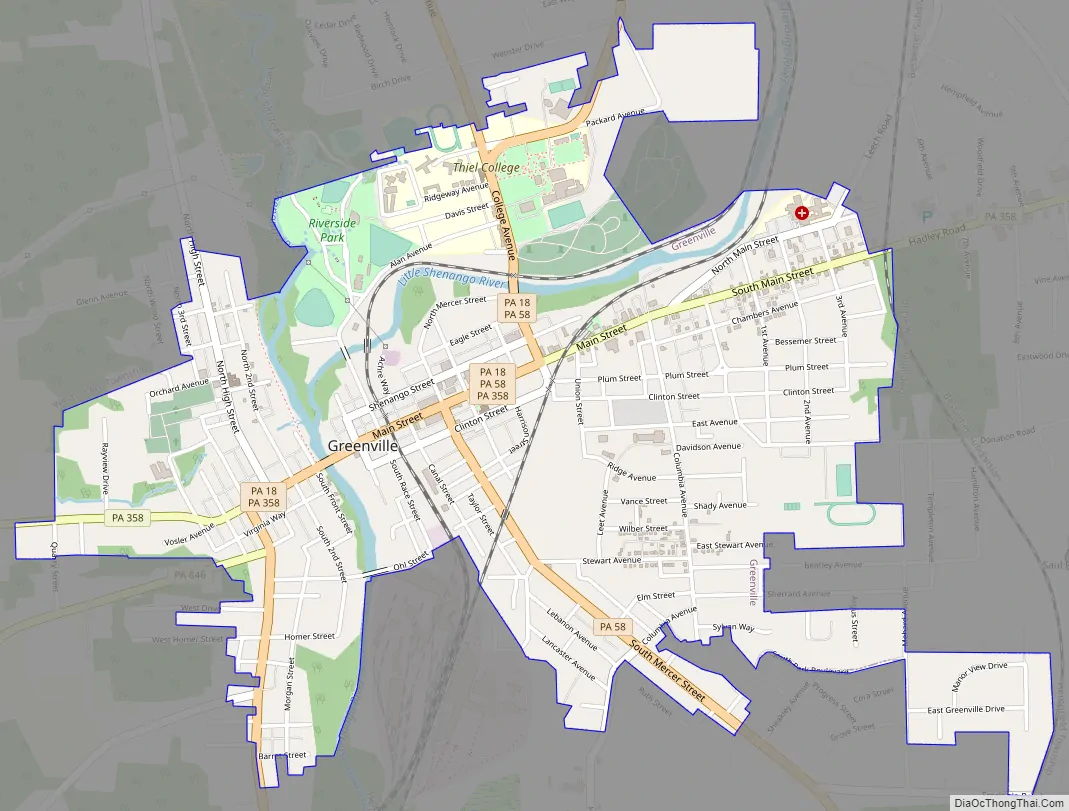
Greenville Road Map
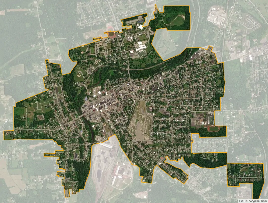
Greenville city Satellite Map
Geography
Greenville is located in northwest Pennsylvania at 41°24′18″N 80°23′12″W / 41.40500°N 80.38667°W / 41.40500; -80.38667 (41.404998, −80.386651), along the Shenango River. Its altitude is 945 feet (288 m) above sea level.
See also
Map of Pennsylvania State and its subdivision:- Adams
- Allegheny
- Armstrong
- Beaver
- Bedford
- Berks
- Blair
- Bradford
- Bucks
- Butler
- Cambria
- Cameron
- Carbon
- Centre
- Chester
- Clarion
- Clearfield
- Clinton
- Columbia
- Crawford
- Cumberland
- Dauphin
- Delaware
- Elk
- Erie
- Fayette
- Forest
- Franklin
- Fulton
- Greene
- Huntingdon
- Indiana
- Jefferson
- Juniata
- Lackawanna
- Lancaster
- Lawrence
- Lebanon
- Lehigh
- Luzerne
- Lycoming
- Mc Kean
- Mercer
- Mifflin
- Monroe
- Montgomery
- Montour
- Northampton
- Northumberland
- Perry
- Philadelphia
- Pike
- Potter
- Schuylkill
- Snyder
- Somerset
- Sullivan
- Susquehanna
- Tioga
- Union
- Venango
- Warren
- Washington
- Wayne
- Westmoreland
- Wyoming
- York
- Alabama
- Alaska
- Arizona
- Arkansas
- California
- Colorado
- Connecticut
- Delaware
- District of Columbia
- Florida
- Georgia
- Hawaii
- Idaho
- Illinois
- Indiana
- Iowa
- Kansas
- Kentucky
- Louisiana
- Maine
- Maryland
- Massachusetts
- Michigan
- Minnesota
- Mississippi
- Missouri
- Montana
- Nebraska
- Nevada
- New Hampshire
- New Jersey
- New Mexico
- New York
- North Carolina
- North Dakota
- Ohio
- Oklahoma
- Oregon
- Pennsylvania
- Rhode Island
- South Carolina
- South Dakota
- Tennessee
- Texas
- Utah
- Vermont
- Virginia
- Washington
- West Virginia
- Wisconsin
- Wyoming