Halfway House is a census-designated place (CDP) in Montgomery County, Pennsylvania, United States. The population was 2,881 at the 2010 census.
| Name: | Halfway House CDP |
|---|---|
| LSAD Code: | 57 |
| LSAD Description: | CDP (suffix) |
| State: | Pennsylvania |
| County: | Montgomery County |
| Elevation: | 384 ft (117 m) |
| Total Area: | 2.10 sq mi (5.44 km²) |
| Land Area: | 2.10 sq mi (5.44 km²) |
| Water Area: | 0.00 sq mi (0.00 km²) |
| Total Population: | 3,273 |
| Population Density: | 1,559.31/sq mi (601.96/km²) |
| ZIP code: | 19464 |
| FIPS code: | 4232024 |
Online Interactive Map
Click on ![]() to view map in "full screen" mode.
to view map in "full screen" mode.
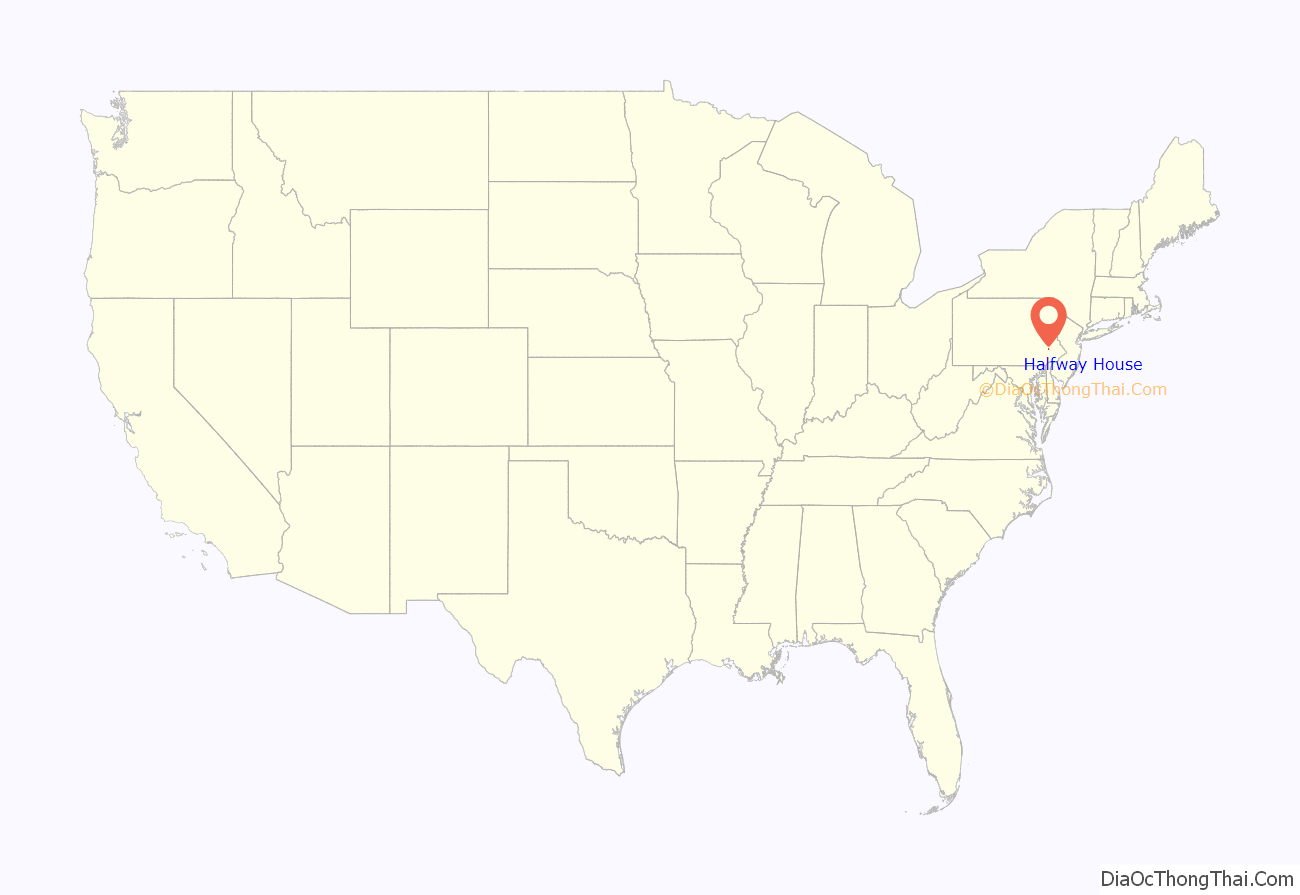
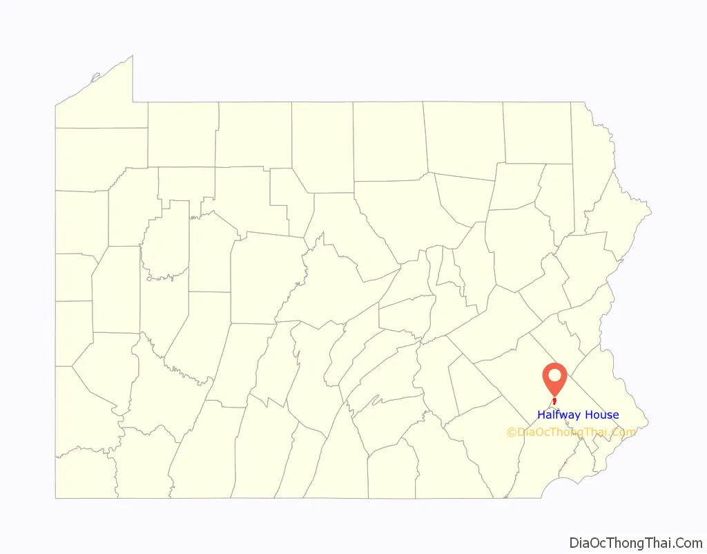
Halfway House location map. Where is Halfway House CDP?
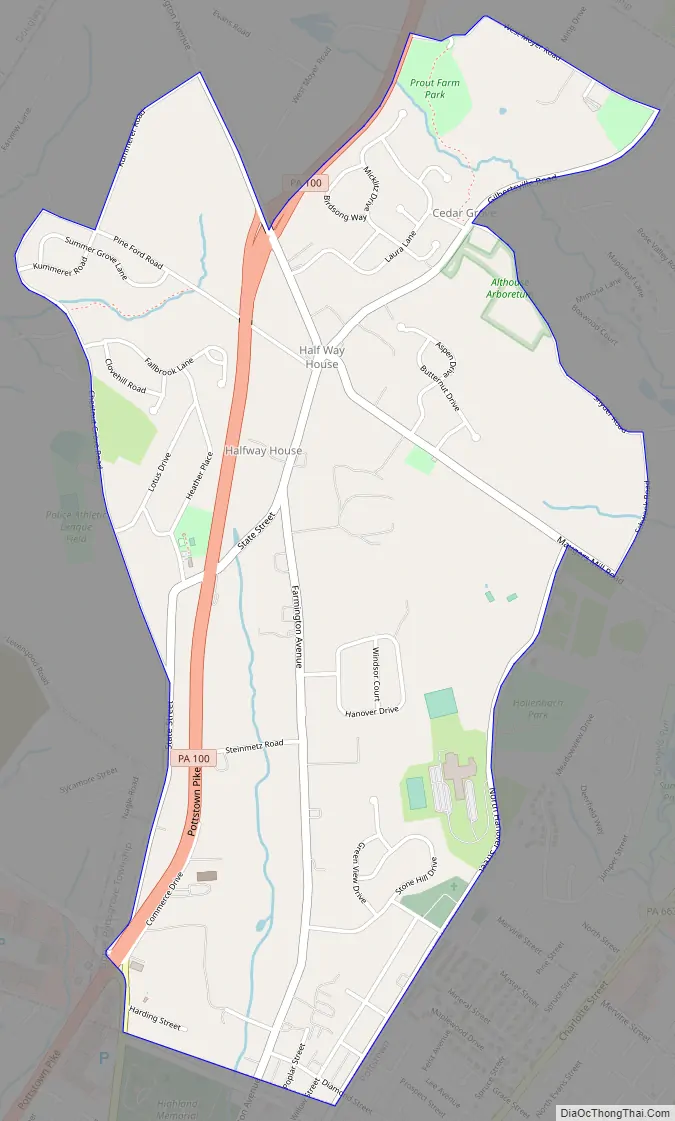
Halfway House Road Map
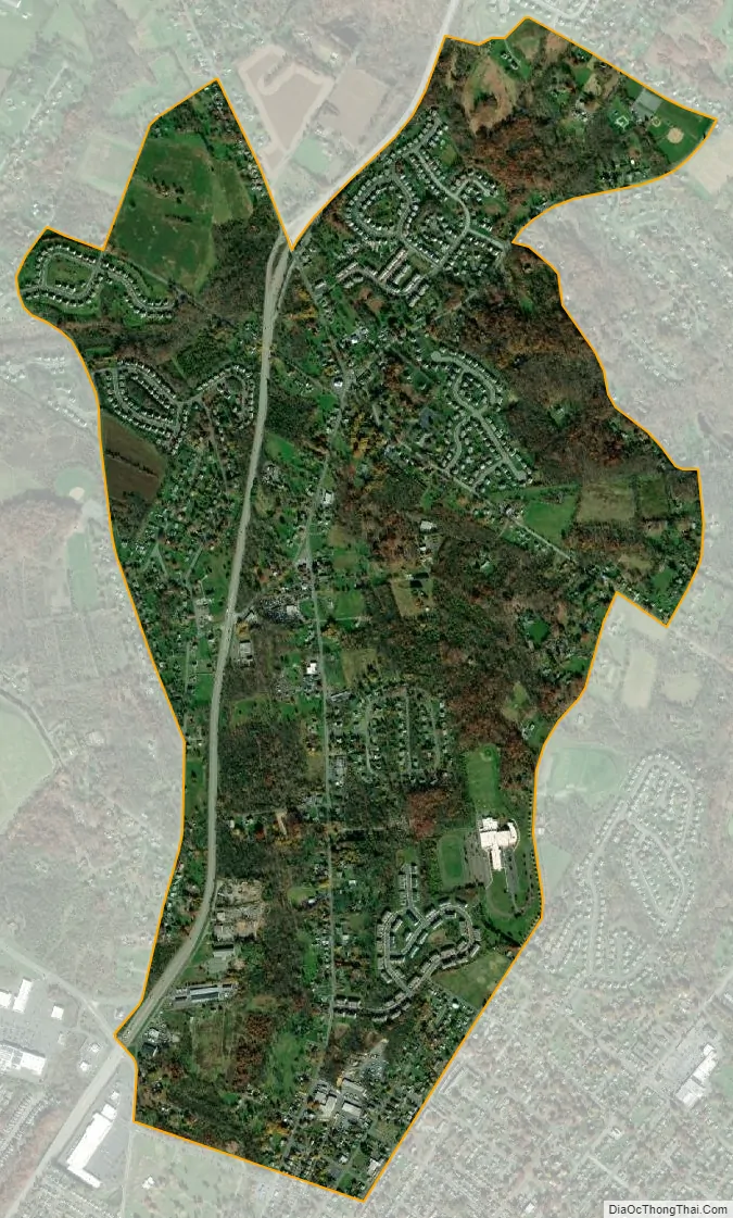
Halfway House city Satellite Map
Geography
Halfway House is located at 40°16′28″N 75°38′21″W / 40.27444°N 75.63917°W / 40.27444; -75.63917 (40.274479, -75.639118). According to the United States Census Bureau, the CDP has a total area of 2.0 square miles (5.2 km), all land.
It is located north of Pottstown on Route 100 and is served by the Pottsgrove School District and the Pottstown post office with the zip code of 19464.
See also
Map of Pennsylvania State and its subdivision:- Adams
- Allegheny
- Armstrong
- Beaver
- Bedford
- Berks
- Blair
- Bradford
- Bucks
- Butler
- Cambria
- Cameron
- Carbon
- Centre
- Chester
- Clarion
- Clearfield
- Clinton
- Columbia
- Crawford
- Cumberland
- Dauphin
- Delaware
- Elk
- Erie
- Fayette
- Forest
- Franklin
- Fulton
- Greene
- Huntingdon
- Indiana
- Jefferson
- Juniata
- Lackawanna
- Lancaster
- Lawrence
- Lebanon
- Lehigh
- Luzerne
- Lycoming
- Mc Kean
- Mercer
- Mifflin
- Monroe
- Montgomery
- Montour
- Northampton
- Northumberland
- Perry
- Philadelphia
- Pike
- Potter
- Schuylkill
- Snyder
- Somerset
- Sullivan
- Susquehanna
- Tioga
- Union
- Venango
- Warren
- Washington
- Wayne
- Westmoreland
- Wyoming
- York
- Alabama
- Alaska
- Arizona
- Arkansas
- California
- Colorado
- Connecticut
- Delaware
- District of Columbia
- Florida
- Georgia
- Hawaii
- Idaho
- Illinois
- Indiana
- Iowa
- Kansas
- Kentucky
- Louisiana
- Maine
- Maryland
- Massachusetts
- Michigan
- Minnesota
- Mississippi
- Missouri
- Montana
- Nebraska
- Nevada
- New Hampshire
- New Jersey
- New Mexico
- New York
- North Carolina
- North Dakota
- Ohio
- Oklahoma
- Oregon
- Pennsylvania
- Rhode Island
- South Carolina
- South Dakota
- Tennessee
- Texas
- Utah
- Vermont
- Virginia
- Washington
- West Virginia
- Wisconsin
- Wyoming


