Hamburg (Pennsylvania German: Hambarig) is a borough in Berks County, Pennsylvania, United States. The population was 4,270 at the 2020 census. The town is thought to have been named after Hamburg, Germany, but this is likely to have been a corruption of Bad Homburg.
| Name: | Hamburg borough |
|---|---|
| LSAD Code: | 21 |
| LSAD Description: | borough (suffix) |
| State: | Pennsylvania |
| County: | Berks County |
| Elevation: | 397 ft (121 m) |
| Total Area: | 1.96 sq mi (5.08 km²) |
| Land Area: | 1.89 sq mi (4.89 km²) |
| Water Area: | 0.07 sq mi (0.19 km²) |
| Total Population: | 4,270 |
| Population Density: | 2,262.85/sq mi (873.50/km²) |
| ZIP code: | 19526 |
| FIPS code: | 4232120 |
| Website: | hamburgboro.com |
Online Interactive Map
Click on ![]() to view map in "full screen" mode.
to view map in "full screen" mode.
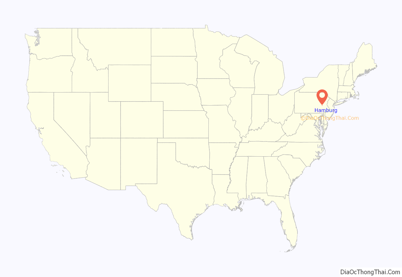
Hamburg location map. Where is Hamburg borough?
History
In 1779, Martin Kaercher Jr. received 250 acres (1.0 km) of land from his father and divided it into building lots, naming the area “Kaercher Stadt”. Hamburg was officially founded in 1787, generally thought to have been named after the “German Hamburg” due to the largely German population of the region. However, Martin Kaerscher Jr.’s father Johann Martin Kaerscher Sr. (1718-1787) emigrated in 1738 from Langenselbold in Hessia which is far from the northern seaport of Hamburg, so it is likely that “Hamburg” is a corruption of Bad Homburg due to the Blue Mountains’ very similar appearance to the Taunus mountain range.
On July 1, 1798 Hamburg became the second town with postal designation in Berks County, preceded only by Reading.
The Centre Turnpike was created in 1812, running between the two cities of Reading and Pottsville. Hamburg began to grow rapidly due to the close proximity of a major roadway. Eight years later, the Schuylkill Canal was completed, followed quickly by railroad lines. Both of these advances in infrastructure had stops in Hamburg and helped spur population growth.
Hamburg Borough was officially organized in 1837.
The Hamburg Historic District, Hamburg Armory, and Hamburg Public Library are listed on the National Register of Historic Places.
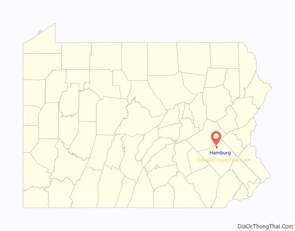
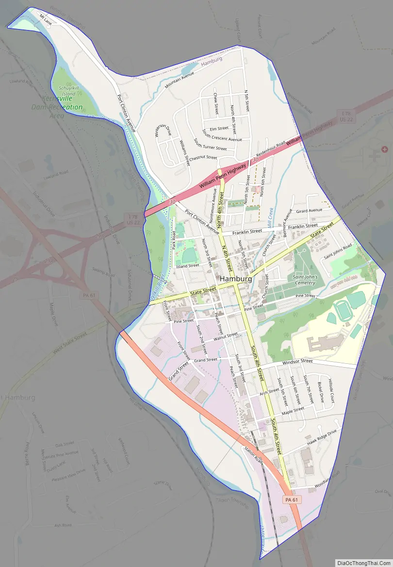
Hamburg Road Map
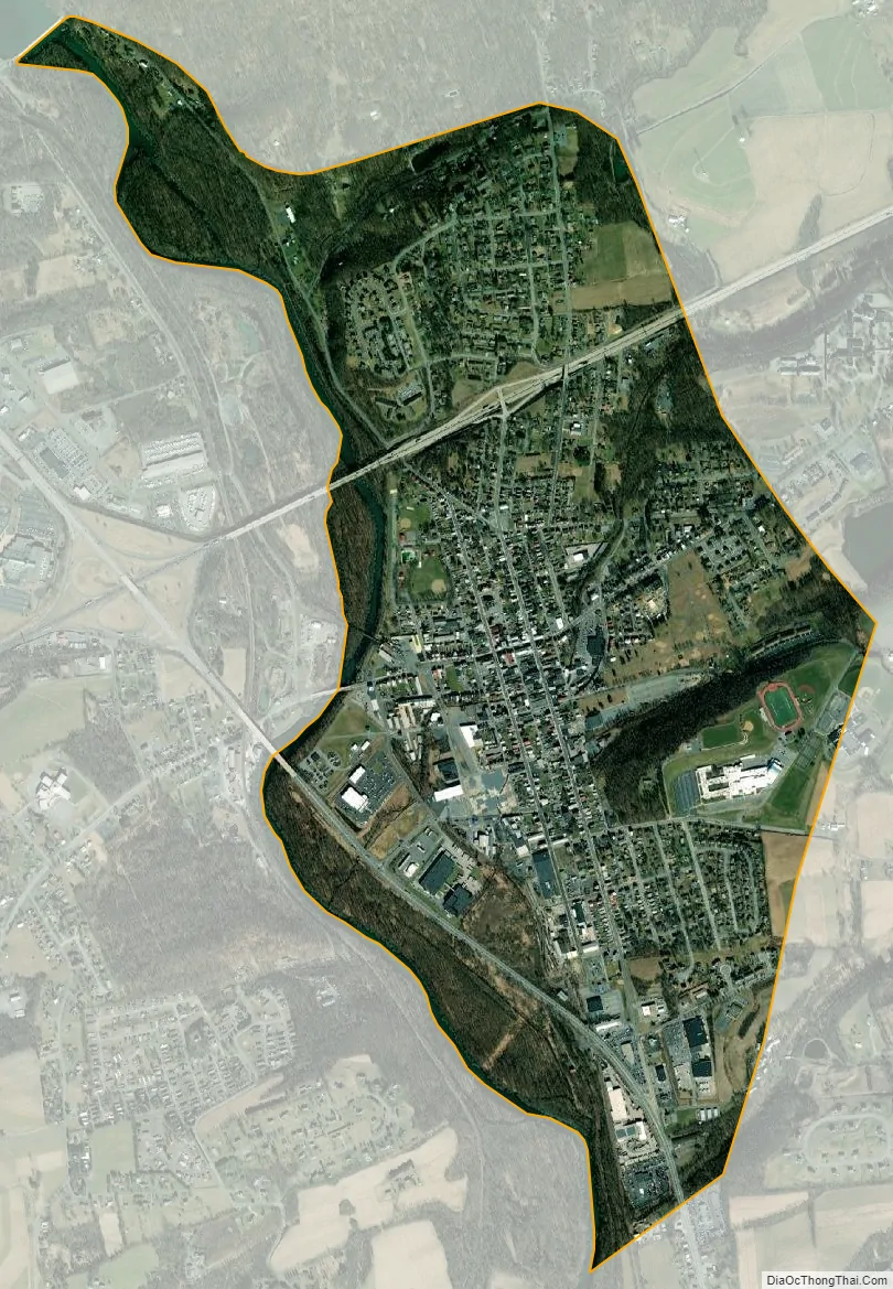
Hamburg city Satellite Map
Geography
Hamburg is located in northern Berks County at 40°33′0″N 75°59′0″W / 40.55000°N 75.98333°W / 40.55000; -75.98333 (40.556271, −75.982667), on the east bank of the Schuylkill River. It is bordered on the north, east, and south by Windsor Township and on the west, across the river, by West Hamburg in Tilden Township.
According to the United States Census Bureau, Hamburg has a total area of 1.9 square miles (5.0 km), of which 1.9 square miles (4.9 km) is land and 0.08 square miles (0.2 km), or 3.55%, is water.
Climate
It has a hot-summer humid continental climate (Dfa) and average monthly temperatures range from 28.4 °F in January to 73.4 °F in July. The hardiness zone is 6b.
See also
Map of Pennsylvania State and its subdivision:- Adams
- Allegheny
- Armstrong
- Beaver
- Bedford
- Berks
- Blair
- Bradford
- Bucks
- Butler
- Cambria
- Cameron
- Carbon
- Centre
- Chester
- Clarion
- Clearfield
- Clinton
- Columbia
- Crawford
- Cumberland
- Dauphin
- Delaware
- Elk
- Erie
- Fayette
- Forest
- Franklin
- Fulton
- Greene
- Huntingdon
- Indiana
- Jefferson
- Juniata
- Lackawanna
- Lancaster
- Lawrence
- Lebanon
- Lehigh
- Luzerne
- Lycoming
- Mc Kean
- Mercer
- Mifflin
- Monroe
- Montgomery
- Montour
- Northampton
- Northumberland
- Perry
- Philadelphia
- Pike
- Potter
- Schuylkill
- Snyder
- Somerset
- Sullivan
- Susquehanna
- Tioga
- Union
- Venango
- Warren
- Washington
- Wayne
- Westmoreland
- Wyoming
- York
- Alabama
- Alaska
- Arizona
- Arkansas
- California
- Colorado
- Connecticut
- Delaware
- District of Columbia
- Florida
- Georgia
- Hawaii
- Idaho
- Illinois
- Indiana
- Iowa
- Kansas
- Kentucky
- Louisiana
- Maine
- Maryland
- Massachusetts
- Michigan
- Minnesota
- Mississippi
- Missouri
- Montana
- Nebraska
- Nevada
- New Hampshire
- New Jersey
- New Mexico
- New York
- North Carolina
- North Dakota
- Ohio
- Oklahoma
- Oregon
- Pennsylvania
- Rhode Island
- South Carolina
- South Dakota
- Tennessee
- Texas
- Utah
- Vermont
- Virginia
- Washington
- West Virginia
- Wisconsin
- Wyoming


