Hatboro (known locally as the Boro) is a borough in Montgomery County, Pennsylvania, United States. The population was 8,238 at the 2020 census.
| Name: | Hatboro borough |
|---|---|
| LSAD Code: | 21 |
| LSAD Description: | borough (suffix) |
| State: | Pennsylvania |
| County: | Montgomery County |
| Founded: | 1715 |
| Elevation: | 223 ft (68 m) |
| Total Area: | 1.42 sq mi (3.68 km²) |
| Land Area: | 1.42 sq mi (3.68 km²) |
| Water Area: | 0.00 sq mi (0.00 km²) |
| Total Population: | 8,238 |
| Population Density: | 5,793.25/sq mi (2,237.17/km²) |
| ZIP code: | 19040 |
| FIPS code: | 4233088 |
| Website: | myhatboro.org |
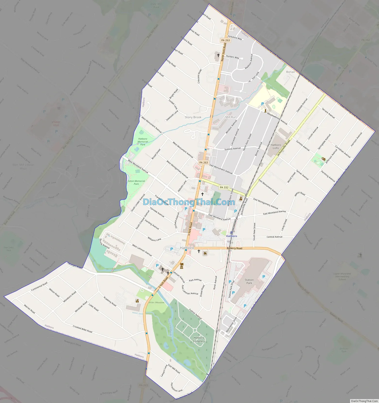
Online Interactive Map
Click on ![]() to view map in "full screen" mode.
to view map in "full screen" mode.
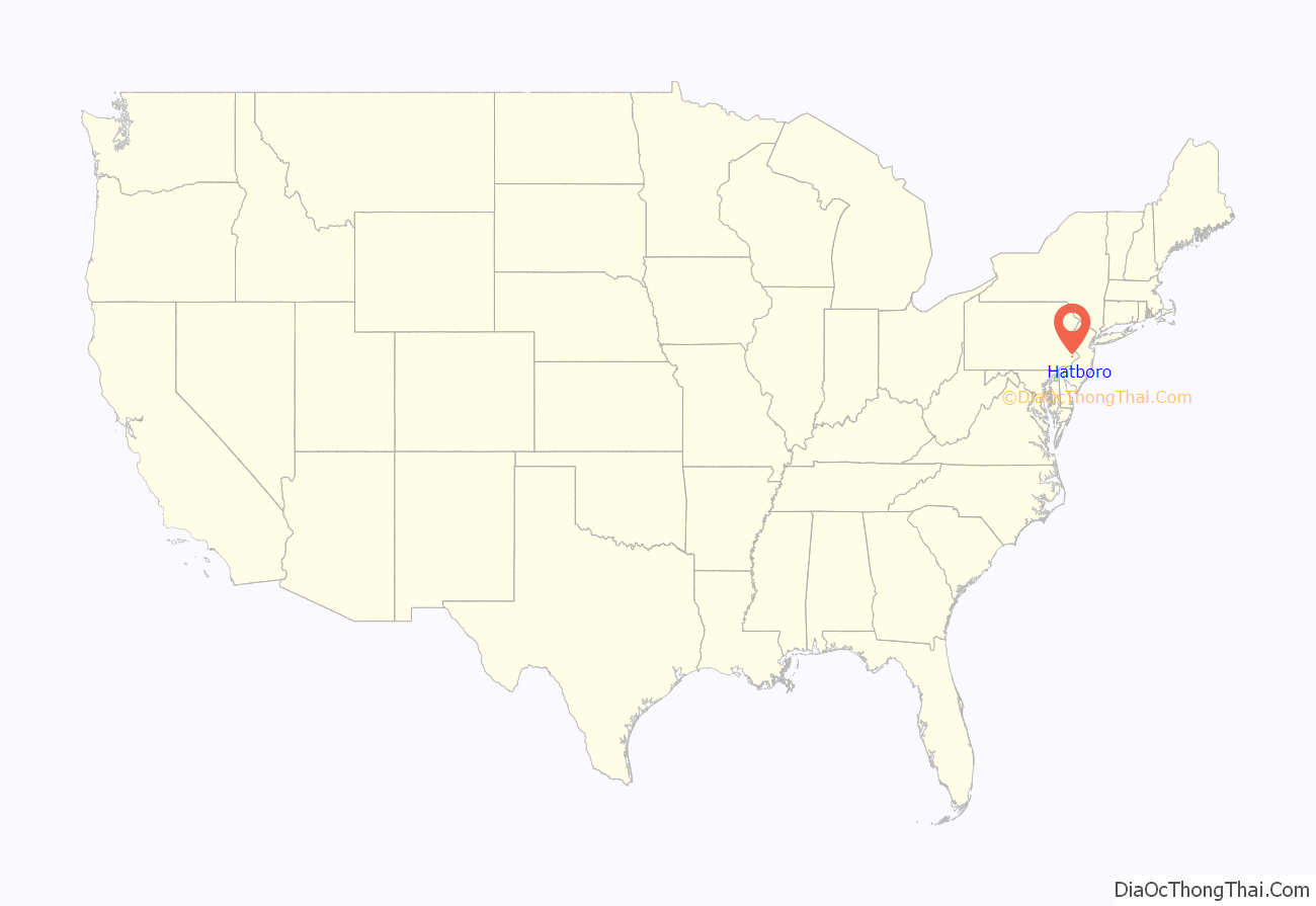
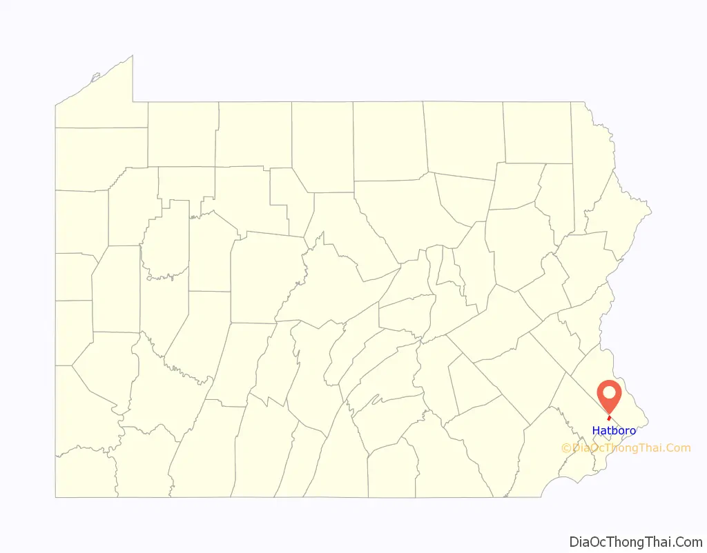
Hatboro location map. Where is Hatboro borough?
History
The town of Hatboro is located on land purchased from William Penn by the family of Nicholas More around 1705. The first land titles in town were issued in 1711. Original construction by early residents of the town occurred between 1715 and 1719. Early settlement pre-dating the Hatboro name occurred in the Crooked Billet area east of York Road, between Moreland Avenue and Byberry Road.
Early resident John Dawson entertained guests at the Crooked Billet Inn as well as manufacturing a line of hats. When the post office opened in 1809 the town was officially called Hatborough. U.S. Postmaster General John Wanamaker officially changed the name of the town in the 1880s to Hatboro.
The Union Library Company of Hatboro, the third library company to be founded in Pennsylvania, was formed in 1755. This building still stands on its original site today and still serves as a library. George Washington and his troops passed through the town numerous times during 1777 in pursuit of British Troops. The Battle of Crooked Billet was fought in 1778.
The year 1811 saw the construction of the Loller Academy, the first bank was built in 1873, and railroad service connected to Hatboro in 1874.
The Loller Academy, Roberts and Mander Stove Company Buildings, and Union Library Company are listed on the National Register of Historic Places.
Hatboro Road Map
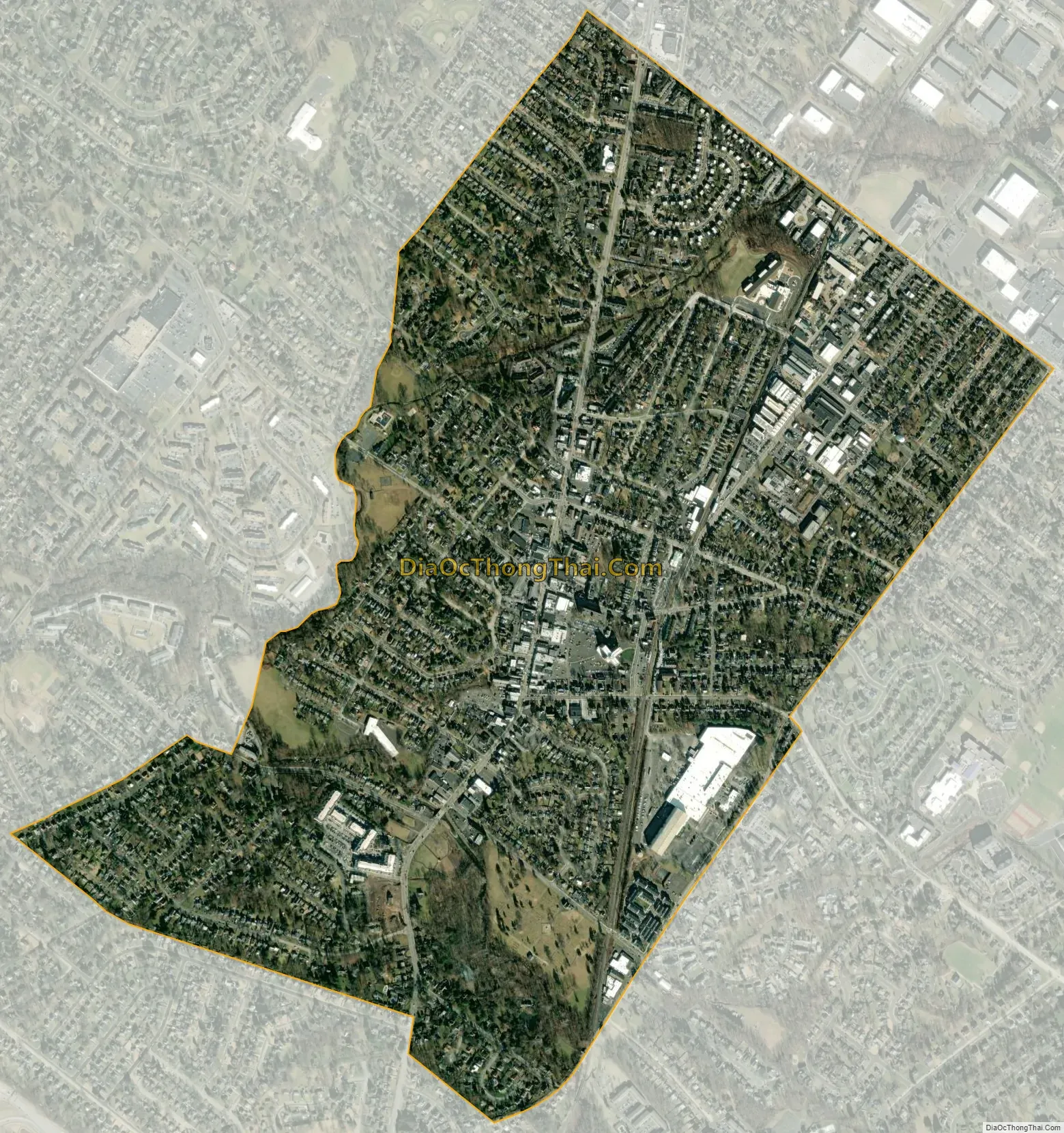
Hatboro city Satellite Map
Geography
Hatboro is located at 40°10′39″N 75°6′16″W / 40.17750°N 75.10444°W / 40.17750; -75.10444 (40.177635, -75.104424). According to the U.S. Census Bureau, the borough has a total area of 1.4 square miles (3.6 km), all land.
The Borough of Hatboro is a small municipality that is surrounded by Upper Moreland Township in Montgomery County to the west, south, and east; and Warminster Township in Bucks County to the north. The Pennypack Creek runs through the center of town under Pennsylvania Route 263 (York Road) and through the municipality.
Climate
The climate in this area is characterized by hot, humid summers and generally mild to cool winters. According to the Köppen Climate Classification system, Hatboro has a humid subtropical climate, abbreviated “Cfa” on climate maps.
See also
Map of Pennsylvania State and its subdivision:- Adams
- Allegheny
- Armstrong
- Beaver
- Bedford
- Berks
- Blair
- Bradford
- Bucks
- Butler
- Cambria
- Cameron
- Carbon
- Centre
- Chester
- Clarion
- Clearfield
- Clinton
- Columbia
- Crawford
- Cumberland
- Dauphin
- Delaware
- Elk
- Erie
- Fayette
- Forest
- Franklin
- Fulton
- Greene
- Huntingdon
- Indiana
- Jefferson
- Juniata
- Lackawanna
- Lancaster
- Lawrence
- Lebanon
- Lehigh
- Luzerne
- Lycoming
- Mc Kean
- Mercer
- Mifflin
- Monroe
- Montgomery
- Montour
- Northampton
- Northumberland
- Perry
- Philadelphia
- Pike
- Potter
- Schuylkill
- Snyder
- Somerset
- Sullivan
- Susquehanna
- Tioga
- Union
- Venango
- Warren
- Washington
- Wayne
- Westmoreland
- Wyoming
- York
- Alabama
- Alaska
- Arizona
- Arkansas
- California
- Colorado
- Connecticut
- Delaware
- District of Columbia
- Florida
- Georgia
- Hawaii
- Idaho
- Illinois
- Indiana
- Iowa
- Kansas
- Kentucky
- Louisiana
- Maine
- Maryland
- Massachusetts
- Michigan
- Minnesota
- Mississippi
- Missouri
- Montana
- Nebraska
- Nevada
- New Hampshire
- New Jersey
- New Mexico
- New York
- North Carolina
- North Dakota
- Ohio
- Oklahoma
- Oregon
- Pennsylvania
- Rhode Island
- South Carolina
- South Dakota
- Tennessee
- Texas
- Utah
- Vermont
- Virginia
- Washington
- West Virginia
- Wisconsin
- Wyoming


