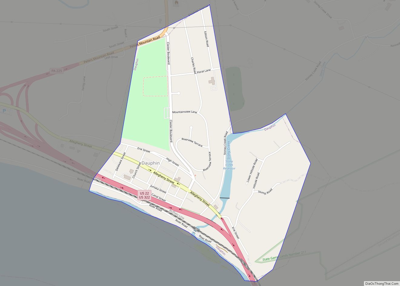
Highspire is a borough in Dauphin County, Pennsylvania, United States. The population was 2,736 at the 2020 census, an increase over the figure of 2,399 tabulated in 2010. It is part of the Harrisburg–Carlisle Metropolitan Statistical Area.
| Name: | Highspire borough |
|---|---|
| LSAD Code: | 21 |
| LSAD Description: | borough (suffix) |
| State: | Pennsylvania |
| County: | Dauphin County |
| Incorporated: | 1867 |
| Elevation: | 312 ft (95 m) |
| Total Area: | 0.74 sq mi (1.92 km²) |
| Land Area: | 0.72 sq mi (1.86 km²) |
| Water Area: | 0.02 sq mi (0.06 km²) |
| Total Population: | 2,741 |
| Population Density: | 3,812.24/sq mi (1,472.27/km²) |
| ZIP code: | 17034 |
| Area code: | 717 |
| FIPS code: | 4234664 |
| Website: | www.highspire.org |
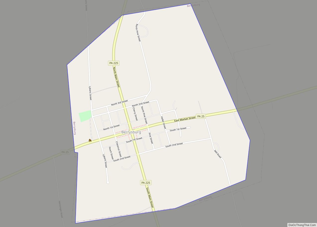
Online Interactive Map
Click on ![]() to view map in "full screen" mode.
to view map in "full screen" mode.
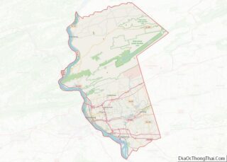
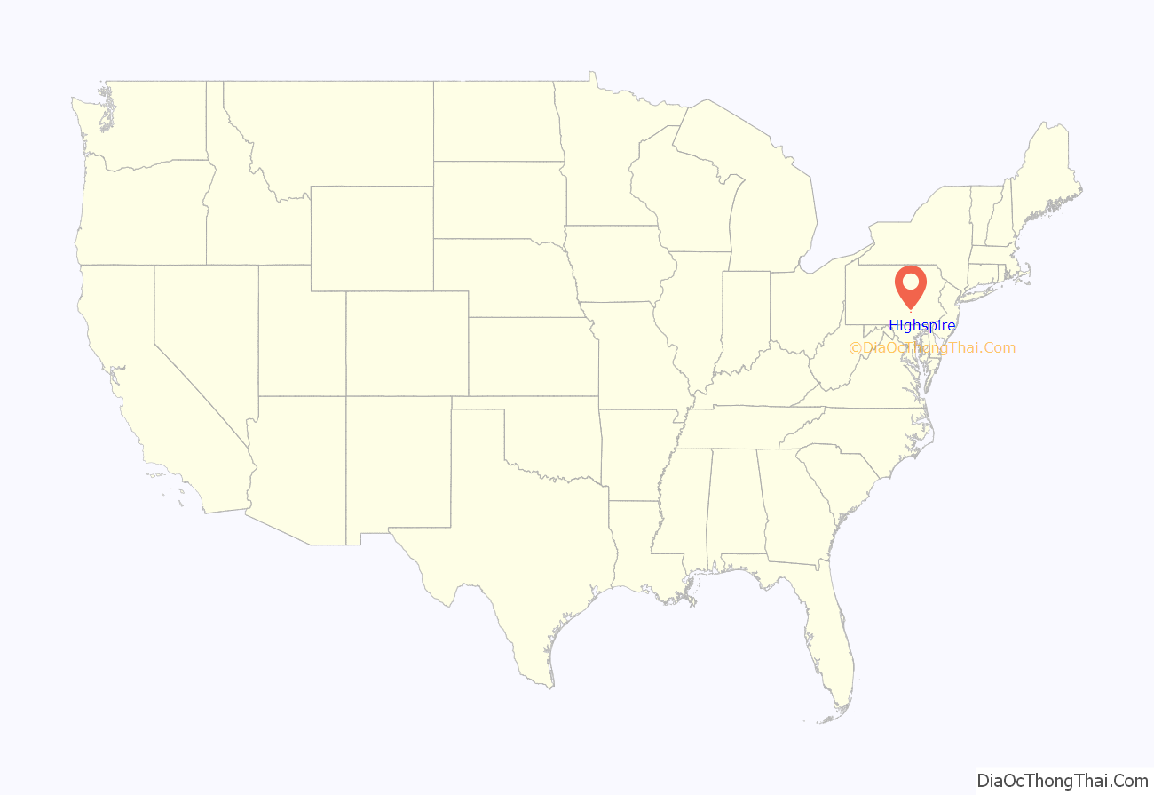
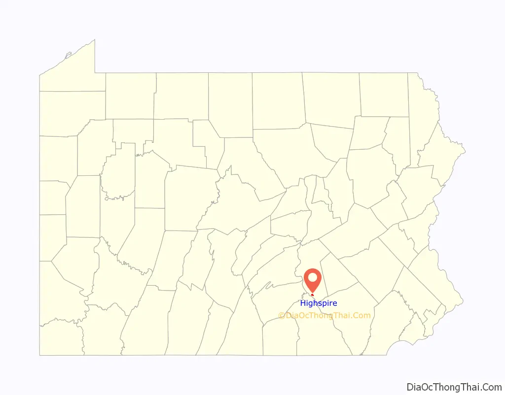
Highspire location map. Where is Highspire borough?
History
It is debated as to whether the town was named for the high spire of the church that could be seen from the Susquehanna River, or for the town in Bavaria where the original settlers and founders of the town were from. Either way, the town has a rich history of logging, the Pennsylvania canal system, candy, potato chips, whiskey, and hard working folks. It is a quaint little town nestled in between the towns of Steelton (home of the steel mill) and Middletown (where Harrisburg International Airport is located).
The Highspire High School was added to the National Register of Historic Places in 1990.
Highspire Road Map
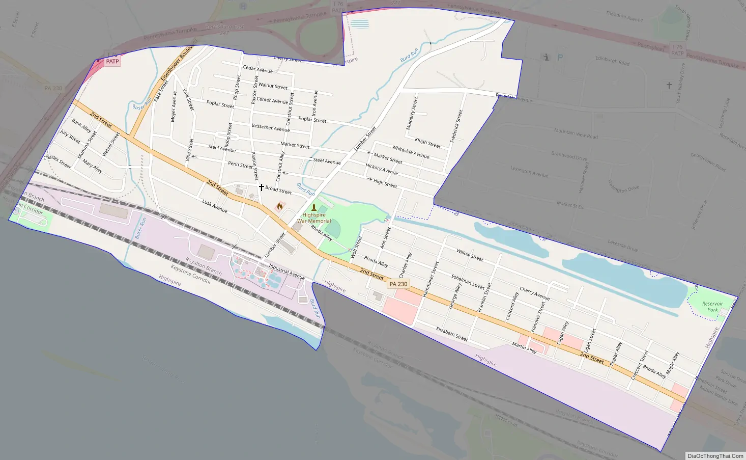
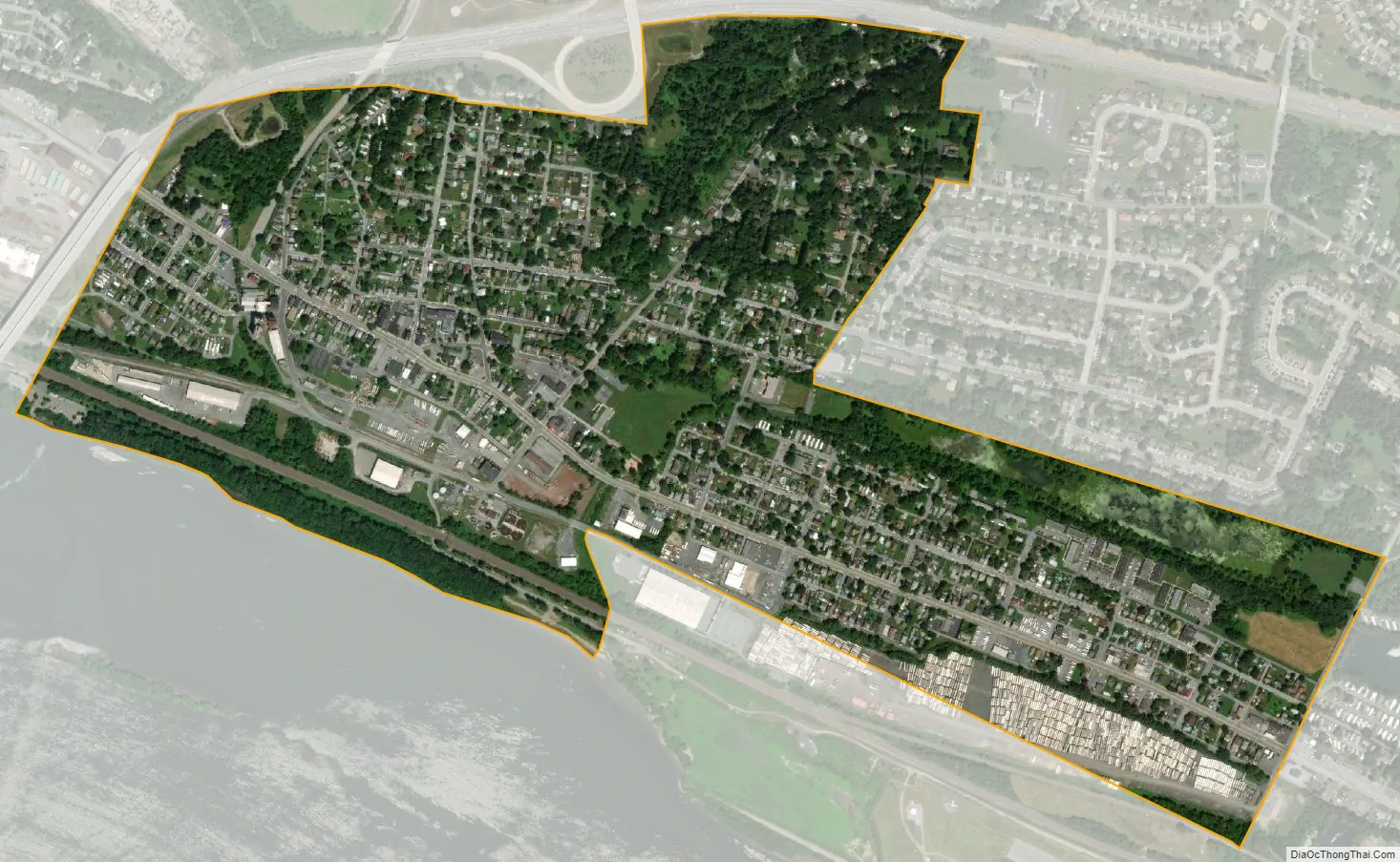
Highspire city Satellite Map
Geography
Highspire is located in southern Dauphin County at 40°12′27″N 76°47′5″W / 40.20750°N 76.78472°W / 40.20750; -76.78472 (40.207622, -76.784698), on the northeast bank of the Susquehanna River. Interstate 76, the Pennsylvania Turnpike, curves around the west and north sides of the borough, with indirect access from Exit 247 (Interstate 283). Pennsylvania Route 230 (Second Street) is the main road through the borough, leading northwest 7 miles (11 km) through Steelton to Harrisburg and southeast 3 miles (5 km) to Middletown and 11 miles (18 km) to Elizabethtown.
According to the United States Census Bureau, the borough has a total area of 0.74 square miles (1.92 km), of which 0.72 square miles (1.86 km) is land and 0.02 square miles (0.06 km), or 2.96%, is water.
See also
Map of Pennsylvania State and its subdivision:- Adams
- Allegheny
- Armstrong
- Beaver
- Bedford
- Berks
- Blair
- Bradford
- Bucks
- Butler
- Cambria
- Cameron
- Carbon
- Centre
- Chester
- Clarion
- Clearfield
- Clinton
- Columbia
- Crawford
- Cumberland
- Dauphin
- Delaware
- Elk
- Erie
- Fayette
- Forest
- Franklin
- Fulton
- Greene
- Huntingdon
- Indiana
- Jefferson
- Juniata
- Lackawanna
- Lancaster
- Lawrence
- Lebanon
- Lehigh
- Luzerne
- Lycoming
- Mc Kean
- Mercer
- Mifflin
- Monroe
- Montgomery
- Montour
- Northampton
- Northumberland
- Perry
- Philadelphia
- Pike
- Potter
- Schuylkill
- Snyder
- Somerset
- Sullivan
- Susquehanna
- Tioga
- Union
- Venango
- Warren
- Washington
- Wayne
- Westmoreland
- Wyoming
- York
- Alabama
- Alaska
- Arizona
- Arkansas
- California
- Colorado
- Connecticut
- Delaware
- District of Columbia
- Florida
- Georgia
- Hawaii
- Idaho
- Illinois
- Indiana
- Iowa
- Kansas
- Kentucky
- Louisiana
- Maine
- Maryland
- Massachusetts
- Michigan
- Minnesota
- Mississippi
- Missouri
- Montana
- Nebraska
- Nevada
- New Hampshire
- New Jersey
- New Mexico
- New York
- North Carolina
- North Dakota
- Ohio
- Oklahoma
- Oregon
- Pennsylvania
- Rhode Island
- South Carolina
- South Dakota
- Tennessee
- Texas
- Utah
- Vermont
- Virginia
- Washington
- West Virginia
- Wisconsin
- Wyoming