Idaville is a census-designated place in Huntington Township, Adams County, Pennsylvania, United States. As of the 2020 census its population was 176. Idaville is served by the Bermudian Springs School District.
| Name: | Idaville CDP |
|---|---|
| LSAD Code: | 57 |
| LSAD Description: | CDP (suffix) |
| State: | Pennsylvania |
| County: | Adams County |
| Elevation: | 804 ft (245 m) |
| Total Area: | 0.70 sq mi (1.81 km²) |
| Land Area: | 0.69 sq mi (1.80 km²) |
| Water Area: | 0.00 sq mi (0.01 km²) |
| Total Population: | 176 |
| Population Density: | 253.24/sq mi (97.78/km²) |
| ZIP code: | 17337 |
| Area code: | 717 |
| FIPS code: | 4236712 |
| GNISfeature ID: | 1177683 |
Online Interactive Map
Click on ![]() to view map in "full screen" mode.
to view map in "full screen" mode.
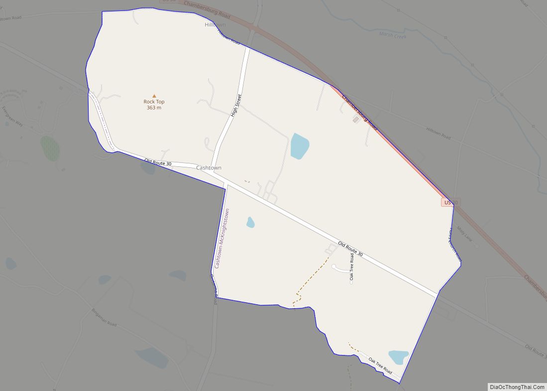
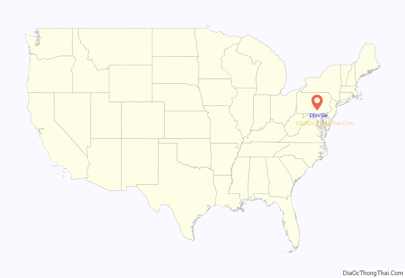
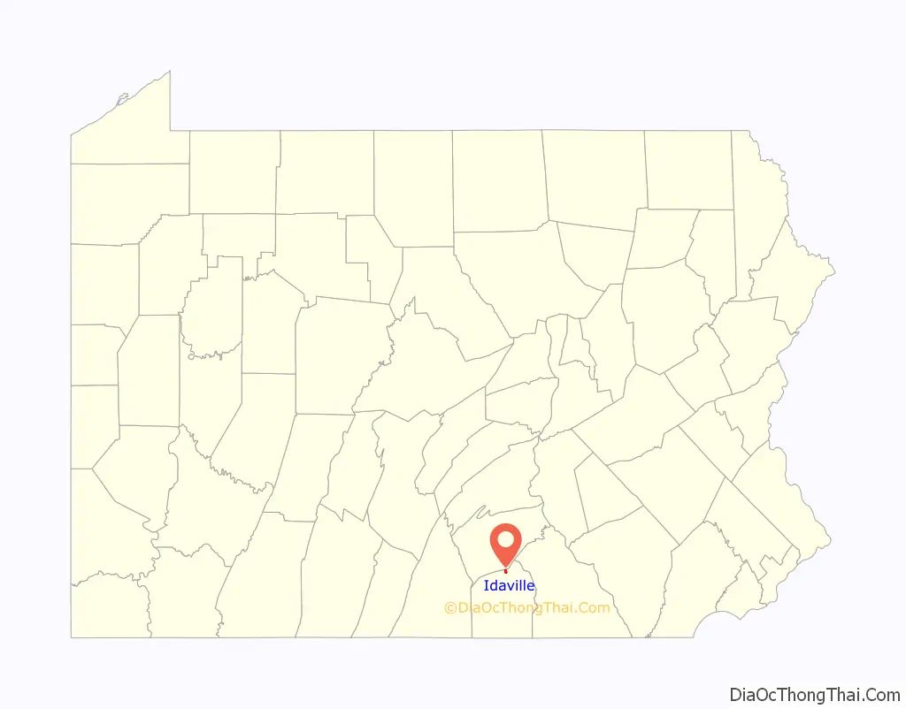
Idaville location map. Where is Idaville CDP?
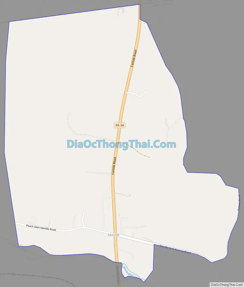
Idaville Road Map
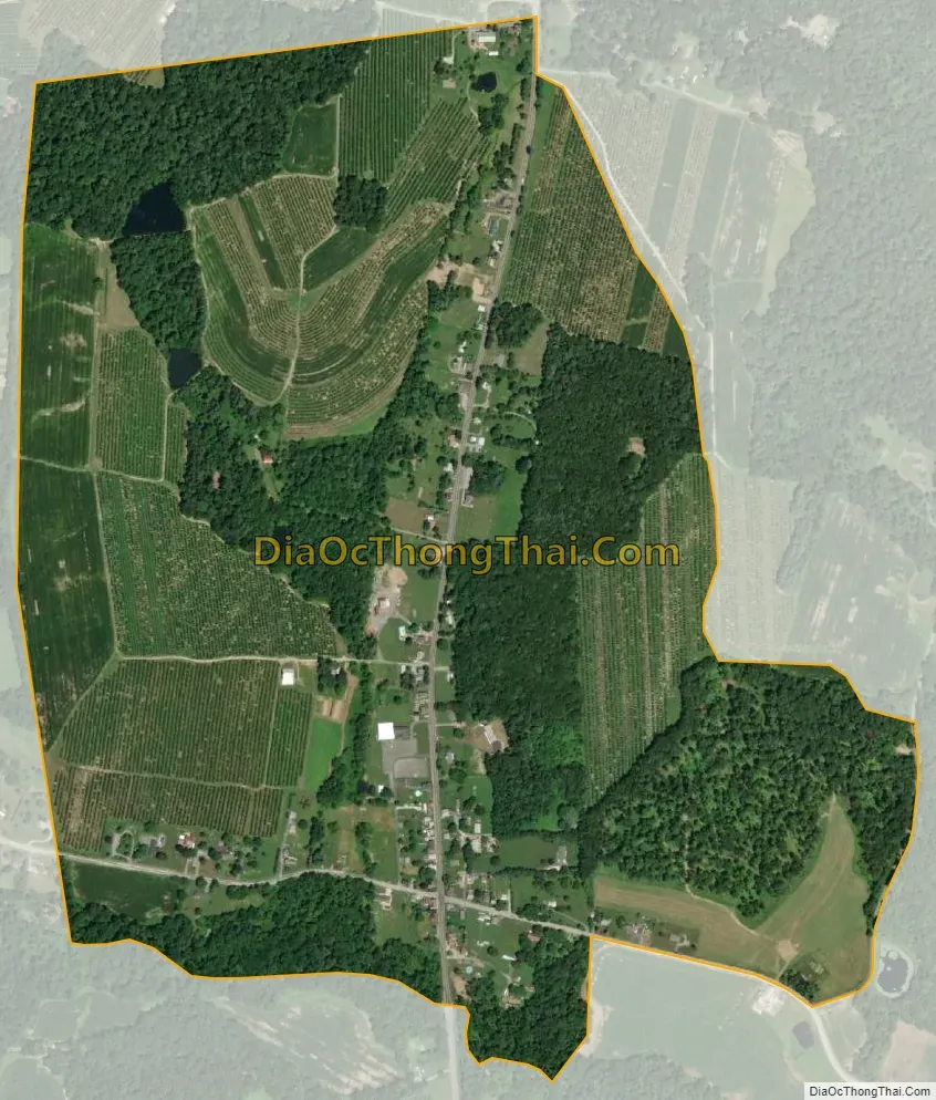
Idaville city Satellite Map
Geography
Idaville is located on Pennsylvania Route 34, 7 miles (11 km) south of Mount Holly Springs. The town (which starts at the Adams-Cumberland County line) stretches for 1 mile (1.6 km) along Route 34 and is separated from Tyrone Township, adjacent to the south end of the town, by Bermudian Creek.
Idaville is located at 40°00′53″N 77°12′10″W / 40.01472°N 77.20278°W / 40.01472; -77.20278 at an elevation of 804 feet (245 m) above sea level.
See also
Map of Pennsylvania State and its subdivision:- Adams
- Allegheny
- Armstrong
- Beaver
- Bedford
- Berks
- Blair
- Bradford
- Bucks
- Butler
- Cambria
- Cameron
- Carbon
- Centre
- Chester
- Clarion
- Clearfield
- Clinton
- Columbia
- Crawford
- Cumberland
- Dauphin
- Delaware
- Elk
- Erie
- Fayette
- Forest
- Franklin
- Fulton
- Greene
- Huntingdon
- Indiana
- Jefferson
- Juniata
- Lackawanna
- Lancaster
- Lawrence
- Lebanon
- Lehigh
- Luzerne
- Lycoming
- Mc Kean
- Mercer
- Mifflin
- Monroe
- Montgomery
- Montour
- Northampton
- Northumberland
- Perry
- Philadelphia
- Pike
- Potter
- Schuylkill
- Snyder
- Somerset
- Sullivan
- Susquehanna
- Tioga
- Union
- Venango
- Warren
- Washington
- Wayne
- Westmoreland
- Wyoming
- York
- Alabama
- Alaska
- Arizona
- Arkansas
- California
- Colorado
- Connecticut
- Delaware
- District of Columbia
- Florida
- Georgia
- Hawaii
- Idaho
- Illinois
- Indiana
- Iowa
- Kansas
- Kentucky
- Louisiana
- Maine
- Maryland
- Massachusetts
- Michigan
- Minnesota
- Mississippi
- Missouri
- Montana
- Nebraska
- Nevada
- New Hampshire
- New Jersey
- New Mexico
- New York
- North Carolina
- North Dakota
- Ohio
- Oklahoma
- Oregon
- Pennsylvania
- Rhode Island
- South Carolina
- South Dakota
- Tennessee
- Texas
- Utah
- Vermont
- Virginia
- Washington
- West Virginia
- Wisconsin
- Wyoming