Jefferson is a borough in Greene County, Pennsylvania, United States. The population was 253 at the 2020 census, a decline from the figure of 270 tabulated in 2010. The borough was named after Thomas Jefferson.
| Name: | Jefferson borough |
|---|---|
| LSAD Code: | 21 |
| LSAD Description: | borough (suffix) |
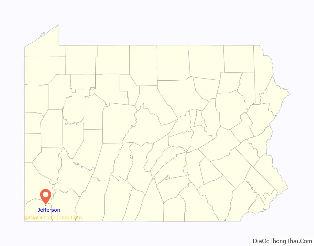
| State: | Pennsylvania |
| County: | Greene County |
| Elevation: | 960 ft (290 m) |
| Total Area: | 0.19 sq mi (0.49 km²) |
| Land Area: | 0.19 sq mi (0.49 km²) |
| Water Area: | 0.00 sq mi (0.00 km²) |
| Total Population: | 253 |
| Population Density: | 1,345.74/sq mi (519.98/km²) |
| ZIP code: | 15344 |
| Area code: | 724 |
| FIPS code: | 4237880 |
Online Interactive Map
Click on ![]() to view map in "full screen" mode.
to view map in "full screen" mode.
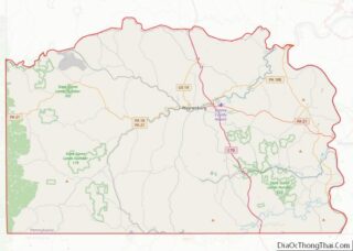
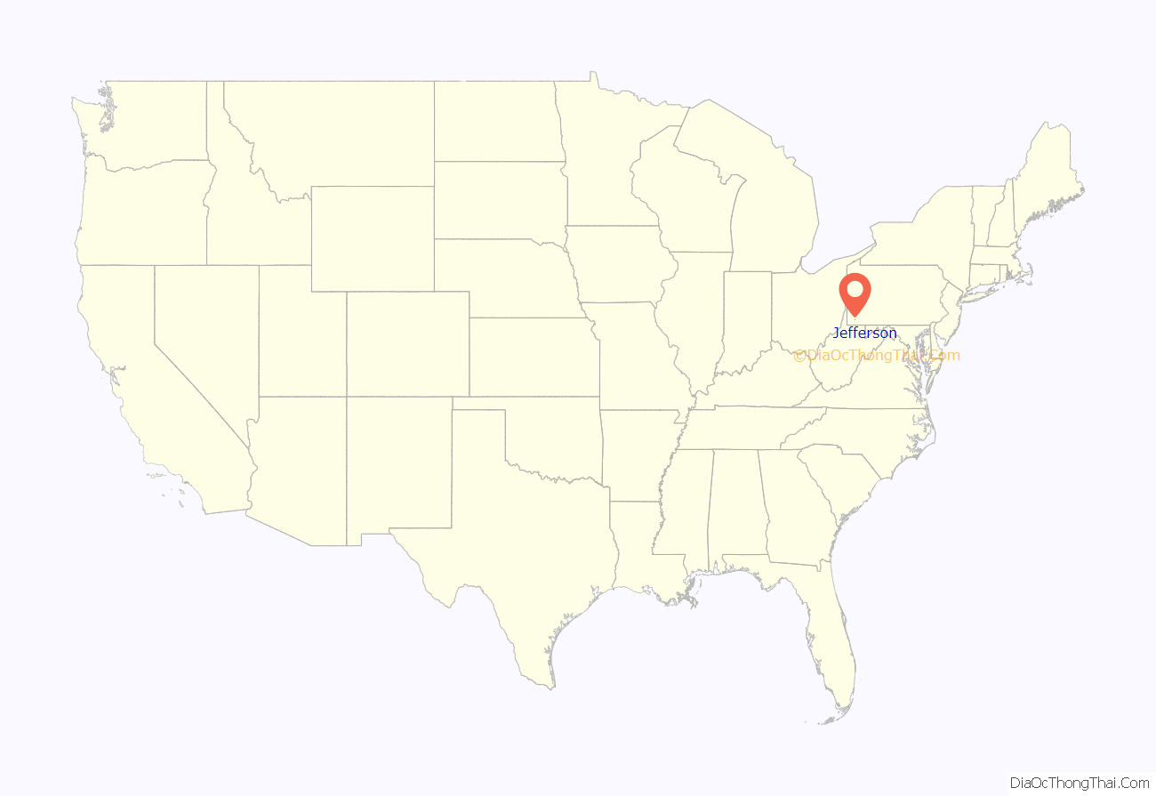
Jefferson location map. Where is Jefferson borough?
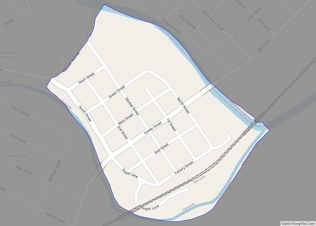
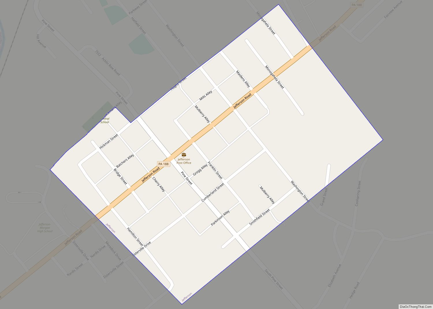
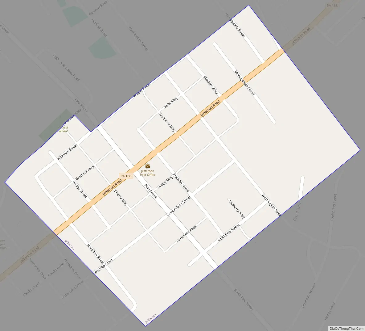
Jefferson Road Map
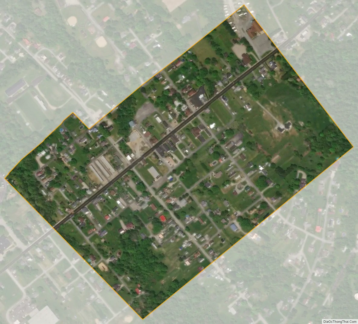
Jefferson city Satellite Map
Geography
Jefferson is located in northeastern Greene County at 39°55′49″N 80°3′32″W / 39.93028°N 80.05889°W / 39.93028; -80.05889 (39.930322, -80.058993). It is surrounded by Jefferson Township, a separate municipality. Pennsylvania Route 188 (Jefferson Road) passes through the center of the borough, leading east 3 miles (5 km) to Dry Tavern and west 7 miles (11 km) to Waynesburg, the county seat.
According to the United States Census Bureau, the borough has a total area of 0.19 square miles (0.49 km), all land. The South Fork of Tenmile Creek passes just north of the borough.
See also
Map of Pennsylvania State and its subdivision:- Adams
- Allegheny
- Armstrong
- Beaver
- Bedford
- Berks
- Blair
- Bradford
- Bucks
- Butler
- Cambria
- Cameron
- Carbon
- Centre
- Chester
- Clarion
- Clearfield
- Clinton
- Columbia
- Crawford
- Cumberland
- Dauphin
- Delaware
- Elk
- Erie
- Fayette
- Forest
- Franklin
- Fulton
- Greene
- Huntingdon
- Indiana
- Jefferson
- Juniata
- Lackawanna
- Lancaster
- Lawrence
- Lebanon
- Lehigh
- Luzerne
- Lycoming
- Mc Kean
- Mercer
- Mifflin
- Monroe
- Montgomery
- Montour
- Northampton
- Northumberland
- Perry
- Philadelphia
- Pike
- Potter
- Schuylkill
- Snyder
- Somerset
- Sullivan
- Susquehanna
- Tioga
- Union
- Venango
- Warren
- Washington
- Wayne
- Westmoreland
- Wyoming
- York
- Alabama
- Alaska
- Arizona
- Arkansas
- California
- Colorado
- Connecticut
- Delaware
- District of Columbia
- Florida
- Georgia
- Hawaii
- Idaho
- Illinois
- Indiana
- Iowa
- Kansas
- Kentucky
- Louisiana
- Maine
- Maryland
- Massachusetts
- Michigan
- Minnesota
- Mississippi
- Missouri
- Montana
- Nebraska
- Nevada
- New Hampshire
- New Jersey
- New Mexico
- New York
- North Carolina
- North Dakota
- Ohio
- Oklahoma
- Oregon
- Pennsylvania
- Rhode Island
- South Carolina
- South Dakota
- Tennessee
- Texas
- Utah
- Vermont
- Virginia
- Washington
- West Virginia
- Wisconsin
- Wyoming