Jenkintown is a borough in Montgomery County, Pennsylvania. It is approximately 10 miles (16 km) north of Center City Philadelphia.
| Name: | Jenkintown borough |
|---|---|
| LSAD Code: | 21 |
| LSAD Description: | borough (suffix) |
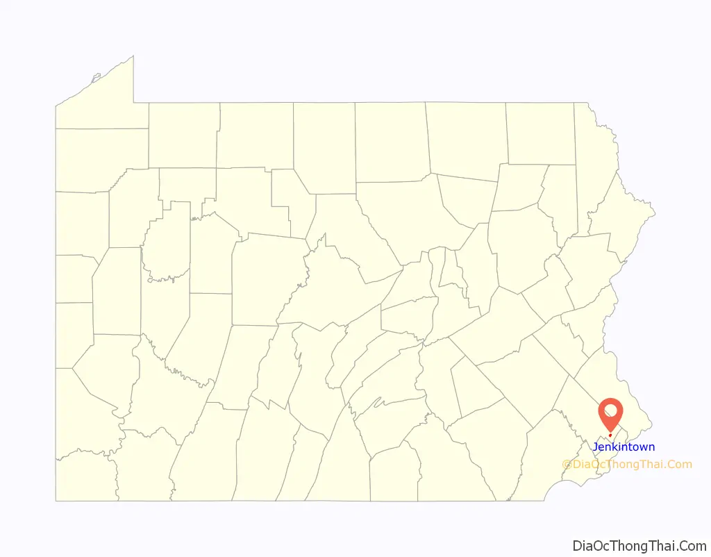
| State: | Pennsylvania |
| County: | Montgomery County |
| Incorporated: | December 8, 1874 |
| Elevation: | 322 ft (98 m) |
| Total Area: | 0.59 sq mi (1.52 km²) |
| Land Area: | 0.59 sq mi (1.52 km²) |
| Water Area: | 0.00 sq mi (0.00 km²) |
| Total Population: | 4,719 |
| Population Density: | 8,052.90/sq mi (3,106.87/km²) |
| ZIP code: | 19046 |
| FIPS code: | 4238000 |
| Website: | www.jenkintownboro.com |
Online Interactive Map
Click on ![]() to view map in "full screen" mode.
to view map in "full screen" mode.
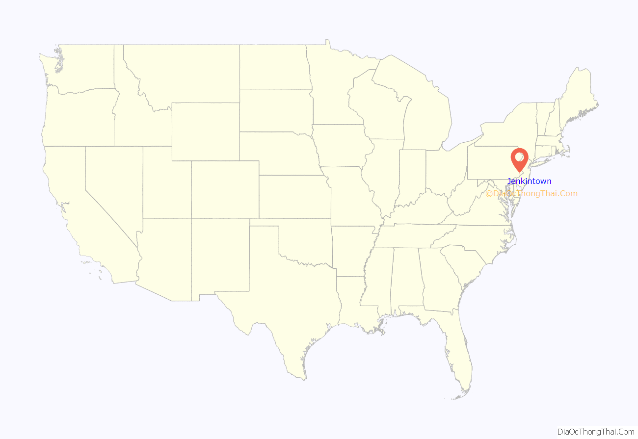
Jenkintown location map. Where is Jenkintown borough?
History
The community was named for William Jenkins, a Welsh pioneer settler.
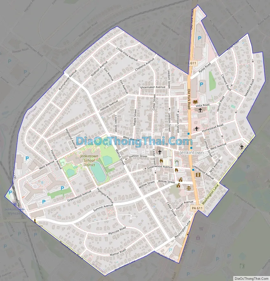
Jenkintown is located just outside Philadelphia along the Route 611 corridor between Abington and Cheltenham Townships. The borough was settled in about 1697 and incorporated on December 8, 1874 when approximately 248 acres (1.00 km) was taken from Abington Township. Today, the Borough is approximately 0.58 square miles and is home to 4,500 residents.
The borough is a mostly residential community that is separated into East and West by the Business District that runs along and surrounds Old York Road (Route 611) corridor. On the east side of Old York Road, residential development is predominantly characterized by larger detached single-family homes on lots larger than the Borough average. On the southeast side of York Road, there is a small mixed concentration of row homes, duplexes, and single-family residences. The majority of the residential development, however, is located to the west of York Road. This area consists of a traditional small town mix of detached single-family homes, duplexes (“twins”), and row homes. Located throughout this area are several multi-family apartment buildings that are residential condominium or rental properties. At the center of this residential area are the Jenkintown Elementary School and the Jenkintown High School.
Until its 2023 consolidation into a single volunteer department, the Jenkintown Fire Department consisted of two fire companies, each founded more than 125 years ago. The Jenkintown Fire Department is a totally volunteer department. Prior to consolidation, it consisted of the Pioneer Fire Company #1 and the Independent Fire Company #2. The Pioneer Company was organized in 1884 and the Independent Company was organized in 1889, an artifact of the historical split between Catholics and Protestants in the population of the borough. The Jenkintown Fire Department has a total membership of approximately 150 with 50 members composing the active firefighting crew.
Elements of the British army passed through Jenkintown en route to the Battle of White Marsh in early December 1777.
The Jenkins’ Town Lyceum Building, Jenkintown-Wyncote station, and Strawbridge and Clothier Store are listed on the National Register of Historic Places.
Jenkintown Road Map
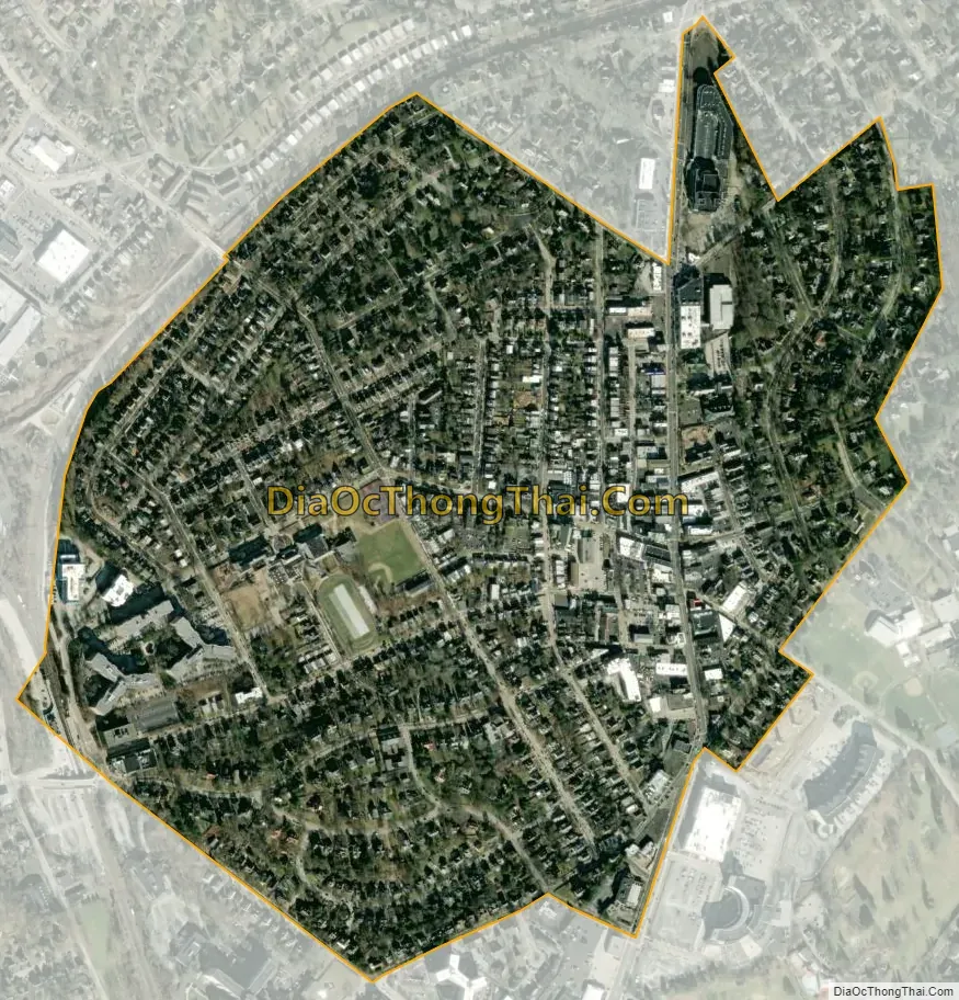
Jenkintown city Satellite Map
Geography
Jenkintown borough is located at 40°5′46″N 75°7′46″W / 40.09611°N 75.12944°W / 40.09611; -75.12944 (40.096060, -75.129415). According to the U.S. Census Bureau, the borough has a total area of 0.6 square miles (1.6 km), all land. Jenkintown is surrounded by Abington Township to the north, west, and east, and borders Cheltenham Township to the south.
See also
Map of Pennsylvania State and its subdivision:- Adams
- Allegheny
- Armstrong
- Beaver
- Bedford
- Berks
- Blair
- Bradford
- Bucks
- Butler
- Cambria
- Cameron
- Carbon
- Centre
- Chester
- Clarion
- Clearfield
- Clinton
- Columbia
- Crawford
- Cumberland
- Dauphin
- Delaware
- Elk
- Erie
- Fayette
- Forest
- Franklin
- Fulton
- Greene
- Huntingdon
- Indiana
- Jefferson
- Juniata
- Lackawanna
- Lancaster
- Lawrence
- Lebanon
- Lehigh
- Luzerne
- Lycoming
- Mc Kean
- Mercer
- Mifflin
- Monroe
- Montgomery
- Montour
- Northampton
- Northumberland
- Perry
- Philadelphia
- Pike
- Potter
- Schuylkill
- Snyder
- Somerset
- Sullivan
- Susquehanna
- Tioga
- Union
- Venango
- Warren
- Washington
- Wayne
- Westmoreland
- Wyoming
- York
- Alabama
- Alaska
- Arizona
- Arkansas
- California
- Colorado
- Connecticut
- Delaware
- District of Columbia
- Florida
- Georgia
- Hawaii
- Idaho
- Illinois
- Indiana
- Iowa
- Kansas
- Kentucky
- Louisiana
- Maine
- Maryland
- Massachusetts
- Michigan
- Minnesota
- Mississippi
- Missouri
- Montana
- Nebraska
- Nevada
- New Hampshire
- New Jersey
- New Mexico
- New York
- North Carolina
- North Dakota
- Ohio
- Oklahoma
- Oregon
- Pennsylvania
- Rhode Island
- South Carolina
- South Dakota
- Tennessee
- Texas
- Utah
- Vermont
- Virginia
- Washington
- West Virginia
- Wisconsin
- Wyoming


