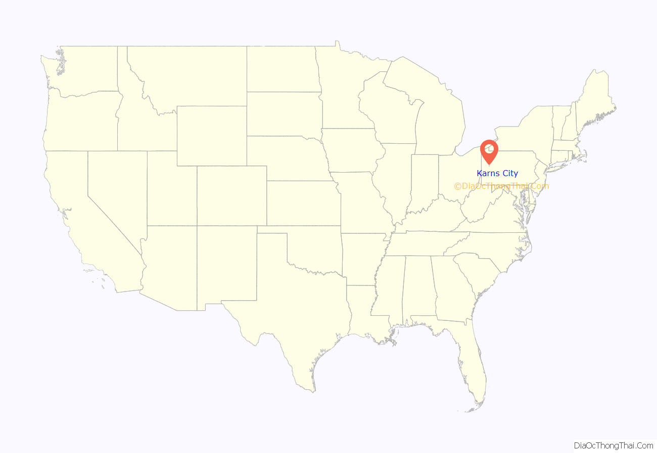
Karns City is a borough that is located in Butler County, Pennsylvania, United States. The population was 209 at the time of the 2010 census.
| Name: | Karns City borough |
|---|---|
| LSAD Code: | 21 |
| LSAD Description: | borough (suffix) |
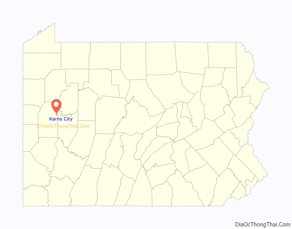
| State: | Pennsylvania |
| County: | Butler County |
| Incorporated: | 1875 |
| Total Area: | 0.36 sq mi (0.94 km²) |
| Land Area: | 0.36 sq mi (0.94 km²) |
| Water Area: | 0.00 sq mi (0.00 km²) |
| Total Population: | 175 |
| Population Density: | 482.09/sq mi (186.32/km²) |
| FIPS code: | 4238768 |
Online Interactive Map
Click on ![]() to view map in "full screen" mode.
to view map in "full screen" mode.
Karns City location map. Where is Karns City borough?
History
In December 1871, Hugh P. McClymonds and Samuel L. Riddle leased fifteen acres of land to two brothers from the Cooper family. Initially slated to be used as farmland, those plans changed when a reserve of oil was discovered on the land. The first oil well, known as “Shasta,” was established shortly thereafter near the western line of MyClymonds’ two hundred and fourteen-acre farm.
On May 29, 1872, S. D. Karns obtained a lease for McClymonds’ entire farm with the hope of increasing the well’s capacity and profitability. Oil, at that time, was priced at four dollars per barrel. By June, Karns’ well was extracting one hundred and twenty barrels of oil from the ground daily. As more speculators became interested in McClymonds’ property, however, discord arose between competitors; in response, McClymonds sold the entire property, with the except of its farm buildings and fourteen acres of surface land, for $60,000 on June 18 of that same year to Karns, O. G. Emery, John H. Haines, William Parker, and William Thompson. Additional derricks and supporting buildings were quickly erected and oil extraction ramped up even further.
In short order, the few buildings grew to several and then many, with entrepreneurs adding hotels, livery stables, machine shops, residences, and restaurants to turn the small, rural village into a booming town that soon became known as Karns City. In 1872, Ralston McQuaide & Co. opened a banking office that operated until 1880.
The borough of Karns City, which included all of McClymonds’ land and roughly ten acres owned by Riddle, was subsequently incorporated on January 4, 1875.
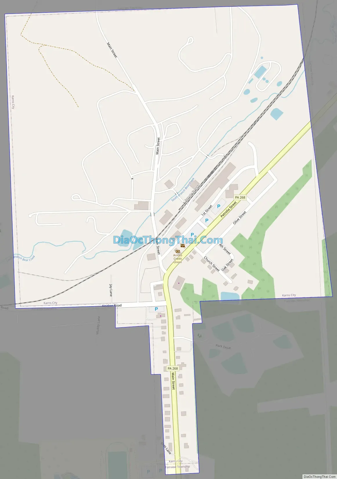
Karns City Road Map
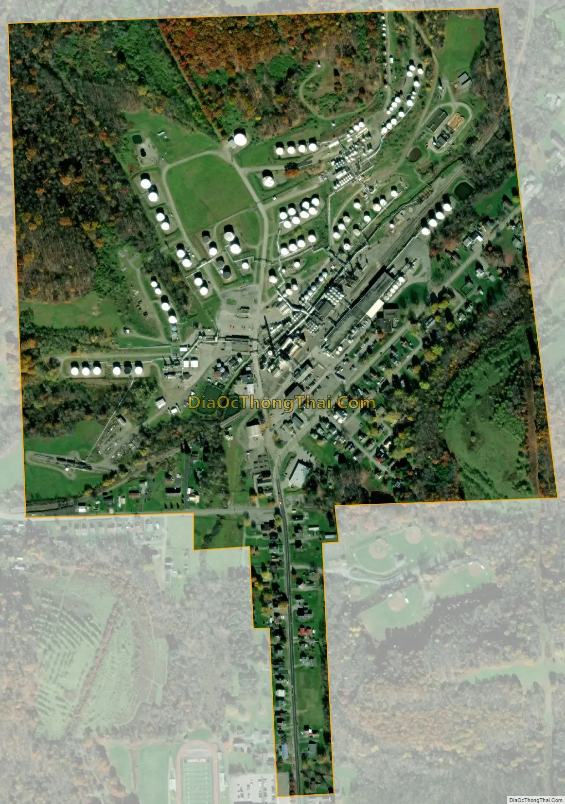
Karns City city Satellite Map
Geography
Karns City is located in eastern Butler County at 40°59′42″N 79°43′33″W / 40.995048°N 79.725743°W / 40.995048; -79.725743, in the valley of the South Branch of Bear Creek, a tributary of the Allegheny River.
Pennsylvania Route 268 passes through the borough, leading north 1.7 miles (2.7 km) to Petrolia and south 3.7 miles (6.0 km) to Chicora.
According to the United States Census Bureau, Karns City has a total area of 0.36 square miles (0.94 km), all land.
See also
Map of Pennsylvania State and its subdivision:- Adams
- Allegheny
- Armstrong
- Beaver
- Bedford
- Berks
- Blair
- Bradford
- Bucks
- Butler
- Cambria
- Cameron
- Carbon
- Centre
- Chester
- Clarion
- Clearfield
- Clinton
- Columbia
- Crawford
- Cumberland
- Dauphin
- Delaware
- Elk
- Erie
- Fayette
- Forest
- Franklin
- Fulton
- Greene
- Huntingdon
- Indiana
- Jefferson
- Juniata
- Lackawanna
- Lancaster
- Lawrence
- Lebanon
- Lehigh
- Luzerne
- Lycoming
- Mc Kean
- Mercer
- Mifflin
- Monroe
- Montgomery
- Montour
- Northampton
- Northumberland
- Perry
- Philadelphia
- Pike
- Potter
- Schuylkill
- Snyder
- Somerset
- Sullivan
- Susquehanna
- Tioga
- Union
- Venango
- Warren
- Washington
- Wayne
- Westmoreland
- Wyoming
- York
- Alabama
- Alaska
- Arizona
- Arkansas
- California
- Colorado
- Connecticut
- Delaware
- District of Columbia
- Florida
- Georgia
- Hawaii
- Idaho
- Illinois
- Indiana
- Iowa
- Kansas
- Kentucky
- Louisiana
- Maine
- Maryland
- Massachusetts
- Michigan
- Minnesota
- Mississippi
- Missouri
- Montana
- Nebraska
- Nevada
- New Hampshire
- New Jersey
- New Mexico
- New York
- North Carolina
- North Dakota
- Ohio
- Oklahoma
- Oregon
- Pennsylvania
- Rhode Island
- South Carolina
- South Dakota
- Tennessee
- Texas
- Utah
- Vermont
- Virginia
- Washington
- West Virginia
- Wisconsin
- Wyoming


